

Guana Island Hiking Trails Travel Guide - Free Web & App
Your ultimate guide to Guana Island Hiking Trails. Discover top landmarks, proposed trips, and local tips. Free on the web or via the Evendo companion app.




Guana Island Hiking Trails in the British Virgin Islands lead through dry hills, coastal woodland and historic sugar ruins above Caribbean beaches.
Island Landscape and Walking
Guana Island Hiking Trails describes the network of footpaths crossing Guana Island, a privately owned island in the British Virgin Islands' Sir Francis Drake Channel. Covering roughly 850 acres, the island rises sharply from the sea, with dry hillsides, rocky ridges, coastal woodland, scrub, sandy coves and wide views towards Tortola, Virgin Gorda and the smaller islands scattered across the channel. Walking here is less about following a single celebrated route than about exploring a tranquil island landscape where paths connect the interior with beaches, viewpoints and historic remains.Read more about Guana Island Hiking Trails
Nature and History
Access and Atmosphere
When is the best time to visit Guana Island Hiking Trails?
Best: May–July · 31–32°C| Month | High (°C) | Rainfall (mm) |
|---|---|---|
| January | 30 | 86 |
| February | 31 | 82 |
| March | 31 | 78 |
| April | 31 | 74 |
| May (best) | 31 | 70 |
| June (best) | 32 | 66 |
| July (best) | 32 | 69 |
| August | 32 | 72 |
| September | 31 | 76 |
| October | 31 | 80 |
| November | 31 | 84 |
| December | 30 | 88 |
Getting to and around Guana Island Hiking Trails
How to get there
Transportation
Best attractions in Guana Island Hiking Trails
The principal attraction is the island's network of footpaths, which climbs through dry Caribbean woodland and scrub to ridges overlooking the Sir Francis Drake Channel, Tortola and neighbouring islands. Walkers can combine elevated views with visits to sandy coves and quieter shoreline areas, subject to access arrangements and sea conditions. The ruins of the former sugar mill provide a tangible link with Guana Island's agricultural past, while old stone walls and altered clearings reveal earlier land use. Nature is central to the experience: birdwatching, native vegetation and conservation areas are more significant here than formal visitor attractions. Beaches offer opportunities for swimming or snorkelling where conditions and local guidance permit, although facilities are limited compared with a mainland resort area. The island's scale allows several landscapes to be encountered in one outing, but paths should be treated as natural walking routes rather than engineered recreational trails, with heat, slopes and uneven surfaces influencing the pace.

Best landmarks in Guana Island Hiking Trails
Guana Island's most important landmarks are primarily natural and archaeological. The island's elevated ridges form a chain of viewpoints across the Sir Francis Drake Channel, with changing sightlines towards Tortola, Virgin Gorda and nearby islets. Its coves and beaches mark the meeting of dry island vegetation with clear Caribbean waters, while rocky headlands demonstrate the steep coastal character of the British Virgin Islands. Inland, the ruins of the former sugar mill are the clearest historical landmark, representing the island's plantation-era agricultural economy and the enslaved labour associated with sugar production across the region. Old stone walls and cultivated clearings add quieter evidence of past land use. Conservation areas and habitats supporting native wildlife are also central to Guana Island's present identity, although they are living environments rather than monuments with unrestricted public access.

Explore Guana Island Hiking Trails on the map
Plan your trip on one map. See where the top attractions, landmarks, restaurants and hotels are, and book hotels and experiences in a few clicks.
Best hotels in Guana Island Hiking Trails
Best restaurants in Guana Island Hiking Trails
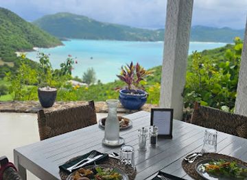
Dining on Guana Island is closely linked to the private resort rather than an independent village restaurant scene. Guests can expect food provision to be arranged through their accommodation, with meals shaped by the wider Caribbean setting and by supplies brought to a small offshore island; menus and service arrangements should be confirmed directly before arrival. There are no ordinary public dining streets, takeaway clusters or dependable choice of cafés on the hiking routes. Visitors using Guana Island as part of a broader British Virgin Islands itinerary will find a wider range of restaurants, beach bars and provision shops in Tortola, Virgin Gorda and other populated islands, but these are outside the hiking destination itself. Independent picnicking should never be assumed without permission, particularly around private facilities and environmentally sensitive areas.
Best bars in Guana Island Hiking Trails
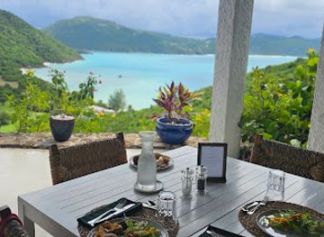
Guana Island does not have a public nightlife district or conventional nightclub scene. Evening activity is centred on the atmosphere of the private resort, where guests may have access to accommodation-based dining, drinks and quiet social spaces according to the arrangements in force during their stay. After dark, the island's appeal lies more in low-density surroundings, sea views and a quieter Caribbean setting than in live entertainment or late-night venues. Visitors seeking a broader choice of bars, music and evening events should look to established settlements such as Road Town on Tortola, while recognising that travel between islands requires separate, prearranged transport. The absence of street lighting and public entertainment makes considerate, low-impact behaviour particularly appropriate.
Best shops in Guana Island Hiking Trails
Shopping on Guana Island is extremely limited because the destination is a privately managed, low-density island rather than a settled commercial centre. Visitors should not expect a high street, permanent craft market or broad range of shops beside the hiking paths. Any souvenirs, gifts or locally inspired products available on the island are likely to be associated with the accommodation operation and should be checked in advance. For groceries, outdoor supplies, crafts and regional goods, visitors generally need to shop in Tortola or another larger BVI settlement before travelling onward. Road Town provides the widest concentration of everyday services in the territory, while smaller island communities offer more restricted choices. Buying locally made art, food products or handicrafts in established BVI settlements can provide a more meaningful connection with the territory's culture than expecting retail infrastructure on Guana Island itself.

Get your free copy of our complete guide to Guana Island Hiking Trails, delivered straight to you.
Everything on this page, from attractions and restaurants to essentials and local phrases, in one PDF you can read offline, print or share.
Already have an account? Sign in
Your Guana Island Hiking Trails guide is ready.
We'll send it to · Not you? Sign out

Getting your guide ready…
We are putting together a fresh copy of the Guana Island Hiking Trails guide. This can take up to a minute.
This can take a few moments. If your browser asks, choose Allow so the download can start. You'll find the guide in your Downloads folder.
Nothing happened? Download it again
Sorry, the guide is taking longer than usual. Please try again in a minute, or get it by email instead.
Guana Island Hiking Trails essentials
Currency and Payment
Safety
Emergency Situations
Do's and Don'ts
Local Tips
From Eve
Local phrases worth knowing
You don't need to get them perfect. A few words go a long way, and locals appreciate the effort.
Basics
| English | Local | Say it |
|---|---|---|
| Hello | Good day | [gud dey] |
| Goodbye | Goodbye | [gud-bye] |
| Yes | Yes | [yes] |
| No | No | [no] |
| Please/You're welcome | Please | [pliz] |
| Thank you | Thank you | [thangk yu] |
| Excuse me/Sorry | Excuse me | [eks-kyoos mi] |
| How are you? | How you dey? | [haw yu dey] |
| Fine. And you? | I dey okay. You? | [I dey okay. yu] |
| Do you speak English? | You sabi English? | [yu sa-bee Ing-glish] |
| I don't understand | I no sabi | [I no sa-bee] |
Eating & Drinking
| English | Local | Say it |
|---|---|---|
| I'd like to see the menu, please | Show me menu, abeg | [sho mi meh-nyu, a-beg] |
| I don't eat meat | I no dey chop meat | [I no dey chop mit] |
| Cheers! | Cheers! | [cheers] |
| I would like to pay, please | I wan pay, abeg | [I wan pay, a-beg] |
Emergencies
| English | Local | Say it |
|---|---|---|
| Help! | Help! | [help] |
| Go away! | Comot! | [co-mot] |
| Call the Police! | Call Police! | [call po-lice] |
| Call a doctor! | Call doctor! | [call do-k-tor] |
| I'm lost | I lost | [I lost] |
| I'm ill | I sick | [I sik] |
Shopping
| English | Local | Say it |
|---|---|---|
| I'd like to buy... | I wan buy... | [I wan buy...] |
| I'm just looking | I dey look | [I dey look] |
| How much is it? | How much e be? | [haw much e be] |
| That's too expensive | E too cost | [E too cost] |
| Can you lower the price? | You fit reduce price? | [yu fit re-duce price] |
Time & Numbers
| English | Local | Say it |
|---|---|---|
| What time is it? | Wetin be time? | [weh-tin be time] |
| It's one o'clock | Na one o'clock | [na wan o'clock] |
| Half past (10) | Half (10) | [haf (10)] |
| Morning | Morning | [mawn-ing] |
| Afternoon | Afternoon | [af-ter-noon] |
| Evening | Evening | [ee-v-ning] |
| Yesterday | Yesterday | [yes-ter-day] |
| Today | Today | [to-day] |
| Tomorrow | Tomorrow | [to-mor-row] |
| 1 | 1 | [wan] |
| 2 | 2 | [tu] |
| 3 | 3 | [tri] |
| 4 | 4 | [foh] |
| 5 | 5 | [fayv] |
| 6 | 6 | [siks] |
| 7 | 7 | [seh-vun] |
| 8 | 8 | [eyt] |
| 9 | 9 | [nin] |
| 10 | 10 | [ten] |
Transport & Directions
| English | Local | Say it |
|---|---|---|
| Where's a/the...? | Wia...dey? | [wee-ah...dey] |
| What's the address? | Wetin be address? | [weh-tin be address] |
| Can you show me (on the map)? | You fit show me for map? | [yu fit show mi for map] |
| When's the next (bus)? | When bus dey come? | [wen bus dey kom] |
| A ticket (to ....) | Ticket (go ...) | [ti-ket (go ...)] |
History of Guana Island Hiking Trails
A Caribbean Island Landscape
Guana Island's hills, ravines and rocky coastline were formed within the geological setting of the British Virgin Islands, an archipelago shaped by volcanic and tectonic activity. Its steep terrain and limited freshwater have always influenced how people could settle and use the island. Before modern tourism, the interior was more significant for small-scale cultivation and grazing than for dense permanent settlement, while the surrounding waters connected it to the wider maritime world of the Caribbean.
Indigenous Caribbean Connections
The wider British Virgin Islands were visited and inhabited by Indigenous Caribbean peoples before European colonisation. Archaeological evidence from the archipelago demonstrates early seafaring, fishing and settlement, although the surviving record does not support attributing every feature on Guana Island to a particular community. European arrival brought major disruption to Indigenous societies and introduced new patterns of land ownership, agriculture and maritime activity across the islands.
Sugar Cultivation and Rural Industry
During the colonial period, Guana Island was used for agriculture, including sugar cultivation. The surviving sugar-mill ruins are the clearest reminder of that phase, when enslaved labour underpinned plantation production throughout the British Virgin Islands. Stonework, old walls and altered clearings show how farming reshaped parts of the island, even though the steep landscape and limited scale of Guana Island prevented it from becoming a large plantation centre comparable with some other Caribbean estates.
Conservation and Private Tourism
After plantation agriculture declined in the British Virgin Islands, Guana Island became increasingly valued for its isolation, beaches, wildlife and undeveloped hillsides. Private ownership and the creation of a small resort helped establish the island as a low-density visitor destination rather than a conventional settlement. Conservation work has included efforts to protect native habitats and support the endangered Anegada rock iguana, while modern walking routes allow visitors to encounter the island's historical and natural features without large-scale infrastructure.
Guana Island Hiking Trails in Photos
Browse through our photo collection highlighting the charm and character of the destination.
Neighbouring destination travel guides
The closest destinations to Guana Island Hiking Trails, if you have time for more than one.
-

-

-

-

-


Swipe for more destinations
Explore more

Explore more of Guana Island
Guana Island in the British Virgin Islands offers private beaches, quiet trails, reef waters and secluded Caribbean landscapes near Tortola.
Explore Guana Island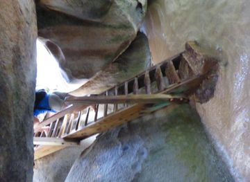
Explore more of British Virgin Islands
Discover the British Virgin Islands: Pristine beaches, vibrant marine life, and a rich cultural heritage await in this Caribbean paradise.
Explore British Virgin Islands