

Free Imperial Valley Travel Guide & Mobile App
Explore Imperial Valley with free travel guides. Discover regional history, expert tips, proposed trips, and audio guides on web or mobile app.


Explore Imperial Valley’s desert fields, Salton Sea shores, sand dunes, border culture, birdlife and water-shaped California history.
Read more about Imperial Valley
When is the best time to visit Imperial Valley?
Best: March–April, November · 23–27°C| Month | High (°C) | Rainfall (mm) |
|---|---|---|
| January | 17 | 11 |
| February | 19 | 9 |
| March (best) | 23 | 7 |
| April (best) | 27 | 3 |
| May | 32 | 1 |
| June | 38 | 0 |
| July | 42 | 5 |
| August | 42 | 6 |
| September | 39 | 6 |
| October | 32 | 6 |
| November (best) | 23 | 8 |
| December | 17 | 12 |
Getting to and around Imperial Valley
How to get there
Transportation
Best attractions in Imperial Valley
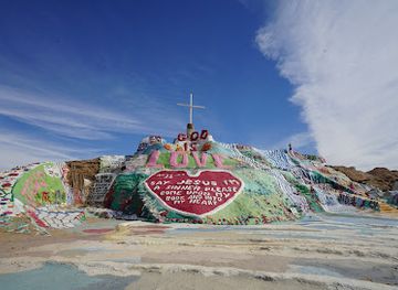
Imperial Valley’s attractions arise from the close meeting of agriculture, desert, border life and environmental change. Around El Centro and Brawley, irrigation canals, field roads and agricultural landscapes reveal how Colorado River water made intensive farming possible in an otherwise arid basin. Calexico offers cross-border urban energy beside Mexicali, although crossing into Mexico requires separate documentation and planning. To the north, the Salton Sea supports birdwatching and landscape observation along its Imperial County shore, with Niland, Bombay Beach and nearby installations illustrating different chapters in the lake’s recreational and environmental history. Salvation Mountain, near Niland, is a large-scale folk-art and religious work created from adobe, paint and found materials. West of the cultivated valley, the Imperial Sand Dunes provide expansive desert scenery and designated off-highway recreation, particularly in the cooler months. Aviation enthusiasts may find the region’s military-flight heritage visible around El Centro, subject to access restrictions. The valley is also a worthwhile base for studying desert botany, geothermal development and changing water management, though many sites require advance route planning, sun protection and a vehicle suited to paved or officially maintained roads.
-
Theme park
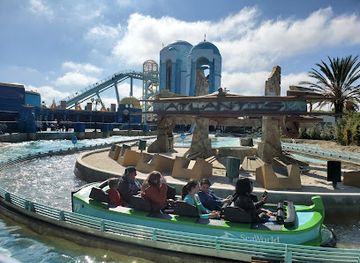
SeaWorld San Diego
Explore the wonders of marine life and thrill-seeking rides at SeaWorld San Diego, an unforgettable theme park experience for the whole family.
-
Park
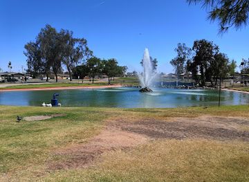
Bucklin Park
Experience nature and family fun at Bucklin Park, El Centro's serene oasis featuring playgrounds, picnic areas, and diverse wildlife.
-
Park
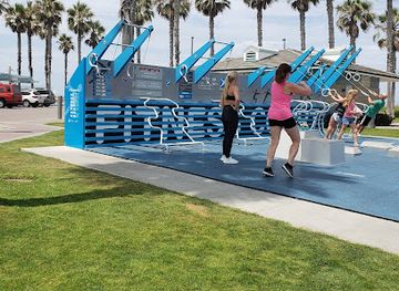
Dunes Park
Experience the natural beauty and tranquility of Dunes Park, a coastal haven in Imperial Beach, California, perfect for relaxation and exploration.
-
Historical landmark
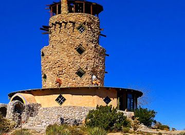
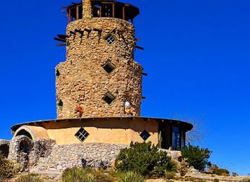
Desert View Tower
Experience breathtaking views and rich history at Desert View Tower, a unique landmark in Jacumba Hot Springs, California.
Best landmarks in Imperial Valley
The Salton Sea is Imperial Valley’s defining natural and historical landmark, an inland lake created by the 1905–07 Colorado River flood and sustained today largely by agricultural drainage. Its changing shoreline and exposed lakebed embody the region’s complicated relationship with water. Around Niland, Salvation Mountain is a highly individual folk-art landmark built from adobe, straw and vivid paint, while the nearby structures of the former Slab City area reflect an informal desert settlement rather than a conventional heritage site. The Imperial Sand Dunes form another major geographic landmark: immense mobile ridges that mark the western edge of the cultivated valley and attract extensive off-highway recreation. In the settled basin, the Imperial Irrigation District’s canals and carefully divided fields are functional landmarks of twentieth-century water engineering. Calexico’s border environment, including the international crossing and the adjoining urban edge of Mexicali, expresses the valley’s enduring binational geography. The flat agricultural plain, date palms, distant mountains and broad skies are themselves essential parts of the region’s visual identity.
-
Historical landmark
Salvation Mountain
Experience the vivid artistry and spiritual essence of Salvation Mountain, a unique desert landmark that inspires creativity and reflection.
-
Historical landmark
Desert View Tower
Explore the Desert View Tower, a historical landmark in California, offering breathtaking views, unique gifts, and serene yoga experiences.
-
Museum
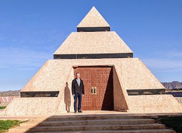
Museum of History In Granite
Discover the Museum of History In Granite in Felicity, CA, where captivating granite murals and historical exhibits bring the past to life for every visitor.
-
Campground
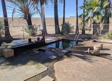
Holtville Hot Springs
Experience the rejuvenating waters of Holtville Hot Springs, a serene campground perfect for relaxation and outdoor adventures in the California desert.
Explore Imperial Valley on the map
Plan your trip on one map. See where the top cities, national parks and sights are, and book hotels and experiences in a few clicks.
Best hotels in Imperial Valley
Best restaurants in Imperial Valley
Dining in Imperial Valley reflects its agricultural output and its relationship with northern Mexico. Calexico and El Centro have the broadest range of restaurants, with Mexican and Mexican-American cooking prominent alongside familiar American formats. Tacos, burritos, carne asada, seafood preparations, rice and beans, and regional variations of border-style comfort food are widely encountered, while Spanish-language menus and bakeries are part of everyday commercial life. Farm production also shapes local markets and roadside stands, where seasonal vegetables, fruit and dates may be available when in season. Small-town cafés, family restaurants and casual grills are more characteristic outside the principal centres than destination fine dining. In winter, the valley’s agricultural cycle is especially visible in fresh produce and workers’ food traditions. Visitors should distinguish between permanent food businesses and seasonal stands, as rural opening patterns can change. Drinking water and cold non-alcoholic refreshments are practical priorities during hot-weather sightseeing, particularly when travelling between communities.
-
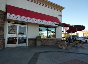
Hamburger
In-N-Out Burger
Savor iconic burgers and fresh-cut fries at In-N-Out Burger in El Centro - an essential stop for every fast food lover visiting California.
-
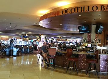
Casino
Quechan Casino Resort
Discover thrilling gaming, exquisite dining, and luxurious accommodations at Quechan Casino Resort in Winterhaven, California.
-
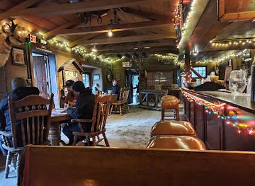
American
Cold Spring Tavern
Discover Cold Spring Tavern: A historic American restaurant nestled in Santa Barbara's scenic hills offering delightful cuisine and enchanting ambiance.
-
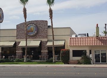
American
Burgers & Beer
Experience mouthwatering burgers and refreshing drinks at Burgers & Beer in El Centro - where great taste meets vibrant atmosphere!
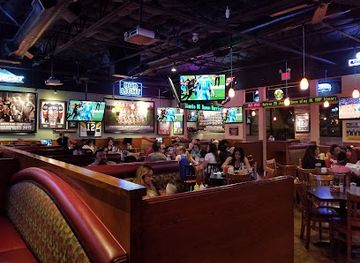
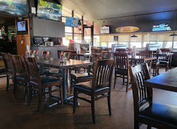
Best bars in Imperial Valley
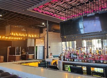
Nightlife in Imperial Valley is modest and concentrated in El Centro and Calexico rather than organised around a large club district. Evening choices include neighbourhood bars, casual restaurants, pool halls, sports-oriented venues and places with Latin music, while some local establishments provide live entertainment on particular nights. Calexico’s border setting gives its evening scene a distinctly binational context, though crossing to Mexicali is an international journey with its own documentation and transport considerations, not simply an extension of local nightlife. In Brawley, Imperial and smaller communities, evenings tend to centre on traditional bars, cafés, restaurants and community events rather than late-night clubs. Summer heat can make outdoor evening activity more comfortable than daytime desert travel, but visitors should still arrange reliable transport and avoid driving after drinking. Venues, licensing arrangements and opening patterns can change, so local businesses should be checked directly before making a dedicated trip.
-
Bar
Quechan Casino Resort
Discover the ultimate entertainment experience at Quechan Casino Resort, where gaming excitement meets luxurious hospitality in Winterhaven, California.
-
Bar
Yard House
Discover the lively Yard House in Rancho Mirage, where craft beer meets New American cuisine in a vibrant atmosphere perfect for every occasion.
-
American
Burgers & Beer
Discover the ultimate American dining experience at Burgers & Beer in El Centro, where delicious burgers and a vibrant atmosphere await.
-
Sports bar
IB Forum Sports Bar & Grill
Discover the vibrant flavors and lively atmosphere of IB Forum Sports Bar & Grill in Imperial Beach, where great food meets sports excitement.


Best nightclubs in Imperial Valley
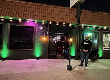
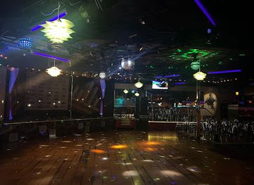
Nightlife in Imperial Valley is modest and concentrated in El Centro and Calexico rather than organised around a large club district. Evening choices include neighbourhood bars, casual restaurants, pool halls, sports-oriented venues and places with Latin music, while some local establishments provide live entertainment on particular nights. Calexico’s border setting gives its evening scene a distinctly binational context, though crossing to Mexicali is an international journey with its own documentation and transport considerations, not simply an extension of local nightlife. In Brawley, Imperial and smaller communities, evenings tend to centre on traditional bars, cafés, restaurants and community events rather than late-night clubs. Summer heat can make outdoor evening activity more comfortable than daytime desert travel, but visitors should still arrange reliable transport and avoid driving after drinking. Venues, licensing arrangements and opening patterns can change, so local businesses should be checked directly before making a dedicated trip.
-
Bar
The Salty Frog Bar
Experience the vibrant nightlife at The Salty Frog Bar, a lively lounge in Imperial Beach with cocktails, karaoke, and live music.
-
Night club
Bravo Night Club
Unleash your inner party spirit at Bravo Night Club, Anaheim's go-to destination for vibrant nightlife and unforgettable dance experiences.
-
Lounge
Torch Room Lounge
Discover the lively Torch Room Lounge in Norwalk, CA – your go-to spot for affordable cocktails, fun vibes, and a taste of local nightlife.
-
Night club
Downtown Experiment
Discover the ultimate nightlife experience at Downtown Experiment, Riverside's vibrant night club with electrifying music and a lively atmosphere.

Best shops in Imperial Valley
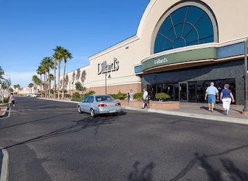
Shopping is practical and locally oriented rather than centred on a major luxury retail scene. El Centro provides the broadest selection of supermarkets, national retailers and everyday services, while Calexico’s commercial streets reflect the city’s border economy and Mexican-American culture. Small businesses, bakeries and food shops are useful places to look for regional ingredients and edible gifts, including dates and other desert-grown produce when available. Farm stands and seasonal roadside sellers may offer vegetables, fruit or dates, but they are often dependent on harvest timing and should not be treated as permanent markets. Niland and Salton Sea communities are associated with distinctive folk-art and desert-made goods, although availability can be informal and irregular. Visitors interested in antiques, handmade objects or local art should explore independent shops and galleries in the larger towns rather than expect a single concentrated craft quarter. The Imperial Valley Mall area in El Centro offers conventional shopping, while border shopping in Calexico requires awareness of customs rules, opening arrangements and the practicalities of returning goods across an international boundary.
-
Shopping mall
Yuma Palms Regional Center
Explore Yuma Palms Regional Center: A shopping haven with diverse retail, delightful dining, and exciting entertainment in Yuma, Arizona.
-
Shopping mall
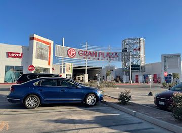
Gran Plaza Outlets
Discover unbeatable deals and stylish finds at Gran Plaza Outlets in Calexico, where shopping meets entertainment in a vibrant atmosphere.
-
Shopping mall
Imperial Valley Mall
Explore the Imperial Valley Mall: A shopping haven in El Centro, California, featuring diverse stores, dining options, and family-friendly fun.
-
Department store
JCPenney
Explore JCPenney in El Centro for an extensive range of clothing, furniture, and accessories at moderate prices, perfect for every traveler.


Get your free copy of our complete guide to Imperial Valley, delivered straight to you.
Everything on this page, from attractions and restaurants to essentials and local phrases, in one PDF you can read offline, print or share.
Already have an account? Sign in
Your Imperial Valley guide is ready.
We'll send it to · Not you? Sign out

Getting your guide ready…
We are putting together a fresh copy of the Imperial Valley guide. This can take up to a minute.
This can take a few moments. If your browser asks, choose Allow so the download can start. You'll find the guide in your Downloads folder.
Nothing happened? Download it again
Sorry, the guide is taking longer than usual. Please try again in a minute, or get it by email instead.
Imperial Valley essentials
Currency and Payment
Safety
Emergency Situations
Do's and Don'ts
Local Tips
From Eve
Local phrases worth knowing
You don't need to get them perfect. A few words go a long way, and locals appreciate the effort.
Basics
| English | Local | Say it |
|---|---|---|
| Hello | Hola | [Ola] |
| Goodbye | Adiós | [Ah-dee-os] |
| Yes | Sí | [See] |
| No | No | [No] |
| Please/You're welcome | Por favor/De nada | [Por fah-vor/Deh nah-dah] |
| Thank you | Gracias | [Gra-thias] |
| Excuse me/Sorry | Perdón | [Per-don] |
| How are you? | ¿Cómo estás? | [Koh-moh es-tas] |
| Fine. And you? | Bien. ¿Y tú? | [Bee-en. Ee too] |
| Do you speak English? | ¿Hablas inglés? | [Ah-blas een-glehs] |
| I don't understand | No entiendo | [No en-tee-en-do] |
Eating & Drinking
| English | Local | Say it |
|---|---|---|
| I'd like to see the menu, please | Me gustaría ver el menú, por favor | [Meh goo-stah-ree-ah vehr el meh-noo, por fah-vor] |
| I don't eat meat | No como carne | [No koh-mo kar-ne] |
| Cheers! | ¡Salud! | [Sah-lud] |
| I would like to pay, please | Me gustaría pagar, por favor | [Meh goo-stah-ree-ah pah-gar, por fah-vor] |
Emergencies
| English | Local | Say it |
|---|---|---|
| Help! | ¡Ayuda! | [Ah-yoo-dah] |
| Go away! | ¡Vete! | [Beh-teh] |
| Call the Police! | ¡Llama a la policía! | [Yah-mah ah lah poh-lee-sia] |
| Call a doctor! | ¡Llama a un doctor! | [Yah-mah ah oon dok-tor] |
| I'm lost | Estoy perdido | [Es-toy per-dee-do] |
| I'm ill | Estoy enfermo/a | [Es-toy en-fer-mo/a] |
Shopping
| English | Local | Say it |
|---|---|---|
| I'd like to buy... | Me gustaría comprar... | [Meh goo-stah-ree-ah kom-prar] |
| I'm just looking | Solo estoy mirando | [Soh-lo es-toy mee-ran-do] |
| How much is it? | ¿Cuánto cuesta? | [Kwan-toh kwes-ta] |
| That's too expensive | Es muy caro | [Es moo-ee kah-ro] |
| Can you lower the price? | ¿Puedes bajar el precio? | [Pweh-des bah-har el preh-syo] |
Time & Numbers
| English | Local | Say it |
|---|---|---|
| What time is it? | ¿Qué hora es? | [Ke oh-ra es] |
| It's one o'clock | Es la una | [Es lah oo-nah] |
| Half past (10) | Y diez y media | [Ee dyez ee meh-dee-ah] |
| Morning | Mañana | [Mah-nyah-nah] |
| Afternoon | Tarde | [Tar-deh] |
| Evening | Noche | [No-cheh] |
| Yesterday | Ayer | [Ah-yer] |
| Today | Hoy | [Oy] |
| Tomorrow | Mañana | [Mah-nyah-nah] |
| 1 | Uno | [Oo-no] |
| 2 | Dos | [Dos] |
| 3 | Tres | [Tres] |
| 4 | Cuatro | [Kwah-tro] |
| 5 | Cinco | [Seen-koh] |
| 6 | Seis | [Says] |
| 7 | Siete | [Syet-eh] |
| 8 | Ocho | [O-cho] |
| 9 | Nueve | [Nweh-veh] |
| 10 | Diez | [Dyez] |
Transport & Directions
| English | Local | Say it |
|---|---|---|
| Where's a/the...? | ¿Dónde está un/una...? | [Don-deh es-tah oon/oo-nah] |
| What's the address? | ¿Cuál es la dirección? | [Kwal es lah dee-rek-syon] |
| Can you show me (on the map)? | ¿Me puedes mostrar (en el mapa)? | [Meh pweh-des mos-trar (en el mah-pah)] |
| When's the next (bus)? | ¿Cuándo es el próximo (autobús)? | [Kwan-do es el prok-si-mo (ow-to-boos)] |
| A ticket (to ....) | Un boleto (a ....) | [Oon bo-leh-to (ah ....)] |
History of Imperial Valley
Indigenous Desert and River Communities
Imperial Valley and the lower Colorado Desert have long been home to Indigenous peoples whose lives were shaped by seasonal water, desert plants, hunting and trade. The region is associated with the traditional territories of communities including the Quechan, Cocopah and Kumeyaay, while Cahuilla communities have longstanding connections around the Salton Sink. Their histories predate American irrigation schemes by many centuries, and archaeological evidence records movement and settlement across the wider desert. Visitors should understand the valley not as an empty wilderness awaiting development, but as a cultural landscape with continuing Indigenous presence and sovereignty.
The Colorado River and Imperial Land Settlement
During the late nineteenth and early twentieth centuries, investors and settlers promoted the Imperial Valley as farmland that could be created in an arid basin through irrigation. Canals diverted Colorado River water into the valley, and the Imperial Land Company helped organise settlement and agricultural development. Towns such as El Centro, Calexico and Brawley grew around this new system. The development connected the valley to railways, markets and the expanding economy of Southern California, but it also created enduring disputes over water, land ownership and the environmental effects of intensive cultivation.
The Colorado River Flood and the Birth of the Salton Sea
In 1905, a breach in irrigation works allowed the Colorado River to flow into the Salton Sink. Engineers struggled for more than a year to close the channels, and the flood created the modern Salton Sea, which remains California’s largest inland lake by surface area when full. The event demonstrated both the power of the river and the risks of altering its course. Although the sea became part of the valley’s geography and supported fish, birds and recreation for a period, it was never a stable natural lake; its level and salinity have always depended heavily on diverted agricultural water.
Agriculture, Migration and Border Economy
Irrigation transformed Imperial Valley into a major winter-growing area, producing vegetables, dates, hay and other crops for national markets. The work required a large seasonal labour force, and Mexican migration became central to the valley’s agricultural economy and social life. Calexico and Mexicali developed as closely connected but nationally distinct cities, with people, goods and family networks crossing the border under changing regulations. This history remains visible in the valley’s bilingual public life, foodways, labour patterns and continuing debates about water, immigration and rural economic security.
Military Aviation and the Desert Landscape
The wide skies and dry climate made Imperial Valley valuable for military aviation training, particularly during the Second World War and the decades that followed. Naval Air Facility El Centro became a major training installation, while nearby airfields and desert ranges supported flight operations. The military presence brought employment and infrastructure but also established restricted areas across parts of the desert. Aviation remains an important modern element of the region, alongside farming and border commerce, and helps explain the frequent sight of aircraft over an otherwise sparsely settled landscape.
Salton Sea Environmental Change
The Salton Sea’s modern history has been marked by changing inflows, rising salinity, fish die-offs, declining recreation and the exposure of increasingly large areas of lakebed. Agricultural drainage sustains much of the remaining water, but long-term water-transfer agreements and conservation programmes have altered the volume entering the sea. Dust from exposed sediment has also become a public-health concern for nearby communities. Restoration efforts, habitat projects and state-led management now form an important part of Imperial Valley’s story, linking local livelihoods to wider debates about water allocation and climate pressure in the American West.
Renewable Energy in the Imperial Valley
The valley’s intense sunlight, geothermal resources and open terrain have attracted substantial renewable-energy development. Geothermal plants around the southern Salton Sea draw on underground heat, while solar facilities occupy parts of the desert and former agricultural margins. These projects reflect a newer phase in the region’s economic history, following the earlier transformation through irrigation and military infrastructure. They also raise questions about land use, transmission, wildlife, local employment and the protection of culturally significant desert places. Renewable energy is therefore both an opportunity and another major change to the valley’s landscape.
Imperial Valley in Photos
Browse through our photo collection highlighting the charm and character of the destination.
Neighbouring regions of Imperial Valley
The closest regions to Imperial Valley, if you have time for more than one.
-

-

-

-

-


Swipe for more regions
Explore more
Explore more of California
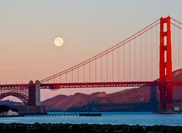
Discover California: A land of diverse landscapes, iconic cities, and endless adventures, from sun-soaked beaches to towering redwoods and vibrant cultural experiences.
Explore California