

Free Mojave Desert Travel Guide & Mobile App
Explore Mojave Desert with free travel guides. Discover regional history, expert tips, proposed trips, and audio guides on web or mobile app.


Explore California's Mojave Desert for Joshua trees, volcanic dunes, Route 66 history, dark skies and wide-open landscapes.
Read more about Mojave Desert
When is the best time to visit Mojave Desert?
Best: April–May, October · 22–26°C| Month | High (°C) | Rainfall (mm) |
|---|---|---|
| January | 13 | 12 |
| February | 15 | 10 |
| March | 18 | 8 |
| April (best) | 22 | 5 |
| May (best) | 26 | 4 |
| June | 31 | 2 |
| July | 36 | 9 |
| August | 35 | 9 |
| September | 29 | 5 |
| October (best) | 23 | 5 |
| November | 17 | 6 |
| December | 13 | 10 |
Getting to and around Mojave Desert
How to get there
Transportation
Top city travel guides in Mojave Desert
The cities of Mojave Desert, and the easiest places to base yourself.
-

-

-

-

-

-


Swipe for more cities
Destinations in Mojave Desert
Resorts, valleys and scenic spots worth a trip of their own.

Swipe for more destinations
Best attractions in Mojave Desert
The Californian Mojave's attractions are spread across a large, harsh landscape rather than concentrated in one resort centre. Joshua Tree National Park combines Joshua-tree woodland, granite formations, cactus gardens, historic ranching sites, hiking and climbing areas. Mojave National Preserve offers a quieter sense of space, with the Kelso Dunes, Cima Dome, volcanic cinder cones, lava features, historic roads and desert tortoise habitat. In the western desert, Red Rock Canyon State Park presents vividly eroded cliffs and layered geology, while the Antelope Valley region is known for seasonal wildflower displays in favourable years. Death Valley National Park lies farther north and requires separate planning, but its California desert landscapes are part of the broader Mojave geographical setting. Route 66 communities, the Calico Ghost Town attraction near Barstow, railway history and small local museums add human context. Outdoor activities include hiking, climbing, photography, birdwatching, scenic driving and astronomy. Conditions vary sharply with elevation and season, and many of the most rewarding places require advance preparation, reliable navigation and respect for closures and protected habitat.
-
National park
Joshua Tree National Park
Explore the surreal beauty of Joshua Tree National Park, where the Mojave and Colorado deserts meet in a landscape of iconic trees and rock formations.
-
Nature preserve
Mojave National Preserve
Discover the stark beauty and rich history of Mojave National Preserve, a vast desert wilderness offering stunning landscapes, historical sites, and unparalleled solitude in southeastern California.
-
Scenic spot
Keys View
Experience breathtaking panoramic views of Coachella Valley and beyond from this easily accessible, must-see spot in Joshua Tree National Park.
-
Tourist attraction
Skull Rock Trail
Explore the iconic Skull Rock Trail in Joshua Tree National Park, where stunning rock formations meet the breathtaking beauty of the California desert.


Best landmarks in Mojave Desert
The most recognisable natural landmark is the Joshua tree itself, a distinctive yucca found across the higher Mojave and especially associated with Joshua Tree National Park. The park's granite formations at locations such as Hidden Valley and Jumbo Rocks create a dramatic geological identity, while Keys View provides a broad outlook across the Coachella Valley and surrounding mountains. In Mojave National Preserve, the Kelso Dunes form one of California's largest dune systems, and the Cima Dome and nearby dense Joshua-tree woodland illustrate the scale and variety of the eastern desert. The Kelso Depot, a former railway station preserved within the preserve, represents the importance of rail transport and mineral extraction. Outside the protected areas, the Route 66 remnants at Amboy, the old railway landscape around Needles and the restored mining-era Calico Ghost Town near Barstow express the desert's transport and extraction history. Red Rock Canyon State Park's red cliffs and eroded formations provide a distinctive western gateway landmark, contrasting with the darker volcanic features farther east.
-
National park
Joshua Tree National Park
Explore the stunning landscapes and unique ecosystems of Joshua Tree National Park, a desert paradise for adventurers and nature lovers alike.
-
Scenic spot
Keys View
Discover the stunning panoramas of Keys View in California's Joshua Tree National Park, where breathtaking landscapes and desert beauty await.
-
Nature preserve
Coachella Valley Preserve - Thousand Palms Oasis Preserve
Discover the breathtaking landscapes and diverse ecosystems of Coachella Valley Preserve, where nature and adventure await in the heart of California's desert.
-
Tourist attraction
Barker Dam
Explore Barker Dam in Joshua Tree National Park: A Historic Oasis Amidst Stunning Desert Landscapes.


Explore Mojave Desert on the map
Plan your trip on one map. See where the top cities, national parks and sights are, and book hotels and experiences in a few clicks.
Best hotels in Mojave Desert
Best restaurants in Mojave Desert
Dining in the Mojave is shaped as much by distance and transport as by a single regional cuisine. Barstow, Ridgecrest, Needles, Twentynine Palms, Joshua Tree and nearby communities provide the broadest choice of cafés, diners, Mexican restaurants, burger counters, independent kitchens and casual international food. Roadside establishments and historic inns reflect the region's railway and Route 66 past, while newer restaurants and cafés around Joshua Tree and Twentynine Palms serve visitors drawn to the parks and the local arts scene. In smaller settlements, opening days and meal choices can be limited, so provisions are important for remote excursions. Regional Californian influences appear in menus featuring seasonal produce, tacos, grilled meats, craft coffee and vegetarian food, but the Mojave does not have one universally recognised local dish. Farmers' markets and small food producers can offer dates, citrus, baked goods and other desert-edge products where available, although markets are seasonal and should be checked locally.
-
American
Wagon Wheel Restaurant
Discover the heart of American cuisine at Wagon Wheel Restaurant in Needles – where rustic charm meets delicious flavors.
-
Barbecue
The Rib Co
Experience authentic barbecue at The Rib Co in Twentynine Palms—home to mouthwatering ribs and friendly service.
-
Traditional American
John's Place
Discover authentic American breakfast at John's Place in Twentynine Palms - where hearty meals meet warm hospitality.
-
New American
Kitchen in the Desert
Experience exquisite New American and Caribbean cuisine at Kitchen in the Desert, where culinary creativity meets stunning desert views.


Best bars in Mojave Desert
Evening life in the Californian Mojave is generally low-key and dispersed. Bars, breweries, restaurants and live-music venues are concentrated in larger communities such as Barstow, Ridgecrest, Joshua Tree and Twentynine Palms, while smaller settlements tend to rely on traditional bars, casual restaurants and occasional community events rather than dedicated nightclub districts. The Joshua Tree area has a noticeable arts-oriented evening scene, with performances, gallery events and independent venues whose programmes change regularly. Historic roadside bars and local pubs along old transport routes provide a different atmosphere from the newer venues near the national park. In much of the desert, the defining evening activity is outside: visitors watch the sunset, attend a ranger programme or observe stars away from town lights. Check transport arrangements before drinking, as distances are long and rideshare availability is limited outside populated areas.
-
American
Wagon Wheel Restaurant
Delight in hearty American fare and a rustic cowboy ambiance at Wagon Wheel Restaurant in Needles, California.
-
Bar
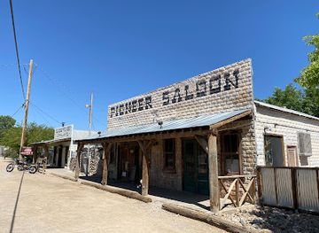
Pioneer Saloon
Experience the charm of the Pioneer Saloon, a historic bar and restaurant in Goodsprings, Nevada, serving delicious food and drinks in a lively atmosphere.
-
Grill
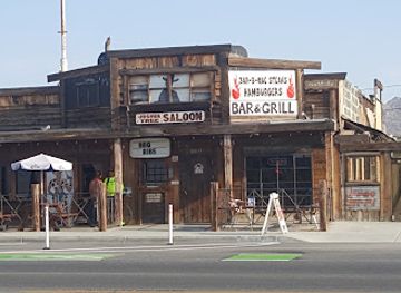
Joshua Tree Saloon
Discover the heart of the desert at Joshua Tree Saloon, where hearty grill dishes meet vibrant local culture in a charming setting.
-
Bar
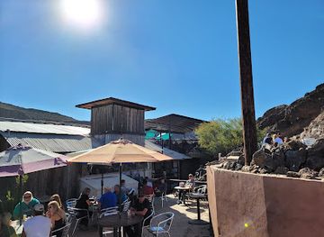
Nellie E Saloon -The Desert Bar
Experience the charm of Nellie E Saloon - The Desert Bar, a vibrant oasis in the heart of Arizona's stunning desert landscape.

Best nightclubs in Mojave Desert
Evening life in the Californian Mojave is generally low-key and dispersed. Bars, breweries, restaurants and live-music venues are concentrated in larger communities such as Barstow, Ridgecrest, Joshua Tree and Twentynine Palms, while smaller settlements tend to rely on traditional bars, casual restaurants and occasional community events rather than dedicated nightclub districts. The Joshua Tree area has a noticeable arts-oriented evening scene, with performances, gallery events and independent venues whose programmes change regularly. Historic roadside bars and local pubs along old transport routes provide a different atmosphere from the newer venues near the national park. In much of the desert, the defining evening activity is outside: visitors watch the sunset, attend a ranger programme or observe stars away from town lights. Check transport arrangements before drinking, as distances are long and rideshare availability is limited outside populated areas.
-
Bar
Bart Lounge
Experience the vibrant nightlife at Bart Lounge, where art meets music in the heart of Cathedral City.

Best shops in Mojave Desert
Shopping in the Californian Mojave is practical, local and widely dispersed rather than centred on a major retail district. Barstow provides the broadest conventional shopping and roadside services for travellers crossing the desert, while Ridgecrest, Needles, Twentynine Palms and Joshua Tree serve their surrounding communities. Independent galleries, studios, vintage shops, bookshops and craft retailers are particularly associated with the Joshua Tree area, where desert imagery and contemporary art influence locally made goods. Look for ceramics, jewellery, photography, textiles, books, prints and small artworks rather than mass-produced souvenirs. Food markets and farm stands at the desert's agricultural margins may sell dates, citrus, preserves and baked products, but availability is seasonal. Route 66 memorabilia, railway-themed items and geological or natural-history books are common in visitor-oriented shops. Carry essential provisions from larger towns before entering remote areas, since park stores and small desert shops cannot be relied upon for a full shopping range.
-
Nature preserve
Mojave National Preserve
Discover the stunning landscapes and rich biodiversity of Mojave National Preserve, a true desert paradise for adventurers and nature lovers.
-
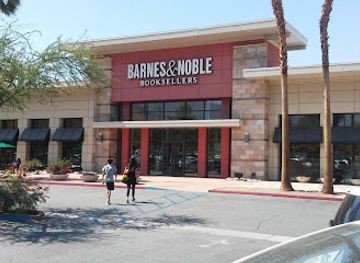
Shopping mall
The Shops at Palm Desert
Discover a shopping oasis at The Shops at Palm Desert, where fashion meets dining in a relaxing ambiance.
-
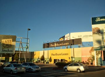
Outlet mall
Primm Mall
Experience unbeatable shopping deals at Primm Mall, where top brands meet incredible prices in a vibrant outlet setting.
-
Cannabis store
The Healing Center Weed Dispensary Needles
Discover wellness at The Healing Center Weed Dispensary in Needles, CA - your gateway to quality cannabis and holistic health solutions.
Get your free copy of our complete guide to Mojave Desert, delivered straight to you.
Everything on this page, from attractions and restaurants to essentials and local phrases, in one PDF you can read offline, print or share.
Already have an account? Sign in
Your Mojave Desert guide is ready.
We'll send it to · Not you? Sign out

Getting your guide ready…
We are putting together a fresh copy of the Mojave Desert guide. This can take up to a minute.
This can take a few moments. If your browser asks, choose Allow so the download can start. You'll find the guide in your Downloads folder.
Nothing happened? Download it again
Sorry, the guide is taking longer than usual. Please try again in a minute, or get it by email instead.
Mojave Desert essentials
Currency and Payment
Safety
Emergency Situations
Do's and Don'ts
Local Tips
From Eve
Local phrases worth knowing
You don't need to get them perfect. A few words go a long way, and locals appreciate the effort.
Basics
| English | Local | Say it |
|---|---|---|
| Hello | Hi | [Hai] |
| Goodbye | See ya | [See yah] |
| Yes | Yeah | [Yah] |
| No | Nope | [Nohp] |
| Please/You're welcome | Sure thing | [Shur thing] |
| Thank you | Thanks | [Thangs] |
| Excuse me/Sorry | Pardon me | [Pardon mee] |
| How are you? | How's it going? | [Hows it goin?] |
| Fine. And you? | Good. You? | [Good. Yoo?] |
| Do you speak English? | You speak English? | [Yoo speak English?] |
| I don't understand | I don't get it | [I dont get it] |
Eating & Drinking
| English | Local | Say it |
|---|---|---|
| I'd like to see the menu, please | Can I see the menu? | [Can I see the menu?] |
| I don't eat meat | I’m vegetarian | [I’m vege-tair-ee-an] |
| Cheers! | Cheers! | [Cheers!] |
| I would like to pay, please | Can I get the bill? | [Can I get the bill?] |
Emergencies
| English | Local | Say it |
|---|---|---|
| Help! | Help! | [Help!] |
| Go away! | Leave me alone! | [Leev me alone!] |
| Call the Police! | Call the cops! | [Call the cops!] |
| Call a doctor! | Get a doctor! | [Get a doctor!] |
| I'm lost | I can't find my way | [I cant find my way] |
| I'm ill | I'm not feeling well | [I'm not feelin well] |
Shopping
| English | Local | Say it |
|---|---|---|
| I'd like to buy... | I want to buy... | [I want to buy...] |
| I'm just looking | Just browsing | [Just browsin] |
| How much is it? | What’s the price? | [What’s the price?] |
| That's too expensive | That's pricey | [That's pry-see] |
| Can you lower the price? | Can you make it cheaper? | [Can you make it chee-per?] |
Time & Numbers
| English | Local | Say it |
|---|---|---|
| What time is it? | What time? | [What time?] |
| It's one o'clock | It's one | [It's one] |
| Half past (10) | Ten-thirty | [Ten-thirty] |
| Morning | Morning | [Morning] |
| Afternoon | Afternoon | [Afternoon] |
| Evening | Evening | [Evening] |
| Yesterday | Yesterday | [Yesterday] |
| Today | Today | [Today] |
| Tomorrow | Tomorrow | [Tomorrow] |
| 1 | One | [One] |
| 2 | Two | [Two] |
| 3 | Three | [Three] |
| 4 | Four | [Four] |
| 5 | Five | [Five] |
| 6 | Six | [Six] |
| 7 | Seven | [Seven] |
| 8 | Eight | [Eight] |
| 9 | Nine | [Nine] |
| 10 | Ten | [Ten] |
Transport & Directions
| English | Local | Say it |
|---|---|---|
| Where's a/the...? | Where's the...? | [Where's the...?] |
| What's the address? | What’s the address? | [What’s the address?] |
| Can you show me (on the map)? | Can you point it out? | [Can you point it out?] |
| When's the next (bus)? | When's the next bus? | [When's the next bus?] |
| A ticket (to ....) | A ticket to... | [A ticket to...] |
History of Mojave Desert
Indigenous Desert Homelands
The Mojave has been inhabited and travelled for thousands of years by Indigenous peoples including the Mojave, Chemehuevi, Serrano and Cahuilla, whose ancestral territories overlap different parts of the Californian desert and its margins. Water sources, seasonal plants, game trails and mountain passes shaped movement and settlement. Mojave communities were particularly associated with the lower Colorado River, while other groups maintained detailed knowledge of the higher desert and surrounding mountains. Petroglyphs, pottery, trails, plant use and place names remain part of this deeper history, which predates the later roads, railways and mining camps that dominate many visitor narratives.
Spanish and Mexican Routes
From the late eighteenth century, Spanish expeditions and missionaries crossed parts of the desert while seeking routes between the inland missions, the Colorado River and settlements in what is now southern California. Travel remained difficult because reliable water was scarce and mountain ranges forced routes into particular passes. During the Mexican period, Indigenous trade and travel continued alongside expanding ranching and overland movement. Later trails often followed or adapted earlier Indigenous paths, although colonial and American accounts frequently obscured that continuity.
Mining and Settlement in the Nineteenth Century
Mining brought prospectors and short-lived settlements to many Californian desert districts during the nineteenth century. Silver, gold, copper, borate minerals and other ores were extracted where geology and transport made operations viable. The boom-and-bust pattern created scattered camps and surviving ruins, but mining also imposed lasting environmental damage and dispossession. Places such as the Calico Ghost Town area near Barstow reflect this era, although the restored visitor attraction should not be mistaken for an untouched historic settlement.
Railways, Roads and Route 66
Railway construction transformed the Mojave by connecting inland California with the Colorado River and the expanding national transport network. Barstow became an important railway and road junction, while Needles developed as a Colorado River crossing and transport centre. In the twentieth century, US Route 66 supported filling stations, cafés, motels and roadside businesses through towns including Amboy and Needles. Interstate highways later diverted much through traffic, leaving a dispersed legacy of surviving signs, buildings and alignments rather than a continuous historic main street.
Military and Aerospace Development
The desert's open terrain, low population density and generally clear skies encouraged major military, aviation and aerospace activity during the twentieth century. Edwards Air Force Base in the western Mojave became associated with flight testing and significant developments in experimental aircraft, while other desert installations supported training, logistics and weapons testing. These facilities occupy extensive restricted areas, so they shape the region's geography even when they are not visitor attractions. Their presence also helped sustain communities and transport infrastructure in an otherwise sparsely settled environment.
Protected Deserts and Conservation
Growing recognition of the Mojave's ecological, geological and cultural importance led to the creation and expansion of protected areas. Joshua Tree National Monument was established in 1936 and became Joshua Tree National Park in 1994. Mojave National Preserve was established in 1994, safeguarding dunes, mountains, volcanic features, wildlife habitat and historic sites across a large part of the eastern California desert. Conservation has also highlighted the vulnerability of groundwater, dark skies, desert tortoise habitat and fragile soils to development, vehicles and visitor pressure.
Contemporary Desert Communities
Today the Mojave combines long-established transport and military economies with tourism, renewable-energy development, creative industries and outdoor recreation. Towns such as Joshua Tree, Twentynine Palms, Barstow, Ridgecrest and Needles serve different parts of the desert and should not be treated as interchangeable bases. Many communities retain working landscapes and limited services alongside galleries, cafés, museums and accommodation. The contemporary desert is therefore neither an empty wilderness nor a single cultural zone, but a varied region where Indigenous history, infrastructure, conservation and new settlement continue to intersect.
Mojave Desert in Photos
Browse through our photo collection highlighting the charm and character of the destination.
Neighbouring regions of Mojave Desert
The closest regions to Mojave Desert, if you have time for more than one.
-

-

-

-

-


Swipe for more regions
Explore more
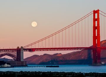
Explore more of California
Discover California: A land of diverse landscapes, iconic cities, and endless adventures, from sun-soaked beaches to towering redwoods and vibrant cultural experiences.
Explore California