

Free Palo Alto Travel Guide & Mobile App
Plan your Palo Alto trip with Evendo. Get free guides to top attractions, restaurants, hotels, and bars. Web access or download the mobile app.


Palo Alto blends Stanford landmarks, Silicon Valley history, leafy streets, Bay wetlands and excellent California dining for an engaging city break.
University Town and Technology Capital
Palo Alto occupies a leafy stretch of the San Francisco Peninsula between the eastern foothills of the Santa Cruz Mountains and the wetlands of San Francisco Bay. Its identity is closely linked to Stanford University, whose broad arcades, palm-lined avenues and Spanish Colonial Revival buildings give much of the city an unusually spacious, collegiate character. The university also helped shape the region's technology economy, while nearby South Bay districts preserve the quieter residential streets, independent shops and cafés that make Palo Alto more than a business centre.Read more about Palo Alto
Historic Streets and Local Neighbourhoods
Baylands and Open Space
When is the best time to visit Palo Alto?
Best: June–July, September · 26–27°C| Month | High (°C) | Rainfall (mm) |
|---|---|---|
| January | 16 | 80 |
| February | 17 | 70 |
| March | 19 | 60 |
| April | 21 | 30 |
| May | 23 | 20 |
| June (best) | 26 | 5 |
| July (best) | 27 | 0 |
| August | 27 | 5 |
| September (best) | 26 | 10 |
| October | 23 | 20 |
| November | 19 | 50 |
| December | 16 | 70 |
Getting to and around Palo Alto
How to get there
Transportation
Best attractions in Palo Alto
Palo Alto's attractions range from Stanford's spacious historic campus to the tidal landscapes of the Baylands. The university's Main Quad, Memorial Church and Hoover Tower create a memorable architectural ensemble, while the Cantor Arts Center and Anderson Collection bring major art holdings into the academic setting. At the edge of campus, the Arizona Garden offers a compact display of drought-tolerant planting, and Elizabeth F. Gamble Garden provides a more expansive horticultural experience in a former private estate setting. The Palo Alto Baylands Nature Preserve introduces visitors to marshes, bird habitat and broad views across southern San Francisco Bay, with the nearby Lucy Evans Baylands Nature Center interpreting the environment. Downtown's University Avenue and California Avenue are attractions in their own right for strolling, cafés and independent shops. The Museum of American Heritage, housed in a historic building, explores the history of household and technological innovation through practical objects and displays.
-
 Tourist attraction
Computer History Museum
Explore the evolution of computing at the Computer History Museum in Mountain View, from the abacus to the smartphone, in the heart of Silicon Valley.
20 min drive · 6.6 km from city centre
-
Tourist attraction
Computer History Museum
Explore 2000 years of computing history with interactive exhibits, iconic artifacts, and inspiring stories at the Computer History Museum.
20 min drive · 6.6 km from city centre
-
University
Stanford University
Explore Stanford University: A world-renowned center for innovation, stunning architecture, and rich history in the heart of Silicon Valley.
9 min drive · 2.9 km from city centre
-
Sculpture
Google Android Statues Square
Relive Android's sweet history at the former home of the iconic dessert-themed statues, awaiting their return to Google's Mountain View campus.
17 min drive · 5.5 km from city centre


Best landmarks in Palo Alto
Palo Alto's landmarks express the relationship between university, civic life and technology history. Stanford Memorial Church, with its mosaic decoration and Stanford family memorial associations, anchors the university's Main Quad, while Hoover Tower is a prominent campus feature housing the Hoover Institution and an observation level when access is available. The sandstone arcades and courtyards of the Main Quad form one of the Peninsula's most recognisable architectural settings. Palo Alto City Hall, designed in the early twentieth-century civic tradition, represents the municipality's established civic identity near downtown. El Palo Alto, the ancient coast redwood beside San Francisquito Creek, gave the city its name and remains a geographical and historical reference point. The HP Garage on Addison Avenue is privately occupied, but its association with the 1939 beginnings of Hewlett-Packard has made it a powerful symbol of Silicon Valley's early technology culture.
-
History museum
Computer History Museum
Discover the fascinating journey of computing at the Computer History Museum, where innovation meets history in Mountain View, California.
20 min drive · 6.6 km from city centre
-
Museum
Cantor Arts Center at Stanford University
Explore the Cantor Arts Center at Stanford University, a free art museum featuring diverse collections and a stunning sculpture garden.
8 min drive · 2.6 km from city centre
-
Church
Memorial Church
Discover the architectural beauty and serene atmosphere of Memorial Church at Stanford University, a must-visit attraction for all travelers.
9 min drive · 3.0 km from city centre
-
Sculpture museum
Rodin Sculpture Garden
Explore the Rodin Sculpture Garden in Palo Alto, a serene outdoor museum featuring iconic sculptures amidst beautiful landscapes.
8 min drive · 2.7 km from city centre


Explore Palo Alto on the map
Plan your Palo Alto trip on one map. See where the top attractions, landmarks, restaurants, bars and hotels are, find what's near where you're staying, and book hotels and experiences in a few clicks.
Best hotels in Palo Alto
Best restaurants in Palo Alto
Palo Alto's dining scene reflects the Bay Area's agricultural abundance, international population and technology-driven cosmopolitanism. University Avenue offers a dense concentration of restaurants and cafés, while California Avenue has a more neighbourhood-oriented selection of casual dining, bakeries and specialist food shops. Menus commonly draw on California produce, Pacific seafood and modern influences from across Asia, Latin America, the Mediterranean and Europe, alongside familiar American formats. The city's farmers' markets provide seasonal fruit, vegetables, flowers, baked goods and prepared foods, with the California Avenue market particularly associated with local weekend shopping. Coffee culture is prominent around Stanford and the commercial corridors, and outdoor seating is common in the mild climate. Dining ranges from quick counter-service meals to polished restaurants, but Palo Alto generally rewards exploration of its districts rather than reliance on one defining local dish.
-
Pakistani
Zareen's Palo Alto
Experience authentic Pakistani and Indian flavors at Zareen's Palo Alto – where every dish is crafted with love and tradition.
5 min drive · 1.7 km from city centre
-
Cajun
Nola
Experience authentic Cajun flavors at Nola in Palo Alto – where Creole traditions meet modern culinary artistry.
5 min drive · 1.7 km from city centre
-
Italian
Terún
Experience authentic Italian cuisine at Terún in Palo Alto, renowned for its wood-fired pizzas and extensive wine selection.
5 min drive · 1.8 km from city centre
-
Israeli
Oren's Hummus
Experience the vibrant flavors of Israeli cuisine at Oren's Hummus in Palo Alto—where tradition meets taste in every delicious dish.
5 min drive · 1.7 km from city centre


Best bars in Palo Alto
Palo Alto's evening scene is more collegiate and restaurant-led than club-focused. University Avenue has the greatest concentration of wine bars, cocktail venues, pubs and late-opening restaurants, with a social atmosphere shaped by Stanford students, academics, technology workers and local residents. California Avenue provides a quieter alternative, combining neighbourhood bars with cafés and restaurants. Live music and cultural events can appear through Stanford's performing-arts programmes and local venues, while cinemas, lectures and gallery events broaden the choices after dark. The city has nightlife, but it is generally dispersed and relatively restrained rather than centred on a large club district. Evening walks should remain attentive to traffic and bicycles, and visitors should check current venue information because opening patterns and performance schedules can change.
-
Cajun
Nola
Experience the rich flavors of Cajun and Creole cuisine at Nola in Palo Alto, where every dish tells a story of southern heritage and culinary artistry.
5 min drive · 1.7 km from city centre
-
Mexican
Reposado
Explore the vibrant flavors of Mexico at Reposado, a premier restaurant and cocktail bar in Palo Alto, offering authentic dishes and a lively atmosphere.
5 min drive · 1.6 km from city centre
-
Sports bar
The Patio @ Rudy's
Experience the ultimate blend of sports, dining, and nightlife at The Patio @ Rudy's in Palo Alto, where every game is a celebration.
6 min drive · 1.9 km from city centre
-
Bar
La Bodeguita del Medio
Discover La Bodeguita del Medio in Palo Alto, where Cuban and Californian flavors meet in a vibrant atmosphere filled with music and culture.
6 min drive · 1.8 km from city centre


Best nightclubs in Palo Alto
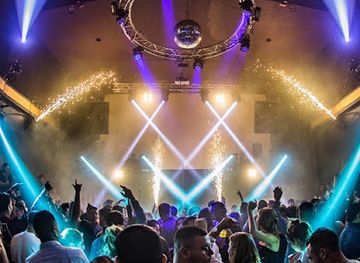
Palo Alto's evening scene is more collegiate and restaurant-led than club-focused. University Avenue has the greatest concentration of wine bars, cocktail venues, pubs and late-opening restaurants, with a social atmosphere shaped by Stanford students, academics, technology workers and local residents. California Avenue provides a quieter alternative, combining neighbourhood bars with cafés and restaurants. Live music and cultural events can appear through Stanford's performing-arts programmes and local venues, while cinemas, lectures and gallery events broaden the choices after dark. The city has nightlife, but it is generally dispersed and relatively restrained rather than centred on a large club district. Evening walks should remain attentive to traffic and bicycles, and visitors should check current venue information because opening patterns and performance schedules can change.
-
Night club
The Patio @ Rudy's
Experience the lively nightlife at The Patio @ Rudy's, a top destination for entertainment, dining, and socializing in Palo Alto.
6 min drive · 1.9 km from city centre
-
Bar
The Rose & Crown
Experience the vibrant nightlife at The Rose & Crown in Palo Alto, where craft beers and cocktails meet a lively atmosphere.
5 min drive · 1.7 km from city centre
-
Wine bar
The Wine Room
Experience a delightful blend of fine wines and exquisite tapas at The Wine Room in Palo Alto, where every sip tells a story.
5 min drive · 1.7 km from city centre
-
Night club
Monte Carlo Restaurant & Bar
Discover the lively atmosphere of Monte Carlo Restaurant & Bar, where delicious food meets electrifying nightlife in Mountain View, California.
23 min drive · 7.8 km from city centre


Best shops in Palo Alto
Shopping in Palo Alto centres on two distinct commercial corridors. University Avenue runs through downtown with independent bookshops, fashion and specialist retailers, cafés, galleries and services, while California Avenue has a smaller-scale, neighbourhood feel with boutiques, food shops and everyday businesses. Stanford Shopping Center, on El Camino Real, provides a larger open-air retail environment with department stores and luxury-oriented brands, contrasting with the city's independent streets. Farmers' markets offer seasonal Californian produce, flowers, baked goods and prepared foods rather than a traditional craft-market experience. Visitors will find design-led gifts, books, regional food products and technology-related merchandise more readily than a single signature souvenir. Store mixes change over time, so Palo Alto is best understood as a set of walkable shopping areas rather than one historic bazaar or specialist craft district.
-
Shopping mall
Stanford Shopping Center
Discover luxury shopping and dining at Stanford Shopping Center, a premier destination in Palo Alto, California, surrounded by scenic beauty.
8 min drive · 2.5 km from city centre
-
Shopping mall
Town & Country Village
Discover the charm of Town & Country Village, a premier shopping destination in Palo Alto offering unique stores, dining, and vibrant community events.
5 min drive · 1.5 km from city centre
-
Department store
Macy's
Discover a shopper's paradise at Macy's Stanford Shopping Center, where fashion meets convenience in the heart of Palo Alto.
7 min drive · 2.5 km from city centre
-
Department store
Nordstrom
Explore Nordstrom in Palo Alto for a unique shopping experience with top fashion brands and exceptional customer service.
8 min drive · 2.7 km from city centre


Get your free copy of our complete guide to Palo Alto, delivered straight to you.
Everything on this page, from attractions and restaurants to essentials and local phrases, in one PDF you can read offline, print or share.
Already have an account? Sign in
Your Palo Alto guide is ready.
We'll send it to · Not you? Sign out

Getting your guide ready…
We are putting together a fresh copy of the Palo Alto guide. This can take up to a minute.
This can take a few moments. If your browser asks, choose Allow so the download can start. You'll find the guide in your Downloads folder.
Nothing happened? Download it again
Sorry, the guide is taking longer than usual. Please try again in a minute, or get it by email instead.
Palo Alto essentials
Currency and Payment
Safety
Emergency Situations
Do's and Don'ts
Local Tips
From Eve
Local phrases worth knowing
You don't need to get them perfect. A few words go a long way, and locals appreciate the effort.
Basics
| English | Local | Say it |
|---|---|---|
| Hello | Hey there | [Hey there] |
| Goodbye | See you later | [See you later] |
| Yes | Yep | [Yep] |
| No | Nah | [Nah] |
| Please/You're welcome | Sure thing | [Sure thing] |
| Thank you | Thanks a bunch | [Thanks a bunch] |
| Excuse me/Sorry | Pardon me | [Pardon me] |
| How are you? | How's it going? | [How's it going?] |
| Fine. And you? | Doing well. How about you? | [Doing well. How about you?] |
| Do you speak English? | Can you speak English? | [Can you speak English?] |
| I don't understand | I'm lost | [I'm lost] |
Eating & Drinking
| English | Local | Say it |
|---|---|---|
| I'd like to see the menu, please | Can I check out the menu? | [Can I check out the menu?] |
| I don't eat meat | I'm vegetarian | [I'm vegetarian] |
| Cheers! | Here's to you! | [Here's to you!] |
| I would like to pay, please | I'll settle the bill, thanks | [I'll settle the bill, thanks] |
Emergencies
| English | Local | Say it |
|---|---|---|
| Help! | I need assistance! | [I need assistance!] |
| Go away! | Please leave me alone | [Please leave me alone] |
| Call the Police! | Contact the authorities! | [Contact the authorities!] |
| Call a doctor! | Get me a doctor! | [Get me a doctor!] |
| I'm lost | I can't find my way | [I can't find my way] |
| I'm ill | I'm not feeling well | [I'm not feeling well] |
Shopping
| English | Local | Say it |
|---|---|---|
| I'd like to buy... | I'm interested in buying... | [I'm interested in buying...] |
| I'm just looking | Just browsing | [Just browsing] |
| How much is it? | What's the price? | [What's the price?] |
| That's too expensive | That's too pricey | [That's too pricey] |
| Can you lower the price? | Can you give me a discount? | [Can you give me a discount?] |
Time & Numbers
| English | Local | Say it |
|---|---|---|
| What time is it? | Do you have the time? | [Do you have the time?] |
| It's one o'clock | It's one | [It's one] |
| Half past (10) | Ten thirty | [Ten thirty] |
| Morning | AM | [AM] |
| Afternoon | PM | [PM] |
| Evening | Evening | [Evening] |
| Yesterday | Yesterday | [Yesterday] |
| Today | Today | [Today] |
| Tomorrow | Tomorrow | [Tomorrow] |
| 1 | One | [One] |
| 2 | Two | [Two] |
| 3 | Three | [Three] |
| 4 | Four | [Four] |
| 5 | Five | [Five] |
| 6 | Six | [Six] |
| 7 | Seven | [Seven] |
| 8 | Eight | [Eight] |
| 9 | Nine | [Nine] |
| 10 | Ten | [Ten] |
Transport & Directions
| English | Local | Say it |
|---|---|---|
| Where's a/the...? | Where can I find...? | [Where can I find...?] |
| What's the address? | What's the location? | [What's the location?] |
| Can you show me (on the map)? | Can you guide me (on the map)? | [Can you guide me (on the map)?] |
| When's the next (bus)? | When's the following (bus)? | [When's the following (bus)?] |
| A ticket (to ....) | One ticket (to ....) | [One ticket (to ....)] |
History of Palo Alto
Ohlone Country and the Tall Palo Alto
Before European settlement, the area around present-day Palo Alto was occupied and used by Ohlone peoples, whose communities depended on the peninsula's oak woodlands, streams, grasslands and bayshore wetlands. The city's name refers to a prominent coast redwood, El Palo Alto, standing near San Francisquito Creek. Members of Gaspar de Portolá's 1769 expedition recorded the tree while travelling along the peninsula, and it later became a lasting geographical marker. Spanish and Mexican rule introduced missions, ranching and new landholding systems that profoundly disrupted Indigenous life. The creek, tree and marshes nevertheless remained central features of the landscape as the region moved towards American settlement.
Mayfield and Early American Settlement
Following Mexican independence and the secularisation of the missions, much of the surrounding peninsula became associated with large ranchos, including Rancho Rinconada de los Gatos and other landholdings along San Francisquito Creek. The town of Mayfield was established in 1855 near what is now California Avenue, developing around agriculture, commerce and the Southern Pacific railway. Its name survived in local streets and neighbourhood identity after the newer settlement of Palo Alto grew to the north. This early period established patterns that remain visible today: railway-linked town centres, irrigated landscapes and a strong relationship between residential districts and the productive lands of the Peninsula.
Stanford University Takes Shape
Leland Stanford, a former governor of California and railroad leader, and his wife, Jane Stanford, founded Stanford University in memory of their only child, Leland Stanford Jr. The university opened in 1891 on the former Stanford family stock farm, with Frederick Law Olmsted involved in the early landscape planning and Charles Allerton Coolidge associated with the campus's Romanesque architecture. Stanford's Main Quad, Memorial Church and arcaded sandstone buildings created a distinctive academic setting, while the institution attracted scholars, students and investment to the developing community. Its presence would become the defining influence on Palo Alto's education, culture, property and technology economies.
Incorporation and the Mayfield Merger
Palo Alto incorporated as a city in 1894, initially developing around the university, railway and residential districts near University Avenue. The community promoted a planned, tree-filled character and grew as Stanford expanded. Mayfield, meanwhile, retained its separate civic identity around California Avenue until Palo Alto annexed it in 1925. The merger brought the older town's commercial centre and established neighbourhoods into the same municipality, explaining why Palo Alto has two principal historic business corridors. During the early twentieth century, homes, schools, gardens and civic buildings expanded across the former ranch and orchard landscape, laying the foundations of the city seen today.
Research, Industry and Silicon Valley
Palo Alto's modern reputation emerged through the close relationship between Stanford University, research institutions and private enterprise. In 1939, Stanford graduates William Hewlett and David Packard began work in a garage at 367 Addison Avenue; the property is privately owned, but it became an enduring symbol of the region's technology history. Stanford's encouragement of industrial collaboration, together with the growth of electronics and computing firms across the Santa Clara Valley, helped create the economic culture later known as Silicon Valley. Palo Alto developed as a centre for research, venture capital and technology companies while retaining neighbourhoods, civic spaces and historic buildings from its earlier life.
Palo Alto in Photos
Browse through our photo collection highlighting the charm and character of the destination.
Cities near Palo Alto
The closest cities to Palo Alto, if you have time for more than one stop.
-

-

-

-
-


Swipe for more cities
Explore more
Explore more of California
Discover California: A land of diverse landscapes, iconic cities, and endless adventures, from sun-soaked beaches to towering redwoods and vibrant cultural experiences.
Explore California