

Bassa (Douala) Travel Guide - Free
Explore Bassa in Douala with Evendo's free guide. Find the best shops, historic streets, restaurants, and gems on web or mobile.


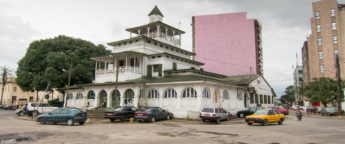


Bassa, Douala reveals Cameroon’s industrial heart through railway corridors, busy markets, local eateries, workshops and everyday urban life beyond the centre.
Industry and Urban Scale
Bassa occupies a broad area of eastern Douala, where major road and railway corridors meet one of the city’s most important concentrations of manufacturing, warehousing and commerce. It is less a compact sightseeing quarter than a working urban landscape: long traffic arteries, industrial compounds, roadside workshops, neighbourhood markets and densely settled residential districts create a sense of movement throughout the day. The area is commonly associated with Douala III and with the approaches leading towards Japoma and the road to Édéa, although local boundaries are fluid rather than marked by a single formal centre.Read more about Bassa
Street Life and Local Character
Connections and Contemporary Douala
Explore Bassa on the map
A handpicked selection of must-see spots in Bassa, mapped for you.
Best hotels in Bassa
Bassa essentials
Getting There
Getting Around
Safety
Emergency Situations
Do's and Don'ts
Local Tips

From Eve
Local phrases worth knowing
You don't need to get them perfect. A few words go a long way, and locals appreciate the effort.
Basics
| English | Local | Say it |
|---|---|---|
| Hello | Mbolo | [m-boh-loh] |
| Goodbye | Adios | [ah-dyohs] |
| Yes | Ee | [ee] |
| No | Aa | [ah] |
| Please/You're welcome | Kala | [kah-lah] |
| Thank you | Mesi | [meh-see] |
| Excuse me/Sorry | Ate | [ah-teh] |
| How are you? | Na mapan? | [nah mah-pahn] |
| Fine. And you? | Na mapan. A na? | [nah mah-pahn. ah nah] |
| Do you speak English? | Na si Inglis? | [nah see een-glees] |
| I don't understand | A na tondi | [ah nah tohn-dee] |
Eating & Drinking
| English | Local | Say it |
|---|---|---|
| I'd like to see the menu, please | Na mbo nde menu, kala | [nah m-boh ndeh meh-noo, kah-lah] |
| I don't eat meat | A na mi nda nyama | [ah nah mee ndah nyah-mah] |
| Cheers! | Kwassa! | [kwah-sah] |
| I would like to pay, please | Na mbo nde pa, kala | [nah m-boh ndeh pah, kah-lah] |
Emergencies
| English | Local | Say it |
|---|---|---|
| Help! | Ndolo! | [ndoh-loh] |
| Go away! | Wewa! | [weh-wah] |
| Call the Police! | Nkolle polis! | [n-kohl-leh poh-lees] |
| Call a doctor! | Nkolle dokta! | [n-kohl-leh dohk-tah] |
| I'm lost | A na jeka | [ah nah jeh-kah] |
| I'm ill | A na mba | [ah nah mbah] |
Shopping
| English | Local | Say it |
|---|---|---|
| I'd like to buy... | Na mbo nde... | [nah m-boh ndeh...] |
| I'm just looking | A na yi nde | [ah nah yee ndeh] |
| How much is it? | E ndi senga? | [eh ndee sehn-gah] |
| That's too expensive | I nja sengi | [ee njah sehn-gee] |
| Can you lower the price? | A na ke ba senga? | [ah nah keh bah sehn-gah] |
Time & Numbers
| English | Local | Say it |
|---|---|---|
| What time is it? | E ngum sika? | [eh ngoom see-kah] |
| It's one o'clock | E yi na sika | [eh yee nah see-kah] |
| Half past (10) | E yi ndi (10) | [eh yee ndee (10)] |
| Morning | Meka | [meh-kah] |
| Afternoon | Ngo | [ngoh] |
| Evening | Ngwai | [ng-wah-ee] |
| Yesterday | Mimba | [meem-bah] |
| Today | Meka | [meh-kah] |
| Tomorrow | Mima | [mee-mah] |
| 1 | Eya | [eh-yah] |
| 2 | Ene | [eh-neh] |
| 3 | Eta | [eh-tah] |
| 4 | Ena | [eh-nah] |
| 5 | Ese | [eh-seh] |
| 6 | Sese | [seh-seh] |
| 7 | Soho | [soh-hoh] |
| 8 | Soso | [soh-soh] |
| 9 | Sote | [soh-teh] |
| 10 | Meka | [meh-kah] |
Transport & Directions
| English | Local | Say it |
|---|---|---|
| Where's a/the...? | E na... | [eh nah...] |
| What's the address? | E ndi adres? | [eh ndee ah-drehss] |
| Can you show me (on the map)? | A na yi sika (na map)? | [ah nah yee see-kah (nah map)] |
| When's the next (bus)? | E ngum nde (bus)? | [eh ngoom ndeh (boos)] |
| A ticket (to ....) | Nkolle tiket (si ....) | [n-kohl-leh tee-keh (see)] |
History of Bassa
From Peri-Urban Land to Douala’s Eastern Edge
Bassa developed on the eastern side of Douala as the city expanded beyond its older commercial and administrative districts. The name refers to the Bassa people, whose historic homeland lies in the wider Littoral and central-southern region of Cameroon; the neighbourhood should not, however, be treated as a self-contained traditional settlement or as a demographic label for every resident. During the colonial and post-colonial periods, roads, administrative growth and the demand for urban land gradually drew the area into Douala’s metropolitan orbit. Its position away from the old port and central business district made it suitable for larger plots, transport connections and industrial activity as the city grew.
Railways, Roads and Industrial Expansion
The railway linking Douala with Yaoundé and the eastern road approaches helped change Bassa from an outer urban zone into a strategic logistics and production area. Rail transport connected the port city with inland markets and the national economy, while the road corridor towards Édéa and the south-east carried passengers, agricultural goods, manufactured products and heavy freight. Industrial premises, depots, workshops and storage yards appeared alongside housing and small commerce. This combination produced the mixed landscape that still characterises Bassa, where factories and transport infrastructure stand close to schools, churches, markets and residential streets.
Post-Independence Metropolisation
After Cameroon’s independence in 1960, Douala’s role as the country’s principal port and commercial centre accelerated the urbanisation of Bassa. Employment in manufacturing, distribution, construction and transport attracted people from across Cameroon and contributed to the district’s socially mixed character. New housing and informal building filled spaces between established industrial sites, while markets and roadside businesses adapted to the needs of a growing workforce. Rather than developing around a single civic square, Bassa expanded through corridors, junctions and incremental neighbourhood growth, producing the dispersed urban form visible today.
A Working District in a Growing City
In recent decades, Bassa has remained closely tied to Douala’s industrial and logistical economy while absorbing further residential expansion. Congestion, drainage, road maintenance and the coexistence of heavy vehicles with pedestrians are recurring urban-management challenges for a district built around movement and employment. At the same time, local commerce, food businesses, repair workshops and community institutions give the area a life beyond its factories and warehouses. Bassa’s contemporary identity therefore reflects both the pressures of metropolitan growth and the practical importance of the workers, traders and families who sustain eastern Douala.
Bassa in Photos
Browse through our photo collection highlighting the charm and character of the destination.
Neighbourhoods near Bassa
The closest neighbourhoods to Bassa, if you have time for more than one stop.
-

-

-


Swipe for more neighbourhoods
Explore more

Explore more of Douala
Douala, Cameroon’s Atlantic port city, combines Wouri estuary scenery, contemporary art, lively markets, Makossa music and distinctive coastal cuisine.
Explore Douala