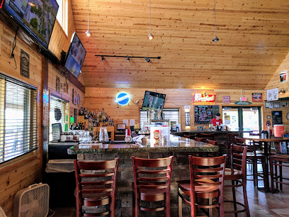
Discover the Majestic Mantario Trail: A Hiker's Paradise
Explore the breathtaking Mantario Trail in Whiteshell, Manitoba – a perfect destination for hiking, wildlife watching, and outdoor adventures.
The Mantario Trail at the South Trailhead in the beautiful Whiteshell Provincial Park offers an unforgettable hiking experience amidst breathtaking landscapes. Spanning over 60 kilometers, this trail showcases the natural beauty of Manitoba with its dense forests, tranquil lakes, and rugged terrain. Ideal for both experienced hikers and nature lovers, the trail provides a perfect escape into the wilderness, making it a must-visit for tourists seeking adventure and serenity.
A brief summary to Mantario Trail - South Trailhead
- MB-312, Whiteshell, Manitoba, R0E 2H0, CA
- +1204-369-3157
Local tips
- Plan your hike during the week to avoid crowds, especially in peak seasons.
- Bring plenty of water and snacks, as there are limited facilities along the trail.
- Check the weather forecast before your visit, as conditions can change rapidly.
- Wear sturdy footwear to navigate the varied terrain safely.
- Consider visiting in the fall for stunning foliage and fewer mosquitoes.
Getting There
-
Car
From central Cariboo, head east on Highway 97 (Cariboo Highway). Continue for approximately 30 kilometers until you reach the junction with Highway 1 (Trans-Canada Highway). Take the exit towards Highway 1 East and merge onto it. Continue on Highway 1 for about 350 kilometers until you reach the town of Falcon Lake. From Falcon Lake, take Provincial Road 312 north, and continue for about 15 kilometers. The Mantario Trail - South Trailhead will be located on your left at the coordinates 49.801792, -95.184367.
-
Public Transportation
Take a bus from Cariboo to Winnipeg. From Winnipeg, you will need to take a bus or a train heading towards Falcon Lake. You may need to check the current schedules on Manitoba Transit. Upon arriving at Falcon Lake, you will need to arrange for a taxi or rideshare service to take you to the Mantario Trail - South Trailhead. The trailhead is approximately 15 kilometers north of Falcon Lake. Be sure to confirm the cost of the taxi in advance as prices may vary.
-
Bicycle
If you are an adventurous cyclist, you can cycle from Cariboo to the Mantario Trail. Start by heading east on Highway 97 towards Highway 1. Once you merge onto Highway 1, follow the route to Falcon Lake and then take Provincial Road 312 north. Note that this route is approximately 400 kilometers and will require multiple days of cycling, so plan accordingly. Ensure you carry enough supplies and check the weather conditions before setting out.
Discover more about Mantario Trail - South Trailhead
Iconic landmarks you can’t miss
Caddy Lake
2.1 km
Explore Manitoba's Caddy Lake: Canoe through historic tunnels, fish in pristine waters, and discover Whiteshell Provincial Park's beauty.
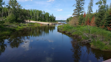
Hunt Lake
6.7 km
Discover the rugged beauty of Hunt Lake in Whiteshell Provincial Park, Manitoba, with its challenging trails and breathtaking Canadian Shield scenery.

Falcon Beach Ranch
16.3 km
Discover the perfect blend of relaxation and adventure at Falcon Beach Ranch in Falcon Lake, Manitoba. A haven for nature lovers and equestrian enthusiasts alike.

Bannock Point Petroforms
46.4 km
Discover the sacred beauty of Bannock Point Petroforms in Manitoba, where Indigenous history and stunning landscapes come together for an unforgettable experience.
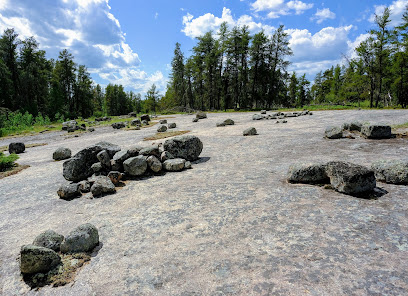
Caribou Falls Lodge
51.2 km
Experience world-class fishing and comfortable wilderness accommodations at Caribou Falls Lodge, your gateway to Northwestern Ontario's English River system.
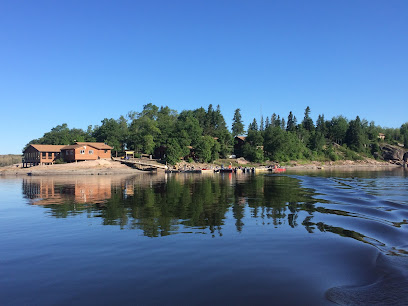
Northernmost Point of the Contiguous US
53.1 km
Explore the Northernmost Point of the Contiguous US in Angle Inlet, Minnesota – a stunning historical landmark with breathtaking views.

Barrier Bay Resort
56.2 km
Experience the tranquility of Barrier Bay Resort, a lodge nestled in the heart of Whiteshell Provincial Park, perfect for outdoor enthusiasts and relaxation seekers.

Flag Island Resort
56.6 km
Discover the perfect blend of relaxation and adventure at Flag Island Resort, a serene getaway in the heart of Minnesota's natural beauty.

Eastman Tourism
59.3 km
Explore the natural beauty and cultural heritage of Eastman, Manitoba with Eastman Tourism – your gateway to unforgettable experiences.

Unmissable attractions to see
Caddy Lake Tunnel #1
4.4 km
Discover the historic Caddy Lake Tunnel #1 in the heart of Whiteshell Provincial Park, where adventure and natural beauty converge for an unforgettable experience.

Whiteshell Provincial Park
21.4 km
Discover the natural beauty and adventure opportunities at Whiteshell Provincial Park, a premier destination for nature lovers in Eastern Manitoba.
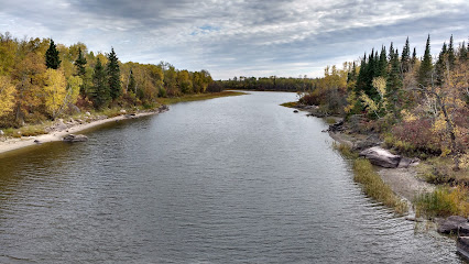
Lake of the Woods
48.4 km
Explore the stunning landscapes and outdoor adventures at Lake of the Woods, a natural paradise in Ontario perfect for every traveler.

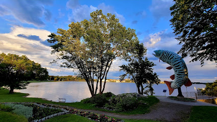
Husky the Muskie
49.5 km
Experience the charm of Husky the Muskie, a legendary giant fish statue in Kenora, Ontario, surrounded by stunning natural beauty and local culture.
Fort St. Charles Historic Site
51.1 km
Discover the rich heritage of Fort St. Charles, a historic site that offers insights into the life of early French fur traders in Minnesota.

Pinawa Dam Provincial Heritage Park
70.4 km
Explore the captivating beauty and historical significance of Pinawa Dam Provincial Heritage Park, a must-visit destination in Manitoba for nature lovers.

Garden Island State Recreation Area
73.6 km
Explore the stunning landscapes and tranquil trails of Garden Island State Recreation Area, a perfect escape for nature lovers and adventure seekers in Minnesota.

Eastman ATV Staging Area
79.2 km
Discover adventure at Eastman ATV Staging Area, a premier destination for ATV enthusiasts and nature lovers in Manitoba's beautiful wilderness.

Arnesen's Rocky Point Resort
93.9 km
Discover tranquility at Arnesen's Rocky Point Resort, where stunning lakeside views meet outdoor adventure in the heart of Minnesota.
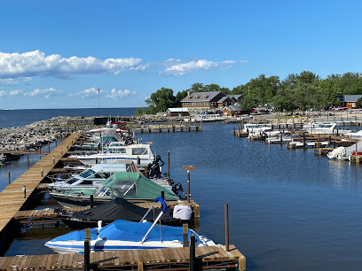
Nopiming Provincial Park
98.0 km
Discover the enchanting beauty and outdoor adventures of Nopiming Provincial Park, a true natural gem in Manitoba, Canada.
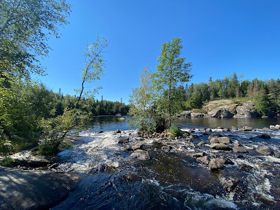
The Shed
99.3 km
Explore the rich history and charming culture of Warroad, Minnesota, at The Shed, a unique museum filled with captivating exhibits and local memorabilia.

Essential places to dine
Spicy Radish Cafe
59.0 km
Discover culinary delights at Spicy Radish Cafe - where fresh ingredients meet comforting flavors in Whitemouth's heart.

Wilderness Edge Retreat and Conference Centre
62.6 km
Discover tranquility at Wilderness Edge Retreat and Conference Centre in Manitoba - where nature meets relaxation.

Jennifer's Restaurant-Picnic
68.8 km
Experience the essence of modern European cuisine at Jennifer's Restaurant-Picnic in scenic Seven Sisters Falls.

Lagimodière Restaurant
93.2 km
Experience authentic Canadian cuisine at Lagimodière Restaurant in Richer, Manitoba - where local flavors meet exceptional hospitality.

Breezy Oaks Inn & Tavern
98.5 km
Discover comfort and delicious dining at Breezy Oaks Inn & Tavern in Beausejour - where hospitality meets culinary delight.

Markets, malls and hidden boutiques
Abundance Home
50.0 km
Explore Abundance Home in Kenora for unique gifts and local artistry, showcasing the best of Ontario's craftsmanship in a charming setting.

The Manitobamade store
80.5 km
Explore The Manitobamade Store in Lac du Bonnet for unique locally crafted gifts that celebrate the essence of Manitoba.

Lac du Bonnet Liquor Mart
80.6 km
Discover local and imported spirits at Lac du Bonnet Liquor Mart, your go-to destination for a diverse selection of beers, wines, and more in Manitoba.

Narrows The (Lake Of The Woods) Ltd
89.8 km
Explore the charm of Narrows The (Lake Of The Woods) Ltd, a gift shop filled with unique local treasures in Sioux Narrows, Ontario.

Doug's Supermarket
99.7 km
Explore Doug's Supermarket in Warroad for fresh produce, baked goods, and a welcoming shopping experience that reflects local charm.

Essential bars & hidden hideouts
Jerry's Restaurant & Lounge
53.1 km
Discover the flavors of Angle Inlet at Jerry's Restaurant & Lounge, where local cuisine meets a cozy atmosphere for an unforgettable dining experience.
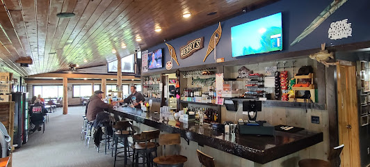
Sportsman's Oak Island Lodge
59.9 km
Experience the perfect blend of adventure and relaxation at Sportsman's Oak Island Lodge, the ultimate retreat for fishing and outdoor enthusiasts in Minnesota.
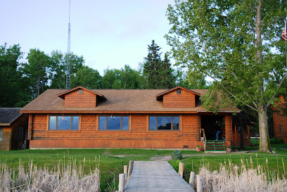
Wild Skies Resort
68.9 km
Discover the perfect getaway at Wild Skies Resort, a serene haven in River Hills, Manitoba, offering stunning nature and cozy accommodations.
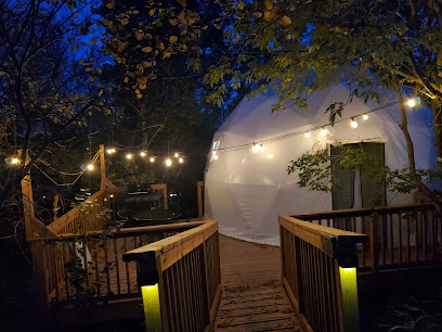
Rock Harbor Lodge
93.9 km
Experience the rustic charm and natural beauty at Rock Harbor Lodge, a perfect retreat for food lovers and nature enthusiasts in Minnesota.
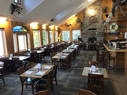
Izzy's Lounge and Grill
99.3 km
Experience the perfect blend of flavor and atmosphere at Izzy's Lounge and Grill in Warroad, Minnesota, where every meal tells a delicious story.

Joab's Algoma Eatery and Tavern
99.4 km
Discover the flavors of Warroad at Joab's Algoma Eatery and Tavern, where local ingredients meet a warm, inviting atmosphere.

Nomad Tavern
99.8 km
Discover Nomad Tavern in Warroad, MN, where local flavors meet a cozy atmosphere for a memorable dining experience.
