

Free Fraser Valley Travel Guide & Mobile App
Explore Fraser Valley with free travel guides. Discover regional history, expert tips, proposed trips, and audio guides on web or mobile app.


Explore Fraser Valley for fertile farmland, Stó:lō heritage, river landscapes, mountain trails, lakes, farm shops and seasonal local produce.
Read more about Fraser Valley
When is the best time to visit Fraser Valley?
Best: June–August · 22–25°C| Month | High (°C) | Rainfall (mm) |
|---|---|---|
| January | 6 | 150 |
| February | 7 | 120 |
| March | 10 | 130 |
| April | 15 | 100 |
| May | 19 | 80 |
| June (best) | 22 | 60 |
| July (best) | 25 | 40 |
| August (best) | 25 | 40 |
| September | 21 | 70 |
| October | 15 | 110 |
| November | 9 | 130 |
| December | 7 | 160 |
Getting to and around Fraser Valley
How to get there
Transportation
Best landmarks in Fraser Valley
The Fraser River is the region's defining natural landmark, flowing past floodplain farms, islands and settlements before the landscape tightens towards the eastern mountains. Mount Cheam, part of the Cheam Range above Chilliwack, is a prominent visual presence and a destination for experienced hikers when access and conditions permit. Cultus Lake is another recognisable feature, set within forested mountains and associated with both recreation and long-standing local communities. Bridal Veil Falls forms a distinctive seasonal landmark near Rosedale, where water drops over a broad rock face into a wooded valley. Around Harrison Mills, the Harrison River and old agricultural landscape provide the setting for Kilby Historic Site, whose buildings represent the commercial and farming history of the area. Mission's Westminster Abbey, perched above the Fraser on a wooded hillside, is an important modern religious and architectural landmark. In the east, Hope's meeting of river corridors and mountain routes gives the town a geographic significance that is more important than monumental architecture: it marks the transition from broad valley agriculture to the Fraser Canyon and interior landscapes.
-
Event venue
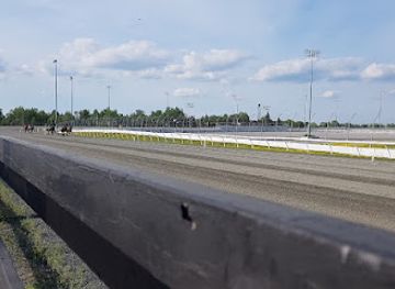
Kawartha Downs Events
Experience the thrill of harness racing, casino excitement, and diverse entertainment at Kawartha Downs in Fraserville, Ontario.
Explore Fraser Valley on the map
Plan your trip on one map. See where the top cities, national parks and sights are, and book hotels and experiences in a few clicks.
Best hotels in Fraser Valley
Best restaurants in Fraser Valley
Dining in the Fraser Valley is closely connected to its agricultural economy. Abbotsford and Chilliwack offer the broadest choice, from cafés, bakeries and family-run restaurants to contemporary kitchens using berries, apples, vegetables, dairy products and locally raised meat. Seasonal farm stands and markets are especially useful for sampling fresh produce, jams, honey and baked goods, while wineries, cideries, breweries and rural tasting rooms provide a regional drinks culture without requiring a formal vineyard itinerary. Harrison Hot Springs combines casual lakeside eating with hotel and resort dining, and smaller communities are known more for pubs, cafés and informal family restaurants than for a concentrated fine-dining scene. Local menus may also feature Pacific Northwest ingredients, including salmon and other seafood, but these belong to a wider British Columbian food culture rather than being exclusive to the Fraser Valley. As the growing season shapes availability, visitors should expect some farm experiences and produce stalls to be seasonal.
-
Brunch
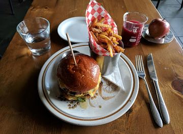
SCHOOL Restaurant
Experience a playful twist on brunch at SCHOOL Restaurant in Toronto, where comfort food meets culinary creativity.
Best bars in Fraser Valley
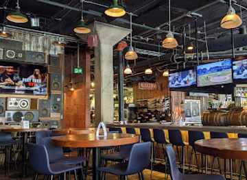
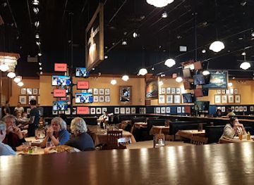
Evening life in the Fraser Valley is generally low-key and concentrated in Abbotsford, Chilliwack, Mission and Harrison Hot Springs rather than organised around a large club district. Traditional pubs, breweries, cideries, wine-focused venues and restaurant bars form the main options, with live music and community events appearing in larger towns and resort areas. Abbotsford has the broadest range of evening venues, while Chilliwack combines independent bars, pubs and cultural programming with an early-closing small-city rhythm. Harrison Hot Springs can feel busier during summer weekends, when visitors gather around the lake and resort, but its nightlife remains more relaxed than that of nearby Vancouver. In rural areas, evenings are usually centred on a pub, inn or accommodation rather than late-night entertainment. Check current arrangements locally, as smaller venues and seasonal events can change more frequently than the region's established attractions.
-
Restaurant
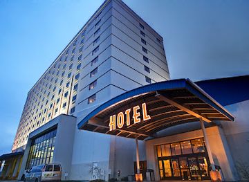
Island Resort & Casino
Discover endless entertainment, fine dining, and luxurious accommodations at Island Resort & Casino in Michigan's beautiful wilderness.
-
Californian
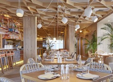
KŌST
Experience the best of Californian cuisine at KŌST, where exquisite flavors meet breathtaking views in Toronto's vibrant skyline.
-
Restaurant
LOCAL Public Eatery Liberty Village
Discover the vibrant LOCAL Public Eatery in Liberty Village, where delicious food meets a lively atmosphere for an unforgettable dining experience.
-
Grill
Jack's Don Mills
Experience the authentic taste of American cuisine at Jack's Don Mills, a family-friendly grill and gastropub in North York, Ontario.
Best nightclubs in Fraser Valley
Evening life in the Fraser Valley is generally low-key and concentrated in Abbotsford, Chilliwack, Mission and Harrison Hot Springs rather than organised around a large club district. Traditional pubs, breweries, cideries, wine-focused venues and restaurant bars form the main options, with live music and community events appearing in larger towns and resort areas. Abbotsford has the broadest range of evening venues, while Chilliwack combines independent bars, pubs and cultural programming with an early-closing small-city rhythm. Harrison Hot Springs can feel busier during summer weekends, when visitors gather around the lake and resort, but its nightlife remains more relaxed than that of nearby Vancouver. In rural areas, evenings are usually centred on a pub, inn or accommodation rather than late-night entertainment. Check current arrangements locally, as smaller venues and seasonal events can change more frequently than the region's established attractions.
-
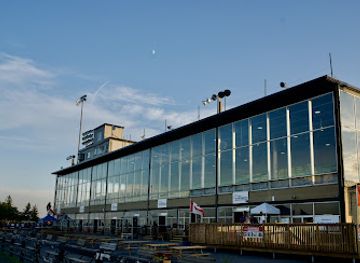
Event venue
Kawartha Downs Events
Discover the ultimate entertainment experience at Kawartha Downs Events, where casino thrills, live music, and delectable dining await in Ontario.
Best shops in Fraser Valley
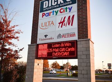
Shopping in the Fraser Valley is shaped by market towns, agricultural production and independent businesses rather than by a single regional shopping quarter. Abbotsford provides the largest conventional retail selection, including shopping centres, everyday high-street services, specialist food shops and independent boutiques, while Chilliwack has a traditional downtown with cafés, local retailers, antiques and arts-oriented businesses. Farm shops and seasonal stands are the best places to buy berries, apples, preserves, honey, vegetables, wine, cider and other locally produced goods, although opening arrangements vary through the year. Harrison Hot Springs offers small-town visitor retail, locally themed gifts and practical outdoor items, while Mission and Hope have independent shops serving residents as well as travellers. Pottery, artwork, books, handmade goods and regional food products make more useful souvenirs than generic mass-produced items. Visitors should distinguish genuine local produce from products merely labelled with a broad British Columbian identity, and should ask permission before entering working farm premises or photographing private businesses.
-
Shopping mall
Macomb Mall
Discover the ultimate shopping experience at Macomb Mall in Roseville, Michigan, featuring diverse stores, dining options, and family-friendly entertainment.
-
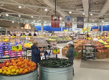
Supermarket
Meijer
Experience the best of grocery and general shopping at Meijer in Fraser, Michigan, where variety, affordability, and convenience meet.
-
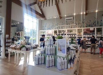
Gift shop
Bleu Lavande (Blue Lavender)
Discover Bleu Lavande, a breathtaking lavender farm and gift shop in Magog, Quebec, offering unique lavender products and stunning landscapes.
-
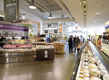
Gourmet grocery store
McEwan Fine Foods (Don Mills)
Explore McEwan Fine Foods in Don Mills for a premium selection of gourmet groceries and culinary delights that will tantalize your taste buds.
Get your free copy of our complete guide to Fraser Valley, delivered straight to you.
Everything on this page, from attractions and restaurants to essentials and local phrases, in one PDF you can read offline, print or share.
Already have an account? Sign in
Your Fraser Valley guide is ready.
We'll send it to · Not you? Sign out

Getting your guide ready…
We are putting together a fresh copy of the Fraser Valley guide. This can take up to a minute.
This can take a few moments. If your browser asks, choose Allow so the download can start. You'll find the guide in your Downloads folder.
Nothing happened? Download it again
Sorry, the guide is taking longer than usual. Please try again in a minute, or get it by email instead.
Fraser Valley essentials
Currency and Payment
Safety
Emergency Situations
Do's and Don'ts
Local Tips
From Eve
Local phrases worth knowing
You don't need to get them perfect. A few words go a long way, and locals appreciate the effort.
Basics
| English | Local | Say it |
|---|---|---|
| Hello | Hey there | [Hay thair] |
| Goodbye | See ya later | [See ya lay-tur] |
| Yes | Yup | [Yup] |
| No | Nah | [Nah] |
| Please/You're welcome | No problem | [No prob-lum] |
| Thank you | Thanks a lot | [Thangs a lot] |
| Excuse me/Sorry | Pardon me | [Pardon me] |
| How are you? | How's it going? | [How's it go-ing?] |
| Fine. And you? | Good, and you? | [Good, and you?] |
| Do you speak English? | Do you speak English, eh? | [Do you speak English, eh?] |
| I don't understand | I'm not following | [I'm not fol-lowing] |
Eating & Drinking
| English | Local | Say it |
|---|---|---|
| I'd like to see the menu, please | Can I see the menu, please? | [Can I see the men-u, please?] |
| I don't eat meat | I'm vegetarian | [I'm vege-tarian] |
| Cheers! | Cheers! | [Cheers!] |
| I would like to pay, please | Can I get the bill, please? | [Can I get the bill, please?] |
Emergencies
| English | Local | Say it |
|---|---|---|
| Help! | Help! | [Help!] |
| Go away! | Leave me alone! | [Leave me a-lone!] |
| Call the Police! | Call the cops! | [Call the cops!] |
| Call a doctor! | Get a doctor! | [Get a doc-tor!] |
| I'm lost | I'm kinda lost here | [I'm kinda lost here] |
| I'm ill | I'm not feeling well | [I'm not feel-ing well] |
Shopping
| English | Local | Say it |
|---|---|---|
| I'd like to buy... | I'm looking to buy... | [I'm looking to buy...] |
| I'm just looking | Just browsing, thanks | [Just brows-ing, thanks] |
| How much is it? | What's the price? | [What's the price?] |
| That's too expensive | That's way too pricey | [That's way too price-y] |
| Can you lower the price? | Can you give me a better deal? | [Can you give me a better deal?] |
Time & Numbers
| English | Local | Say it |
|---|---|---|
| What time is it? | What time is it? | [What time is it?] |
| It's one o'clock | It's one o'clock | [It's one o'clock] |
| Half past (10) | Half past ten | [Half past ten] |
| Morning | Morning | [Morn-ing] |
| Afternoon | Afternoon | [Af-ter-noon] |
| Evening | Evening | [Eve-ning] |
| Yesterday | Yesterday | [Yes-ter-day] |
| Today | Today | [To-day] |
| Tomorrow | Tomorrow | [To-mor-row] |
| 1 | One | [One] |
| 2 | Two | [Two] |
| 3 | Three | [Three] |
| 4 | Four | [Four] |
| 5 | Five | [Five] |
| 6 | Six | [Six] |
| 7 | Seven | [Seven] |
| 8 | Eight | [Eight] |
| 9 | Nine | [Nine] |
| 10 | Ten | [Ten] |
Transport & Directions
| English | Local | Say it |
|---|---|---|
| Where's a/the...? | Where's the nearest...? | [Where's the near-est...?] |
| What's the address? | What's the address? | [What's the ad-dress?] |
| Can you show me (on the map)? | Can you point it out on the map? | [Can you point it out on the map?] |
| When's the next (bus)? | When's the next bus? | [When's the next bus?] |
| A ticket (to ....) | A ticket to... | [A tick-et to...] |
History of Fraser Valley
Stó:lō Peoples and the Fraser River
The Fraser Valley is the traditional homeland of the Stó:lō peoples, whose communities have lived along the Fraser River and its tributaries since long before European settlement. The river provided transportation, salmon and other food sources, while established cultural landscapes and trading relationships connected communities across the valley. Stó:lō history remains central to the region rather than being confined to the distant past. Cultural organisations, archaeological places and contemporary communities continue to protect and interpret this heritage, offering visitors an essential perspective on the valley's geography and development.
Early Colonial Trade and Settlement
European involvement increased during the nineteenth century through the fur trade, missionary activity, river transport and the development of colonial settlements. Fort Langley, outside the contemporary Fraser Valley travel area to the west, was an important regional trading and political centre, while routes through the valley connected the coast with the interior. Colonial settlement brought new land claims, agricultural schemes and institutions that altered Indigenous access to land and resources. The resulting history is complex and includes both economic development and the continuing consequences of colonial policies.
The Fraser Canyon Gold Rush, 1858–1860s
The discovery of gold in the Fraser River and its tributaries drew prospectors and merchants into the valley and towards the canyon during the late 1850s and early 1860s. Hope became an important gateway to the interior routes, while river traffic and supply activity reshaped settlements along the Fraser. The rush was short-lived compared with later mining booms elsewhere, but it accelerated colonial administration, road building and migration. Its legacy is visible in the region's eastern transport corridors and in the historic importance of Hope as a meeting point between valley, canyon and mountain routes.
Railways and Agricultural Expansion
The arrival of the Canadian Pacific Railway in the 1880s linked the Fraser Valley more firmly to Vancouver, the interior and national markets. Railways supported the growth of towns such as Mission and Chilliwack, moved agricultural products and encouraged further settlement. Drainage, dykes and irrigation gradually converted portions of the floodplain into productive farmland, although the valley remained vulnerable to river flooding. Dairy farming, horticulture and mixed agriculture became defining parts of the regional economy, with transportation infrastructure allowing perishable produce to reach larger urban markets.
Agriculture, Migration and Sumas Prairie
The drainage of Sumas Lake in the 1920s created the agricultural area now known as Sumas Prairie, one of the most visible examples of how engineering transformed the valley landscape. Japanese Canadian farmers were among those who developed highly productive farms in British Columbia before the Second World War, when the forced removal and internment of Japanese Canadians caused profound personal and economic loss. The region's agricultural history therefore includes both innovation and injustice, and it is best understood through the experiences of Indigenous, immigrant and settler communities together.
Floods, Dykes and a Changing Valley
Flood management has shaped Fraser Valley life throughout the modern period. The great Fraser flood of 1894 and later events encouraged the construction and reinforcement of dykes, pumps and drainage systems, but they did not eliminate risk. In November 2021, atmospheric-river rainfall caused severe flooding and landslides across parts of southern British Columbia, including the Fraser Valley, damaging roads, farms and infrastructure. The event renewed attention to climate resilience, emergency planning and the need to balance agricultural protection, river processes and growing communities.
Contemporary Growth and Regional Identity
In recent decades the Fraser Valley has changed from a predominantly agricultural corridor into a diverse region of farms, suburbs, universities, manufacturing, tourism and Indigenous communities. Abbotsford and Chilliwack have expanded, while rural land continues to support food production and open landscapes. The region's identity now rests on managing competing pressures: housing and transport demand, protection of agricultural land, flood preparedness, ecological restoration and access to mountains and lakes. Visitors encounter this layered present in the contrast between busy arterial roads, working farms, historic settlements and comparatively wild upland terrain.
Fraser Valley in Photos
Browse through our photo collection highlighting the charm and character of the destination.
Neighbouring regions of Fraser Valley
The closest regions to Fraser Valley, if you have time for more than one.
-

-

-

-

-


Swipe for more regions
Explore more
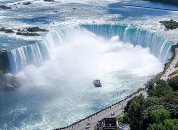
Explore more of Canada
Discover Canada's breathtaking landscapes, diverse cities, and rich cultural heritage. A must-visit destination for outdoor adventures and vibrant urban experiences.
Explore Canada