

Free Kootenays Travel Guide & Mobile App
Explore Kootenays with free travel guides. Discover regional history, expert tips, proposed trips, and audio guides on web or mobile app.


Explore British Columbia's Kootenays for mountain drives, hot springs, historic towns, lakes, skiing and wilderness across the Selkirks and Rockies.
Read more about Kootenays
When is the best time to visit Kootenays?
Best: June–August · 21–25°C| Month | High (°C) | Rainfall (mm) |
|---|---|---|
| January | 1 | 40 |
| February | 3 | 35 |
| March | 6 | 40 |
| April | 12 | 50 |
| May | 17 | 55 |
| June (best) | 21 | 50 |
| July (best) | 25 | 40 |
| August (best) | 25 | 40 |
| September | 19 | 45 |
| October | 12 | 50 |
| November | 5 | 45 |
| December | 1 | 40 |
Getting to and around Kootenays
How to get there
Transportation
Best attractions in Kootenays
The Kootenays offer a broad mixture of mountain wilderness, historic communities and outdoor recreation. Kootenay National Park is the region's best-known protected landscape, with routes through the Rocky Mountain Trench, Marble Canyon and the Kootenay Valley, while provincial parks such as Kokanee Glacier and Valhalla preserve more rugged Selkirk terrain. Lakeside travel is central around Kootenay Lake, Slocan Lake and Columbia Lake, where paddling, boating, fishing and shoreline walks are popular in suitable conditions. Developed hot springs at Ainsworth, Radium and Fairmont provide very different settings for soaking. Former mining centres including Rossland, Greenwood and Sandon reveal the region's industrial past through streetscapes, museums and surviving structures. Castlegar's Doukhobor heritage, Trail's industrial story and Cranbrook's railway collections add cultural depth. In winter, Fernie, Red Mountain, Kimberley and Panorama support downhill skiing and snowboarding, while other valleys offer Nordic skiing, snowshoeing and winter touring. The attraction landscape is defined less by a single headline sight than by the way heritage towns, long scenic drives and substantial wilderness fit together.
-
Tourist attraction
TrailTours
Discover the breathtaking beauty and adventure of TrailTours in Kawartha Lakes, Ontario, where nature and excitement await every traveler.
-
Golf course
Centennial Park Golf Centre
Discover golfing bliss at Centennial Park Golf Centre, featuring a lush golf course, driving range, and fun miniature golf for all ages in Etobicoke.
-
Lake
Lake of the Woods
Explore the stunning landscapes and outdoor adventures at Lake of the Woods, a natural paradise in Ontario perfect for every traveler.
-
Tourist attraction
Wapiti Valley Ski Resort
Experience the thrill of winter sports and the beauty of nature at Wapiti Valley Ski Resort, Saskatchewan's premier ski destination.


Best landmarks in Kootenays
Kootenay landmarks express the region's relationship with mountains, mining and transport. The distinctive canyon walls and layered limestone of Marble Canyon in Kootenay National Park provide one of the area's clearest geological symbols, while the open mountain setting around Radium Hot Springs marks the transition between the Rocky Mountain Trench and the Rockies. Kootenay Lake and its long western and eastern arms are defining geographical features rather than a single viewpoint, shaping communities, ferry routes and recreation across the West Kootenay. In Nelson, the historic civic streetscape and restored late-nineteenth- and early-twentieth-century buildings reflect the wealth generated by mining. Rossland's compact historic core recalls its gold-rush origins, and Greenwood preserves the character of a Boundary mining town. The Trail smelter complex is a major industrial landmark, representing the scale and continuing importance of metal processing in the region. In Castlegar, Doukhobor heritage buildings and the Columbia River landscape connect settlement history with agriculture and migration. The railway heritage of Cranbrook and the mountain-town architecture of Fernie and Kimberley complete a varied collection of human landmarks.
-
Boat rental service
Houseboat Holidays Ltd
Discover the tranquil beauty of Gananoque's Thousand Islands with unforgettable houseboat rentals at Houseboat Holidays Ltd.
-
Corporate office
Parks Canada Agency
Discover the essence of Canada's natural and cultural heritage at the Parks Canada Agency in Gatineau, your gateway to breathtaking landscapes and rich history.
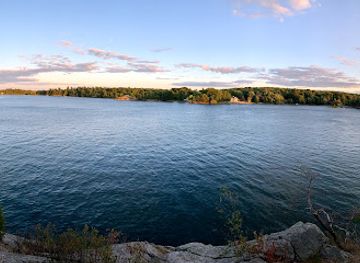

Explore Kootenays on the map
Plan your trip on one map. See where the top cities, national parks and sights are, and book hotels and experiences in a few clicks.
Best hotels in Kootenays
Best restaurants in Kootenays
Kootenay dining reflects mountain travel, agricultural valleys and a strong independent-business culture rather than one exclusive regional cuisine. Cafés, bakeries, breweries, pubs and small restaurants are concentrated in towns such as Nelson, Fernie, Rossland, Kimberley, Cranbrook and Castlegar, while rural dining options can be widely spaced. Menus commonly draw on British Columbian produce, including orchard fruit, berries, vegetables, mushrooms and locally made preserves, alongside Canadian comfort food, game where legally and responsibly sourced, and freshwater or coastal seafood supplied through wider provincial distribution. Farmers' markets provide a useful introduction to local growers, cheesemakers and prepared foods during the warmer months. The West Kootenay has a particularly visible vegetarian, organic and craft-food culture, while resort towns cater to skiers and hikers with hearty breakfasts, casual dining and après-ski menus. Regional wines and craft beer from British Columbia are widely available, and some communities also have cider, spirits and small-batch food producers.
-
Jamaican
Patty Time
Discover authentic Jamaican cuisine at Patty Time in Scarborough – famous for delicious patties and vibrant flavors.
-
Restaurant
Annie's Seafood Restaurant
Experience the freshest seafood in Stratford at Annie's Seafood Restaurant, where family-friendly dining meets coastal flavors.
-
 Restaurant
Theodore Motor Hotel
Discover comfort and culinary delights at Theodore Motor Hotel in Saskatchewan - your perfect travel stop with great food and friendly service.


Best bars in Kootenays
Evening life in the Kootenays is usually centred on independent pubs, brewpubs, cafés, restaurants and live-music rooms rather than large clubs. Nelson has the broadest concentration of bars, arts venues and late-evening entertainment, while Rossland, Fernie, Kimberley, Cranbrook, Castlegar and Trail offer smaller scenes shaped by local residents, seasonal workers and visitors. Ski areas and resort towns often have après-ski gatherings, although atmosphere and opening arrangements vary by season. Breweries and taprooms provide a relaxed alternative to conventional nightlife, and historic hotel bars and community pubs remain important social spaces in many towns. Rural areas become quiet earlier, with evening choices often limited to an inn, restaurant or pub, so do not assume that a small mountain community will have late transport or a nightclub. Alcohol service and licensing follow British Columbia regulations, and visitors should plan a safe return when staying outside town centres.
-
Car dealer
Team Chrysler Jeep Dodge RAM
Discover Mississauga's premier destination for Chrysler, Jeep, Dodge, and RAM vehicles with outstanding service and financing options.
-
Movie theater
Galaxy Cinemas Orillia
Discover unforgettable cinematic experiences at Galaxy Cinemas Orillia, where every film becomes a memorable adventure in a welcoming atmosphere.
-
Jamaican
Patty Time
Savor authentic Jamaican cuisine with mouthwatering patties and vibrant flavors at Patty Time in Scarborough, Ontario.
-
Grocery store
Yal Market
Explore Yal Market in Scarborough for fresh local produce, international delicacies, and a taste of community culture.


Best nightclubs in Kootenays
Evening life in the Kootenays is usually centred on independent pubs, brewpubs, cafés, restaurants and live-music rooms rather than large clubs. Nelson has the broadest concentration of bars, arts venues and late-evening entertainment, while Rossland, Fernie, Kimberley, Cranbrook, Castlegar and Trail offer smaller scenes shaped by local residents, seasonal workers and visitors. Ski areas and resort towns often have après-ski gatherings, although atmosphere and opening arrangements vary by season. Breweries and taprooms provide a relaxed alternative to conventional nightlife, and historic hotel bars and community pubs remain important social spaces in many towns. Rural areas become quiet earlier, with evening choices often limited to an inn, restaurant or pub, so do not assume that a small mountain community will have late transport or a nightclub. Alcohol service and licensing follow British Columbia regulations, and visitors should plan a safe return when staying outside town centres.
-
Night club
Man and Oak
Discover the vibrant mix of cocktails, music, and dance at Man and Oak, Portland's premier night club destination.

Best shops in Kootenays
Shopping in the Kootenays is concentrated in traditional town centres rather than large metropolitan malls. Nelson has the region's broadest selection of independent boutiques, bookshops, galleries, cafés and outdoor retailers, while Rossland, Fernie and Kimberley combine local shops with equipment providers serving seasonal visitors. Cranbrook and Trail offer more conventional high-street services and practical shopping for a wider surrounding area. Farmers' markets are important sources of fruit, vegetables, preserves, baked goods, local meat, cheese and prepared foods, especially in summer and early autumn, although locations and operating periods vary. Galleries and craft shops sell ceramics, woodwork, textiles, jewellery, paintings and photography made by artists working in the mountain communities. Outdoor clothing and equipment are useful purchases in a region where hiking, skiing, cycling and paddling shape everyday commerce. Good regional souvenirs include locally produced food, art and books about mining, railways, Indigenous history and mountain landscapes; visitors should buy contemporary Indigenous-made work through reputable, clearly identified sources.
-
Car dealer
Team Chrysler Jeep Dodge RAM
Discover your next vehicle at Team Chrysler Jeep Dodge RAM, where quality meets exceptional service in Mississauga.
-
Grocery store
Yal Market
Yal Market: Your Gateway to Fresh Produce and International Flavors in Scarborough.
-
Barber shop
Falls Barber Shop
Experience premium grooming services at Falls Barber Shop, the stylish retreat for tourists in Niagara Falls, Ontario, blending quality with relaxation.
-
Lake
Lake of the Woods
Experience the breathtaking beauty and recreational wonders of Lake of the Woods, a serene paradise in Kenora District, Ontario.


Get your free copy of our complete guide to Kootenays, delivered straight to you.
Everything on this page, from attractions and restaurants to essentials and local phrases, in one PDF you can read offline, print or share.
Already have an account? Sign in
Your Kootenays guide is ready.
We'll send it to · Not you? Sign out

Getting your guide ready…
We are putting together a fresh copy of the Kootenays guide. This can take up to a minute.
This can take a few moments. If your browser asks, choose Allow so the download can start. You'll find the guide in your Downloads folder.
Nothing happened? Download it again
Sorry, the guide is taking longer than usual. Please try again in a minute, or get it by email instead.
Kootenays essentials
Currency and Payment
Safety
Emergency Situations
Do's and Don'ts
Local Tips
From Eve
Local phrases worth knowing
You don't need to get them perfect. A few words go a long way, and locals appreciate the effort.
Basics
| English | Local | Say it |
|---|---|---|
| Hello | Hey there | [Hey thair] |
| Goodbye | See ya | [See yah] |
| Yes | Yup | [Yup] |
| No | Nah | [Nah] |
| Please/You're welcome | No problem | [No prob] |
| Thank you | Thanks a bunch | [Thanks a bunch] |
| Excuse me/Sorry | Pardon me | [Pardon mee] |
| How are you? | How's it going? | [How's it goin'?] |
| Fine. And you? | Good. You? | [Good. You?] |
| Do you speak English? | You speak English? | [You speak English?] |
| I don't understand | I don't get it | [I don't get it] |
Eating & Drinking
| English | Local | Say it |
|---|---|---|
| I'd like to see the menu, please | Can I see the menu? | [Can I see the menu?] |
| I don't eat meat | I'm vegetarian | [I'm vege-tair-ian] |
| Cheers! | Cheers! | [Cheers!] |
| I would like to pay, please | Can I get the bill? | [Can I get the bill?] |
Emergencies
| English | Local | Say it |
|---|---|---|
| Help! | Help! | [Help!] |
| Go away! | Leave me alone! | [Leave me alone!] |
| Call the Police! | Call the cops! | [Call the cops!] |
| Call a doctor! | Get a doctor! | [Get a doctor!] |
| I'm lost | I'm turned around | [I'm turned around] |
| I'm ill | I'm not feeling well | [I'm not feelin' well] |
Shopping
| English | Local | Say it |
|---|---|---|
| I'd like to buy... | I want to buy... | [I want to buy...] |
| I'm just looking | Just browsing | [Just browsing] |
| How much is it? | What’s the price? | [What’s the price?] |
| That's too expensive | That’s pricey | [That’s pricey] |
| Can you lower the price? | Can you make it cheaper? | [Can you make it cheaper?] |
Time & Numbers
| English | Local | Say it |
|---|---|---|
| What time is it? | What’s the time? | [What’s the time?] |
| It's one o'clock | It’s one | [It’s one] |
| Half past (10) | Half past ten | [Half past ten] |
| Morning | Morning | [Morning] |
| Afternoon | Afternoon | [Afternoon] |
| Evening | Evening | [Evening] |
| Yesterday | Yesterday | [Yesterday] |
| Today | Today | [Today] |
| Tomorrow | Tomorrow | [Tomorrow] |
| 1 | One | [One] |
| 2 | Two | [Two] |
| 3 | Three | [Three] |
| 4 | Four | [Four] |
| 5 | Five | [Five] |
| 6 | Six | [Six] |
| 7 | Seven | [Seven] |
| 8 | Eight | [Eight] |
| 9 | Nine | [Nine] |
| 10 | Ten | [Ten] |
Transport & Directions
| English | Local | Say it |
|---|---|---|
| Where's a/the...? | Where's the...? | [Where's the...?] |
| What's the address? | What’s the address? | [What’s the address?] |
| Can you show me (on the map)? | Can you point it out? | [Can you point it out?] |
| When's the next (bus)? | When’s the next bus? | [When’s the next bus?] |
| A ticket (to ....) | A ticket to... | [A ticket to...] |
History of Kootenays
Indigenous Homelands and Trade Networks
The Kootenays are part of the traditional territories of several Indigenous peoples, including the Ktunaxa, Sinixt and Secwépemc, with neighbouring communities and territories also connected across the mountain passes and river systems. These landscapes supported seasonal travel, hunting, fishing, gathering and trade long before colonial settlement. The Columbia, Kootenay and Slocan watersheds were routes through a complex interior geography rather than barriers separating isolated communities. Contemporary visitors can encounter Indigenous cultural interpretation and community-led initiatives, but should remember that cultural sites and living traditions are not simply historical attractions.
Exploration and the Fur Trade, 1800s
European exploration entered the region through the Columbia and Kootenay drainage systems. David Thompson travelled through parts of the Columbia Basin in the early nineteenth century while working for the North West Company, mapping routes and assessing opportunities for the fur trade. Trading activity never produced a large permanent European settlement across the mountains, but exploration altered existing travel networks and encouraged later commercial interest in river corridors, passes and mineral resources. The region's difficult terrain meant that waterways and mountain routes remained crucial to movement well into the colonial period.
Gold, Silver and the Mining Frontier
Mineral discoveries transformed the Kootenays during the late nineteenth century. Gold drew prospectors to areas around Rossland, while silver and lead mining helped establish communities such as Sandon and supported the growth of Nelson and the Slocan Valley. Greenwood became an important centre in the Boundary mining district, and railway construction connected mines with smelters and wider markets. Many mines later closed or declined, but their legacy remains visible in heritage buildings, abandoned workings, museums, cemeteries and the street plans of former company towns.
Railways, Smelting and Industrial Development
The arrival of the Canadian Pacific Railway and associated lines in the late nineteenth and early twentieth centuries linked the interior valleys with national and international markets. Rail transport supported mining, lumber, agriculture and tourism, while the smelter at Trail became one of the region's most important industrial enterprises. Railways also shaped town locations and immigration patterns, bringing workers and families into the valleys. Although many passenger services later disappeared, railway bridges, stations, museum collections and industrial landscapes still explain how the Kootenays became economically connected to the rest of British Columbia.
Doukhobor Settlement in the West Kootenay
At the end of the nineteenth century, Doukhobor immigrants from Russia settled in the West Kootenay, particularly around the Columbia Valley near Castlegar. Their communal agricultural settlements, pacifist religious traditions and distinctive buildings contributed significantly to the region's cultural history. Community life changed over time as land arrangements, state policies and economic pressures evolved, but Doukhobor heritage remains an important part of local identity. The Doukhobor Discovery Centre in Castlegar interprets this history through buildings, objects and accounts of settlement and daily life.
Japanese Canadian Internment during the Second World War
During the Second World War, Japanese Canadians were forcibly removed from the British Columbia coast and dispersed to interior settlements, including New Denver in the West Kootenay. The Nikkei Internment Memorial Centre preserves the history of the internment, the restrictions imposed on families and their difficult lives in the region. Its interpretation is an essential reminder that the Kootenays' history includes discrimination and state injustice as well as migration and economic development. The site connects national wartime policy with the lived experience of one particular interior community.
Postwar Industry, Conservation and Outdoor Tourism
After 1945, mining, smelting, forestry, hydroelectricity and agriculture continued to support Kootenay communities, while improvements to roads and growing recreational interest changed the visitor economy. National and provincial parks protected mountain landscapes, and ski areas developed near Rossland, Fernie, Kimberley and other communities. Environmental concerns also became more prominent, particularly around industrial pollution, wildlife habitat and large-scale resource projects. The contemporary Kootenays therefore combine an active resource economy with heritage conservation, outdoor recreation, arts communities and a strong interest in protecting the valleys and mountains on which local life depends.
Kootenays in Photos
Browse through our photo collection highlighting the charm and character of the destination.
Neighbouring regions of Kootenays
The closest regions to Kootenays, if you have time for more than one.
-

-

-

-

-


Swipe for more regions
Explore more
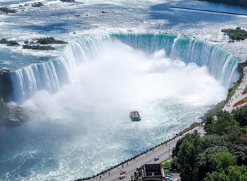
Explore more of Canada
Discover Canada's breathtaking landscapes, diverse cities, and rich cultural heritage. A must-visit destination for outdoor adventures and vibrant urban experiences.
Explore Canada