Free Yukon Travel Guide & Mobile App
Explore Yukon with free travel guides. Discover regional history, expert tips, proposed trips, and audio guides on web or mobile app.


Explore Yukon through gold-rush history, First Nations culture, glacier-clad mountains, vast wilderness, northern wildlife and remarkable seasonal light.
Read more about Yukon
When is the best time to visit Yukon?
Best: June–August · 20–22°C| Month | High (°C) | Rainfall (mm) |
|---|---|---|
| January | -14 | 18 |
| February | -11 | 15 |
| March | -4 | 13 |
| April | 7 | 10 |
| May | 17 | 11 |
| June (best) | 20 | 18 |
| July (best) | 22 | 23 |
| August (best) | 20 | 28 |
| September | 14 | 23 |
| October | 2 | 18 |
| November | -6 | 13 |
| December | -13 | 8 |
Getting to and around Yukon
How to get there
Transportation
Best attractions in Yukon
Yukon's attractions are inseparable from its scale and environment. Whitehorse offers the Yukon Beringia Interpretive Centre, MacBride Museum, riverfront paths, Miles Canyon and the SS Klondike National Historic Site, which together explain the territory's natural and transport history. South of the capital, Carcross combines mountain scenery, Tagish cultural heritage and the unusual sandy terrain of the Carcross Desert. Kluane National Park and Reserve, reached from Haines Junction, is the territory's great alpine destination, with hiking, flightseeing, paddling and viewpoints towards enormous mountains and icefields. Dawson City's preserved streets, museums and goldfields provide a concentrated encounter with the Klondike Gold Rush, while nearby Bonanza Creek adds industrial and mining context. Farther north, the Dempster Highway leads towards Tombstone Territorial Park, where tundra, jagged peaks and permafrost landscapes create a more remote walking experience. Wildlife viewing, canoeing, fishing, aurora watching, snowshoeing and dog sledding are available in appropriate seasons, but distances and weather make preparation part of the attraction rather than an afterthought.
Best landmarks in Yukon
The Yukon River is the territory's defining geographic landmark, and its course gives Whitehorse and Dawson City much of their historic character. In Whitehorse, Miles Canyon's dark basalt walls mark a dramatic section of the river, while the SS Klondike National Historic Site preserves a large sternwheeler associated with the era when riverboats carried people and supplies through the interior. Dawson City's wooden commercial streets, former administrative buildings and surviving gold-rush structures form one of Yukon's most recognisable historic townscapes. In the south-west, the Kluane mountain landscape presents a monumental natural landmark of glaciers, icefields and high peaks, including Mount Logan within the national park and reserve. The Tombstone Range, viewed from the Dempster Highway, is another distinctive symbol of Yukon's northern wilderness, with sharp peaks rising above broad tundra valleys. The Five Finger Rapids area on the Yukon River also recalls the hazards faced by historic river travellers, while the long Alaska Highway represents the territory's twentieth-century transformation through road building and military logistics.
Explore Yukon on the map
Plan your trip on one map. See where the top cities, national parks and sights are, and book hotels and experiences in a few clicks.
Best hotels in Yukon
Best restaurants in Yukon
Yukon's dining scene is concentrated in Whitehorse and Dawson City, with smaller communities offering cafés, bakeries, hotel dining rooms, roadhouses and locally oriented restaurants rather than a large choice of venues. Menus commonly draw on northern ingredients such as game, freshwater fish, wild berries and locally grown produce when available, alongside familiar Canadian and international cooking. Whitehorse has the territory's broadest range, including contemporary restaurants, cafés, breweries and food businesses shaped by a diverse population. Dawson City combines casual dining with historic-hotel and pub settings, while highway stops are important for travellers covering long distances. Yukon-made beer, spirits and preserves make practical edible souvenirs, although availability varies by community and season. Visitors should distinguish regional ingredients from dishes that are simply part of wider Canadian cuisine, and should carry provisions when travelling to remote areas where shops and restaurants may be limited.
Best bars in Yukon
Yukon's evening culture centres on pubs, hotel bars, breweries, live music and community events rather than a large nightclub circuit. Whitehorse has the territory's widest selection of casual bars, restaurants, music venues and seasonal cultural programming, with activity generally concentrated in the central area. Dawson City's historic downtown supports a more theatrical gold-rush atmosphere, with heritage hotels, saloons, music and festival-season entertainment, though its programme and opening arrangements change through the year. In smaller settlements, evening life is more likely to involve a local pub, café, community hall or accommodation lounge than dedicated nightlife venues. Winter visitors may combine an aurora outing with a quiet meal or drink, while summer's long daylight can make evenings feel unusually extended. Check local arrangements in advance and avoid driving after drinking, particularly on long, dark or unfamiliar roads.
-
Steak
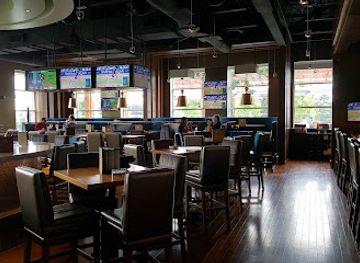
Chop Steakhouse & Bar
Experience the finest steaks and exceptional dining at Chop Steakhouse & Bar in Mississauga, Ontario.
-
Gastropub
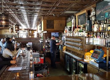
The Griffon Gastropub
Discover the culinary excellence of The Griffon Gastropub in Niagara Falls, where American and Canadian flavors unite in a vibrant pub atmosphere.
-
Grill
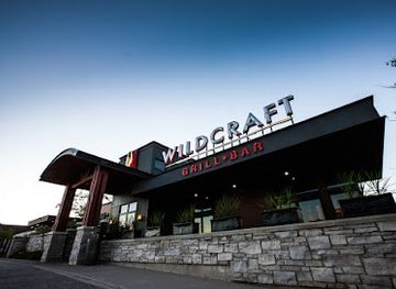
Wildcraft Grill + Long Bar
Explore exquisite American cuisine at Wildcraft Grill + Long Bar, where local flavors meet a vibrant atmosphere in Waterloo, Ontario.
-
American
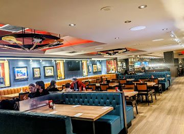
Hard Rock Cafe
Savor American cuisine and rock culture at Hard Rock Cafe Niagara Falls, a vibrant hotspot for music lovers and foodies alike.
Best nightclubs in Yukon
Yukon's evening culture centres on pubs, hotel bars, breweries, live music and community events rather than a large nightclub circuit. Whitehorse has the territory's widest selection of casual bars, restaurants, music venues and seasonal cultural programming, with activity generally concentrated in the central area. Dawson City's historic downtown supports a more theatrical gold-rush atmosphere, with heritage hotels, saloons, music and festival-season entertainment, though its programme and opening arrangements change through the year. In smaller settlements, evening life is more likely to involve a local pub, café, community hall or accommodation lounge than dedicated nightlife venues. Winter visitors may combine an aurora outing with a quiet meal or drink, while summer's long daylight can make evenings feel unusually extended. Check local arrangements in advance and avoid driving after drinking, particularly on long, dark or unfamiliar roads.
Best shops in Yukon
Shopping in Yukon is practical, locally focused and concentrated in Whitehorse and Dawson City. Whitehorse offers independent shops, galleries, bookshops, outdoor retailers, artisan studios and places selling food products such as preserves, smoked goods, beer and spirits. Dawson City has a strong heritage and arts character, with galleries, craft businesses, books and locally made items reflecting the Klondike's visual culture. Across the territory, visitors may find work by Yukon First Nations artists and makers, including beadwork, carving, jewellery, prints and textiles; buy directly from reputable artists or established galleries and ask about the cultural context and provenance of pieces. Smaller communities have limited retail hours and stock, so do not postpone essential purchases until a remote stop. Markets and seasonal events can provide local produce and crafts, but their dates and availability change. Appropriate souvenirs are durable, locally made goods rather than objects removed from historic or natural sites.
-
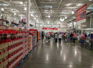
Warehouse store
Costco Wholesale
Discover unbeatable deals on groceries, electronics, and more at Costco Wholesale in Kingston, your ultimate shopping destination!
-
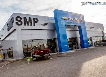
GMC dealer
Saskatoon Motor Products
Explore top-notch automotive options at Saskatoon Motor Products, your premier GMC dealer in Saskatchewan, offering vehicles and exceptional service.
-
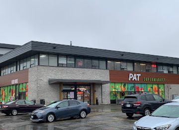
Supermarket
PAT Supermarket Mississauga
Discover the unique flavors and vibrant culture at PAT Supermarket in Mississauga, your go-to spot for groceries and beauty products.
-
Restaurant
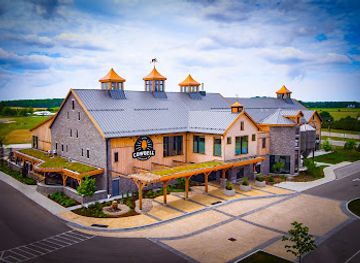
Cowbell Brewing Co.
Experience the best of craft brewing and local cuisine at Cowbell Brewing Co. in Blyth, Ontario, a perfect blend of flavors and community spirit.
Get your free copy of our complete guide to Yukon, delivered straight to you.
Everything on this page, from attractions and restaurants to essentials and local phrases, in one PDF you can read offline, print or share.
Already have an account? Sign in
Your Yukon guide is ready.
We'll send it to · Not you? Sign out

Getting your guide ready…
We are putting together a fresh copy of the Yukon guide. This can take up to a minute.
This can take a few moments. If your browser asks, choose Allow so the download can start. You'll find the guide in your Downloads folder.
Nothing happened? Download it again
Sorry, the guide is taking longer than usual. Please try again in a minute, or get it by email instead.
Yukon essentials
Currency and Payment
Safety
Emergency Situations
Do's and Don'ts
Local Tips
From Eve
Local phrases worth knowing
You don't need to get them perfect. A few words go a long way, and locals appreciate the effort.
Basics
| English | Local | Say it |
|---|---|---|
| Hello | Hello | [həˈloʊ] |
| Goodbye | Goodbye | [ɡʊdˈbaɪ] |
| Yes | Yes | [jɛs] |
| No | No | [noʊ] |
| Please/You’re welcome | Please/You’re welcome | [pliːz/juːr ˈwɛlkəm] |
| Thank you | Thank you | [θæŋk ju] |
| Excuse me/Sorry | Excuse me/Sorry | [ɪkˈskjuːz mi/ˈsɔːri] |
| How are you? | How are you? | [haʊ ɑːr ju] |
| Fine. And you? | Fine. And you? | [faɪn. ənd ju] |
| Do you speak English? | Do you speak English? | [du ju spiːk ˈɪŋɡlɪʃ] |
| I don't understand | I don't understand | [aɪ doʊnt ˌʌndərˈstænd] |
Eating & Drinking
| English | Local | Say it |
|---|---|---|
| I’d like to see the menu, please | I’d like to see the menu, please | [aɪd laɪk tə si ðə ˈmɛnjuː pliːz] |
| I don't eat meat | I don't eat meat | [aɪ doʊnt iːt miːt] |
| Cheers! | Cheers! | [ʧɪrz] |
| I would like to pay, please | I would like to pay, please | [aɪ wʊd laɪk tə peɪ pliːz] |
Emergencies
| English | Local | Say it |
|---|---|---|
| Help! | Help! | [hɛlp] |
| Go away! | Go away! | [ɡoʊ əˈweɪ] |
| Call the Police! | Call the Police! | [kɔːl ðə pəˈliːs] |
| Call a doctor! | Call a doctor! | [kɔːl ə ˈdɑːktər] |
| I’m lost | I’m lost | [aɪm lɔːst] |
| I’m ill | I’m ill | [aɪm ɪl] |
Shopping
| English | Local | Say it |
|---|---|---|
| I’d like to buy... | I’d like to buy... | [aɪd laɪk tə baɪ...] |
| I’m just looking | I’m just looking | [aɪm dʒʌst ˈlʊkɪŋ] |
| How much is it? | How much is it? | [haʊ mʌʧ ɪz ɪt] |
| That’s too expensive | That’s too expensive | [ðæts tuː ɪkˈspɛnsɪv] |
| Can you lower the price? | Can you lower the price? | [kæn ju ˈloʊər ðə praɪs] |
Time & Numbers
| English | Local | Say it |
|---|---|---|
| What time is it? | What time is it? | [wʌt taɪm ɪz ɪt] |
| It’s one o’clock | It’s one o’clock | [ɪts wʌn əˈklɒk] |
| Half past (10) | Half past (10) | [hæf pɑːst (10)] |
| Morning | Morning | [ˈmɔrnɪŋ] |
| Afternoon | Afternoon | [ˌæftərˈnuːn] |
| Evening | Evening | [ˈivnɪŋ] |
| Yesterday | Yesterday | [ˈjɛstərdeɪ] |
| Today | Today | [təˈdeɪ] |
| Tomorrow | Tomorrow | [təˈmɔroʊ] |
| 1 | 1 | [wʌn] |
| 2 | 2 | [tuː] |
| 3 | 3 | [θriː] |
| 4 | 4 | [fɔːr] |
| 5 | 5 | [faɪv] |
| 6 | 6 | [sɪks] |
| 7 | 7 | [sɛvən] |
| 8 | 8 | [eɪt] |
| 9 | 9 | [naɪn] |
| 10 | 10 | [tɛn] |
Transport & Directions
| English | Local | Say it |
|---|---|---|
| Where's a/the...? | Where's a/the...? | [wɛrz ə/ðə...?] |
| What’s the address? | What’s the address? | [wʌts ði ˈædrɛs] |
| Can you show me (on the map)? | Can you show me (on the map)? | [kæn ju ʃoʊ mi (ɑn ðə mæp)?] |
| When's the next (bus)? | When's the next (bus)? | [wɛn's ðə nɛkst (bʌs)?] |
| A ticket (to ....) | A ticket (to ....) | [ə ˈtɪkɪt (tə ....)] |
History of Yukon
First Peoples and Ancient Beringia
Yukon's human history extends deep into the period when Beringia connected north-east Asia and North America across the region now covered by the Bering Strait and adjacent lands. Archaeological evidence records long-standing Indigenous occupation, adaptation to changing climates and sophisticated knowledge of rivers, animals and seasonal movement. The First Nations of Yukon, including the Tr’ondëk Hwëch’in, Kwanlin Dün, Carcross/Tagish, Vuntut Gwitchin and other communities, maintain living cultural, linguistic and political traditions. Sites such as the Yukon Beringia Interpretive Centre introduce this ancient environmental context without separating it from the continuing presence of Indigenous peoples.
Trade Networks and the Fur Era
Before and after European contact, Yukon waterways and mountain passes supported extensive Indigenous travel and exchange. The arrival of the Hudson’s Bay Company and other traders in the nineteenth century altered existing commercial relationships, while coastal and inland routes linked Yukon communities with Alaska and British Columbia. Forts and trading posts became part of a wider colonial economy, but Indigenous traders, guides and knowledge holders remained essential to movement and survival. This period also brought disease, political pressure and disruptive changes to established ways of life.
The Klondike Gold Rush, 1896–1899
The discovery of gold on Bonanza Creek, in the Klondike near Dawson City, triggered one of the most dramatic migrations in North American history. Prospectors travelled through difficult routes to reach the goldfields, and Dawson rapidly developed into a boomtown on the Yukon River. The rush brought banks, theatres, newspapers, government offices and intense social inequality, while placing severe pressure on the Tr’ondëk Hwëch’in and other Indigenous communities. Although the mass rush was brief, its buildings, stories and environmental consequences remain highly visible in Dawson City and the Klondike region.
Administration, Transport and Whitehorse
The gold rush encouraged Canada to strengthen its administrative presence in the territory, and Whitehorse grew as a transportation and supply centre. The construction of the White Pass and Yukon Route railway to nearby Skagway, Alaska, and the development of river transport connected the interior with Pacific ports. During the Second World War, the Alaska Highway further transformed Yukon, linking the territory by road with Alaska and western Canada. Whitehorse's later growth as the territorial capital reflects this continuing role as a centre of government, services and northern commerce.
Mines, Highways and Modern Yukon
Mining has remained central to Yukon's economy and landscape, with periods of expansion and closure affecting communities across the territory. Silver mining helped sustain Keno City and Mayo, while the Faro mine became one of Canada's major lead-zinc operations before its closure and complicated environmental legacy. Roads such as the Klondike, Dempster and Alaska highways opened access to remote districts and reshaped settlement patterns. Modern Yukon balances resource development with conservation, tourism and the priorities of self-governing Yukon First Nations.
Land Claims and Self-Government
The modern political landscape was transformed by the Umbrella Final Agreement of 1993 and subsequent individual agreements between Canada, Yukon and Yukon First Nations. These settlements provided land, financial compensation and powers of self-government, creating a distinctive framework for governance in the territory. Not every Yukon First Nation has concluded an agreement, and the relationships remain evolving rather than purely historical. Visitors encounter this contemporary reality through cultural centres, interpretive programmes, place names and the active management of land and heritage.
Yukon in Photos
Browse through our photo collection highlighting the charm and character of the destination.
Neighbouring regions of Yukon
The closest regions to Yukon, if you have time for more than one.
-

-

-

-

-


Swipe for more regions