

Free Peace River Country Travel Guide & Mobile App
Explore Peace River Country with free travel guides. Discover regional history, expert tips, proposed trips, and audio guides on web or mobile app.


Explore Peace River Country across British Columbia and Alberta for Indigenous heritage, open farmland, boreal wilderness, fossils and northern road journeys.
Read more about Peace River Country
When is the best time to visit Peace River Country?
Best: June–August · 21–22°C| Month | High (°C) | Rainfall (mm) |
|---|---|---|
| January | -8 | 25 |
| February | -5 | 20 |
| March | 3 | 23 |
| April | 9 | 26 |
| May | 18 | 40 |
| June (best) | 21 | 61 |
| July (best) | 22 | 59 |
| August (best) | 21 | 54 |
| September | 16 | 41 |
| October | 8 | 34 |
| November | -1 | 29 |
| December | -6 | 25 |
Getting to and around Peace River Country
How to get there
Transportation
Best landmarks in Peace River Country
The most recognisable landmark in Peace River Country is the Mile 0 Post in Dawson Creek, a symbolic marker for the Alaska Highway and the town's wartime transformation. The Kiskatinaw Bridge, a preserved curved timber-truss bridge on the historic highway route in British Columbia, represents the engineering challenges of northern road construction and is visited as a heritage structure rather than a normal through route. Near Hudson's Hope, W.A.C. Bennett Dam dominates the Peace landscape and stands as one of the region's most consequential modern works, creating the vast Williston Lake reservoir. The Peace River valley itself is a geographical landmark, particularly where the river passes through wooded banks, agricultural country and historic crossing areas in Alberta. Historic Dunvegan, near the river in Alberta, preserves a rare concentration of fur-trade, missionary and settlement heritage. Tumbler Ridge's waterfalls, hoodoos, fossil-bearing formations and mountain-edge escarpments provide a natural counterpoint to the engineered and agricultural landmarks farther east.
-
Historical place
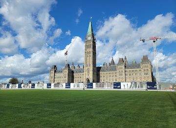
Parliament Hill
Discover the heart of Canadian democracy at Parliament Hill in Ottawa. Explore historic buildings, witness the Changing of the Guard, and enjoy panoramic views.
-
 Event venue
Canalside
Explore Canalside in Buffalo, NY - a lively waterfront destination brimming with history, recreation, and entertainment for all ages.
-
Historical landmark
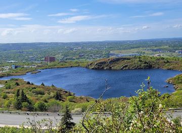
Signal Hill National Historic Site
Explore Signal Hill National Historic Site in St. John's: where military history meets communication innovation with stunning panoramic views.
-
Park
Assiniboine Park
Explore Assiniboine Park: A serene blend of gardens, art, and wildlife in the heart of Winnipeg, perfect for family outings and leisurely strolls.

Explore Peace River Country on the map
Plan your trip on one map. See where the top cities, national parks and sights are, and book hotels and experiences in a few clicks.
Best hotels in Peace River Country
Best restaurants in Peace River Country
Dining in Peace River Country reflects northern Canadian practicality, agricultural production and a long-distance road culture. Grande Prairie, Fort St John and Dawson Creek have the widest choice of cafés, family restaurants, pubs and internationally influenced cooking, while smaller communities tend to offer straightforward meals, bakeries and locally owned eateries. Grain farming and ranching support regional menus featuring beef, poultry, baking and seasonal produce, and farmers' markets are useful places to find vegetables, preserves, honey and prepared foods when in season. Fish from local waters may appear in regional cooking, although visitors should follow current provincial rules and advisories rather than assume every catch is suitable for the table. Roadside stops and community diners remain part of the travel experience, especially along the Alaska Highway and major provincial routes. Indigenous food traditions and contemporary Indigenous-led businesses should be approached through reputable local interpretation, with respect for cultural ownership and seasonal practices.
-
Barbecue
Memphis Fire Barbeque Company
Experience mouthwatering barbecue and gourmet burgers at Memphis Fire Barbeque Company in Stoney Creek - A must-visit culinary delight!
-
National park
Prince Albert National Park
Discover Prince Albert National Park: A Natural Wonderland with Hiking Trails, Canoeing Adventures & Diverse Wildlife in Saskatchewan.
-
Family-friendly
Green Acres Family Restaurant
Discover the heartwarming flavors of family dining at Green Acres Restaurant in Fort Erie, where delicious meals and friendly service await!
-
American
Chocolate Moose Restaurant Company
Experience delicious American cuisine at Chocolate Moose Restaurant Company in International Falls - where flavor meets comfort.


Best bars in Peace River Country
Evening life in Peace River Country is centred on pubs, restaurants, hotel lounges, breweries and community events rather than a large, region-wide nightclub circuit. Grande Prairie provides the broadest urban choice, including live music, entertainment venues and later-opening bars, while Dawson Creek and Fort St John have established pub and restaurant scenes shaped by working, student and travelling populations. Peace River, Fairview, Hudson's Hope and other smaller centres are more likely to offer quiet hospitality, local gatherings and occasional live performances than dedicated clubs. In summer, long daylight hours encourage outdoor activities well into the evening, and winter nights often favour indoor dining, cultural programmes and community sports. Opening arrangements and venue status change, so current local listings are advisable. Alcohol is only one part of the region's evening culture; galleries, theatres, festivals and conversations in local cafés can be equally characteristic ways to spend the night.
-
Brewpub
Niagara Brewing Company
Discover the best of local craft beer at Niagara Brewing Company, where flavor meets fun in the heart of Niagara Falls.
-
Family-friendly
Green Acres Family Restaurant
Experience family-friendly dining at Green Acres Family Restaurant in Fort Erie, where delicious meals meet a warm atmosphere.
-
Grill
Bobby Macs Bayside Tavern & Grill
Discover Bobby Macs Bayside Tavern & Grill, a delightful lakeside dining experience in Ira Township, serving mouthwatering grill cuisine and stunning views.
-
Bar
Murphy's Lockside Pub & Patio
Discover Murphy's Lockside Pub & Patio, a vibrant Irish gastropub in Fenelon Falls, offering delicious food, live music, and a cozy atmosphere.


Best nightclubs in Peace River Country
Evening life in Peace River Country is centred on pubs, restaurants, hotel lounges, breweries and community events rather than a large, region-wide nightclub circuit. Grande Prairie provides the broadest urban choice, including live music, entertainment venues and later-opening bars, while Dawson Creek and Fort St John have established pub and restaurant scenes shaped by working, student and travelling populations. Peace River, Fairview, Hudson's Hope and other smaller centres are more likely to offer quiet hospitality, local gatherings and occasional live performances than dedicated clubs. In summer, long daylight hours encourage outdoor activities well into the evening, and winter nights often favour indoor dining, cultural programmes and community sports. Opening arrangements and venue status change, so current local listings are advisable. Alcohol is only one part of the region's evening culture; galleries, theatres, festivals and conversations in local cafés can be equally characteristic ways to spend the night.
-
Resort hotel
Eganridge Resort, Golf Club & Spa
Experience luxury and leisure at Eganridge Resort, Golf Club & Spa, where golf, relaxation, and fine dining await amidst Ontario's stunning landscapes.
Best shops in Peace River Country
Shopping in Peace River Country is practical, locally oriented and distributed among small-town high streets rather than concentrated in a single retail district. Grande Prairie and the larger centres provide the broadest selection of national retailers, services, outdoor equipment and everyday supplies, while Dawson Creek and Fort St John are useful for road-trip provisions, clothing and specialist northern gear. Independent shops, galleries and seasonal markets offer handmade crafts, artwork, books, preserves, honey, baked goods and other products associated with the agricultural and northern economy. Visitors may find Indigenous art and cultural products, but should buy through reputable Indigenous-owned or clearly identified sellers and ask about provenance rather than treating cultural items as generic souvenirs. Farmers' markets are seasonal and vary by community, so dates should be checked locally. A sensible regional purchase might be locally produced food, a work by a northern artist or a practical outdoor item rather than a mass-produced highway souvenir.
-
Grocery store
Real Canadian Superstore Confederation Drive
Experience the local flavor at Real Canadian Superstore in Saskatoon, your one-stop destination for groceries and fresh produce.
-
Grocery store
Safeway River Avenue
Experience local flavors and fresh produce at Safeway River Avenue, your go-to grocery store in Winnipeg, complete with a bakery and florist.
-
Grocery store
Safeway Corral Centre
Explore the local flavors and fresh offerings at Safeway Corral Centre, your premier grocery destination in Brandon, Manitoba.
-
Grocery store
Safeway Marion & Braemar
Explore Safeway Marion & Braemar in Winnipeg for fresh groceries, delicious baked goods, and beautiful floral arrangements in a vibrant community setting.


Get your free copy of our complete guide to Peace River Country, delivered straight to you.
Everything on this page, from attractions and restaurants to essentials and local phrases, in one PDF you can read offline, print or share.
Already have an account? Sign in
Your Peace River Country guide is ready.
We'll send it to · Not you? Sign out

Getting your guide ready…
We are putting together a fresh copy of the Peace River Country guide. This can take up to a minute.
This can take a few moments. If your browser asks, choose Allow so the download can start. You'll find the guide in your Downloads folder.
Nothing happened? Download it again
Sorry, the guide is taking longer than usual. Please try again in a minute, or get it by email instead.
Peace River Country essentials
Currency and Payment
Safety
Emergency Situations
Do's and Don'ts
Local Tips
From Eve
Local phrases worth knowing
You don't need to get them perfect. A few words go a long way, and locals appreciate the effort.
Basics
| English | Local | Say it |
|---|---|---|
| Hello | Howdy | [haʊdi] |
| Goodbye | See ya | [si jə] |
| Yes | Yup | [jʌp] |
| No | Nope | [noʊp] |
| Please/You're welcome | Sure thing | [ʃʊr θɪŋ] |
| Thank you | Thanks a lot | [θæŋks ə lɑt] |
| Excuse me/Sorry | Pardon me | [ˈpɑrdən mi] |
| How are you? | How's it going? | [haʊz ɪt ˈgoʊɪŋ] |
| Fine. And you? | Good. You? | [gʊd. ju?] |
| Do you speak English? | Do ya speak English? | [du jə spiːk ˈɪŋɡlɪʃ] |
| I don't understand | I ain't got it | [aɪ eɪnt gɑt ɪt] |
Eating & Drinking
| English | Local | Say it |
|---|---|---|
| I'd like to see the menu, please | Can I see the menu? | [kæn aɪ si ðə ˈmɛnju] |
| I don't eat meat | I'm a vegetarian | [aɪm ə ˌvɛdʒəˈtɛriən] |
| Cheers! | Cheers! | [ʧɪrz] |
| I would like to pay, please | Can I get the bill? | [kæn aɪ gɛt ðə bɪl] |
Emergencies
| English | Local | Say it |
|---|---|---|
| Help! | Help! | [hɛlp] |
| Go away! | Get lost! | [ɡɛt lɔst] |
| Call the Police! | Call the cops! | [kɔl ðə kɑps] |
| Call a doctor! | Get a doctor! | [ɡɛt ə ˈdɑktər] |
| I'm lost | I'm all turned around | [aɪm ɔl tɜrnd əˈraʊnd] |
| I'm ill | I ain't feeling well | [aɪ eɪnt ˈfiːlɪŋ wɛl] |
Shopping
| English | Local | Say it |
|---|---|---|
| I'd like to buy... | I wanna buy... | [aɪ ˈwɑnə baɪ] |
| I'm just looking | Just browsing | [dʒʌst ˈbraʊzɪŋ] |
| How much is it? | What’s the price? | [wʌts ðə praɪs] |
| That's too expensive | That's pricey | [ðæts ˈpraɪsi] |
| Can you lower the price? | Can ya knock down the price? | [kæn jə nɑk daʊn ðə praɪs] |
Time & Numbers
| English | Local | Say it |
|---|---|---|
| What time is it? | What’s the time? | [wʌts ðə taɪm] |
| It's one o'clock | It's one | [ɪts wʌn] |
| Half past (10) | Half past ten | [hæf pæst tɛn] |
| Morning | Morning | [ˈmɔrnɪŋ] |
| Afternoon | Afternoon | [ˌæftərˈnun] |
| Evening | Evening | [ˈivnɪŋ] |
| Yesterday | Yesterday | [ˈjɛstərdeɪ] |
| Today | Today | [təˈdeɪ] |
| Tomorrow | Tomorrow | [təˈmɔroʊ] |
| 1 | One | [wʌn] |
| 2 | Two | [tu] |
| 3 | Three | [θri] |
| 4 | Four | [fɔr] |
| 5 | Five | [faɪv] |
| 6 | Six | [sɪks] |
| 7 | Seven | [ˈsɛvən] |
| 8 | Eight | [eɪt] |
| 9 | Nine | [naɪn] |
| 10 | Ten | [tɛn] |
Transport & Directions
| English | Local | Say it |
|---|---|---|
| Where's a/the...? | Where's the...? | [wɛrz ðə] |
| What's the address? | What’s the address? | [wʌts ði əˈdrɛs] |
| Can you show me (on the map)? | Can you point it out? | [kæn jə pɔɪnt ɪt aʊt] |
| When's the next (bus)? | When's the next bus? | [wɛn z ðə nɛkst bʌs] |
| A ticket (to ....) | A ticket to ... | [ə ˈtɪkɪt tu] |
History of Peace River Country
Dane-zaa, Cree and Treaty 8 Homelands
The Peace River Country lies within the wider Treaty 8 region, where Dane-zaa, Cree and other Indigenous peoples have maintained longstanding relationships with the river, forests, grasslands and wildlife. Hunting, fishing, trapping, travel routes and oral traditions shaped the landscape long before colonial settlement. Treaty 8 was made in 1899 and later adhesions extended its legal and geographic reach. Contemporary First Nations, including communities in northeastern British Columbia and northwestern Alberta, remain central to the region's cultural and political life.
Fur Trade and the Peace River Corridor
The Peace River became an important route linking the northern plains with the Rocky Mountain passes and interior trade networks. Fur-trade posts and seasonal Indigenous trading relationships connected the area to wider commercial systems during the late eighteenth and nineteenth centuries. Fort St John traces its colonial origins to a North West Company post established in 1794, while settlements near present-day Peace River developed around river transport, trade and agriculture. The river was a practical corridor long before modern roads replaced much of its transport function.
Missionaries, Surveyors and Agricultural Settlement
During the nineteenth and early twentieth centuries, missionaries, traders, surveyors and settlers entered the Peace region in increasing numbers. The fertile valley and prairie-like uplands supported farming in a northern climate, although settlement was never separate from Indigenous displacement and the restrictions imposed by colonial policy. River crossings, trails and later wagon roads helped connect communities such as Peace River, Fairview and Dawson Creek. The resulting agricultural landscape remains visible in grain fields, ranches, elevators, local fairs and small market towns.
The Railway and the Rise of Regional Towns
Railway construction in the early twentieth century altered the balance of travel and commerce across Peace River Country. Lines associated with the Northern Alberta Railways and British Columbia's northern network linked farming districts with outside markets, encouraged immigration and strengthened service centres. Grande Prairie, Dawson Creek, Peace River and related communities grew as places for grain handling, retail, transport and government services. Railways also helped reduce the Peace River's former dominance as a commercial route, although river valleys and crossings remained important to settlement patterns.
The Alaska Highway, 1942
Built rapidly during the Second World War to connect the continental United States with military installations in Alaska, the Alaska Highway began at Dawson Creek and crossed a vast, sparsely populated northern landscape. Its construction brought soldiers, engineers, civilian workers and major changes to transport infrastructure. Dawson Creek's Mile 0 now commemorates the highway's starting point, while the route helped establish the community as a gateway to northern British Columbia and the Yukon. The highway also accelerated outside access to lands already inhabited and used by Indigenous peoples.
Hydroelectric Transformation on the Peace
The W.A.C. Bennett Dam, completed in the 1960s on the Peace River near Hudson's Hope, created Williston Lake, one of the world's largest artificial lakes by area. The project generated electricity and altered regional transport, ecosystems and Indigenous land use, with consequences that remain subjects of public discussion. The later Peace Canyon project further developed the river's hydroelectric potential. The dams are therefore both major engineering landmarks and reminders that northern development has brought substantial social and environmental change.
Oil, Gas, Forestry and Contemporary Change
Twentieth-century discoveries of oil and natural gas, together with forestry, farming and hydroelectricity, reshaped Peace River Country's economy. Fort St John and Grande Prairie became important service and industrial centres, while smaller communities experienced cycles of expansion and contraction tied to commodity prices. Resource development has created employment and infrastructure but has also generated debate about water, wildlife, forests, land rights and cumulative environmental effects. Today the region combines agriculture, energy, tourism, public services and Indigenous governance rather than belonging to a single economic story.
Peace River Country in Photos
Browse through our photo collection highlighting the charm and character of the destination.
Neighbouring regions of Peace River Country
The closest regions to Peace River Country, if you have time for more than one.
-

-

-

-

-


Swipe for more regions
Explore more
Explore more of Canada
Discover Canada's breathtaking landscapes, diverse cities, and rich cultural heritage. A must-visit destination for outdoor adventures and vibrant urban experiences.
Explore Canada