Dragsmur & Draget Isthmus, Helgenæs
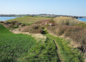
A low stone rampart on a narrow isthmus, where Helgenæs meets Mols between two tranquil bays of sea, stories and coastal light.
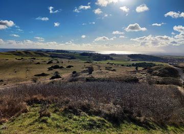
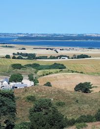
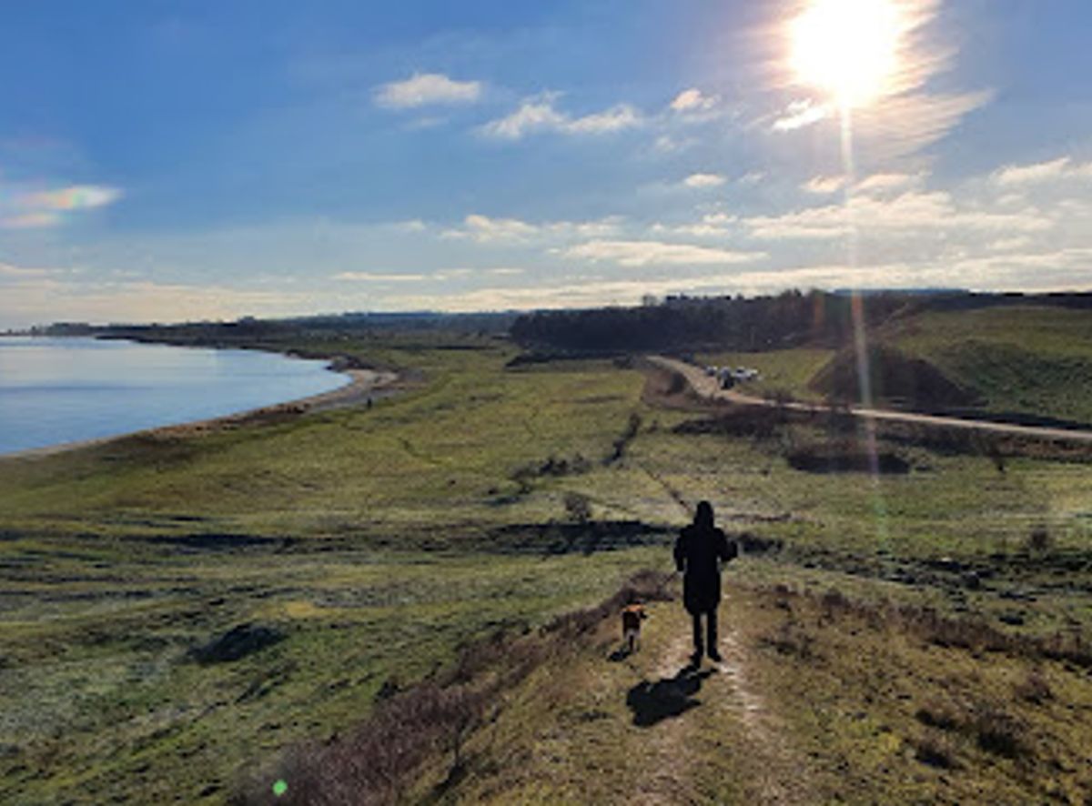
Dragsmur is a low stone-and-earth rampart stretched across the narrow Draget isthmus, where the Helgenæs peninsula connects to mainland Mols. This flat, wave-shaped strip of land between Ebeltoft Vig and Begtrup Vig is rich in coastal nature and Danish history, from Viking ship-dragging tales to medieval fortifications and 19th‑century earthworks. Today it is a scenic spot for walks, bathing, kayaking and quiet contemplation by the water.
A brief summary to Dragsmur
- Olaf Ryes Vej 4, Knebel, 8420, DK
- Click to display
- Free
-
Outdoor
- Mobile reception: 4 out of 5
- Monday 12 am-12 am
- Tuesday 12 am-12 am
- Wednesday 12 am-12 am
- Thursday 12 am-12 am
- Friday 12 am-12 am
- Saturday 12 am-12 am
- Sunday 12 am-12 am
Local tips
- Bring sturdy shoes or sandals suitable for walking on shingle, gravel and occasionally uneven, grassy paths along the shore and rampart.
- Pack windproof layers even in summer; the isthmus is very exposed to breezes from both Ebeltoft Vig and Begtrup Vig.
- If you plan to wade or kayak, check local conditions and respect seasonal restrictions around bird and seal protection areas nearby.
- Visit around early morning or late evening for softer light over the bays and a quieter, more contemplative atmosphere.
- Carry water and snacks; facilities are limited directly at the isthmus, and services are found in surrounding villages and towns.
Do you manage this location?
Take control to get all the benefits, like improved information, better appearance, and stronger visibility across AI-powered discovery. Learn more
Activate your presenceOther nearby places you may find interesting
Getting There
-
Car from Aarhus
From Aarhus city centre, driving to Dragsmur typically takes about 50–70 minutes, mainly on regional roads through Djursland. Expect a mix of faster country roads and slower sections through villages. Parking is available at designated nature parking areas near the isthmus, but car access directly onto the coastal meadows is restricted and new barriers may limit informal parking. Fuel stations are only found in larger towns along the way.
-
Bus and walk from Ebeltoft
From Ebeltoft, regional buses run towards the Helgenæs area with journey times usually between 35 and 60 minutes depending on route and transfer. Services are less frequent in evenings and on weekends, so check current timetables in advance. From the nearest bus stop, expect a walk of 1–3 km on minor roads and paths to reach the isthmus, on generally level but potentially windy terrain.
-
Cycling from Knebel or nearby villages
Cycling from Knebel to Dragsmur typically takes 20–40 minutes, following small country roads through gently undulating terrain. The route is suitable for most reasonably fit cyclists, but expect some short hills and exposure to wind near the coast. There are no dedicated bike lanes for much of the way, so you share the road with local traffic. Bring lights and reflective gear if returning late, as roadside lighting is limited.
-
Sea kayak approach
Experienced paddlers can reach Dragsmur by sea kayak from sheltered launch points around Ebeltoft Vig or Begtrup Vig, with typical paddling times of 1–3 hours depending on distance and conditions. The bays are relatively protected but can be affected by wind, currents and changing weather, and water temperatures remain cold for much of the year. Proper safety gear, knowledge of local regulations and avoidance of nearby bird and seal protection zones are essential.
For the on-the-go comforts that matter to you
-
Restrooms
-
Seating Areas
-
Picnic Areas
-
Trash Bins
-
Information Boards
Discover more about Dragsmur
A narrow neck between two sheltered bays
Dragsmur sits on Draget, a flat, low-lying isthmus only a few metres above sea level and a few hundred metres wide, joining Helgenæs to the Mols peninsula. On one side you look over the calm waters of Ebeltoft Vig, on the other the broad curve of Begtrup Vig. The landscape feels almost like a gently undulating beach plain, the ground shaped into soft, wave-like ridges built from old shoreline deposits as the land slowly rose from the Stone Age sea.Despite its modest height, the setting feels spacious and open. Sky and water fill much of your view, with the higher hills of Helgenæs and Mols forming a low backdrop. The contrast between the flat salt meadows, shingle beaches and the slightly steeper, gravelly banks near the skanser creates a subtle but distinctive coastal character.Stone rampart with a mysterious past
Across the middle of the isthmus, from shore to shore, runs the low linear embankment known as Dragsmur. Built of fieldstones with an overlying bank of earth, it is no towering wall, but its continuous line across such a narrow land bridge gives it a clear sense of purpose. Written sources from the 1600s already refer to it as an old structure, with traditions linking it to the powerful 13th‑century landowner Marsk Stig.Its original function is still debated. Some historians see it as a medieval defensive work controlling movement onto Helgenæs, others as a boundary marker for a royal hunting ground. Whatever its first purpose, the location is strategic: anyone moving between peninsula and mainland had to pass here, between two shallow, boat‑friendly bays.From Viking shortcuts to modern military lines
The very name Dragsmur hints at Viking‑age habits. The narrowness of Draget made it possible to haul light ships across the spit instead of sailing the longer and more exposed route around Helgenæs. This idea of using the landscape as a shortcut echoes in later centuries, when the isthmus again gained military relevance.During 19th‑century conflicts, earthwork batteries known as Ryes Skanser were constructed on the higher ground just south of the isthmus. Dragsmur was strengthened on its northern side as an outer defensive line in front of these zigzagging ramparts. Today the remains of the skanser and the low wall together tell a layered story of shifting military technology and changing threats, set against a coastline that has been slowly reshaped since the last ice age.Sea, shore and quiet outdoor adventures
For visitors, Dragsmur is as much about nature as about history. The shallow, clear water along the shores makes inviting spots for a summer dip, beachcombing or wading with a net in search of crabs, shrimps and mussels. The sheltered inlets are popular departure points for sea kayaks, offering relatively calm conditions and easy landings along the coast.Low salt meadows, stony beaches and nearby coastal slopes provide varied habitats for birds and coastal plants. The light can be striking on clear days, with sunrise and sunset often mirrored in the still water of the bays. Simple paths and informal tracks encourage slow wandering rather than strenuous hiking, though longer coastal routes around Helgenæs also begin or end here.Boundaries, stories and today’s protected landscape
In the present, Dragsmur marks more than just a physical crossing. The rampart forms the parish boundary between Vistoft to the north and Helgenæs to the south, and lies at the local southern edge of the broader Mols Bjerge landscape protection. Regulations on driving, camping and dog‑walking reflect efforts to balance access with the vulnerability of coastal meadows, birdlife and shallow bays.Simple facilities such as marked paths, nearby parking areas and information from the nature agency make it easy to explore without disturbing the surroundings. With its mix of subtle geology, quiet coastline and compact human history, Dragsmur offers a small but evocative window into how land, sea and people have shaped each other over thousands of years.Explore the best of what Dragsmur has to offer
Your all‑in‑one travel companion app
Explore expert travel guides, compare and book tours, experiences, hotels, and more—all from the palm of your hand. Download now for seamless trip planning wherever your wanderlust takes you.
Denmark’s longest church and Aarhus’ defining spired landmark, where medieval brickwork, gilded art and Gothic light meet above the bustle of Store Torv.
A 19th-century Danish military fortification honoring a war hero with commanding views across the Jutland landscape.