

Essequibo River Travel Guide - Free Web & App
Your ultimate guide to Essequibo River. Discover top landmarks, proposed trips, and local tips. Free on the web or via the Evendo companion app.


Explore Guyana’s Essequibo River for rainforest journeys, historic Dutch forts, river islands, Indigenous heritage and access to the country’s interior.
A River of Forest, Islands and Wide Horizons
The Essequibo River is Guyana’s principal waterway, flowing north from the forested interior to a broad Atlantic estuary. Its immense drainage basin covers much of the country, although the river itself is best experienced through a combination of gateway settlements, tributaries, islands and river journeys rather than as a single easily accessible attraction. Near Bartica, the Cuyuni and Mazaruni rivers join the Essequibo, creating a strategic meeting point for travel into Guyana’s interior. Farther downstream, the river widens around numerous islands before reaching the sea.Read more about Essequibo River
Gateway to the Interior
History Along the Water
When is the best time to visit Essequibo River?
Best: June–August · 32°C| Month | High (°C) | Rainfall (mm) |
|---|---|---|
| January | 31 | 250 |
| February | 31 | 230 |
| March | 31 | 210 |
| April | 32 | 190 |
| May | 32 | 170 |
| June (best) | 32 | 150 |
| July (best) | 32 | 130 |
| August (best) | 32 | 130 |
| September | 32 | 150 |
| October | 32 | 170 |
| November | 32 | 190 |
| December | 31 | 210 |
Getting to and around Essequibo River
How to get there
Transportation
Best attractions in Essequibo River
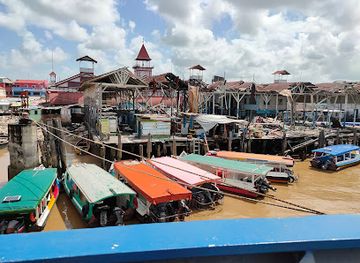
The Essequibo’s main attractions are reached by water and are spread across a large river system. Bartica provides access to the meeting waters of the Essequibo, Mazaruni and Cuyuni rivers, with boat journeys leading towards forested banks, islands and interior communities. Near this confluence, the ruins of Fort Kyk-Over-Al occupy a historically important island site associated with Dutch colonial control. Downstream, the broad estuary contains Fort Island, where visitors can see remnants of Dutch-era occupation and experience the contrast between colonial heritage and mangrove-fringed waterways. River excursions may also focus on birdwatching, fishing, forest scenery and quiet sandbanks, although wildlife encounters and landing conditions vary. Parika is an important lower-river gateway, while travel beyond the settled sections becomes increasingly dependent on local boats, guides, weather and river levels. The attraction lies as much in the changing scale of the waterway and surrounding rainforest as in any single monument.
-
Tourist attraction
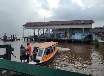
Stabroek Market
Discover the vibrant heart of Georgetown at Stabroek Market, where local culture and commerce come alive with every visit.
-
Bridge
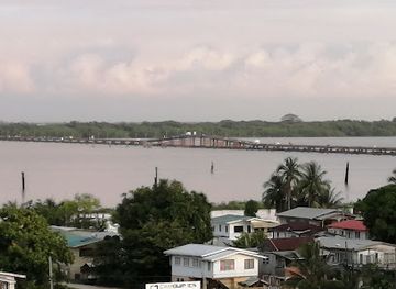
Demerara Harbour Bridge
Experience the architectural wonder of Demerara Harbour Bridge, a vital connection and scenic landmark that beautifully frames the landscape of Georgetown, Guyana.
-
Park
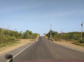
Joe Vieira Park
Discover the serene beauty of Joe Vieira Park in Schoonord, a tranquil escape perfect for nature lovers and families looking to relax.
Best landmarks in Essequibo River
The Essequibo’s defining landmark is the river itself: a vast waterway whose lower reaches widen into an island-studded estuary and whose upper corridors lead towards rainforest and mineral-bearing uplands. Fort Kyk-Over-Al, near the confluence of the Essequibo, Cuyuni and Mazaruni, is one of the area’s most significant historic sites, though its surviving ruins are limited and its setting is reached by boat. Fort Island in the lower Essequibo preserves further traces of Dutch colonial history and illustrates the strategic importance of river transport. Bartica’s position at a major confluence is a geographical landmark as well as a commercial one, while the surrounding islands, mangrove edges, sandbanks and forested banks form a changing natural landscape. These features are best understood together, as parts of a river system that shaped settlement, trade, colonial competition and access to Guyana’s interior.
-
Tourist attraction
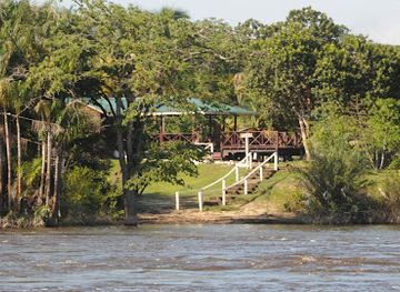
Iwokrama River Lodge
Experience the untouched beauty of the Guyanese rainforest at Iwokrama River Lodge, where adventure meets eco-tourism.
-
Historical landmark
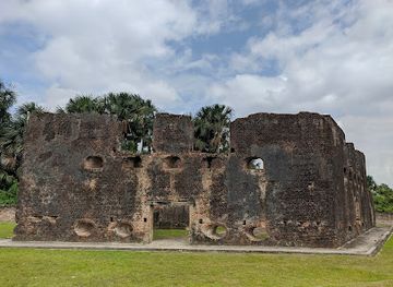
Fort Zeelandia
Explore Fort Zeelandia, a historic landmark in Guyana that captures the essence of colonial heritage amidst beautiful landscapes.
-
Monument maker
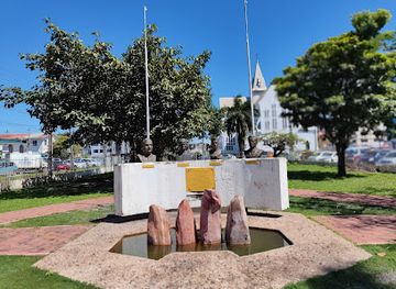
Non-Aligned Monument
Explore the Non-Aligned Monument in Georgetown, Guyana, a symbol of peace, unity, and cultural heritage in the heart of the city.
-
Tourist attraction
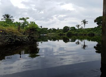
Bonasika Creek
Discover the serene beauty of Bonasika Creek, a tranquil escape in Guyana perfect for nature lovers and adventure seekers.
Explore Essequibo River on the map
Plan your trip on one map. See where the top attractions, landmarks, restaurants and hotels are, and book hotels and experiences in a few clicks.
Best hotels in Essequibo River
Best restaurants in Essequibo River
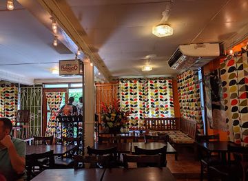
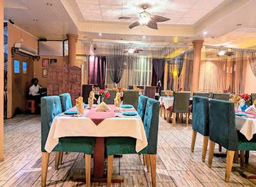
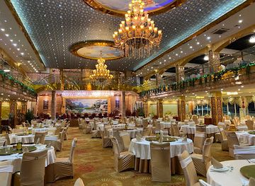
Dining around the Essequibo is concentrated in gateway settlements rather than dispersed along the riverbanks. Bartica and Parika provide the most practical choices, including informal eateries, small restaurants and shops serving Guyanese staples such as rice, roti, curry, stewed meats, fish and fresh juices. The wider river region reflects Guyana’s multicultural food traditions, shaped by Indigenous ingredients and knowledge alongside African, Indian, European and other Caribbean influences. Fresh river fish may appear in local cooking, but availability depends on season, supply and the individual establishment. On boat excursions, meals are often arranged in advance or carried from a settlement, especially when visiting islands or remote tributaries. Travellers heading into the interior should confirm food and drinking-water arrangements before departure rather than expecting cafés or restaurants away from the main population centres.
-
American
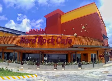
Hard Rock Cafe Guyana
Discover the perfect blend of American cuisine and rock culture at Hard Rock Cafe Guyana in Georgetown - an unforgettable dining experience.
-
South American
Oasis Cafe
Experience the vibrant tastes of South America at Oasis Cafe in Georgetown - your go-to spot for delightful breakfasts and cozy ambiance.
-
Indian
Aagman Indian Restaurant
Discover the authentic taste of India at Aagman Indian Restaurant in Georgetown – where every meal is a celebration of flavor.
-
Asian
The New Thriving Restaurant
Discover authentic Asian flavors at The New Thriving Restaurant in Georgetown - where culinary tradition meets modern dining.
Best bars in Essequibo River
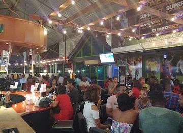
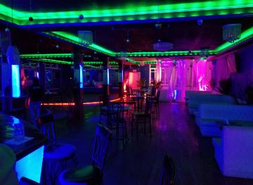
Nightlife on the Essequibo is modest and centred on the larger river settlements, particularly Bartica, rather than on the water itself. Visitors are more likely to find relaxed rum shops, local bars, small restaurants and community social spaces than dedicated nightclubs or a concentrated entertainment district. Parika functions primarily as a transport and commercial hub, so evening activity may be limited and practical in character. In Bartica, the atmosphere can be more sociable, with music and informal gatherings varying according to local events, weekends and seasonal activity, but venues and opening arrangements should be checked locally. On islands, at remote camps and during river journeys, evenings are generally quiet, shaped by darkness, forest sounds and the need to follow boat and accommodation safety arrangements. Avoid travelling on unfamiliar stretches after dark.
-
Sports bar
The Boardroom
Experience the thrill of sports and camaraderie at The Boardroom, Georgetown's premier sports bar located in Giftland Mall.
-
Bar
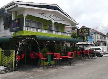
Seeta's Bar
Experience the vibrant nightlife of Georgetown at Seeta's Bar, where friendly service meets a lively atmosphere, perfect for unwinding with friends.
-
Bar
Shooters Bar
Discover the lively nightlife and local charm at Shooters Bar in Anna Regina, where great drinks and friendly faces await.
-
Cocktail bar
World of Cocktails & Casetello's Grill
Experience the vibrant flavors of Georgetown at World of Cocktails & Casetello's Grill, where cocktails and grill meet Caribbean charm.

Best nightclubs in Essequibo River
Nightlife on the Essequibo is modest and centred on the larger river settlements, particularly Bartica, rather than on the water itself. Visitors are more likely to find relaxed rum shops, local bars, small restaurants and community social spaces than dedicated nightclubs or a concentrated entertainment district. Parika functions primarily as a transport and commercial hub, so evening activity may be limited and practical in character. In Bartica, the atmosphere can be more sociable, with music and informal gatherings varying according to local events, weekends and seasonal activity, but venues and opening arrangements should be checked locally. On islands, at remote camps and during river journeys, evenings are generally quiet, shaped by darkness, forest sounds and the need to follow boat and accommodation safety arrangements. Avoid travelling on unfamiliar stretches after dark.
-
Disco club
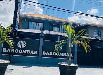
Baroombar
Experience Georgetown's vibrant nightlife at Baroombar, the ultimate disco club for music, dance, and unforgettable nights out.
-
Night club
Club Martini Inc
Dive into the vibrant nightlife of Georgetown at Club Martini Inc – your go-to night club for unforgettable music and dance experiences.
-
Night club
Club RainArena
Discover the vibrant nightlife at Club RainArena, a premier night club in East Coast Demerara, featuring lively music and a welcoming atmosphere.
-
Night club
Sowiya Night Club
Dance the night away at Sowiya Night Club, the heartbeat of Anna Regina's nightlife, where vibrant music and great company await you.

Best shops in Essequibo River
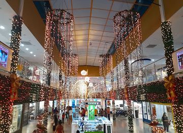
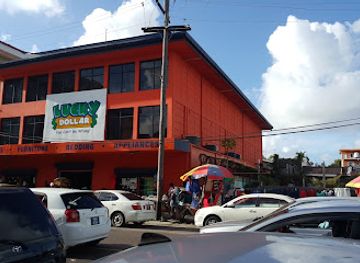
Shopping opportunities are concentrated in Bartica, Parika and other settled river communities, with limited retail provision once visitors travel into the interior. Small shops and markets supply everyday goods, food, drinks, household necessities and practical items for river journeys, while craft and locally made products may be found through community contacts or established tourism businesses rather than in a dedicated shopping quarter. Guyanese food products, handmade objects and artwork can provide more meaningful souvenirs than mass-produced items, but availability varies and visitors should ask about provenance, especially for objects claimed to be Indigenous or historic. Buy only legally traded products and never purchase archaeological material, wildlife parts or items taken from protected environments. Stock essentials, cash, insect repellent and dry bags before leaving the larger settlements, where choice and payment facilities become increasingly limited.
-
Market
Stabroek Market
Discover the vibrant culture and local commerce at Stabroek Market, an iconic marketplace in the heart of Georgetown, Guyana.
-
Shopping mall
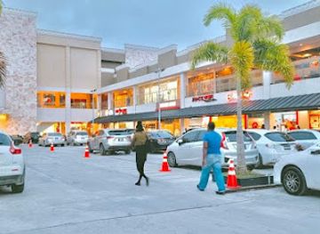
Giftland Mall
Experience the lively shopping and dining at Giftland Mall, Georgetown's premier destination for retail therapy and local culture.
-
Shopping mall
Shopping City Mall
Discover the vibrant Shopping City Mall in Georgetown, a retail haven with diverse shopping, dining, and entertainment options for everyone.
-
Shopping mall
Amazonia Mall
Explore the vibrant Amazonia Mall in Georgetown, a premier shopping destination with diverse stores, dining, and entertainment options for all.
Get your free copy of our complete guide to Essequibo River, delivered straight to you.
Everything on this page, from attractions and restaurants to essentials and local phrases, in one PDF you can read offline, print or share.
Already have an account? Sign in
Your Essequibo River guide is ready.
We'll send it to · Not you? Sign out

Getting your guide ready…
We are putting together a fresh copy of the Essequibo River guide. This can take up to a minute.
This can take a few moments. If your browser asks, choose Allow so the download can start. You'll find the guide in your Downloads folder.
Nothing happened? Download it again
Sorry, the guide is taking longer than usual. Please try again in a minute, or get it by email instead.
Essequibo River essentials
Currency and Payment
Safety
Emergency Situations
Do's and Don'ts
Local Tips
From Eve
Local phrases worth knowing
You don't need to get them perfect. A few words go a long way, and locals appreciate the effort.
Basics
| English | Local | Say it |
|---|---|---|
| Hello | Wah gwaan | [wah gwaan] |
| Goodbye | Later | [lay-ter] |
| Yes | Yeah, man | [yeah, man] |
| No | Nah | [nah] |
| Please/You're welcome | Leh meh | [leh meh] |
| Thank you | Tank yuh | [tank yuh] |
| Excuse me/Sorry | Sarry | [sarry] |
| How are you? | Yuh deh how? | [yuh deh how] |
| Fine. And you? | Mi deh gud. An yuh? | [mi deh gud. an yuh] |
| Do you speak English? | Yuh talk English? | [yuh talk English] |
| I don't understand | Mi nah get yuh | [mi nah get yuh] |
Eating & Drinking
| English | Local | Say it |
|---|---|---|
| I'd like to see the menu, please | Lemme see de menu, please | [lemme see de menu, please] |
| I don't eat meat | Mi nah eat meat | [mi nah eat meat] |
| Cheers! | Cheers! | [Cheers] |
| I would like to pay, please | Lemme pay, please | [lemme pay, please] |
Emergencies
| English | Local | Say it |
|---|---|---|
| Help! | Help! | [Help] |
| Go away! | Go way! | [Go way] |
| Call the Police! | Call de Police! | [Call de Police] |
| Call a doctor! | Call a doc! | [Call a doc] |
| I'm lost | Mi lost | [mi lost] |
| I'm ill | Mi sick | [mi sick] |
Shopping
| English | Local | Say it |
|---|---|---|
| I'd like to buy... | Mi wan buy... | [mi wan buy] |
| I'm just looking | Mi just looking | [mi just looking] |
| How much is it? | How much dis is? | [how much dis is] |
| That's too expensive | Dat too much | [dat too much] |
| Can you lower the price? | Yuh can drop de price? | [yuh can drop de price] |
Time & Numbers
| English | Local | Say it |
|---|---|---|
| What time is it? | Wah time it is? | [wah time it is] |
| It's one o'clock | It one o'clock | [it one o'clock] |
| Half past (10) | Half ten | [half ten] |
| Morning | Mahnin | [mahnin] |
| Afternoon | Aftanoon | [aftanoon] |
| Evening | Evinin | [evinin] |
| Yesterday | Yestadeh | [yestadeh] |
| Today | Today | [Today] |
| Tomorrow | Tomorrah | [tomorrah] |
| 1 | One | [one] |
| 2 | Two | [two] |
| 3 | Tree | [tree] |
| 4 | Fo' | [fo'] |
| 5 | Fie | [fie] |
| 6 | Siks | [siks] |
| 7 | Seven | [seven] |
| 8 | Eight | [eight] |
| 9 | Nine | [nine] |
| 10 | Ten | [ten] |
Transport & Directions
| English | Local | Say it |
|---|---|---|
| Where's a/the...? | Way deh... | [way deh] |
| What's the address? | Wah deh address? | [wah deh address] |
| Can you show me (on the map)? | Yuh can show meh (pan de map)? | [yuh can show meh (pan de map)] |
| When's the next (bus)? | When de nex' (bus)? | [when de nex' (bus)] |
| A ticket (to ....) | A tikkit (to ....) | [a tikkit (to ....)] |
History of Essequibo River
Geology and the River Basin
The Essequibo drains a vast area of Guyana, rising in the country’s southern interior before travelling north through forested uplands and lowlands to the Atlantic. Its course is shaped by tributaries including the Rupununi, Potaro, Mazaruni and Cuyuni, as well as rapids, sandbanks and islands. The river has historically been less a fixed line than a network of navigable corridors linking ecological zones and communities. Its basin remains closely associated with rainforest, mineral-bearing uplands and extensive waterways, although modern extraction, transport and settlement have altered parts of the surrounding landscape.
Indigenous River Networks
Long before European colonisation, Indigenous peoples used the Essequibo and its tributaries for movement, fishing, hunting, trade and communication. Carib, Arawak and other Indigenous communities have longstanding connections with the broader river basin, expressed through knowledge of waterways, forest resources and seasonal conditions. The river’s tributaries remain important routes into the interior, where small settlements and communities are often more closely connected by boat than by road. Visitors should understand that the Essequibo is not an empty wilderness but a lived cultural landscape with continuing Indigenous presence and customary knowledge.
Dutch Colonisation and Forts
The Dutch established Essequibo as one of their earliest colonies on the river during the seventeenth century, initially developing trade and plantation interests from posts on islands and riverbanks. Fort Kyk-Over-Al, positioned near the meeting of the Essequibo, Cuyuni and Mazaruni rivers, protected an important inland junction and became a symbol of Dutch authority in the region. Fort Island, in the lower river, also preserves evidence of Dutch colonial occupation. Control later shifted to the British, but Dutch place names, ruins and parts of the plantation landscape remain visible markers of this earlier period.
Plantations, Trade and Colonial Change
Under Dutch and later British rule, the lower Essequibo became associated with plantations, river commerce and the movement of agricultural goods towards the coast. The river provided the principal transport system in a region where roads were few and waterways connected estates, settlements and coastal markets. Enslaved Africans and, after emancipation, indentured workers from India formed part of the labour history of the wider plantation economy. These developments transformed riverbanks and islands, while also creating the multicultural social landscape found in Guyana today.
Mining, Bartica and Modern Conservation
The upper Essequibo and its tributaries became increasingly important as routes towards gold and diamond fields, helping Bartica develop as a commercial and transport centre for the interior. River travel continues to support mining, forestry, fishing, tourism and the movement of supplies, although access varies greatly between the populated lower river and remote upstream areas. Modern conservation concerns include pressure on forests, waterways and wildlife from resource extraction and other development. Tourism focused on boat travel, heritage and nature provides an additional reason to value the river’s ecological and cultural character.
Essequibo River in Photos
Browse through our photo collection highlighting the charm and character of the destination.
Cities in Essequibo River
The towns and cities of Essequibo River, and the easiest places to base yourself.
-

-

-
-

-

-


Swipe for more cities
Neighbouring destination travel guides
The closest destinations to Essequibo River, if you have time for more than one.
-

-

-

-

-


Swipe for more destinations
Explore more

Explore more of Essequibo Islands-West Demerara
Discover the serene beauty and rich heritage of Essequibo Islands-West Demerara, Guyana's hidden paradise, where nature meets history in perfect harmony.
Explore Essequibo Islands-West Demerara
Explore more of Guyana
Discover Guyana, where the Amazon Rainforest meets Caribbean charm, offering everything from stunning waterfalls to vibrant cities and rich cultural experiences.
Explore Guyana