

Free Kamarang Travel Guide & Mobile App
Plan your Kamarang trip with Evendo. Get free guides to top attractions, restaurants, hotels, and bars. Web access or download the mobile app.


Kamarang, Guyana, opens onto Upper Mazaruni landscapes, Indigenous culture and river journeys, offering adventurous travellers a remote, quiet frontier.
River Country and Forested Highlands
Kamarang is a remote settlement in Guyana's Upper Mazaruni region, set among dense tropical forest, rocky river valleys and the uplands of the country's interior. It is not a conventional resort town or a compact urban centre; rather, it serves as one of the important local communities and transport points in a sparsely populated landscape reached principally by small aircraft and river travel. The Kamarang River and the wider Mazaruni system shape daily life, movement and local commerce, while the surrounding forest gives the area a strong sense of geographical isolation.Read more about Kamarang
Indigenous Heritage and Interior Life
A Base for Remote Exploration
When is the best time to visit Kamarang?
Best: January–March · 31–32°C| Month | High (°C) | Rainfall (mm) |
|---|---|---|
| January (best) | 31 | 186 |
| February (best) | 31 | 157 |
| March (best) | 32 | 146 |
| April | 32 | 220 |
| May | 32 | 299 |
| June | 32 | 374 |
| July | 32 | 310 |
| August | 32 | 323 |
| September | 32 | 340 |
| October | 32 | 350 |
| November | 31 | 341 |
| December | 31 | 246 |
Getting to and around Kamarang
How to get there
Transportation
Explore Kamarang on the map
Plan your Kamarang trip on one map. See where the top attractions, landmarks, restaurants, bars and hotels are, find what's near where you're staying, and book hotels and experiences in a few clicks.
Best hotels in Kamarang
Get your free copy of our complete guide to Kamarang, delivered straight to you.
Everything on this page, from attractions and restaurants to essentials and local phrases, in one PDF you can read offline, print or share.
Already have an account? Sign in
Your Kamarang guide is ready.
We'll send it to · Not you? Sign out

Getting your guide ready…
We are putting together a fresh copy of the Kamarang guide. This can take up to a minute.
This can take a few moments. If your browser asks, choose Allow so the download can start. You'll find the guide in your Downloads folder.
Nothing happened? Download it again
Sorry, the guide is taking longer than usual. Please try again in a minute, or get it by email instead.
Kamarang essentials
Currency and Payment
Safety
Emergency Situations
Do's and Don'ts
Local Tips
From Eve
Local phrases worth knowing
You don't need to get them perfect. A few words go a long way, and locals appreciate the effort.
Basics
| English | Local | Say it |
|---|---|---|
| Hello | Wanakam | [Wah-nah-kam] |
| Goodbye | Kakamala | [Kah-kah-mah-lah] |
| Yes | Ah | [Ah] |
| No | Na | [Nah] |
| Please/You're welcome | Tanka | [Tahn-kah] |
| Thank you | Makaru | [Mah-kah-roo] |
| Excuse me/Sorry | Kamala | [Kah-mah-lah] |
| How are you? | Yamala? | [Yah-mah-lah?] |
| Fine. And you? | Tanka. Kamala? | [Tahn-kah. Kah-mah-lah?] |
| Do you speak English? | Yala inglish? | [Yah-lah ing-glish?] |
| I don't understand | Mi na fahstand | [Mee nah fah-stahnd] |
Eating & Drinking
| English | Local | Say it |
|---|---|---|
| I'd like to see the menu, please | Mi wan fe see di menu, pliiz | [Mee wahn fay see dee meh-noo, pleez] |
| I don't eat meat | Mi na nyam flesh | [Mee nah nyam flesh] |
| Cheers! | Ching ching! | [Ching ching!] |
| I would like to pay, please | Mi wan fe pay, pliiz | [Mee wahn fay pay, pleez] |
Emergencies
| English | Local | Say it |
|---|---|---|
| Help! | Helf! | [Helf!] |
| Go away! | Gwaan weh! | [Gwaan way!] |
| Call the Police! | Kaal di poliis! | [Kahl dee poh-lees!] |
| Call a doctor! | Kaal ah dokta! | [Kahl ah dohk-tah!] |
| I'm lost | Mi loss | [Mee loss] |
| I'm ill | Mi sik | [Mee sick] |
Shopping
| English | Local | Say it |
|---|---|---|
| I'd like to buy... | Mi wan fe buy... | [Mee wahn fay buy...] |
| I'm just looking | Mi juss ah luk | [Mee jus ah look] |
| How much is it? | Awee moch dis? | [Ah-wee moch dees?] |
| That's too expensive | Dat tuh much | [Dat too much] |
| Can you lower the price? | Yu kyan lowa di praas? | [You kyan low-ah dee prahs?] |
Time & Numbers
| English | Local | Say it |
|---|---|---|
| What time is it? | Wat tahm dis? | [What tahm dees?] |
| It's one o'clock | Awan a klaak | [Ah-wan ah klahk] |
| Half past (10) | Aaf aas | [Ah-fahs] |
| Morning | Mahnin | [Mahn-in] |
| Afternoon | Aftanuun | [Af-tah-noon] |
| Evening | Iivnin | [Eev-neen] |
| Yesterday | Yestideh | [Yes-tee-deh] |
| Today | Tuudeh | [Too-deh] |
| Tomorrow | Tumara | [Too-mah-rah] |
| 1 | Wahn | [Wah-n] |
| 2 | Tu | [Too] |
| 3 | Tii | [Tee] |
| 4 | Foh | [Foh] |
| 5 | Fiiv | [Fihv] |
| 6 | Siks | [Siks] |
| 7 | Sevun | [Sev-un] |
| 8 | Eit | [Ayt] |
| 9 | Nain | [Nayn] |
| 10 | Ten | [Tehn] |
Transport & Directions
| English | Local | Say it |
|---|---|---|
| Where's a/the...? | Wie di...? | [Wye dee...?] |
| What's the address? | Wat di adres? | [What dee ah-dress?] |
| Can you show me (on the map)? | Yu kyan shuo mi (ahn di maap)? | [You kyan show mee (ahn dee map)?] |
| When's the next (bus)? | Wen di neks (bass)? | [When dee neks (bahs)?] |
| A ticket (to ....) | A tiket (tu ....) | [Ah tee-ket (to ....)] |
History of Kamarang
Indigenous Upper Mazaruni Communities
Long before the modern settlement of Kamarang, the Upper Mazaruni was inhabited and travelled by Indigenous peoples whose lives were connected to its rivers, forests and mountain country. Akawaio communities, part of the wider Cariban-speaking cultural world of the Guiana Shield, developed knowledge of river navigation, farming, hunting and forest resources suited to the interior environment. Movement between villages and along waterways created a regional network rather than a single urban centre. This cultural geography remains essential to understanding Kamarang: its importance comes from its position within a living Indigenous landscape, not from a large built heritage. Any account of the locality must therefore recognise community authority, customary knowledge and the continuing presence of Indigenous traditions.
Colonial Routes into the Interior
European colonial control in what became British Guiana was concentrated for centuries along the coast and major rivers, while the Upper Mazaruni remained comparatively distant from colonial administration. Missionaries, traders, officials and prospectors gradually travelled farther inland, using waterways as the principal routes through the forest. These contacts brought new religious, commercial and administrative influences, but they did not erase Indigenous systems of settlement and movement. The interior was often described by outsiders through the language of exploration and resources, whereas local communities already possessed detailed geographical knowledge of the rivers and surrounding country. Kamarang's later role as a service and transport point grew from this gradual incorporation of the region into wider administrative networks.
Gold and Interior Commerce
Gold prospecting and mining became important forces in Guyana's interior economy from the nineteenth century onwards, encouraging travel, trading relationships and new forms of outside settlement along rivers such as the Mazaruni. In the Upper Mazaruni, mining activity has coexisted with village life, subsistence agriculture and river-based exchange. The effects have been mixed: mineral wealth has created opportunities for income and commerce, while also raising concerns about environmental damage, land use and the protection of Indigenous interests. Kamarang's modern identity is consequently linked not only to public services and transport but also to the wider economic history of Guyana's hinterland, where rivers connect communities to regional markets.
A Regional Service Centre
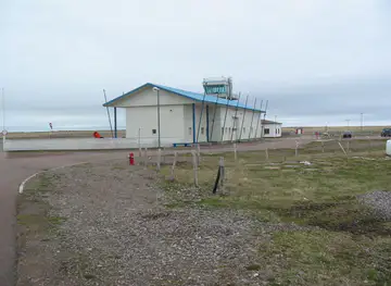
During the twentieth century, improved air links and government administration gave Kamarang a more defined role within the Upper Mazaruni. Small aircraft became especially significant in connecting interior communities with Georgetown and other parts of Guyana, reducing the dependence on long and difficult river journeys for passengers, supplies and official services. The settlement developed as a modest regional centre rather than a conventional town, with its importance measured through access and community connections. This history explains the practical character of Kamarang today: an airstrip, river transport and basic local facilities are central to its identity, while the surrounding Indigenous villages and forested landscape remain the defining context.
Kamarang in Photos
Browse through our photo collection highlighting the charm and character of the destination.
Cities near Kamarang
The closest cities to Kamarang, if you have time for more than one stop.
-

-

-
-
-


Swipe for more cities
Explore more

Explore more of Guyana
Discover Guyana, where the Amazon Rainforest meets Caribbean charm, offering everything from stunning waterfalls to vibrant cities and rich cultural experiences.
Explore Guyana