

Free Bitterroot Mountains Travel Guide & Mobile App
Explore Bitterroot Mountains with free travel guides. Discover regional history, expert tips, proposed trips, and audio guides on web or mobile app.


Explore Idaho’s Bitterroot Mountains through wilderness trails, forested river valleys, historic routes and carefully planned backcountry journeys.
Read more about Bitterroot Mountains
Getting to and around Bitterroot Mountains
How to get there
Transportation
Best attractions in Bitterroot Mountains
The Bitterroot Mountains’ attractions are primarily landscape-based rather than built: forested river corridors, high passes, trailheads and extensive public lands. The Selway-Bitterroot Wilderness offers demanding backpacking, solitude and wildlife observation across a roadless mountain environment shared by Idaho and Montana. Along the Idaho side, the Lochsa River corridor on US 12 provides a scenic introduction to the range, with opportunities for rafting, fishing, picnicking and short walks where access and conditions permit. The Lolo Trail and historic route across the mountains add cultural and exploratory context, while the surrounding Nez Perce-Clearwater National Forests provide a wider network of hiking, camping, hunting and fishing opportunities. Forest roads lead to viewpoints and dispersed recreation areas, although their condition and access can vary greatly. The region suits visitors who enjoy self-guided outdoor travel, changing weather and large-scale scenery more than those seeking a concentration of museums or family attractions. Check current land-manager information before setting out, as fires, snow, road damage and habitat protections can alter access.
-
Ski resort
Lookout Pass Ski & Recreation Area
Explore the breathtaking Lookout Pass Ski & Recreation Area, a premier ski destination in the Bitterroot Mountains, perfect for family fun and winter sports.

Best landmarks in Bitterroot Mountains
The Selway-Bitterroot Wilderness is the region’s defining natural landmark, its roadless ridges and river valleys representing one of the clearest expressions of protected mountain country on the Idaho–Montana border. The Lochsa River is another landmark landscape, cutting through the range beside US 12 and forming a memorable sequence of forest, bends, tributary valleys and steep slopes. Lolo Pass, on the Idaho–Montana boundary, is significant both geographically and historically as a crossing of the Bitterroot Mountains and part of the route associated with the Lewis and Clark Expedition. The Lolo Trail carries an older Indigenous history that predates the expedition by centuries. Farther across the wilderness, the Selway River provides a remote counterpart to the more accessible highway corridor. Rather than a skyline dominated by buildings, the region is marked by passes, rivers, ridges, old forest roads and the broad absence of permanent development.
-
Historical landmark
Bitterroot Valley, Homeland of the Selíš Marker
Explore the Bitterroot Valley, home to the Selíš Marker, where history meets stunning natural beauty in the heart of Montana.

Explore Bitterroot Mountains on the map
Plan your trip on one map. See where the top cities, national parks and sights are, and book hotels and experiences in a few clicks.
Best hotels in Bitterroot Mountains
Best restaurants in Bitterroot Mountains
There is no concentrated restaurant scene in the mountain interior, so most visitors eat in gateway communities or prepare food for the road and trail. Kooskia, Lowell and Salmon provide the most useful bases for cafés, diners, takeaway food and provisions, while meals along US 12 are limited and spread over long distances. Local dining reflects the wider inland Idaho tradition of hearty breakfasts, burgers, sandwiches, grilled meats, trout where responsibly sourced and baked goods suited to road travel. River communities may offer seasonal opportunities for locally caught fish, but visitors should not assume that every menu item is locally produced. Farmers’ markets and small food shops can be useful for fruit, vegetables, preserves and picnic supplies when operating, particularly in warmer months. Backcountry travellers need compact, bear-aware food storage and should plan all meals before entering wilderness, where restaurants, shops and reliable refrigeration are absent.
-
Grill
Big Eddy's
Discover Big Eddy's in Thompson Falls - where delicious grill cuisine meets a cozy bar atmosphere amidst stunning Montana landscapes.
-
Restaurant
Noah's Canteen
Experience delicious meals at Noah's Canteen in Kellogg, Idaho - where great food meets a warm atmosphere.


Best bars in Bitterroot Mountains
Nightlife in the Bitterroot Mountains is small-scale and concentrated in gateway communities rather than within the wilderness itself. Kooskia, Lowell and Salmon may offer traditional pubs, casual bars, restaurants and occasional live music, while roadside establishments along the main corridors generally serve practical evening needs rather than a dedicated club scene. The area’s evenings are more commonly spent around a campsite, lodge or riverside accommodation, subject to fire rules and quiet-hour requirements. Missoula and Hamilton in neighbouring Montana provide a broader choice of bars, breweries, music venues and late-night establishments for travellers approaching from that side, but they are outside Idaho’s Bitterroot Mountains. Visitors should arrange a safe return to accommodation, as distances are long and rural roads are poorly suited to impaired driving.
-
Bar
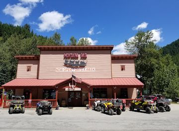
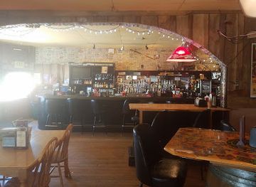
Old Montana Bar
Discover the Old Montana Bar, where rustic charm meets vibrant entertainment in the heart of Saltese, Montana.
-
Grill
Big Eddy's
Discover Big Eddy's in Thompson Falls, a delightful grill and bar offering local flavors and a vibrant atmosphere for a memorable dining experience.
-
Bar
Fergie's Pub
Experience the heart of Hot Springs at Fergie's Pub, where strong drinks and friendly vibes await in a cozy Montana setting.
-
Bar
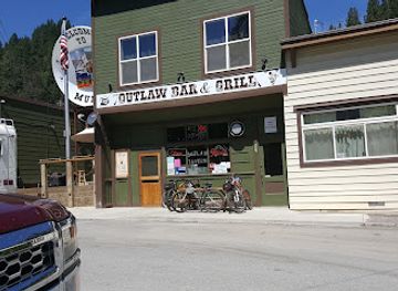
Outlaw Bar & Grill
Experience the heart of the Wild West at Outlaw Bar & Grill in Mullan, Idaho, offering hearty meals, local brews, and live music.

Best nightclubs in Bitterroot Mountains
Nightlife in the Bitterroot Mountains is small-scale and concentrated in gateway communities rather than within the wilderness itself. Kooskia, Lowell and Salmon may offer traditional pubs, casual bars, restaurants and occasional live music, while roadside establishments along the main corridors generally serve practical evening needs rather than a dedicated club scene. The area’s evenings are more commonly spent around a campsite, lodge or riverside accommodation, subject to fire rules and quiet-hour requirements. Missoula and Hamilton in neighbouring Montana provide a broader choice of bars, breweries, music venues and late-night establishments for travellers approaching from that side, but they are outside Idaho’s Bitterroot Mountains. Visitors should arrange a safe return to accommodation, as distances are long and rural roads are poorly suited to impaired driving.
-
Night club
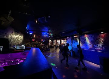
Mik's
Experience the vibrant nightlife of Coeur d'Alene at Mik's, where great drinks, live music, and unforgettable nights await.
Best shops in Bitterroot Mountains
Shopping is functional and locally oriented, with the main opportunities found in gateway towns rather than in the mountain interior. Kooskia, Lowell and Salmon are useful places for fuel, outdoor equipment, groceries, fishing supplies, maps and provisions before entering national-forest or wilderness country. Independent shops and small galleries may carry regional crafts, artwork, books, preserves, locally produced foods and Idaho-themed gifts, while seasonal farmers’ markets can provide fresh produce and baked goods. Visitors should distinguish practical outdoor supplies from souvenirs: remote trailheads and forest roads rarely have retail facilities, and there are no major shopping centres in the wilderness. For a more extensive selection of clothing, specialist equipment or general retail, travellers may need to use larger towns outside the immediate range, including Missoula in neighbouring Montana. Buying locally in gateway communities can support the small businesses that provide services to this dispersed destination.
-
Gift shop
Re-POP Gifts
Explore the vibrant world of Re-POP Gifts in Boise, where unique souvenirs and local artistry come together in a delightful shopping experience.
-
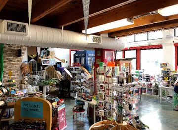
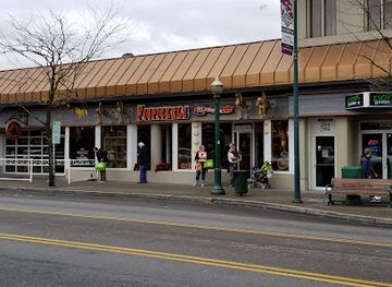
Toy store
Figpickels Toy Emporium
Explore Figpickels Toy Emporium in Coeur d'Alene, a magical toy store filled with unique toys, games, and collectibles for all ages.
-
Gift shop
Mountain Madness Soap Co
Discover unique handcrafted soaps and beauty products at Mountain Madness Soap Co, the perfect gift shop in Coeur d'Alene, Idaho.
-
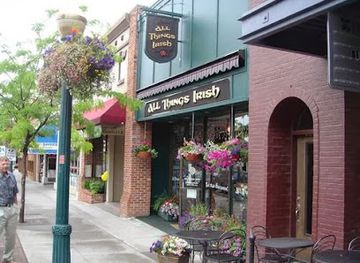
Gift shop
All Things Irish
Explore All Things Irish: A treasure trove of authentic Irish goods in Coeur d'Alene, where culture meets craftsmanship.

Get your free copy of our complete guide to Bitterroot Mountains, delivered straight to you.
Everything on this page, from attractions and restaurants to essentials and local phrases, in one PDF you can read offline, print or share.
Already have an account? Sign in
Your Bitterroot Mountains guide is ready.
We'll send it to · Not you? Sign out

Getting your guide ready…
We are putting together a fresh copy of the Bitterroot Mountains guide. This can take up to a minute.
This can take a few moments. If your browser asks, choose Allow so the download can start. You'll find the guide in your Downloads folder.
Nothing happened? Download it again
Sorry, the guide is taking longer than usual. Please try again in a minute, or get it by email instead.
Bitterroot Mountains essentials
Currency and Payment
Safety
Emergency Situations
Do's and Don'ts
Local Tips
From Eve
Local phrases worth knowing
You don't need to get them perfect. A few words go a long way, and locals appreciate the effort.
Basics
| English | Local | Say it |
|---|---|---|
| Hello | Howdy | [Ha-dee] |
| Goodbye | See ya | [See yah] |
| Yes | Yep | [Yep] |
| No | Nope | [Nope] |
| Please/You're welcome | Sure thing | [Shur thing] |
| Thank you | Thanks a bunch | [Thanks uh bunch] |
| Excuse me/Sorry | Pardon me | [Par-dun mee] |
| How are you? | How ya doin'? | [How ya doin'?] |
| Fine. And you? | Good, and you? | [Good, an' you?] |
| Do you speak English? | Ya speak English? | [Ya speak In-glish?] |
| I don't understand | I ain't following | [I ain't followin'] |
Eating & Drinking
| English | Local | Say it |
|---|---|---|
| I'd like to see the menu, please | Can I see the menu? | [Can I see the men-u?] |
| I don't eat meat | I don't do meat | [I don't do meet] |
| Cheers! | Cheers! | [Cheers!] |
| I would like to pay, please | I'd like to settle up | [I'd like to set-ul up] |
Emergencies
| English | Local | Say it |
|---|---|---|
| Help! | Help! | [Help!] |
| Go away! | Beat it! | [Beat it!] |
| Call the Police! | Call 911! | [Call nine-one-one!] |
| Call a doctor! | Get a doctor! | [Get a doctor!] |
| I'm lost | I’m turned around | [I’m turned around] |
| I'm ill | I ain't feelin' good | [I ain't feelin' good] |
Shopping
| English | Local | Say it |
|---|---|---|
| I'd like to buy... | I'm lookin' to buy... | [I'm lookin' t' buy...] |
| I'm just looking | Just browsing | [Just browsin'] |
| How much is it? | What’s the price? | [What's the price?] |
| That's too expensive | That’s a bit rich | [That's a bit rich] |
| Can you lower the price? | Can you knock down the price? | [Can ya knock down the price?] |
Time & Numbers
| English | Local | Say it |
|---|---|---|
| What time is it? | What time ya got? | [What time ya got?] |
| It's one o'clock | It's one | [It's one] |
| Half past (10) | Half past ten | [Half past ten] |
| Morning | Mornin' | [Mornin'] |
| Afternoon | Afternoon | [Afternoon] |
| Evening | Evenin' | [Evenin'] |
| Yesterday | Yesterday | [Yesterday] |
| Today | Today | [Today] |
| Tomorrow | Tomorrow | [Tomorrow] |
| 1 | One | [One] |
| 2 | Two | [Two] |
| 3 | Three | [Three] |
| 4 | Four | [Four] |
| 5 | Five | [Five] |
| 6 | Six | [Six] |
| 7 | Seven | [Seven] |
| 8 | Eight | [Eight] |
| 9 | Nine | [Nine] |
| 10 | Ten | [Ten] |
Transport & Directions
| English | Local | Say it |
|---|---|---|
| Where's a/the...? | Where's a...? | [Where's a...?] |
| What's the address? | What’s the address? | [What's the address?] |
| Can you show me (on the map)? | Can ya point it out? | [Can ya point it out?] |
| When's the next (bus)? | When's the next bus? | [When's the next bus?] |
| A ticket (to ....) | A ticket to... | [A ticket t'...] |
History of Bitterroot Mountains
Nez Perce Homeland and Mountain Travel
The Bitterroot Mountains lie within the broader homeland and travel landscape of the Nimiipuu, commonly known as the Nez Perce, whose communities used river valleys, mountain passes and upland areas across what is now Idaho and neighbouring states. Seasonal movement, hunting, fishing and trade depended on detailed environmental knowledge. The Bitterroot country was not an empty wilderness before American exploration; it formed part of a lived cultural geography with established routes and places of significance.
The Lolo Trail and the Lewis and Clark Expedition, 1805–1806
The Lolo Trail crossed the Bitterroot Mountains and became famous through the Lewis and Clark Expedition’s difficult westward journey in 1805 and return journey in 1806. The expedition relied on guidance and knowledge supplied by Indigenous people, while the route itself was an established travel corridor rather than a newly created trail. The crossing demonstrated the formidable terrain, limited food resources and severe seasonal conditions that shaped later movement through northern Idaho.
Fur Trade and Early American Exploration
During the early nineteenth century, fur traders, explorers and missionaries entered the inland Northwest along routes that connected the Bitterroot country with the Columbia basin and the northern plains. Travel remained dependent on passes and river corridors, and permanent settlement in the higher mountains was limited. These encounters brought expanding American and European commercial and political interests into a region already shaped by Indigenous diplomacy, trade and territorial knowledge.
Mining and Settlement in the Surrounding Country
Mining transformed parts of Idaho during the nineteenth century, particularly in valleys and districts surrounding the Bitterroot and other northern mountain ranges. Prospectors and supply routes reached remote country, while nearby communities grew around mining, transport and trade. Although the highest wilderness areas remained sparsely settled, mining history influenced roads, river crossings and the development of service towns that still provide access to the mountain landscape.
Forest Service Administration and Road Building
Federal forest administration expanded during the early twentieth century as the United States sought to manage timber, watersheds, grazing and fire across the national forests. Roads, ranger stations and bridges gradually made selected river corridors more accessible, including routes through the Lochsa country. This infrastructure enabled recreation and resource use while also changing the relationship between isolated mountain valleys and towns elsewhere in Idaho.
The Great Fires of 1910
The large wildfires of 1910 burned across extensive areas of Idaho, Montana and neighbouring states, including country associated with the northern Rocky Mountains. The disaster profoundly influenced American wildfire policy, firefighting organisation and public attitudes towards forest management. Its legacy remains visible in national-forest practices, fire lookouts, forest-age patterns and the continuing recognition that fire is a natural but sometimes highly destructive force in the Bitterroot landscape.
Wilderness Protection Since 1964
The Wilderness Act of 1964 established a national framework for protecting roadless federal lands, and later designations preserved extensive portions of the Bitterroot country from permanent roads and motorised development. The Selway-Bitterroot Wilderness, shared between Idaho and Montana, is central to this history. Wilderness management now prioritises ecological integrity and primitive recreation, requiring visitors to accept limited facilities, self-reliance and restrictions on vehicles and other mechanised access.
Bitterroot Mountains in Photos
Browse through our photo collection highlighting the charm and character of the destination.
Neighbouring regions of Bitterroot Mountains
The closest regions to Bitterroot Mountains, if you have time for more than one.
-

-

-

-

-


Swipe for more regions
Explore more

Explore more of Idaho
Idaho: Discover the Gem State's stunning landscapes, vibrant cities, and outdoor adventures. From majestic mountains to serene lakes, experience the natural wonders of Idaho.
Explore Idaho