

Free Salmon River Travel Guide & Mobile App
Explore Salmon River with free travel guides. Discover regional history, expert tips, proposed trips, and audio guides on web or mobile app.


Explore Idaho’s Salmon River through mountain towns, whitewater canyons, wilderness trails, historic mining country and remote outdoor adventures.
Read more about Salmon River
Getting to and around Salmon River
How to get there
Transportation
Top city travel guides in Salmon River
The cities of Salmon River, and the easiest places to base yourself.
-

-

-


Swipe for more cities
Destinations in Salmon River
Resorts, valleys and scenic spots worth a trip of their own.
-

-

-

-


Swipe for more destinations
Best attractions in Salmon River
The Salmon River’s attractions are closely tied to its changing geography. Salmon and Challis offer museums, historic buildings, river access and routes into the upper valley, while the Yankee Fork mining district preserves the physical traces of Idaho’s nineteenth-century gold rush. Around the river and its tributaries, visitors can fish, hike, camp, watch wildlife, ride horses, explore hot springs and follow scenic mountain roads. The central corridor is defined by the Frank Church–River of No Return Wilderness, where multi-day rafting journeys pass through steep canyons, sandy beaches, side streams and remote camps with no continuous road access. Riggins is an important lower-river base for whitewater trips and outdoor excursions. Some experiences depend on permits, seasonal roads, specialist equipment or an outfitter, and facilities may be extremely limited once visitors leave the valley towns. The appeal lies less in a concentration of formal attractions than in the combination of river travel, public-land solitude, working landscapes, geological variety and historic routes.
-
Tourist attraction
Payette National Forest
Discover the breathtaking beauty of Payette National Forest in Idaho, a paradise for outdoor adventures and nature lovers alike.
-
Tourist attraction
Gold Fork Hot Springs
Experience the healing warmth of Gold Fork Hot Springs in Donnelly, Idaho – a perfect blend of nature and relaxation for every traveler.
-
Park
Rotary Park
Experience serene landscapes and engaging outdoor activities at Rotary Park, a must-visit destination in McCall, Idaho, perfect for nature lovers and families.
-
Park
Legacy Park
Explore the natural beauty of Legacy Park in McCall, Idaho, a perfect retreat for outdoor enthusiasts and families alike, surrounded by stunning landscapes.


Best landmarks in Salmon River
The Salmon River itself is the region’s principal landmark, cutting a persistent line through mountains and canyonlands and earning its historic name, the River of No Return, from the difficulty of travelling upstream in earlier times. The Frank Church–River of No Return Wilderness forms an immense backdrop of protected central Idaho country, with river corridors and ridges that are recognisable even when individual sites are reachable only by boat or trail. In the upper valley, the Salmon River and Lemhi Valley landscapes frame the town of Salmon, while the Yankee Fork mining district preserves cabins, works and other reminders of the gold-mining frontier. Around Challis, broad valley floors contrast with the higher ranges and stark slopes of the Salmon-Challis National Forest. Near Riggins, the river enters a more deeply incised canyon setting before continuing towards the Snake River. Bridges, historic town buildings, mining remnants and cottonwood-lined reaches are modest landmarks individually, but together explain how water, transport, geology and settlement shaped the corridor.
-
National forest
Salmon-Challis National Forest
Discover the breathtaking landscapes and outdoor adventures waiting for you at Salmon-Challis National Forest in Idaho.
-
Ski resort
Little Ski Hill / Payette Lakes Ski Club
Discover the charm of Little Ski Hill, a family-friendly ski resort in McCall, Idaho, perfect for winter sports enthusiasts and unforgettable snow adventures.
-
Hiking area
Bear Basin Trailhead
Explore the breathtaking Bear Basin Trailhead in McCall, Idaho, where scenic hiking trails and stunning nature await every adventurer.
-
Raft trip outfitter
Hells Canyon Raft
Discover the thrill of rafting in Hells Canyon, where adventure meets stunning natural beauty, perfect for outdoor enthusiasts and families.


Explore Salmon River on the map
Plan your trip on one map. See where the top cities, national parks and sights are, and book hotels and experiences in a few clicks.
Best hotels in Salmon River
Best restaurants in Salmon River
Dining in the Salmon River region is practical, informal and shaped by small-town life, ranching and outdoor recreation. Salmon, Challis and Riggins provide the broadest choice of cafés, diners, pubs and family-run restaurants, while roadside and rural establishments may have limited hours or seasonal schedules. Menus commonly draw on American comfort food, beef, burgers, trout and other regional ingredients, with packed provisions particularly important for rafting and backcountry trips. Bakeries, coffee shops and grocery stores are useful early-day stops before heading onto remote roads. Visitors may also encounter locally produced beef, game, honey, preserves and craft beverages, although availability varies by season and business. Food is generally part of the region’s service culture rather than a highly formal culinary scene, and advance planning matters for groups, late arrivals and remote camps. Respect fishing regulations and confirm how locally caught fish may legally be prepared or transported.
-
Italian
Ragazza Di Bufalo
Experience authentic Italian cuisine at Ragazza Di Bufalo in Donnelly - where every dish tells a story.
-
Grill
Secesh Stage Stop
Discover Secesh Stage Stop: A rustic mountain grill offering delicious comfort food amidst Idaho's stunning wilderness.
-
Sandwich
Subway
Discover fresh flavors at Subway in Salmon, Idaho – where every sandwich is made just for you!
-
Steak
The RANCH
Experience mouthwatering steaks and warm hospitality at The RANCH in Salmon, Idaho - a steak lover's paradise.


Best bars in Salmon River
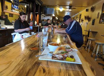
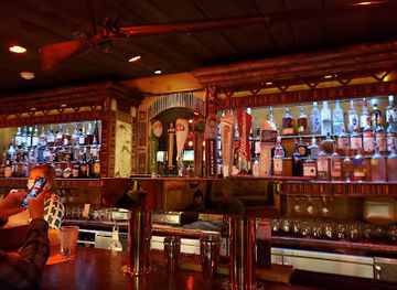
Evening life is concentrated in Salmon, Challis and Riggins, where traditional bars, pub-style restaurants and small-town gathering places provide the main social options. Visitors may find live music, pool tables, local beer and casual dining, particularly during the warmer travel season, but the region does not have a large nightclub circuit. In smaller settlements, venues may close earlier or operate seasonally, and distances make drinking and driving especially hazardous on winding mountain roads. River outfitters, lodges and campgrounds often create a sociable atmosphere around organised trips, but remote wilderness evenings are more likely to involve camp meals, stargazing and quiet conversation than commercial entertainment. Alcohol-service rules and tipping follow Idaho and wider United States practice, and visitors should carry identification when required.
-
Hamburger
My Father's Place
Experience the best hamburgers in McCall, Idaho, at My Father's Place, where quality meets comfort in a welcoming atmosphere.
-
Grill
Lardo Grill & Saloon
Experience the best of McCall, Idaho at Lardo Grill & Saloon, where great food and a lively atmosphere come together.
-
Restaurant
Junkyard Bistro
Experience the eclectic charm and delicious flavors of Junkyard Bistro in Salmon, Idaho – a must-visit for food lovers!
-
Pizza
Growler's Pizza Grill
Discover the delicious flavors of Growler's Pizza Grill in McCall, Idaho, where fresh ingredients meet friendly service in a cozy atmosphere.



Best nightclubs in Salmon River
-
Grill
Lardo Grill & Saloon
Discover the delicious flavors of Idaho at Lardo Grill & Saloon, where great food meets a vibrant atmosphere in McCall.
-
American
Pioneer Saloon
Discover the Pioneer Saloon: A historic steakhouse in Ketchum, Idaho, serving delicious American cuisine in a rustic, welcoming atmosphere.
-
Pub
Salmon River Brewery
Experience the best craft beer and local cuisine at Salmon River Brewery in McCall, Idaho – a perfect stop for all travelers.
-
Grill
Lefty's Bar & Grill
Experience the heart of Ketchum at Lefty's Bar & Grill, where delicious American cuisine meets a welcoming atmosphere in the Idaho mountains.



Best shops in Salmon River
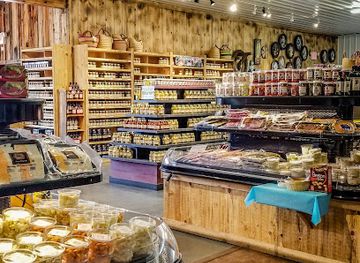
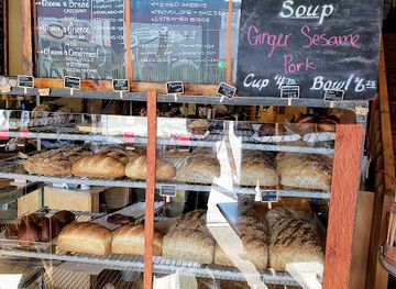
Shopping is centred on the small communities of Salmon, Challis and Riggins rather than on large retail districts. General stores, outfitters and independent shops supply practical equipment, clothing, maps, fishing tackle and provisions for river and mountain travel. Visitors may find locally made jewellery, artwork, photographs, woodwork, books about Idaho history, Indigenous cultures and the backcountry, as well as regional honey, preserves, coffee and other food products. Galleries and craft displays are more likely in the larger valley towns or during seasonal events than along remote stretches of river. Farmers’ and producers’ offerings vary by season, so they should be treated as opportunities rather than guaranteed daily markets. A responsible souvenir might support a local artist or small producer, while archaeological objects, fossils, historic mining material and Indigenous cultural items should never be removed from public land or purchased without clear, lawful provenance.
-
Store
Baker Country Market
Explore the heart of Salmon at Baker Country Market, a unique grocery store and garden center offering local flavors and artisan goods.
-
Bakery
Odd Fellows Bakery
Experience the delightful flavors of Odd Fellows Bakery, where fresh-baked pastries and hearty breakfasts create lasting memories in Salmon, Idaho.
-
Department store
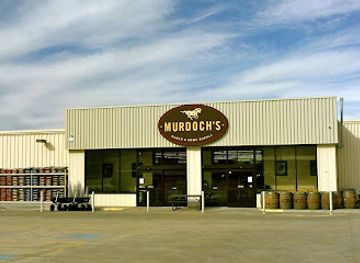
Murdoch's Ranch & Home Supply
Discover the essence of Idaho at Murdoch's Ranch & Home Supply, your go-to destination for outdoor gear, clothing, and home supplies in Salmon.
-
Outdoor sports store
The Bent Rod Outdoors
Explore The Bent Rod Outdoors in Challis, Idaho - your one-stop destination for camping, fishing, and outdoor adventures.
Get your free copy of our complete guide to Salmon River, delivered straight to you.
Everything on this page, from attractions and restaurants to essentials and local phrases, in one PDF you can read offline, print or share.
Already have an account? Sign in
Your Salmon River guide is ready.
We'll send it to · Not you? Sign out

Getting your guide ready…
We are putting together a fresh copy of the Salmon River guide. This can take up to a minute.
This can take a few moments. If your browser asks, choose Allow so the download can start. You'll find the guide in your Downloads folder.
Nothing happened? Download it again
Sorry, the guide is taking longer than usual. Please try again in a minute, or get it by email instead.
Salmon River essentials
Currency and Payment
Safety
Emergency Situations
Do's and Don'ts
Local Tips
From Eve
Local phrases worth knowing
You don't need to get them perfect. A few words go a long way, and locals appreciate the effort.
Basics
| English | Local | Say it |
|---|---|---|
| Hello | Howdy | [haʊ.di] |
| Goodbye | See ya | [si jə] |
| Yes | Yep | [jɛp] |
| No | Nope | [noʊp] |
| Please/You're welcome | Sure thing | [ʃʊr θɪŋ] |
| Thank you | Thanks a lot | [θæŋks ə lɑt] |
| Excuse me/Sorry | Pardon me | [ˈpɑrdən mi] |
| How are you? | How's it going? | [haʊz ɪt ˈɡoʊɪŋ] |
| Fine. And you? | Good. And you? | [ɡʊd. ənd ju] |
| Do you speak English? | Can you talk English? | [kæn ju tɔk ˈɪŋɡlɪʃ] |
| I don't understand | I ain't got it | [aɪ eɪnt ɡɑt ɪt] |
Eating & Drinking
| English | Local | Say it |
|---|---|---|
| I'd like to see the menu, please | Can I check out the menu? | [kæn aɪ tʃɛk aʊt ðə ˈmɛnju] |
| I don't eat meat | I don't do meat | [aɪ doʊnt du mit] |
| Cheers! | Cheers! | [tʃɪrz] |
| I would like to pay, please | Can I settle up, please? | [kæn aɪ ˈsɛtəl ʌp pliz] |
Emergencies
| English | Local | Say it |
|---|---|---|
| Help! | Help! | [hɛlp] |
| Go away! | Leave me be! | [liːv mi bi] |
| Call the Police! | Get the cops! | [ɡɛt ðə kɑps] |
| Call a doctor! | Get a doc! | [ɡɛt ə dɑk] |
| I'm lost | I can't find my way | [aɪ kænt faɪnd maɪ weɪ] |
| I'm ill | I'm not feeling good | [aɪm nɑt ˈfiːlɪŋ ɡʊd] |
Shopping
| English | Local | Say it |
|---|---|---|
| I'd like to buy... | I wanna buy... | [aɪ ˈwɑnə baɪ] |
| I'm just looking | Just browsing | [dʒʌst ˈbraʊzɪŋ] |
| How much is it? | What’s the price? | [wʌts ðə praɪs] |
| That's too expensive | That costs too much | [ðæt kɔsts tu mʌtʃ] |
| Can you lower the price? | Can you bring it down? | [kæn ju brɪŋ ɪt daʊn] |
Time & Numbers
| English | Local | Say it |
|---|---|---|
| What time is it? | What time ya got? | [wʌt taɪm jə ɡɑt] |
| It's one o'clock | It's one | [ɪts wʌn] |
| Half past (10) | Half past ten | [hæf pæst tɛn] |
| Morning | Mornin' | [ˈmɔrnɪn] |
| Afternoon | Afternoo | [ˌæf.tɚˈnuː] |
| Evening | Evenin' | [ˈivnɪn] |
| Yesterday | Yesterday | [ˈjɛstərdeɪ] |
| Today | Today | [təˈdeɪ] |
| Tomorrow | Tomorrow | [təˈmɔroʊ] |
| 1 | One | [wʌn] |
| 2 | Two | [tu] |
| 3 | Three | [θri] |
| 4 | Four | [fɔr] |
| 5 | Five | [faɪv] |
| 6 | Six | [sɪks] |
| 7 | Seven | [ˈsɛvən] |
| 8 | Eight | [eɪt] |
| 9 | Nine | [naɪn] |
| 10 | Ten | [tɛn] |
Transport & Directions
| English | Local | Say it |
|---|---|---|
| Where's a/the...? | Where's the...? | [wɛrz ðə] |
| What's the address? | What’s the address? | [wʌts ði əˈdrɛs] |
| Can you show me (on the map)? | Can you point it out? | [kæn ju pɔɪnt ɪt aʊt] |
| When's the next (bus)? | When's the next bus? | [wɛnʔs ðə nɛkst bʌs] |
| A ticket (to ....) | A ticket to... | [ə ˈtɪkɪt tu] |
History of Salmon River
Indigenous homelands and river travel
The Salmon River drainage has long been used and cared for by Indigenous peoples, including the Nimiipuu, or Nez Perce, and the Lemhi Shoshone, as well as other connected communities of the northern Great Basin and Columbia Plateau. Rivers, tributaries, fishing places, hunting grounds and mountain routes formed part of an extensive seasonal geography rather than an isolated wilderness. Their histories remain important to understanding the corridor, especially around the upper Salmon and Lemhi valleys and the routes later used by explorers and settlers.
Lewis and Clark in the upper country, 1805–1806
The Lewis and Clark Expedition entered the region in 1805 through the Lemhi Valley, where the explorers encountered the Lemhi Shoshone and sought routes across the northern Rocky Mountains. The expedition did not follow the entire Salmon River to its mouth, but its difficult passage through the upper watershed helped place the area on the map of United States expansion. The journals also record the formidable terrain, cold conditions and dependence on Indigenous knowledge that shaped early outside impressions of Idaho’s interior.
Mining and the formation of frontier towns
Gold discoveries in the 1860s transformed the upper Salmon country. Prospectors entered tributary valleys and sought deposits in districts such as the Yankee Fork, while Salmon and Challis developed as supply and administrative centres. Mining brought roads, freight routes, machinery and a shifting population, but it also left tailings, altered waterways and abandoned workings across the mountain landscape. The surviving buildings, cemeteries and industrial remains of the mining era provide a tangible historical layer alongside the region’s continuing ranching and public-land economies.
Ranching, transport and settlement
As easily accessible mineral deposits declined, ranching and related services became increasingly important in the river valleys. Communities depended on difficult stage, wagon and later motor routes linking the upper country with Idaho’s larger settlements. The river itself was both a barrier and a route, while bridges, ferries and mountain passes influenced where towns could prosper. Modern roads improved access to Salmon, Challis and Riggins, but the corridor’s scattered settlement pattern and large public-land holdings still reflect the challenges of distance, terrain and water.
Protection of the River of No Return country
The Salmon River’s remote canyonlands became central to the American conservation movement and the development of the United States wilderness system. The Frank Church–River of No Return Wilderness, designated in 1980 and later expanded through federal legislation, protects a vast area surrounding much of the central Idaho backcountry. Its restrictions on roads and mechanised development preserve ecological processes, wildlife habitat, river access and a sense of remoteness, while making journeys there more demanding and dependent on careful preparation.
The modern river recreation era
Commercial rafting, fishing, hunting, trail travel and scenic tourism developed into important parts of the Salmon River economy during the twentieth century. The river became recognised internationally for multi-day whitewater journeys through remote canyons, while Salmon, Challis and Riggins adapted as service centres for visitors and outfitters. Recreation exists alongside ranching, forestry, conservation and Indigenous interests, making management of access, fish populations, fire risk and wilderness character an ongoing part of the region’s contemporary history.
Salmon River in Photos
Browse through our photo collection highlighting the charm and character of the destination.
Neighbouring regions of Salmon River
The closest regions to Salmon River, if you have time for more than one.
-

-

-

-

-


Swipe for more regions
Explore more

Explore more of Idaho
Idaho: Discover the Gem State's stunning landscapes, vibrant cities, and outdoor adventures. From majestic mountains to serene lakes, experience the natural wonders of Idaho.
Explore Idaho