

Free Des Moines River Valley Travel Guide & Mobile App
Explore Des Moines River Valley with free travel guides. Discover regional history, expert tips, proposed trips, and audio guides on web or mobile app.


Explore Iowa’s Des Moines River Valley for state-capital culture, reservoirs, prairie parks, historic river towns and scenic drives through the heartland.
Read more about Des Moines River Valley
When is the best time to visit Des Moines River Valley?
Best: May–June, September · 23–28°C| Month | High (°C) | Rainfall (mm) |
|---|---|---|
| January | -3 | 25 |
| February | 0 | 23 |
| March | 7 | 43 |
| April | 16 | 79 |
| May (best) | 23 | 100 |
| June (best) | 28 | 111 |
| July | 30 | 98 |
| August | 29 | 106 |
| September (best) | 24 | 79 |
| October | 17 | 68 |
| November | 9 | 49 |
| December | 1 | 33 |
Getting to and around Des Moines River Valley
How to get there
Transportation
Top city travel guides in Des Moines River Valley
The cities of Des Moines River Valley, and the easiest places to base yourself.
-

-

-


Swipe for more cities
Best attractions in Des Moines River Valley
The Des Moines River Valley’s attractions range from urban cultural institutions to broad reservoirs, wooded parks and small historic settlements. In Des Moines, visitors can combine the Iowa State Capitol, museums, galleries, public art and riverfront parks with the city’s restaurants and events. North of the capital, Saylorville Lake offers boating, fishing, camping, beaches and trails, while Ledges State Park near Boone is known for sandstone cliffs, ravines and wooded walks. Farther south, Lake Red Rock provides an extensive recreation landscape of water, prairie, wetlands and wildlife habitat, with nearby communities offering museums, heritage sites and seasonal activities. Historic Pella adds Dutch-American architecture and cultural institutions, while Ottumwa remains an important centre for the southern valley. Lower-valley communities including Bentonsport and Bonaparte preserve nineteenth-century commercial buildings linked to the river’s former navigation ambitions. State parks, county conservation areas and river access points support hiking, cycling, paddling and birdwatching, although facilities are dispersed and some routes are affected by weather or water levels. The attraction landscape is best understood as a sequence of contrasting places connected by roads and the river rather than as one concentrated resort area.
-
Amusement park
Urban Air Trampoline and Adventure Park
Experience the ultimate indoor adventure at Urban Air Trampoline and Adventure Park in Ankeny, Iowa, where fun and excitement await for all ages.

Best landmarks in Des Moines River Valley
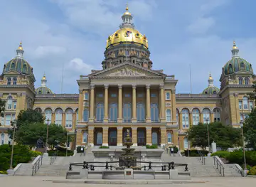
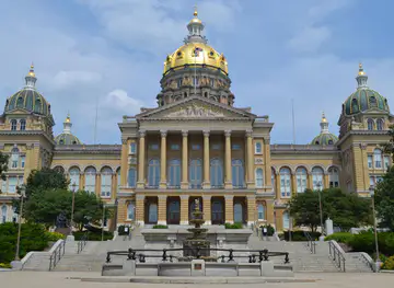
The Iowa State Capitol in Des Moines is the valley’s most prominent civic landmark, recognised for its central dome, public interiors and position above the capital city. The Des Moines River itself is a geographical landmark whose changing character can be seen from urban bridges, reservoir shorelines and lower-valley floodplains. Saylorville Dam and Lake Red Rock Dam represent the twentieth-century transformation of the river into a managed flood-control and recreation system, although both should be viewed only from permitted areas. Ledges State Park near Boone provides one of the most distinctive natural scenes in the upper valley, with sandstone formations and steep wooded ravines shaped by erosion. Historic Bentonsport and Bonaparte contain some of the clearest surviving groups of nineteenth-century river-commercial architecture in the lower valley. Pella’s central streets and buildings express the town’s Dutch-American heritage, while Fort Dodge’s historic institutions recall its origins as a frontier military post and later regional centre. Together these landmarks show how the valley has been shaped by geology, Indigenous history, government, transport, industry and water management.
-
Historical landmark
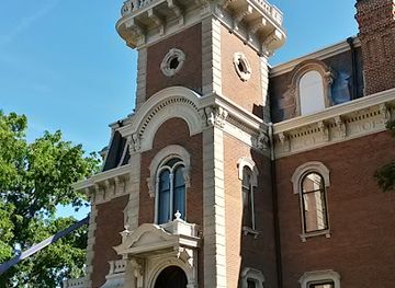
Terrace Hill Historic Site
Explore the majestic Terrace Hill Historic Site in Des Moines, Iowa, a historical landmark that tells the story of the state's heritage and governance.
-
Historical place
Des Moines Historic District
Discover the captivating charm and rich history of the Des Moines Historic District, a must-visit destination for culture and architecture enthusiasts.
-
Historical landmark
Bates Park Historic District
Discover the Bates Park Historic District in Des Moines, Iowa - a historical landmark that showcases stunning architecture and rich local heritage.

Explore Des Moines River Valley on the map
Plan your trip on one map. See where the top cities, national parks and sights are, and book hotels and experiences in a few clicks.
Best hotels in Des Moines River Valley
Best restaurants in Des Moines River Valley
Dining in the Des Moines River Valley reflects Iowa’s agricultural base and the different scales of its communities. Des Moines has the broadest choice, including independent restaurants, international cuisines, cafés, bakeries, breweries and the seasonal Downtown Farmers’ Market. Away from the capital, dining is more commonly found in family-run restaurants, diners, cafés, taverns, rural inns and small-town bakeries. Local menus often draw on sweet corn, pork, beef, seasonal vegetables and orchard produce, while Iowa-made beer and spirits are widely available. Around lakes and recreation areas, casual food and picnic provisions are more practical than a dense restaurant scene. Pella brings Dutch-American influences to its shops and bakeries, while communities such as Ottumwa and Fort Dodge have long-established commercial dining districts shaped by working and agricultural populations. Farmers’ markets, roadside stands and seasonal events can be good sources of local produce, but their dates and availability change through the year.
-
Southern
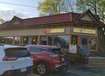
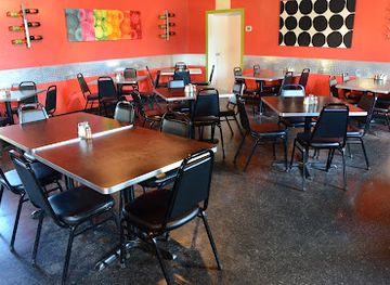
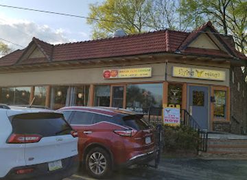
Flying Mango
Experience authentic Southern barbecue at Flying Mango in Des Moines – where flavor meets hospitality in every bite.
-
American
RoCA
Discover RoCA in Downtown Des Moines - where innovative American cuisine meets exceptional cocktails in a vibrant atmosphere.
-
Sushi
Blue Sushi Sake Grill
Discover exquisite sushi and sake in downtown Des Moines at Blue Sushi Sake Grill - where culinary creativity meets tradition.
-
Pizza
Georgioz
Savor the authentic taste of Italy at Georgioz in Colfax - where every slice tells a story.


Best bars in Des Moines River Valley
Evening life is concentrated in Des Moines, where downtown and nearby neighbourhoods offer pubs, breweries, cocktail bars, live music, restaurants and theatre-related venues. The city has the region’s most varied late-evening options, although the character of individual areas changes as businesses open and close. Fort Dodge, Ottumwa, Pella and other larger valley communities provide local bars, taverns, breweries, restaurants and occasional live entertainment rather than a major club circuit. Around Lake Red Rock and Saylorville Lake, evenings are more likely to centre on campfires, waterfront accommodation, private gatherings or a meal in a nearby town. Rural communities may have limited late-night transport, so visitors should plan a safe return journey instead of relying on taxis appearing on demand. Seasonal festivals and concerts can add activity, but dates and venues should be checked locally.
-
Southern
Flying Mango
Experience the best of Southern barbecue at Flying Mango, a top-rated restaurant in Des Moines, Iowa, known for its authentic flavors and friendly atmosphere.
-
Restaurant
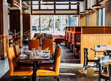
Mulberry Street Tavern
Explore Mulberry Street Tavern in Downtown Des Moines for a unique blend of vibrant atmosphere, delicious food, and creative drinks.
Best nightclubs in Des Moines River Valley
Evening life is concentrated in Des Moines, where downtown and nearby neighbourhoods offer pubs, breweries, cocktail bars, live music, restaurants and theatre-related venues. The city has the region’s most varied late-evening options, although the character of individual areas changes as businesses open and close. Fort Dodge, Ottumwa, Pella and other larger valley communities provide local bars, taverns, breweries, restaurants and occasional live entertainment rather than a major club circuit. Around Lake Red Rock and Saylorville Lake, evenings are more likely to centre on campfires, waterfront accommodation, private gatherings or a meal in a nearby town. Rural communities may have limited late-night transport, so visitors should plan a safe return journey instead of relying on taxis appearing on demand. Seasonal festivals and concerts can add activity, but dates and venues should be checked locally.
-
River
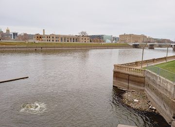
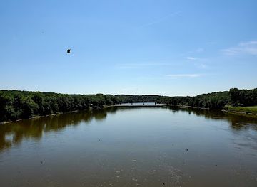
Des Moines River
Experience the breathtaking beauty and recreational opportunities of the Des Moines River, a must-visit destination in Iowa.
Best shops in Des Moines River Valley
Shopping is most varied in Des Moines, where visitors will find established retail areas, independent boutiques, bookshops, galleries, cafés and the seasonal Downtown Farmers’ Market. The market is particularly useful for Iowa-grown produce, baked goods, preserves, flowers and prepared food, though its operating pattern is seasonal. Fort Dodge and Ottumwa serve as practical shopping centres for their surrounding rural areas, with traditional downtown businesses alongside larger commercial districts. Pella offers locally oriented shops, Dutch-American decorative goods, baked products, gifts and craft items, while smaller river towns are better suited to browsing antiques, galleries and independent stores than to extensive retail. Farm stands and roadside vendors appear throughout the valley when produce is in season. Good regional purchases include Iowa food products, locally made beer or spirits where legally sold, pottery, artwork, books on local history and practical outdoor goods. Retail hours can be limited in small communities, particularly outside peak visitor periods, so plan village shopping during the daytime.
-
Department store
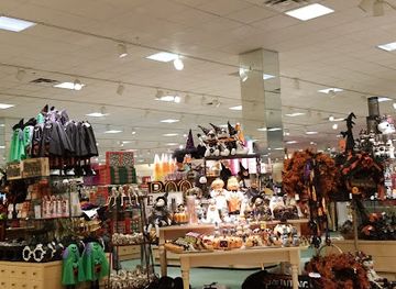
Von Maur
Discover the elegance and charm of Von Maur, a premier department store in West Des Moines offering an exceptional shopping experience.
-
Clothing store
Nordstrom Rack
Discover unbeatable deals on designer fashion at Nordstrom Rack, the ultimate outlet shopping experience in West Des Moines, Iowa.
-
Department store
Marshalls
Explore Marshalls in Des Moines for unbeatable discounts on fashion, footwear, and home essentials, perfect for tourists and locals alike.
-
Gift shop
Bing's
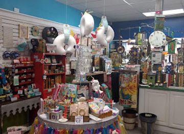
Explore Bing's in West Des Moines for unique gifts, games, and garden treasures that capture the spirit of Iowa's Valley Junction.


Get your free copy of our complete guide to Des Moines River Valley, delivered straight to you.
Everything on this page, from attractions and restaurants to essentials and local phrases, in one PDF you can read offline, print or share.
Already have an account? Sign in
Your Des Moines River Valley guide is ready.
We'll send it to · Not you? Sign out

Getting your guide ready…
We are putting together a fresh copy of the Des Moines River Valley guide. This can take up to a minute.
This can take a few moments. If your browser asks, choose Allow so the download can start. You'll find the guide in your Downloads folder.
Nothing happened? Download it again
Sorry, the guide is taking longer than usual. Please try again in a minute, or get it by email instead.
Des Moines River Valley essentials
Currency and Payment
Safety
Emergency Situations
Do's and Don'ts
Local Tips
From Eve
Local phrases worth knowing
You don't need to get them perfect. A few words go a long way, and locals appreciate the effort.
Basics
| English | Local | Say it |
|---|---|---|
| Hello | Howdy | [haʊdi] |
| Goodbye | See ya | [si jə] |
| Yes | Yep | [jɛp] |
| No | Nope | [noʊp] |
| Please/You're welcome | Please/No problem | [pliz/noʊ ˈprɑːbləm] |
| Thank you | Thanks | [θæŋks] |
| Excuse me/Sorry | Excuse me/Sorry | [ɪkˈskjuːz mi/ˈsɔːri] |
| How are you? | How's it going? | [haʊz ɪt ˈɡoʊɪŋ] |
| Fine. And you? | Good. And you? | [ɡʊd. ənd ju] |
| Do you speak English? | Do ya speak English? | [du jə spiːk ˈɪŋɡlɪʃ] |
| I don't understand | I don’t get it | [aɪ doʊnt ɡɛt ɪt] |
Eating & Drinking
| English | Local | Say it |
|---|---|---|
| I'd like to see the menu, please | Can I see the menu, please? | [kæn aɪ si ðə ˈmɛnjuː, pliz] |
| I don't eat meat | I'm a vegetarian | [aɪm ə ˌvɛdʒəˈtɛriən] |
| Cheers! | Cheers! | [ʧɪrz] |
| I would like to pay, please | Can I get the check, please? | [kæn aɪ ɡɛt ðə ʧɛk, pliz] |
Emergencies
| English | Local | Say it |
|---|---|---|
| Help! | Help! | [hɛlp] |
| Go away! | Leave me alone! | [liːv mi əˈloʊn] |
| Call the Police! | Call 911! | [kɔl naɪn wʌn wʌn] |
| Call a doctor! | Get a doctor! | [ɡɛt ə ˈdɑktər] |
| I'm lost | I’m lost | [aɪm lɔst] |
| I'm ill | I’m not feeling well | [aɪm nɑt ˈfiːlɪŋ wɛl] |
Shopping
| English | Local | Say it |
|---|---|---|
| I'd like to buy... | I want to buy... | [aɪ wɑnt tu baɪ] |
| I'm just looking | Just browsing | [dʒʌst ˈbraʊzɪŋ] |
| How much is it? | What’s the price? | [wʌts ðə praɪs] |
| That's too expensive | That costs too much | [ðæt kɔsts tu mʌʧ] |
| Can you lower the price? | Can you make it cheaper? | [kæn jə meɪk ɪt ˈʧipər] |
Time & Numbers
| English | Local | Say it |
|---|---|---|
| What time is it? | What time is it? | [wʌt taɪm ɪz ɪt] |
| It's one o'clock | It's one o'clock | [ɪts wʌn əˈklɑk] |
| Half past (10) | Half past ten | [hæf pæst tɛn] |
| Morning | Morning | [ˈmɔrnɪŋ] |
| Afternoon | Afternoon | [ˌæftərˈnun] |
| Evening | Evening | [ˈivnɪŋ] |
| Yesterday | Yesterday | [ˈjɛstərˌdeɪ] |
| Today | Today | [təˈdeɪ] |
| Tomorrow | Tomorrow | [təˈmɔroʊ] |
| 1 | One | [wʌn] |
| 2 | Two | [tu] |
| 3 | Three | [θri] |
| 4 | Four | [fɔr] |
| 5 | Five | [faɪv] |
| 6 | Six | [sɪks] |
| 7 | Seven | [ˈsɛvən] |
| 8 | Eight | [eɪt] |
| 9 | Nine | [naɪn] |
| 10 | Ten | [tɛn] |
Transport & Directions
| English | Local | Say it |
|---|---|---|
| Where's a/the...? | Where's the...? | [wɛrz ðə] |
| What's the address? | What’s the address? | [wʌts ði əˈdrɛs] |
| Can you show me (on the map)? | Can you show me on the map? | [kæn jə ʃoʊ mi ɑn ðə mæp] |
| When's the next (bus)? | When’s the next bus? | [wɛnʔs ðə nɛkst bʌs] |
| A ticket (to ....) | A ticket to ... | [ə ˈtɪkɪt tu ...] |
History of Des Moines River Valley
Indigenous Homelands and River Networks
Long before American settlement, the Des Moines River valley formed part of a wider Indigenous landscape used for travel, hunting, agriculture and trade. Ioway, Sauk and Meskwaki peoples are among the nations associated with the region, although Indigenous communities and territorial relationships changed over time. The river connected prairie, woodland and wetland environments and served as a natural route through what is now Iowa. Later treaties and forced removals transferred Indigenous lands to the United States, with lasting consequences for Native communities and the landscape.
The Des Moines River Improvement Project, 1830s–1850s
In the nineteenth century, American officials and investors hoped to make the Des Moines River a navigable commercial route from the Mississippi towards the interior. Federal and state support led to plans for dams, locks and other improvements, but funding disputes, engineering difficulties and changing transport technology undermined the scheme. Several structures and remnants survived, and the project influenced land ownership, settlement and the development of river communities. Its failure also demonstrated how quickly railways could replace rivers as the most dependable long-distance transport system.
Fort Dodge and Frontier Settlement
Fort Dodge was established by the United States Army in 1850 near the Des Moines River during a period of expanding American settlement and military control of the central Iowa frontier. The post was abandoned soon afterwards, but the community that grew around it became an important centre for commerce, government and transport. Fort Dodge’s later institutions and historic sites preserve elements of this frontier story, while the surrounding valley was transformed from Indigenous country and prairie into farms, towns and connected markets.
Coal, Brick and River-Valley Industry
Coal mining became particularly important around Des Moines and in parts of the central and southern valley during the nineteenth and early twentieth centuries. Mines supplied households, railways and industries, while brickmaking and other manufacturing used local materials and expanding transport links. Des Moines developed as a commercial and governmental centre, and Ottumwa became an important industrial and railway city farther downstream. Mining declined as energy systems changed, but former workings, company neighbourhoods, museums and urban landscapes retain traces of the valley’s industrial era.
Railways and the Rise of Connected Towns
Railways altered the economic geography of the Des Moines River Valley from the mid-nineteenth century onwards. Lines connected agricultural producers and industrial towns with regional and national markets, reducing reliance on the river’s unreliable navigation. Des Moines expanded rapidly as a transport and administrative centre, while smaller communities gained depots, warehouses and commercial streets. Many historic downtowns and railway-related buildings in the valley reflect this transition from river-based aspirations to a modern network of rail and road connections.
Des Moines as Iowa’s Political and Cultural Centre
Des Moines became Iowa’s capital in the nineteenth century and grew into the state’s principal political, financial and cultural centre. The city’s location near the river helped its early development, although its later importance rested more on government, commerce, railways and diverse urban institutions than on river transport. The Iowa State Capitol, civic buildings, theatres, museums and neighbourhoods express successive phases of growth. Today, Des Moines provides the valley with its largest concentration of cultural venues and services.
Reservoirs, Flood Control and Recreation
Twentieth-century flood-control projects reshaped major sections of the river. Saylorville Lake north of Des Moines and Lake Red Rock farther south were created through large dams designed principally to manage flooding and water resources. Their reservoirs also produced new settings for boating, fishing, camping, wildlife habitat and trails. These projects changed the appearance of the historic river corridor, replacing some former floodplain landscapes with managed lakes and recreation areas while reflecting the continuing importance of the river to Iowa’s settlements.
Des Moines River Valley in Photos
Browse through our photo collection highlighting the charm and character of the destination.
Neighbouring regions of Des Moines River Valley
The closest regions to Des Moines River Valley, if you have time for more than one.
-
-
-

-

-


Swipe for more regions
Explore more

Explore more of Iowa
Explore Iowa: The American Heartland with its blend of rural charm, vibrant cities, rich cultural experiences, and natural beauty, perfect for nature lovers and cultural enthusiasts.
Explore Iowa