

Free Wellington-McPherson Lowlands Travel Guide & Mobile App
Explore Wellington-McPherson Lowlands with free travel guides. Discover regional history, expert tips, proposed trips, and audio guides on web or mobile app.


Explore the Wellington-McPherson Lowlands for open Kansas landscapes, Mennonite heritage, historic rail towns, local museums and quiet outdoor recreation.
Read more about Wellington-McPherson Lowlands
Getting to and around Wellington-McPherson Lowlands
How to get there
Transportation
Top city travel guides in Wellington-McPherson Lowlands
The cities of Wellington-McPherson Lowlands, and the easiest places to base yourself.
-
-


Swipe for more cities
Destinations in Wellington-McPherson Lowlands
Resorts, valleys and scenic spots worth a trip of their own.
Swipe for more destinations
Best attractions in Wellington-McPherson Lowlands
Attractions in the Wellington-McPherson Lowlands centre on local history, working landscapes and accessible outdoor recreation rather than a single concentration of major monuments. McPherson offers museums, historic buildings and cultural institutions that explain settlement, industry and community life, while Newton's historic centre and railway associations illuminate the importance of transport and cattle commerce. Wellington provides county-seat architecture, museums and a useful southern base. Around Moundridge and other McPherson County communities, Mennonite heritage can be explored through churches, cemeteries, family histories and food traditions, provided visitors check access arrangements. Lakes, reservoirs and wildlife areas add opportunities for fishing, boating, birdwatching, picnicking and quiet walks. Maxwell Wildlife Refuge, near the lowland's eastern side, is known for prairie wildlife and bison viewing, while local parks and smaller water bodies offer more informal recreation. The region's most rewarding itinerary links several modest experiences: a grain-town main street, an independent museum, a rural landscape drive and an evening beneath the broad Kansas sky.
-
Tourist attraction
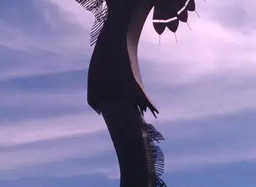
The Keeper of the Plains
Discover the breathtaking Keeper of the Plains, a stunning cultural landmark in Wichita, Kansas, symbolizing Native American heritage and natural beauty.

Best landmarks in Wellington-McPherson Lowlands
The most recognisable landmarks of the Wellington-McPherson Lowlands are closely tied to town building, transport and the prairie setting. McPherson's historic civic and commercial buildings express the confidence of a nineteenth-century county and railway centre, while Wellington's courthouse square and surrounding historic architecture reflect its continuing role as a county seat. Newton's historic downtown and railway heritage recall the period when the town connected agricultural Kansas with national passenger, freight and cattle networks. Grain elevators and other agricultural structures, although primarily working infrastructure, are striking visual markers of the region's economy and broad horizons. In the countryside, the level fields, shelterbelts and distant horizons form a landscape landmark of their own, contrasting with the more broken terrain found in neighbouring Kansas districts. Maxwell Wildlife Refuge, near Canton, adds a natural point of reference, where open prairie and bison habitat help visitors understand the ecological setting behind the settled farmland.
-
Tourist attraction
The Keeper of the Plains
Explore The Keeper of the Plains in Wichita, Kansas: A stunning landmark celebrating Native American heritage and culture amidst breathtaking natural beauty.

Explore Wellington-McPherson Lowlands on the map
Plan your trip on one map. See where the top cities, national parks and sights are, and book hotels and experiences in a few clicks.
Best hotels in Wellington-McPherson Lowlands
Best restaurants in Wellington-McPherson Lowlands
Dining in the Wellington-McPherson Lowlands reflects central Kansas agriculture and small-town hospitality. In McPherson, Newton, Wellington and other larger communities, visitors will find cafés, family restaurants, bakeries, grills and pubs serving familiar American fare alongside contemporary dishes. Wheat, beef, pork, eggs and seasonal produce underpin much of the regional food economy, while Mennonite influence is especially visible in parts of McPherson County through homemade breads, pies, noodles, preserves and other baked or prepared foods. These traditions are associated with particular communities and families rather than with every restaurant in the region. Farmers' markets and farm shops, where operating seasonally, are useful places to find produce and locally made goods. Rural cafés can be important social and dining centres, but hours may be limited, especially outside the main towns. Kansas beer and spirits may appear on local menus, while coffee, pie and hearty breakfasts remain dependable choices for travellers following the highways.
-
Family-friendly
Carriage Crossing Restaurant and Bakery
Experience the charm of Yoder at Carriage Crossing Restaurant and Bakery - where delicious meals meet delightful baked goods in a family-friendly setting.
-
Sports bar
Twin Peaks
Experience the ultimate sports bar at Twin Peaks in Wichita - where American cuisine meets lively entertainment in a welcoming atmosphere.
-
American
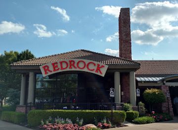
Redrock Canyon Grill - Wichita
Experience the best of American cuisine at Redrock Canyon Grill in Wichita - where flavor meets hospitality in a warm setting.
-
American
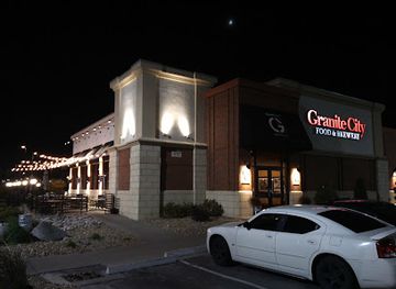
Granite City Food & Brewery
Experience authentic American cuisine and handcrafted beers at Granite City Food & Brewery in Kansas City - A must-visit culinary destination.


Best bars in Wellington-McPherson Lowlands
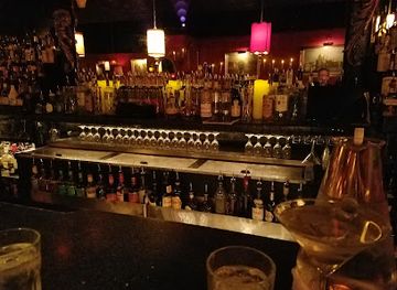
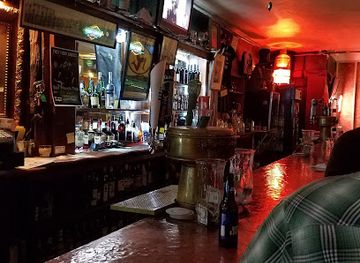
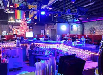
Evening life in the Wellington-McPherson Lowlands is concentrated in McPherson, Newton and Wellington, with smaller communities offering a more limited choice. Traditional pubs, taverns, grills and casual restaurants provide the main social settings, while breweries or taprooms may supplement the scene where locally produced beer is available. Historic downtown buildings in the larger towns sometimes accommodate live music, community performances or seasonal events, but this is not a region defined by large nightclubs or late-night entertainment districts. University and college activity adds some evening energy in McPherson, although schedules and venues change. In rural areas, evenings are more likely to centre on a restaurant, local gathering or outdoor setting than on organised nightlife. Check current arrangements before travelling for a particular performance or venue, and plan transport in advance when staying outside a town centre.
-
Family-friendly
Carriage Crossing Restaurant and Bakery
Experience the heart of Yoder at Carriage Crossing Restaurant and Bakery, where delicious comfort food meets delightful baked goods in a cozy setting.
-
Cocktail bar
Green Lady Lounge
Discover a vibrant cocktail bar and jazz club in Downtown Kansas City, featuring live music, expertly crafted drinks, and an inviting atmosphere.
-
New American
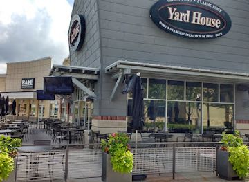
Yard House
Experience the lively ambiance and diverse menu at Yard House, Kansas City's favorite New American gastropub with a passion for craft beer.
-
Grill
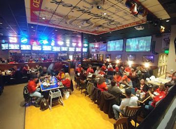
Danny's Bar & Grill North
Experience the casual charm of Danny's Bar & Grill North in Kansas City, where delicious grilled dishes meet a friendly atmosphere.

Best nightclubs in Wellington-McPherson Lowlands
-
Bar
The Monarch
Discover The Monarch in Wichita, where American cuisine meets lively nightlife in a vibrant bar atmosphere, perfect for every taste and occasion.
-
Bar
Shamrock Lounge
Discover Shamrock Lounge in Wichita, the perfect blend of Irish charm and American pub culture with live music and delicious food.
-
Bar
XY Bar
Experience the vibrant nightlife of Wichita at XY Bar, offering delicious drinks, lively entertainment, and a welcoming atmosphere in Old Town.
-
Night club
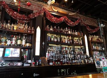
John Barleycorn's
Discover the lively night scene at John Barleycorn's, where live music, delicious pizza, and a vibrant bar atmosphere create unforgettable memories.

Best shops in Wellington-McPherson Lowlands
Shopping in the Wellington-McPherson Lowlands is centred on the historic main streets and commercial districts of McPherson, Newton and Wellington, with smaller communities offering independent stores, antiques, books, clothing, gifts and practical provisions. Local museums and cultural organisations may sell books on Kansas history, regional families, railways and Mennonite heritage. Seasonal farmers' markets and farm stands are the best places to look for produce, baked goods, preserves and other locally made food, though schedules vary. Visitors interested in craft items should explore independent galleries, studios and specialist shops rather than expect a large design-shopping scene. Regional souvenirs are more likely to be locally produced food, prairie-themed artwork, pottery, handmade textiles or historical publications than mass-market merchandise. Plan purchases around town opening hours, particularly on Sundays and in smaller settlements, where retail activity can be limited.
-
Department store
Walmart Supercenter
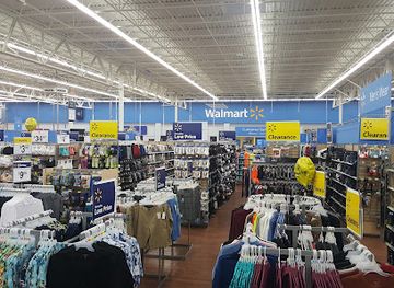
Explore Walmart Supercenter in Wellington, KS - your ultimate shopping destination for groceries, clothing, electronics, and more at unbeatable prices.
-
Shopping mall
Shops At Tallgrass
Explore the vibrant Shops At Tallgrass, Wichita's premier shopping destination offering diverse retail and dining experiences for all.
-
Grocery store
Dillons
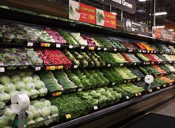
Discover a delightful grocery experience at Dillons in Wellington, featuring local produce, artisanal goods, and a variety of specialty items.
-
Tobacco shop
Smoker's Choice LLC
Explore Smoker's Choice LLC in Wellington for an exceptional selection of quality tobacco products and friendly service that enhances your smoking experience.


Get your free copy of our complete guide to Wellington-McPherson Lowlands, delivered straight to you.
Everything on this page, from attractions and restaurants to essentials and local phrases, in one PDF you can read offline, print or share.
Already have an account? Sign in
Your Wellington-McPherson Lowlands guide is ready.
We'll send it to · Not you? Sign out

Getting your guide ready…
We are putting together a fresh copy of the Wellington-McPherson Lowlands guide. This can take up to a minute.
This can take a few moments. If your browser asks, choose Allow so the download can start. You'll find the guide in your Downloads folder.
Nothing happened? Download it again
Sorry, the guide is taking longer than usual. Please try again in a minute, or get it by email instead.
Wellington-McPherson Lowlands essentials
Currency and Payment
Safety
Emergency Situations
Do's and Don'ts
Local Tips
From Eve
Local phrases worth knowing
You don't need to get them perfect. A few words go a long way, and locals appreciate the effort.
Basics
| English | Local | Say it |
|---|---|---|
| Hello | Howdy | [hau-dee] |
| Goodbye | See ya | [see yah] |
| Yes | Yep | [yehp] |
| No | Nah | [nah] |
| Please/You're welcome | Sure thing | [shoor thing] |
| Thank you | Thanks a lot | [thanks uh lot] |
| Excuse me/Sorry | Pardon me | [par-dun mee] |
| How are you? | How's it going? | [how's it goin'] |
| Fine. And you? | Good. And you? | [good. an' you?] |
| Do you speak English? | You speakin' English? | [you speakin' ing-lish?] |
| I don't understand | I ain't followin' | [I ain't fol-lowin'] |
Eating & Drinking
| English | Local | Say it |
|---|---|---|
| I'd like to see the menu, please | Can I see the menu? | [can I see thuh men-yoo?] |
| I don't eat meat | I don't do meat | [I don't do meet] |
| Cheers! | Cheers! | [cheers!] |
| I would like to pay, please | Can I get the check? | [can I get thuh check?] |
Emergencies
| English | Local | Say it |
|---|---|---|
| Help! | Help! | [help!] |
| Go away! | Leave me be! | [leave me bee!] |
| Call the Police! | Call the cops! | [call thuh cops!] |
| Call a doctor! | Get a doctor! | [get a doc-tor!] |
| I'm lost | I'm turned around | [I'm turned uh-round] |
| I'm ill | I'm not feelin' well | [I'm not feelin' wel] |
Shopping
| English | Local | Say it |
|---|---|---|
| I'd like to buy... | I wanna buy... | [I wanna buy...] |
| I'm just looking | Just lookin' | [just lookin'] |
| How much is it? | What's the price? | [what's thuh price?] |
| That's too expensive | That's way too pricey | [that's way too pry-see] |
| Can you lower the price? | Can ya do better on the price? | [can ya do bet-ter on thuh price?] |
Time & Numbers
| English | Local | Say it |
|---|---|---|
| What time is it? | What time ya got? | [what time ya got?] |
| It's one o'clock | It's one o'clock | [it's one o'clock] |
| Half past (10) | Half past ten | [half past ten] |
| Morning | Mornin' | [mornin'] |
| Afternoon | Afternoon | [afternoon] |
| Evening | Evenin' | [evenin'] |
| Yesterday | Yesterday | [yes-ter-day] |
| Today | Today | [to-day] |
| Tomorrow | Tomorrow | [to-mor-row] |
| 1 | One | [one] |
| 2 | Two | [two] |
| 3 | Three | [three] |
| 4 | Four | [four] |
| 5 | Five | [five] |
| 6 | Six | [six] |
| 7 | Seven | [sev-en] |
| 8 | Eight | [eight] |
| 9 | Nine | [nine] |
| 10 | Ten | [ten] |
Transport & Directions
| English | Local | Say it |
|---|---|---|
| Where's a/the...? | Where's the...? | [where's thuh...?] |
| What's the address? | What's the address? | [what's thuh address?] |
| Can you show me (on the map)? | Can ya show me on the map? | [can ya show me on thuh map?] |
| When's the next (bus)? | When's the next bus? | [when's thuh next bus?] |
| A ticket (to ....) | A ticket to... | [a ticket to...] |
History of Wellington-McPherson Lowlands
Indigenous Plains and River Landscapes
Long before Euro-American settlement, the lowlands formed part of the wider central Kansas landscape used by Indigenous peoples for hunting, travel and seasonal settlement. Communities including the Pawnee, Kansa, Wichita and other peoples maintained knowledge of the region's rivers, grasslands and wildlife, while later nineteenth-century expansion brought new pressures, treaties and displacement. The lowland's apparently open character should not be mistaken for an empty past: trails, hunting grounds and river corridors connected it to a much larger Indigenous geography across the Plains.
Trails, Forts and Early Euro-American Expansion
During the nineteenth century, overland movement across Kansas followed routes linking the Missouri frontier with settlements and trading centres farther west and south. Although the best-known trails did not run through every part of the Wellington-McPherson Lowlands, their wider network influenced settlement, military policy and commerce in the district. Federal land policy and the removal of Indigenous peoples opened the way for organised colonisation, bringing surveyors, farmers, merchants and religious communities into a landscape transformed by roads and later railways.
Mennonite Settlement in McPherson County
Mennonite migration became one of the defining cultural developments in the northern lowlands during the 1870s. Families from Europe and communities established elsewhere in North America settled around places such as McPherson and Moundridge, bringing distinctive church traditions, agricultural practices and patterns of mutual support. Their descendants contributed to farming, education, business and civic life. Mennonite influence remains visible in several communities through congregations, cemeteries, family histories and food traditions, although the region is socially broader than any single religious or ethnic heritage.
Railways and the Growth of Towns
Railway construction in the late nineteenth century gave the lowlands a durable economic framework. McPherson, Newton and Wellington grew as transport, agricultural and commercial centres, while smaller settlements depended on rail access for farm supplies, grain shipment, mail and passenger travel. Newton's position on a major east-west route also connected it with the cattle trade and the wider history of Kansas rail towns. Main streets, depots, warehouses and civic buildings preserve aspects of the period when railway connections determined the fortunes of prairie communities.
Wheat, Grain and the Agricultural Economy
The lowlands' relatively level terrain and productive soils encouraged the expansion of wheat farming and mixed agriculture. Grain elevators, cooperative organisations, farm machinery and county fairs became central to local economic life, while improved roads and mechanisation gradually changed the relationship between farms and town centres. Agriculture continues to shape the view from the highway and the rhythm of many communities, even as modern employment also includes manufacturing, education, health services and regional commerce.
Salt, Industry and Subsurface Resources
Salt-bearing geological formations influenced industry across central Kansas, especially in and around the broader lowland and neighbouring Arkansas River country. Commercial extraction, processing and associated transport helped diversify an economy otherwise strongly linked to farming and railways. The region's geology has also supported other industrial activity, including oil and gas development in parts of central and south-central Kansas. These industries left a practical rather than ornamental legacy: roads, rail sidings, processing sites and working landscapes remain part of the region's modern identity.
The Modern Small-Town and Rural Region
Twentieth-century changes brought paved highways, agricultural consolidation, fewer passenger trains and population shifts towards regional centres. At the same time, communities invested in schools, museums, historic preservation, reservoirs and local heritage programmes to maintain a sense of place. Today the Wellington-McPherson Lowlands combine highly mechanised agriculture with manufacturing, education, healthcare and small-town civic life. Its history is most legible in the relationship between open farmland and the compact towns that continue to service it.
Wellington-McPherson Lowlands in Photos
Browse through our photo collection highlighting the charm and character of the destination.
Neighbouring regions of Wellington-McPherson Lowlands
The closest regions to Wellington-McPherson Lowlands, if you have time for more than one.
-

-

-

-

-


Swipe for more regions
Explore more

Explore more of Kansas
Explore Kansas: Where history, nature, and small-town charm converge in the heart of America. Discover prairies, cultural landmarks, and delicious cuisine in the Sunflower State.
Explore Kansas