

Free Arkansas River Lowlands Travel Guide & Mobile App
Explore Arkansas River Lowlands with free travel guides. Discover regional history, expert tips, proposed trips, and audio guides on web or mobile app.


Explore Kansas's Arkansas River Lowlands for frontier history, river landscapes, wildlife wetlands, farming towns and wide-open prairie roads.
Read more about Arkansas River Lowlands
Getting to and around Arkansas River Lowlands
How to get there
Transportation
Top city travel guides in Arkansas River Lowlands
The cities of Arkansas River Lowlands, and the easiest places to base yourself.
-

-


Swipe for more cities
Destinations in Arkansas River Lowlands
Resorts, valleys and scenic spots worth a trip of their own.
-

-


Swipe for more destinations
Best attractions in Arkansas River Lowlands
-
Tourist attraction
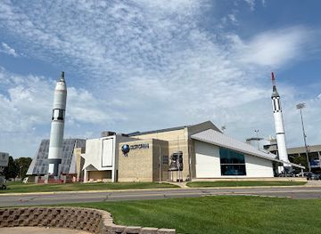
Cosmosphere
Explore the Cosmosphere: A Unique Space Museum in Hutchinson, Kansas, Featuring Exhibits, IMAX Theater, and Space-Themed Gifts.
-
History museum
Boot Hill Museum
Explore the Wild West's rich history at Boot Hill Museum in Dodge City, Kansas, featuring engaging exhibits, reenactments, and a charming gift shop.
-
Tourist attraction
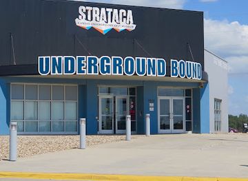
Strataca
Explore the fascinating underground world of Strataca in Hutchinson, Kansas, where history and adventure meet in a historic salt mine.
-
Park
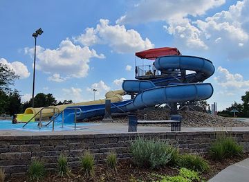
Carey Park
Explore the vast beauty of Carey Park in Hutchinson, Kansas – a perfect spot for recreation, relaxation, and family fun amidst nature's tranquility.

Best landmarks in Arkansas River Lowlands
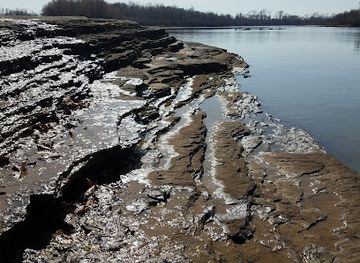
The Arkansas River Lowlands are marked by places that express the relationship between transport, water, settlement and the open Plains. Fort Larned's surviving sandstone buildings form one of the clearest architectural reminders of the military frontier and Santa Fe Trail period. In Dodge City, the Long Branch Lagoon area and surviving historic commercial buildings evoke the town's cattle-shipping era, while the Boot Hill Museum complex interprets the wider mythology and material history of the frontier. Santa Fe Trail traces and markers appear at scattered locations rather than as one continuous monument. The Arkansas River itself is the region's defining natural landmark, although its appearance varies from wooded or wet channels to broad, dry-looking stretches. Around Great Bend, Cheyenne Bottoms and associated wetland landscapes demonstrate the ecological importance of shallow water in the Plains. Strataca's subterranean salt environment near Hutchinson is an unusual geological and industrial landmark, and the Keeper of the Plains in Wichita, beside the confluence of the Arkansas and Little Arkansas rivers, represents the eastern urban end of the corridor.
-
Historical place
Fort Smith National Historic Site
Discover the captivating history and scenic beauty of Fort Smith National Historic Site, a must-visit destination for history lovers and tourists.
Explore Arkansas River Lowlands on the map
Plan your trip on one map. See where the top cities, national parks and sights are, and book hotels and experiences in a few clicks.
Best hotels in Arkansas River Lowlands
Best restaurants in Arkansas River Lowlands
Dining in the Arkansas River Lowlands reflects the practical food culture of the Great Plains, with independent restaurants, family cafés, steakhouses, Mexican and other immigrant-influenced cooking, bakeries, diners and traditional pubs spread among the larger towns. Beef, wheat, barbecue-style dishes and locally grown agricultural products are more characteristic of the wider Kansas setting than of a narrowly defined river cuisine, while western communities also show the influence of Hispanic and other longstanding local populations. Garden City and Dodge City have some of the region's broadest choices, including Mexican and Latin American restaurants alongside American classics. Wichita offers the most diverse dining scene, with contemporary restaurants, specialist cafés and international food. In smaller towns, breakfast cafés, seasonal produce stands and community markets can be as representative as formal restaurants. Visitors should expect generous portions, counter-service options and a strong role for locally owned establishments rather than a single signature dish associated with the whole lowlands.
-
American
Flying Fish
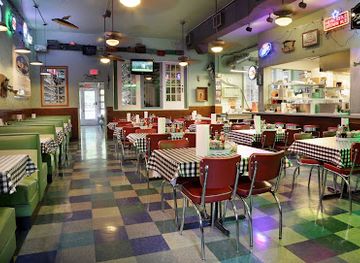
Experience the best of American seafood at Flying Fish in Little Rock—a family-friendly destination known for its fresh catches and lively atmosphere.
-
Chicken
Gus's World Famous Fried Chicken
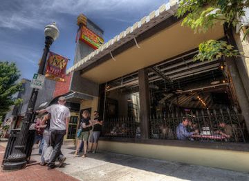
Experience authentic Southern soul food at Gus's World Famous Fried Chicken in Little Rock - where every bite tells a story.
Best bars in Arkansas River Lowlands
-
Fast Food
Bogey's
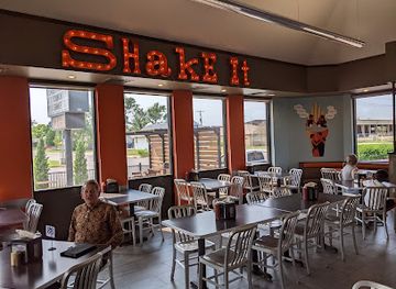
Experience the best of American fast food at Bogey's in Hutchinson – burgers, fresh salads, and delightful ice cream await!
-
Steak
Texas T-bone Steakhouse
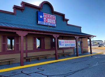
Indulge in expertly crafted steaks and a lively atmosphere at Texas T-bone Steakhouse in Hutchinson, Kansas.
-
Restaurant
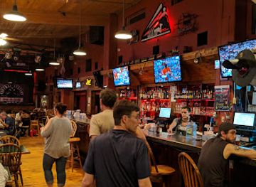
Central Station Bar & Grill
Experience the charm of Dodge City at Central Station Bar & Grill, where delicious food meets a unique railroad car setting.
-
Bar
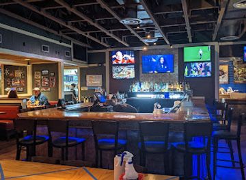
Chili's Grill & Bar
Discover the vibrant flavors of American and Tex-Mex cuisine at Chili's Grill & Bar in Hutchinson, Kansas, a perfect dining spot for every traveler.
Best nightclubs in Arkansas River Lowlands
Evening life is concentrated in the larger towns and is generally relaxed rather than dominated by nightclubs. Wichita has the region's widest choice of cocktail bars, breweries, live-music venues, restaurants and late-evening entertainment, while Hutchinson, Great Bend, Garden City and Dodge City provide local bars, pubs and occasional music or cultural events. In smaller communities, a bar, bowling venue, restaurant or community event may be the main evening option, and trading hours can be limited outside busy periods. Dodge City's historic identity is reflected in western-themed hospitality, but contemporary nightlife is not confined to frontier attractions. Breweries and taprooms form part of the modern Kansas social scene, particularly in larger centres. Rural driving distances make a designated driver or pre-arranged transport important, and visitors should never assume that a late-night venue or public transport service is available outside the main towns.
-
Adult entertainment club
Showboat Bikini & Sports Resort
Discover the vibrant nightlife at Showboat Bikini & Sports Resort, an adult entertainment hub in El Dorado, Kansas, featuring stunning dancers and great drinks.

Best shops in Arkansas River Lowlands
-
Department store
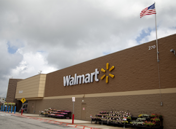
Walmart Supercenter
Explore the convenience of Walmart Supercenter in Dodge City, offering everything from groceries to electronics at affordable prices.
-
Shopping mall
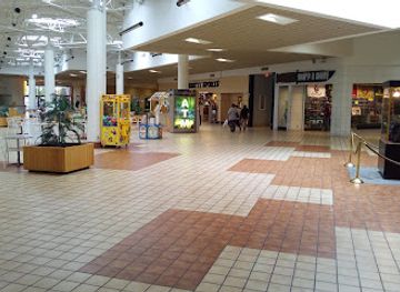
Hutchinson City Mall
Explore Hutchinson City Mall, your go-to shopping and dining destination in Hutchinson, Kansas, featuring diverse stores and a vibrant atmosphere.
-
Park
Wilson State Park
Explore the wonders of Wilson State Park, a natural paradise in Kansas offering outdoor adventures, stunning landscapes, and vibrant wildlife.
-
Department store
Kohl's
Discover unbeatable deals and a vast selection of fashion and home goods at Kohl's Hutchinson, your go-to department store in Kansas.
Get your free copy of our complete guide to Arkansas River Lowlands, delivered straight to you.
Everything on this page, from attractions and restaurants to essentials and local phrases, in one PDF you can read offline, print or share.
Already have an account? Sign in
Your Arkansas River Lowlands guide is ready.
We'll send it to · Not you? Sign out

Getting your guide ready…
We are putting together a fresh copy of the Arkansas River Lowlands guide. This can take up to a minute.
This can take a few moments. If your browser asks, choose Allow so the download can start. You'll find the guide in your Downloads folder.
Nothing happened? Download it again
Sorry, the guide is taking longer than usual. Please try again in a minute, or get it by email instead.
Arkansas River Lowlands essentials
Currency and Payment
Safety
Emergency Situations
Do's and Don'ts
Local Tips
From Eve
Local phrases worth knowing
You don't need to get them perfect. A few words go a long way, and locals appreciate the effort.
Basics
| English | Local | Say it |
|---|---|---|
| Hello | Howdy | [haʊdi] |
| Goodbye | See ya later | [siː jə ˈleɪtər] |
| Yes | Yep | [jɛp] |
| No | Nope | [noʊp] |
| Please/You're welcome | Please | [pliz] |
| Thank you | Thanks a bunch | [θæŋks ə bʌnʧ] |
| Excuse me/Sorry | Pardon me | [ˈpɑrdən mi] |
| How are you? | How ya doin'? | [haʊ jə ˈduɪn] |
| Fine. And you? | I’m good. And you? | [aɪm gʊd. ənd ju] |
| Do you speak English? | Y'all speak English? | [jɔl spiːk ˈɪŋɡlɪʃ] |
| I don't understand | I ain't followin' | [aɪ eɪnt ˈfɑloʊɪn] |
Eating & Drinking
| English | Local | Say it |
|---|---|---|
| I'd like to see the menu, please | Can I see the menu? | [kæn aɪ si ðə ˈmɛnju] |
| I don't eat meat | I don’t eat meat | [aɪ doʊnt iːt miːt] |
| Cheers! | Cheers! | [tʃɪrz] |
| I would like to pay, please | I’d like to settle up, please | [aɪd laɪk tə ˈsɛtəl ʌp pliz] |
Emergencies
| English | Local | Say it |
|---|---|---|
| Help! | Help! | [hɛlp] |
| Go away! | Get outta here! | [ɡɛt ˈaʊtə hɪr] |
| Call the Police! | Call the cops! | [kɔl ðə kɑps] |
| Call a doctor! | Get a doc! | [ɡɛt ə dɑk] |
| I'm lost | I’m lost | [aɪm lɔst] |
| I'm ill | I’m not feelin' good | [aɪm nɑt ˈfiːlɪn ɡʊd] |
Shopping
| English | Local | Say it |
|---|---|---|
| I'd like to buy... | I wanna buy... | [aɪ ˈwɑnə baɪ] |
| I'm just looking | Just browsin' | [dʒʌst ˈbraʊzɪn] |
| How much is it? | How much's this gonna cost? | [haʊ mʌʧz ðɪs ˈɡʌnə kɔst] |
| That's too expensive | That’s too high | [ðæts tu haɪ] |
| Can you lower the price? | Can ya knock down the price? | [kæn jə nɑk daʊn ðə praɪs] |
Time & Numbers
| English | Local | Say it |
|---|---|---|
| What time is it? | What time's it? | [wʌt taɪmz ɪt] |
| It's one o'clock | It's one | [ɪts wʌn] |
| Half past (10) | Half past ten | [hæf pæst tɛn] |
| Morning | Mornin' | [ˈmɔrnɪn] |
| Afternoon | Afternoon | [ˌæftərˈnun] |
| Evening | Evenin' | [ˈivnɪn] |
| Yesterday | Yestiddy | [ˈjɛstɪdi] |
| Today | Today | [təˈdeɪ] |
| Tomorrow | Tomorra | [təˈmɔrə] |
| 1 | One | [wʌn] |
| 2 | Two | [tu] |
| 3 | Three | [θri] |
| 4 | Four | [fɔr] |
| 5 | Five | [faɪv] |
| 6 | Six | [sɪks] |
| 7 | Seven | [ˈsɛvən] |
| 8 | Eight | [eɪt] |
| 9 | Nine | [naɪn] |
| 10 | Ten | [tɛn] |
Transport & Directions
| English | Local | Say it |
|---|---|---|
| Where's a/the...? | Where's the...? | [wɛrz ðə] |
| What's the address? | What’s the address? | [wʌts ði əˈdrɛs] |
| Can you show me (on the map)? | Can ya point it out? | [kæn jə pɔɪnt ɪt aʊt] |
| When's the next (bus)? | When's the next bus? | [wɛn z ðə nɛkst bʌs] |
| A ticket (to ....) | A ticket to ... | [ə ˈtɪkɪt tə] |
History of Arkansas River Lowlands
Indigenous Peoples and the River Corridor
Long before American settlement, the Arkansas River valley was used by Indigenous peoples for travel, hunting, trade and seasonal activity. The river connected the southern Plains with routes extending towards the Rocky Mountains and the central Great Plains. Pawnee, Wichita, Kiowa, Comanche and other peoples had important historical relationships with the wider region, while Osage influence also extended across parts of the central Plains. The valley's water, grasslands and crossings made it strategically valuable, although its significance cannot be reduced to a single community or period. Many later trails and settlements followed routes already shaped by Indigenous movement and knowledge.
The Santa Fe Trail and Borderlands Trade
From the early nineteenth century, the Arkansas River became part of the Santa Fe Trail, the major commercial route linking Missouri with Santa Fe. Traders, teamsters, soldiers and migrants followed or crossed the river through the southern Plains, where water and established trackways were crucial resources. The river also marked an international boundary for part of the period when the area lay near the edge of Mexican territory. Trail crossings, wagon ruts and commemorative sites remain among the most tangible reminders of this era, although modern roads and farms have altered much of the original landscape.
Military Posts and Westward Expansion
The United States established military posts along the trail and river corridor to protect travellers and support federal policy during a period of intensifying westward expansion. Fort Atkinson, established in 1850 near the Arkansas River in present-day western Kansas, was short-lived, while Fort Larned, founded in 1859 near the Pawnee Fork, became a more substantial post. Soldiers, traders and government agents operated within a landscape of conflict, treaty-making and forced Indigenous dispossession. The surviving buildings and interpreted grounds at Fort Larned provide an important, carefully documented setting for understanding this complicated period.
Railways, Towns and the Cattle Trade
Railway construction transformed the Arkansas River corridor after the Civil War, connecting Kansas communities to eastern markets and encouraging settlement. Dodge City became a major cattle-shipping point in the 1870s and acquired a lasting reputation as a frontier boomtown. Other towns grew through rail transport, farming, military supply and local commerce rather than cattle alone. The arrival of the railway accelerated the conversion of prairie into farms and altered Indigenous lifeways, land ownership and regional economies. Historic depots, street plans, museums and surviving commercial buildings preserve parts of this transition.
Irrigation and Agricultural Development
Water management became central to the region's modern economy, especially in the western Arkansas River valley, where rainfall is limited and farming depends heavily on irrigation. Canals, wells, reservoirs and later large-scale groundwater pumping supported crops including wheat, sorghum, corn and alfalfa, while ranching remained important on surrounding grasslands. The expansion of irrigation brought prosperity and population growth but also created long-term questions about aquifer decline and sustainable water use. Present-day landscapes of cultivated fields, shelterbelts and irrigation infrastructure are direct products of this twentieth-century transformation.
Aviation, Industry and Urban Growth
In the eastern part of the lowlands, especially around Wichita, the river corridor became associated with manufacturing, aircraft production, oil-related enterprise and expanding urban services. Wichita's aviation industry developed during the twentieth century and helped give the city an international industrial profile, while smaller communities continued to depend on agriculture, railways and regional trade. The contrast between Wichita's metropolitan economy and the smaller farming and ranching towns farther west illustrates how the Arkansas River Lowlands evolved into a connected but highly varied region.
Arkansas River Lowlands in Photos
Browse through our photo collection highlighting the charm and character of the destination.
Neighbouring regions of Arkansas River Lowlands
The closest regions to Arkansas River Lowlands, if you have time for more than one.
-

-

-

-

-


Swipe for more regions
Explore more

Explore more of Kansas
Explore Kansas: Where history, nature, and small-town charm converge in the heart of America. Discover prairies, cultural landmarks, and delicious cuisine in the Sunflower State.
Explore Kansas