

Free Karkaraly Mountains Travel Guide & Mobile App
Explore Karkaraly Mountains with free travel guides. Discover regional history, expert tips, proposed trips, and audio guides on web or mobile app.


Explore Kazakhstan’s Karkaraly Mountains for granite trails, pine forests, mountain lakes, steppe views and the historic gateway town of Karkaraly.
Read more about Karkaraly Mountains
When is the best time to visit Karkaraly Mountains?
Best: June–August · 22–25°C| Month | High (°C) | Rainfall (mm) |
|---|---|---|
| January | -5 | 15 |
| February | -2 | 15 |
| March | 2 | 20 |
| April | 10 | 25 |
| May | 17 | 30 |
| June (best) | 22 | 35 |
| July (best) | 25 | 40 |
| August (best) | 24 | 35 |
| September | 17 | 30 |
| October | 10 | 25 |
| November | 2 | 20 |
| December | -3 | 15 |
Getting to and around Karkaraly Mountains
How to get there
Transportation
Best attractions in Karkaraly Mountains
The principal attraction of the Karkaraly Mountains is the combination of forest, granite and steppe within a relatively compact national park. Walking routes from Karkaraly lead towards Lake Shaitankol, a mountain lake surrounded by rocky slopes and local folklore, while Lake Bassein offers another wooded setting for a quieter excursion. Viewpoints across the ridges reveal the sharp contrast between the dark pine-covered uplands and the open grassland beyond. The Three Caves area and other granite formations provide interest for walkers and landscape photographers, although routes may be uneven and lightly marked. The Kent mountain group, within the wider protected landscape, offers more remote scenery and requires greater logistical preparation than the readily accessible sites near town. Birdwatching, wildflower interest, camping where permitted and wildlife observation are central to the park experience. Karkaraly itself adds historic streets, local museums or cultural displays where available, guesthouses and everyday Kazakh regional life. This is not a resort landscape with dense visitor infrastructure; its appeal comes from self-directed outdoor activity, geological scenery and the transition between wooded mountain valleys and the Central Kazakhstan steppe.
-
National park
Karkaraly National Park
Explore the breathtaking beauty and diverse ecosystems of Karkaraly National Park in Kazakhstan, a true haven for nature enthusiasts and adventure seekers.
-
 Mountain peak
Karkaralinskiye Gory
Explore the breathtaking beauty of Karkaralinskiye Gory, where majestic peaks and rich biodiversity create unforgettable adventures in Kazakhstan's stunning nature.
Best landmarks in Karkaraly Mountains
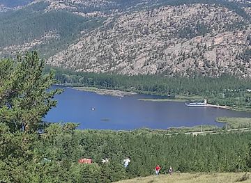
The most recognisable natural landmark is Lake Shaitankol, whose dark waters and enclosed granite setting have made it a prominent feature of local storytelling and visitor routes. Lake Bassein is another significant landscape marker, lying among wooded slopes rather than the open steppe. The granite ridges and outcrops around Karkaraly form the visual identity of the range, with elevated viewpoints revealing isolated hills rising from Central Kazakhstan’s broad grasslands. The Three Caves are notable geological features associated with walking routes in the national park, though access conditions and route clarity can vary. The historic town of Karkaraly serves as a cultural landmark in its own right: its position at the foot of the mountains reflects the longstanding relationship between settlement, trade and the upland landscape. Farther into the protected area, the Kent mountain group provides a more remote counterpart to the better-known sites near town. Together these places show why Karkaraly is important not for a single monumental building, but for the close relationship between distinctive geology, forested terrain, water and steppe horizons.
-
National park
Karkaraly National Park
Explore the stunning landscapes and rich biodiversity of Karkaraly National Park, a natural paradise in Kazakhstan perfect for outdoor adventures.
-
Mountain peak
Karkaralinskiye Gory
Explore Karkaralinskiye Gory, a breathtaking mountain peak in Kazakhstan, offering stunning views, diverse wildlife, and rich cultural experiences.
-
Historical landmark
Shozhe Akyn Karzhabayuly Mausoleum (Шөже ақын Қаржабайұлы кесенесі)
Discover the rich cultural heritage of Kazakhstan at the Shozhe Akyn Karzhabayuly Mausoleum, a historical landmark surrounded by breathtaking landscapes.
-
Mountain peak
Qarqaraly Tauy
Explore the breathtaking Qarqaraly Tauy, a stunning mountain peak in Kazakhstan, perfect for nature lovers and adventure seekers.


Explore Karkaraly Mountains on the map
Plan your trip on one map. See where the top cities, national parks and sights are, and book hotels and experiences in a few clicks.
Best hotels in Karkaraly Mountains
Get your free copy of our complete guide to Karkaraly Mountains, delivered straight to you.
Everything on this page, from attractions and restaurants to essentials and local phrases, in one PDF you can read offline, print or share.
Already have an account? Sign in
Your Karkaraly Mountains guide is ready.
We'll send it to · Not you? Sign out

Getting your guide ready…
We are putting together a fresh copy of the Karkaraly Mountains guide. This can take up to a minute.
This can take a few moments. If your browser asks, choose Allow so the download can start. You'll find the guide in your Downloads folder.
Nothing happened? Download it again
Sorry, the guide is taking longer than usual. Please try again in a minute, or get it by email instead.
Karkaraly Mountains essentials
Currency and Payment
Safety
Emergency Situations
Do's and Don'ts
Local Tips
From Eve
Local phrases worth knowing
You don't need to get them perfect. A few words go a long way, and locals appreciate the effort.
Basics
| English | Local | Say it |
|---|---|---|
| Hello | Сәлем | [Sälem] |
| Goodbye | Сау бол | [Sau bol] |
| Yes | Иә | [İä] |
| No | Жоқ | [Joq] |
| Please/You're welcome | Өтінемін/Қош келдіңіз | [Ötinemin/Qoş keldiniz] |
| Thank you | Рақмет | [Raqmet] |
| Excuse me/Sorry | Кешіріңіз | [Keshiriniz] |
| How are you? | Қалайсыз? | [Qalaysız?] |
| Fine. And you? | Жақсы. Ал сіз? | [Jaqsı. Al siz?] |
| Do you speak English? | Сіз ағылшынша сөйлейсіз бе? | [Siz aǵylshınşa söyleysiz be?] |
| I don't understand | Мен түсінбеймін | [Men tüsınbeymin] |
Eating & Drinking
| English | Local | Say it |
|---|---|---|
| I'd like to see the menu, please | Мәзірді көргім келеді, өтінемін | [Mäzirdi körgım keledi, ötinemin] |
| I don't eat meat | Мен ет жемеймін | [Men et jemeımin] |
| Cheers! | Денсаулық! | [Densaulyq!] |
| I would like to pay, please | Мен төлемақыны төлеуім керек, өтінемін | [Men tölemakını töleuım kereq, ötinemin] |
Emergencies
| English | Local | Say it |
|---|---|---|
| Help! | Көмектесіңіз! | [Kömektesıñız!] |
| Go away! | Жоғал! | [Joğal!] |
| Call the Police! | Полицияны шақырыңыз! | [Politsiyany şaqırıñız!] |
| Call a doctor! | Дәрігерді шақырыңыз! | [Därigerdi şaqırıñız!] |
| I'm lost | Мен жоғалып кеттім | [Men joğalıp kettım] |
| I'm ill | Мен ауырып жатырмын | [Men awırıp jatırmın] |
Shopping
| English | Local | Say it |
|---|---|---|
| I'd like to buy... | Мен сатып алғым келеді... | [Men satıp algım keledi...] |
| I'm just looking | Мен тек қарап жүрмін | [Men tek qarap jürmin] |
| How much is it? | Бұл қанша тұрады? | [Bul qanşa turadı?] |
| That's too expensive | Бұл тым қымбат | [Bul tym qımbat] |
| Can you lower the price? | Бағаны төмендетсеңіз болады ма? | [Baǵanı tömendedseñiz boladı ma?] |
Time & Numbers
| English | Local | Say it |
|---|---|---|
| What time is it? | Сағат қанша? | [Saǵat qanşa?] |
| It's one o'clock | Сағат бір | [Saǵat bir] |
| Half past (10) | Он бір жарым | [On bir jarım] |
| Morning | Таң | [Tañ] |
| Afternoon | Түскі уақыт | [Tüski waqıt] |
| Evening | Кеш | [Kesh] |
| Yesterday | Кеше | [Keshe] |
| Today | Бүгін | [Bügın] |
| Tomorrow | Ертең | [Erteñ] |
| 1 | Бір | [Bir] |
| 2 | Екі | [Eki] |
| 3 | Үш | [Üş] |
| 4 | Төрт | [Tört] |
| 5 | Бес | [Bes] |
| 6 | Алты | [Alty] |
| 7 | Жеті | [Jeti] |
| 8 | Сегіз | [Segiz] |
| 9 | Тоғыз | [Toğız] |
| 10 | Он | [On] |
Transport & Directions
| English | Local | Say it |
|---|---|---|
| Where's a/the...? | Қайда ...? | [Qayda ...?] |
| What's the address? | Мекенжайыңыз қандай? | [Mekenjayıñız qanday?] |
| Can you show me (on the map)? | Маған (картадан) көрсете аласыз ба? | [Mağan (kartadan) körsete alasız ba?] |
| When's the next (bus)? | Келесі (автобус) қашан? | [Kelesı (avtobus) qaşan?] |
| A ticket (to ....) | Билет (....-ға) | [Bilet (....-ğa)] |
History of Karkaraly Mountains
Early Steppe Settlement and Archaeology
The Karkaraly area forms part of Central Kazakhstan, a region occupied and travelled by pastoral communities since prehistoric times. Archaeological remains across the Kazakh Uplands include Bronze Age settlements, burial monuments and evidence of metalworking and herding. The mountains provided water, shelter and seasonal grazing within a wider steppe economy. Although the landscape is often encountered as wilderness today, its valleys and passes have long been connected to human movement between the central steppe and the upland ranges.
Nomadic Networks of the Central Steppe
For many centuries the Karkaraly Mountains lay within the cultural world of Kazakh pastoral nomadism. Seasonal movement between grazing grounds connected mountain valleys with the surrounding steppe, while routes through the uplands supported exchange between communities. The area became associated with the Middle Zhuz, one of the major historical divisions of the Kazakh people. Oral history, place names and customary relationships with pasture and water remain important elements of the region’s cultural background.
The Russian Imperial Frontier
Russian imperial administration reached the area in the nineteenth century as fortified settlements and new districts were established across the steppe. Karkaraly developed as an administrative centre and settlement, helping to link local pastoral communities with imperial officials, merchants and military networks. This period brought new forms of land administration, taxation and trade, while also altering established patterns of movement. The town’s historic role reflects the wider transformation of northern and central Kazakhstan during the imperial era.
The Karkaraly Trade Fair
The Karkaraly trade fair became one of the most important commercial gatherings in the surrounding steppe during the nineteenth and early twentieth centuries. Merchants, herders and craftsmen met to exchange livestock, manufactured goods and agricultural products, bringing the town into wider regional trading networks. The fair also encouraged cultural contact and the circulation of news and ideas. Its importance declined as modern transport, administrative systems and Soviet economic planning changed the regional economy.
Karkaraly in the Early Twentieth Century
Karkaraly participated in the political and intellectual changes that affected the Kazakh Steppe in the early twentieth century. The region experienced growing administrative control, land pressures and debates about education and representation. The Karkaraly Petition of 1905, prepared by Kazakh political and community figures, became an important expression of local grievances and reformist demands under imperial rule. Its legacy is associated with the wider emergence of modern Kazakh political consciousness.
Soviet Transformation and Protected Landscapes
The Soviet period reshaped Karkaraly through collectivisation, state administration, changes in pastoral life and the expansion of regional infrastructure. At the same time, the mountains gained recognition for their forests, lakes and recreational value. Karkaraly National Park was established in 1998 to protect the area’s landscapes, habitats and cultural features. The park now represents both a conservation project and a continuation of the region’s longer history as a place of seasonal movement, settlement and recreation.
Karkaraly Mountains in Photos
Browse through our photo collection highlighting the charm and character of the destination.
Neighbouring regions of Karkaraly Mountains
The closest regions to Karkaraly Mountains, if you have time for more than one.
-

-

-

-

-


Swipe for more regions
Explore more

Explore more of Kazakhstan
Explore Kazakhstan's rich culture, modern cities, and stunning natural landscapes. From the Caspian Sea to the Altai Mountains, find adventure and beauty in Central Asia.
Explore Kazakhstan