

Copper Canyon Travel Guide - Free Web & App
Your ultimate guide to Copper Canyon. Discover top landmarks, proposed trips, and local tips. Free on the web or via the Evendo companion app.


Copper Canyon, Mexico, combines vast Sierra Madre gorges, Rarámuri culture, El Chepe rail journeys, mountain villages and guided outdoor adventures.
A Landscape of Interlocking Canyons
Copper Canyon, or Barranca del Cobre, is a vast network of gorges in the Sierra Madre Occidental of north-western Mexico, within the state of Chihuahua. Its name describes a landscape rather than one single ravine: several canyons, including Urique, Batopilas, and Sinforosa, cut deeply through pine-clad highlands, dry lower valleys and rugged mountain country. In places, the canyon system is larger and deeper than commonly imagined, although comparisons with other famous canyons depend on how their dimensions are measured. The terrain changes dramatically with altitude, from cool forests around Creel and Divisadero to warmer, more arid valleys far below.Read more about Copper Canyon
Railways, Villages and Rarámuri Culture
Exploring the Sierra Madre
When is the best time to visit Copper Canyon?
Best: February–March, November · 24–26°C| Month | High (°C) | Rainfall (mm) |
|---|---|---|
| January | 22 | 15 |
| February (best) | 24 | 10 |
| March (best) | 26 | 8 |
| April | 28 | 5 |
| May | 30 | 3 |
| June | 32 | 1 |
| July | 31 | 1 |
| August | 30 | 1 |
| September | 30 | 2 |
| October | 28 | 4 |
| November (best) | 25 | 8 |
| December | 22 | 10 |
Getting to and around Copper Canyon
How to get there
Transportation
Best attractions in Copper Canyon
Copper Canyon’s principal attractions are spread across a large mountain region rather than concentrated at one site. Divisadero offers accessible views into the meeting of several barrancas and is a common stopping point on the El Chepe railway. Creel provides access to the highland landscapes of the Sierra Madre, including the Valley of the Monks, the Valley of the Frogs and the Valley of the Mushrooms, as well as Lake Arareko and the nearby Mission of San Ignacio. Deeper journeys lead towards Urique, associated with the region’s profound canyon scenery, and Batopilas, a historic former mining settlement reached by a winding mountain road. The route and stops of the railway are attractions in themselves, revealing tunnels, bridges, forested slopes and changing altitudes. Guided walks, horseback outings and visits arranged through local communities can add context, particularly where roads and paths reach landscapes beyond the principal viewpoints.
-
Tourist attraction
Cascada de Basaseachi National Park
Experience the breathtaking beauty of Cascada de Basaseachic National Park, a natural wonder filled with stunning waterfalls, diverse wildlife, and endless adventure.
-
Tourist attraction
Cascada Basaseachi
Discover the breathtaking Cascada Basaseachic, a stunning waterfall in Chihuahua, Mexico, perfect for hiking and nature exploration amidst scenic landscapes.
-
Tourist attraction
Cañón de Namurachi
Explore the breathtaking beauty of Cañón de Namurachi, a natural wonder in Chihuahua, Mexico, perfect for hiking, wildlife watching, and outdoor adventures.
-
Hiking area
Valle de la fertilidad
Discover the awe-inspiring Valle de la Fertilidad in Chihuahua, a premier hiking destination boasting stunning landscapes and rich biodiversity.


Explore Copper Canyon on the map
Plan your trip on one map. See where the top attractions, landmarks, restaurants and hotels are, and book hotels and experiences in a few clicks.
Best hotels in Copper Canyon
Best restaurants in Copper Canyon
Dining in Copper Canyon is concentrated in gateway settlements, railway stops and accommodation areas rather than scattered throughout the remote barrancas. Creel and Divisadero offer the broadest choice for travellers, with hotels, cafés and restaurants serving Mexican staples alongside practical meals for hikers and railway passengers. Regional cooking reflects the highland environment through beans, maize, chilli, squash and locally available produce, while the warmer canyon valleys have different growing conditions. In smaller settlements and rural communities, options may be limited and meal arrangements are often linked to guesthouses or local hosts. Visitors should carry provisions for long road journeys and confirm whether food is included when arranging transport or excursions. Buying from locally owned businesses supports communities, but photographs, visits to homes and food-related cultural encounters should be approached with permission and respect.
-
Restaurant
Restaurante El Barranco
Experience authentic Mexican cuisine amidst breathtaking landscapes at Restaurante El Barranco in Parque Barrancas del Cobre.

Best bars in Copper Canyon
Copper Canyon is not a nightlife destination, and evening entertainment is generally quiet, informal and centred on the settlements where visitors stay. Creel and Divisadero may offer hotel bars, dining rooms or relaxed social spaces, while smaller villages are more likely to have modest local establishments than dedicated nightlife venues. In Batopilas and other remote communities, the evening atmosphere is shaped by the historic streets, mountain darkness and limited infrastructure rather than clubs or late-night entertainment. Alcohol is available in some restaurants and shops, but opening arrangements vary and should not be assumed. Travellers venturing away from accommodation after dark should remember the remoteness, uneven ground and limited lighting, particularly in canyon settlements and along rural roads.
-
Restaurant
Copper Canyon Adventure Park
Experience thrilling adventures and breathtaking views at Copper Canyon Adventure Park in Barrancas del Cobre, Mexico.
-
Bar
The Lodge at Creel Hotel & SPA
Discover the beauty of Creel at The Lodge at Creel Hotel & SPA, where luxury meets nature in an unforgettable getaway.
-
Mexican
Restaurante Verónica
Discover the rich flavors of authentic Mexican cuisine at Restaurante Verónica in Creel, perfect for breakfast and lunch in a warm, inviting atmosphere.
-
Mexican
Tio Molcas Restaurant
Discover the rich flavors of Mexico at Tio Molcas Restaurant in Creel, where every dish tells a story of tradition and passion.


Best nightclubs in Copper Canyon
Copper Canyon is not a nightlife destination, and evening entertainment is generally quiet, informal and centred on the settlements where visitors stay. Creel and Divisadero may offer hotel bars, dining rooms or relaxed social spaces, while smaller villages are more likely to have modest local establishments than dedicated nightlife venues. In Batopilas and other remote communities, the evening atmosphere is shaped by the historic streets, mountain darkness and limited infrastructure rather than clubs or late-night entertainment. Alcohol is available in some restaurants and shops, but opening arrangements vary and should not be assumed. Travellers venturing away from accommodation after dark should remember the remoteness, uneven ground and limited lighting, particularly in canyon settlements and along rural roads.
-
Theme park
Copper Canyon Adventure Park
Experience the heart-pounding excitement and stunning beauty of Copper Canyon Adventure Park, a premier destination for adventure sports in Mexico.
-
 Hotel
COPPER CANYON BOUTIQUE HOTEL
Discover the charm of Copper Canyon Boutique Hotel, where comfort meets adventure in the heart of Chihuahua, Mexico.
-
Ravine
Copper Canyon
Discover the breathtaking beauty and adventure of Copper Canyon, a stunning natural ravine system in Chihuahua, Mexico, perfect for exploration and cultural immersion.
-
Tour agency
Copper Canyon Tours
Discover the breathtaking landscapes and rich culture of Mexico's Copper Canyon with expert-guided tours and unforgettable adventures.


Best shops in Copper Canyon
Shopping opportunities are modest and concentrated in Creel, Divisadero, Batopilas and other gateway settlements. Visitors may find Rarámuri handicrafts such as woven baskets, textiles, wooden items and other locally made goods, although provenance and quality vary and purchases should be made respectfully through reputable local sellers. Creel is also a practical place to obtain food, basic supplies and outdoor necessities before travelling deeper into the mountains. Small shops and market-style stalls may sell regional snacks, craft products and souvenirs, while larger retail selections are more likely in Chihuahua City or other transport hubs outside the canyon area. Avoid buying archaeological objects, protected natural materials or items presented vaguely as Indigenous without clear information about their origin. Carry cash for small purchases, particularly away from established hotels and larger businesses.
-
Theme park
Copper Canyon Adventure Park
Discover adventure and breathtaking views at Copper Canyon Adventure Park, a premier destination for thrill-seekers in Chihuahua, Mexico.
-
Hotel
COPPER CANYON BOUTIQUE HOTEL
Discover unparalleled comfort at Copper Canyon Boutique Hotel, your perfect retreat in the heart of Chihuahua, Mexico’s stunning landscapes.
-
Ravine
Copper Canyon
Explore the majestic beauty of Copper Canyon, a breathtaking ravine system in Chihuahua, Mexico, offering rich culture and thrilling outdoor adventures.
-
Supermarket
Super Yumis
Explore the flavors of Creel at Super Yumis, your go-to supermarket for fresh produce and local delicacies in the heart of Chihuahua.


Get your free copy of our complete guide to Copper Canyon, delivered straight to you.
Everything on this page, from attractions and restaurants to essentials and local phrases, in one PDF you can read offline, print or share.
Already have an account? Sign in
Your Copper Canyon guide is ready.
We'll send it to · Not you? Sign out

Getting your guide ready…
We are putting together a fresh copy of the Copper Canyon guide. This can take up to a minute.
This can take a few moments. If your browser asks, choose Allow so the download can start. You'll find the guide in your Downloads folder.
Nothing happened? Download it again
Sorry, the guide is taking longer than usual. Please try again in a minute, or get it by email instead.
Copper Canyon essentials
Currency and Payment
Safety
Emergency Situations
Do's and Don'ts
Local Tips
From Eve
Local phrases worth knowing
You don't need to get them perfect. A few words go a long way, and locals appreciate the effort.
Basics
| English | Local | Say it |
|---|---|---|
| Hello | Hola | [oh-lah] |
| Goodbye | Adiós | [ah-dee-ohs] |
| Yes | Sí | [see] |
| No | No | [noh] |
| Please/You're welcome | Por favor | [por fah-vor] |
| Thank you | Gracias | [grah-see-ahs] |
| Excuse me/Sorry | Perdón | [pair-dohn] |
| How are you? | ¿Cómo estás? | [koh-moh ehs-tahs] |
| Fine. And you? | Bien. ¿Y tú? | [bee-ehn. ee too] |
| Do you speak English? | ¿Hablas inglés? | [ah-blahs een-glays] |
| I don't understand | No entiendo | [noh ehn-tee-ehn-doh] |
Eating & Drinking
| English | Local | Say it |
|---|---|---|
| I'd like to see the menu, please | Me gustaría ver el menú, por favor | [meh goo-stah-ree-ah vehr ehl meh-noo, por fah-vor] |
| I don't eat meat | No como carne | [noh koh-moh kahr-neh] |
| Cheers! | ¡Salud! | [sah-lood] |
| I would like to pay, please | Me gustaría pagar, por favor | [meh goo-stah-ree-ah pah-gahr, por fah-vor] |
Emergencies
| English | Local | Say it |
|---|---|---|
| Help! | ¡Ayuda! | [ah-yoo-dah] |
| Go away! | ¡Vete! | [veh-teh] |
| Call the Police! | ¡Llama a la Policía! | [yah-mah ah lah poh-lee-see-ah] |
| Call a doctor! | ¡Llama a un médico! | [yah-mah ah oon meh-dee-koh] |
| I'm lost | Estoy perdido | [ehs-toy pair-dee-doh] |
| I'm ill | Estoy enfermo/a | [ehs-toy ehn-fehr-moh/ah] |
Shopping
| English | Local | Say it |
|---|---|---|
| I'd like to buy... | Me gustaría comprar... | [meh goo-stah-ree-ah kohm-prahr...] |
| I'm just looking | Sólo estoy mirando | [soh-loh ehs-toy mee-rahn-doh] |
| How much is it? | ¿Cuánto cuesta? | [kwan-toh kwehs-tah] |
| That's too expensive | Eso es demasiado caro | [eh-soh ehs deh-mah-see-ah-doh kah-roh] |
| Can you lower the price? | ¿Puedes bajar el precio? | [pweh-dehs bah-hahr ehl pree-syoh] |
Time & Numbers
| English | Local | Say it |
|---|---|---|
| What time is it? | ¿Qué hora es? | [keh oh-rah ehs] |
| It's one o'clock | Es la una en punto | [ehs lah oo-nah ehn poon-toh] |
| Half past (10) | Las diez y media | [lahs d'yehs ee meh-dee-ah] |
| Morning | Mañana | [mah-nyah-nah] |
| Afternoon | Tarde | [tahr-deh] |
| Evening | Noche | [noh-cheh] |
| Yesterday | Ayer | [ah-yehr] |
| Today | Hoy | [oy] |
| Tomorrow | Mañana | [mah-nyah-nah] |
| 1 | Uno | [oo-noh] |
| 2 | Dos | [dohs] |
| 3 | Tres | [trehs] |
| 4 | Cuatro | [kwah-troh] |
| 5 | Cinco | [seen-koh] |
| 6 | Seis | [says] |
| 7 | Siete | [syeh-teh] |
| 8 | Ocho | [oh-choh] |
| 9 | Nueve | [nweh-veh] |
| 10 | Diez | [dyehs] |
Transport & Directions
| English | Local | Say it |
|---|---|---|
| Where's a/the...? | ¿Dónde está el/la...? | [dohn-deh ehs-tah ehl/lah] |
| What's the address? | ¿Cuál es la dirección? | [kwal ehs lah dee-rehk-syohn] |
| Can you show me (on the map)? | ¿Puedes mostrarme (en el mapa)? | [pweh-dehs mohs-trahr-meh (ehn ehl mah-pah)] |
| When's the next (bus)? | ¿Cuándo es el próximo (autobús)? | [kwan-doh ehs ehl proh-ksee-moh (ow-toh-boos)] |
| A ticket (to ....) | Un boleto (para ....) | [oon boh-leh-toh (pah-rah)] |
History of Copper Canyon
The Sierra Madre Takes Shape
Copper Canyon is part of the Sierra Madre Occidental, a mountain system formed through extensive volcanic activity and later shaped by erosion. The resulting plateau, ravines and deeply incised river valleys create striking changes in climate and vegetation over relatively short distances. Pine and oak forests dominate many higher areas, while warmer, drier conditions occur in the lower barrancas. This geological and climatic variety explains why the region is better understood as a connected canyon system than as one uniform gorge.
Rarámuri Homeland
The canyons and highlands have long been the homeland of the Rarámuri, also widely known by the exonym Tarahumara. Communities developed ways of living adapted to steep terrain, seasonal water availability and dispersed settlements, maintaining agricultural, linguistic and cultural traditions despite major outside pressures. Spanish colonial expansion brought missions, mining interests and new political structures into the region, but the remoteness of the mountains limited direct control in many areas. Rarámuri presence remains central to the cultural identity of Copper Canyon.
Mining and Mountain Settlements
From the colonial period onwards, mineral wealth drew prospectors and companies into the deeper ravines. Batopilas became especially associated with silver mining and developed as a significant settlement in an otherwise difficult landscape. Mining connected canyon communities to wider commercial networks, while roads and mule routes linked the valleys with the plateau. The industry has fluctuated over time, leaving behind historic buildings, transport routes and settlement patterns that help explain why places such as Batopilas and Urique occupy such remote locations.
The Railway Across the Canyons
The railway now known to visitors as El Chepe was built over many decades through exceptionally challenging mountain terrain and eventually connected the interior of Chihuahua with the Pacific coast. Its bridges, tunnels and steep alignments transformed access to the Sierra Madre, replacing much slower overland journeys for passengers and freight. Although tourism has made the railway one of Mexico’s best-known scenic routes, it remains part of the region’s broader transport history and helped bring highland settlements such as Creel and Divisadero into closer contact with the national economy.
Tourism and Conservation
Modern tourism developed around the railway, canyon viewpoints, highland scenery and interest in Rarámuri culture. Visitors now arrive through a combination of rail, road and guided travel, with Creel and Divisadero functioning as important bases. Tourism has brought employment and investment but also creates responsibilities concerning cultural respect, waste, water use and the protection of fragile mountain environments. The wider canyon country includes areas with very different levels of infrastructure, so tourism development is uneven and should not be confused with uniform access throughout the Sierra Madre.
Copper Canyon in Photos
Browse through our photo collection highlighting the charm and character of the destination.
Neighbouring destination travel guides
The closest destinations to Copper Canyon, if you have time for more than one.
-

-

-

-
-
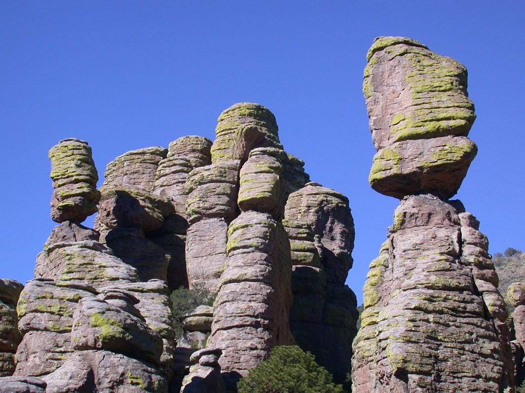 Chiricahua National Monument
Explore the unique rock formations and diverse wildlife of Chiricahua National Monument, a hidden gem in southeast Arizona.


Swipe for more destinations
Explore more

Explore more of Tarahumara Sierra
Discover the magic of Mexico's Tarahumara Sierra, where breathtaking landscapes, rich cultural heritage, and thrilling outdoor adventures await.
Explore Tarahumara Sierra
Explore more of Mexico
Discover Mexico: A land of ancient ruins, vibrant culture, and stunning natural landscapes. Experience diverse cuisine, rich traditions, and warm hospitality.
Explore Mexico