

Mount Washington Travel Guide - Free Web & App
Your ultimate guide to Mount Washington. Discover top landmarks, proposed trips, and local tips. Free on the web or via the Evendo companion app.


Mount Washington, New Hampshire, rises above the White Mountains with alpine scenery, historic railways, challenging hikes, dramatic weather and summit views.
Mountain and Weather
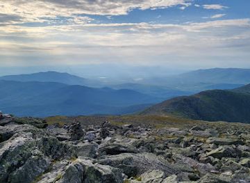
Mount Washington rises to 6,288 feet in New Hampshire’s Presidential Range, within the White Mountain National Forest. It is the highest peak in the northeastern United States, but its significance lies as much in its exposed alpine environment as in its elevation. Above treeline, krummholz trees give way to boulder fields, low alpine vegetation and broad ridgelines shaped by ice, wind and heavy snowfall. Weather can change rapidly, with cloud, strong winds, rain and cold conditions possible even when valleys are warm and clear.Read more about Mount Washington
Ways Up the Mountain
Landscape and Mountain Heritage
When is the best time to visit Mount Washington?
Best: June–August · 12–15°C| Month | High (°C) | Rainfall (mm) |
|---|---|---|
| January | -10 | 200 |
| February | -9 | 180 |
| March | -3 | 190 |
| April | 2 | 160 |
| May | 8 | 170 |
| June (best) | 12 | 160 |
| July (best) | 15 | 170 |
| August (best) | 14 | 160 |
| September | 11 | 170 |
| October | 6 | 180 |
| November | 0 | 190 |
| December | -6 | 200 |
Getting to and around Mount Washington
How to get there
Transportation
Best attractions in Mount Washington
The summit of Mount Washington is the principal attraction, with its exposed alpine terrain, weather station, historic summit buildings and views across the Presidential Range and wider White Mountains when visibility allows. The Mount Washington Cog Railway provides a distinctive ascent from the Bretton Woods side, while the Mount Washington Auto Road climbs from Pinkham Notch through changing forest and subalpine environments. Hikers often explore the Tuckerman Ravine area, whose steep headwall and spring snowfields are central to the mountain’s outdoor culture, or approach via Lion Head and the Ammonoosuc Ravine. The neighbouring Presidential peaks, including Mount Adams and Mount Jefferson, extend the high-country experience but require separate planning. Pinkham Notch offers an important eastern base, with trail information, facilities and access to the Appalachian Mountain Club’s network of routes; Bretton Woods and Gorham serve as useful gateways outside the immediate summit area.
-
State park
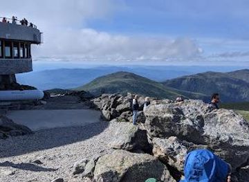
Mt. Washington State Park
Discover breathtaking views and outdoor adventures at Mt. Washington State Park, New Hampshire's highest peak and a top tourist attraction.
-
Tourist attraction
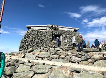
Tip Top House
Discover the historical marvel of Tip Top House atop Mount Washington, a captivating blend of history and breathtaking mountain views in New Hampshire.
-
Weather forecast service
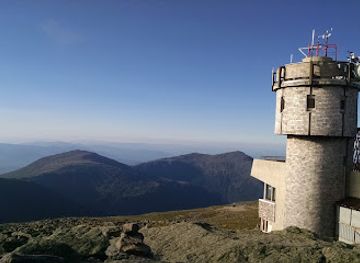
Mount Washington Observatory
Discover the scientific marvels and breathtaking views at Mount Washington Observatory, where nature and science unite in stunning harmony.
Best landmarks in Mount Washington
Mount Washington’s defining landmark is its exposed 6,288-foot summit, the highest point in the northeastern United States and the focal point of the Presidential Range. Tuckerman Ravine is a major natural feature on the eastern slope, a glacial cirque recognised for its steep headwall, dramatic snow conditions and mountaineering history. Huntington Ravine, farther north, is another rugged alpine basin associated with technical climbing and winter hazards. The Mount Washington Cog Railway and the Mount Washington Auto Road are important human landmarks, representing two nineteenth-century engineering responses to the mountain’s difficult terrain. At the summit, the weather observatory and visitor buildings embody the peak’s scientific and tourism heritage, while the surrounding ridgelines and neighbouring Presidential summits create a continuous high-elevation landscape rather than a single isolated viewpoint.
-
State park
Mt. Washington State Park
Explore the breathtaking beauty of Mt. Washington State Park, New Hampshire's highest peak, and enjoy endless outdoor adventures in a stunning natural landscape.
-
Historical place
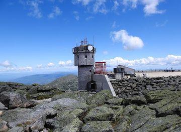
Tip Top House
Explore the rich history of Tip Top House on Mt. Washington Auto Road, a must-visit historical site with stunning mountain views in New Hampshire.
Explore Mount Washington on the map
Plan your trip on one map. See where the top attractions, landmarks, restaurants and hotels are, and book hotels and experiences in a few clicks.
Best hotels in Mount Washington
Best shops in Mount Washington
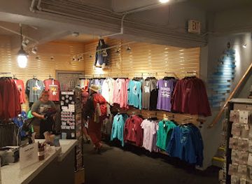
Shopping on Mount Washington is limited to practical visitor retail associated with the summit and transport facilities, including souvenirs, books, clothing and other items connected with the mountain’s identity, where services are operating. More substantial shopping is found in gateway communities outside the destination, particularly Gorham, North Conway, Jackson and the Bretton Woods area. These places provide outdoor equipment, warm clothing, maps, local artwork, gifts and regional food from independent shops and producers. The wider White Mountains are also associated with craft and seasonal farm-shop traditions, although the selection varies between settlements and times of year. Visitors planning a hike should buy specialist equipment and provisions before reaching a remote trailhead, as the mountain itself is not a full-service retail centre and replacement supplies may be difficult to obtain.
-
State park
Mt. Washington State Park
Explore Mt. Washington State Park: A natural wonder in New Hampshire, perfect for hiking, scenic drives, and wildlife watching.
Get your free copy of our complete guide to Mount Washington, delivered straight to you.
Everything on this page, from attractions and restaurants to essentials and local phrases, in one PDF you can read offline, print or share.
Already have an account? Sign in
Your Mount Washington guide is ready.
We'll send it to · Not you? Sign out

Getting your guide ready…
We are putting together a fresh copy of the Mount Washington guide. This can take up to a minute.
This can take a few moments. If your browser asks, choose Allow so the download can start. You'll find the guide in your Downloads folder.
Nothing happened? Download it again
Sorry, the guide is taking longer than usual. Please try again in a minute, or get it by email instead.
Mount Washington essentials
Currency and Payment
Safety
Emergency Situations
Do's and Don'ts
Local Tips
From Eve
Local phrases worth knowing
You don't need to get them perfect. A few words go a long way, and locals appreciate the effort.
Basics
| English | Local | Say it |
|---|---|---|
| Hello | Howdy | [haw-dee] |
| Goodbye | See ya | [see yah] |
| Yes | Yup | [yuhp] |
| No | Nah | [nuh] |
| Please/You're welcome | Please/No problem | [pleez/no prah-blum] |
| Thank you | Thanks a lot | [thanks uh laht] |
| Excuse me/Sorry | Pardon me | [pahrd-un me] |
| How are you? | How ya doin'? | [how yuh doin] |
| Fine. And you? | Good. How 'bout you? | [good. how 'bout yuh] |
| Do you speak English? | Ya speak English? | [yuh speak ing-glish] |
| I don't understand | I ain't gettin' it | [I aint get-tin it] |
Eating & Drinking
| English | Local | Say it |
|---|---|---|
| I'd like to see the menu, please | Menu, please | [men-yoo, pleez] |
| I don't eat meat | I'm vegetarian | [I'm vedge-eh-tair-ee-un] |
| Cheers! | Cheers! | [cheers] |
| I would like to pay, please | Check, please | [chek, pleez] |
Emergencies
| English | Local | Say it |
|---|---|---|
| Help! | Help! | [help] |
| Go away! | Get lost! | [get lost] |
| Call the Police! | Call the cops! | [call the cops] |
| Call a doctor! | Get a doc! | [get a doc] |
| I'm lost | I'm lost | [I'm lost] |
| I'm ill | I'm sick | [I'm sick] |
Shopping
| English | Local | Say it |
|---|---|---|
| I'd like to buy... | I wanna buy... | [I wanna buy] |
| I'm just looking | Just lookin' | [just look-in] |
| How much is it? | How much? | [how much] |
| That's too expensive | Too pricey | [too prah-see] |
| Can you lower the price? | Can ya do better? | [can ya do bet-tur] |
Time & Numbers
| English | Local | Say it |
|---|---|---|
| What time is it? | What time is it? | [what time is it] |
| It's one o'clock | It's one | [It's one] |
| Half past (10) | Half past ten | [half past ten] |
| Morning | Morning | [morning] |
| Afternoon | Afternoon | [afternoon] |
| Evening | Evenin' | [even-in] |
| Yesterday | Yesterday | [yess-ter-day] |
| Today | Today | [to-day] |
| Tomorrow | Tomorrow | [to-mor-row] |
| 1 | One | [wun] |
| 2 | Two | [too] |
| 3 | Three | [three] |
| 4 | Four | [four] |
| 5 | Five | [five] |
| 6 | Six | [six] |
| 7 | Seven | [sev-un] |
| 8 | Eight | [ate] |
| 9 | Nine | [nine] |
| 10 | Ten | [ten] |
Transport & Directions
| English | Local | Say it |
|---|---|---|
| Where's a/the...? | Where's the...? | [where's the] |
| What's the address? | What's the address? | [what's the address] |
| Can you show me (on the map)? | Can ya show me (on the map)? | [can ya show me on the map] |
| When's the next (bus)? | When's the next (bus)? | [whens the next bus] |
| A ticket (to ....) | A ticket (to ....) | [a ticket to] |
History of Mount Washington
A Glacially Shaped Summit
Mount Washington’s present form reflects major geological and climatic processes rather than human history. The Presidential Range consists largely of resistant rock, while repeated glaciation carved the surrounding valleys and helped create the steep ravines and cirques associated with the mountain. Tuckerman Ravine, Huntington Ravine and neighbouring valleys display the effects of frost, snow and ice, and the exposed summit environment supports a distinctive alpine plant community. The mountain’s severe weather is also a defining historical force, influencing transport, scientific observation, recreation and the design of buildings and infrastructure.
Indigenous Names and Early Exploration
The mountain has long been part of the landscape known to Indigenous peoples of northern New England. The name Agiocochook, often associated with Mount Washington, appears in historical sources in several spellings and interpretations, and its use should not be treated as a simple single-name tradition. European colonial-era records gradually brought the peak into wider written attention. Darby Field’s ascent in 1642 is commonly described as the first recorded European climb, although accounts of early exploration and Indigenous familiarity with the mountain belong to different historical traditions.
Tourism Reaches the High Country
Nineteenth-century interest in the White Mountains transformed Mount Washington from a remote summit into a recognised destination for organised travel. The Mount Washington Carriage Road, now known as the Auto Road, opened in 1861, allowing visitors to approach the summit by horse-drawn vehicle. The Mount Washington Cog Railway began operating in 1869 from the western side, introducing an engineering landmark as well as a new way to experience the mountain. Hotels and transport networks developed in surrounding valleys and notches, linking the peak to the expanding tourism economy of the White Mountains.
Science, Weather and Alpine Recreation
Mount Washington became an important site for meteorological observation because of its exposed position and extreme conditions. The Mount Washington Observatory began systematic operations in the twentieth century, and a wind speed of 231 miles per hour was recorded at the summit in 1934, a world record for several decades. The mountain also acquired a strong recreational identity through hiking, mountaineering and winter skiing in Tuckerman Ravine and Huntington Ravine. These activities brought new visitors while reinforcing the need for careful study of weather, snow and avalanche conditions.
Conservation and Managed Access
Modern Mount Washington lies within a landscape managed through several overlapping interests, including the White Mountain National Forest, transport operators, scientific organisations and recreational communities. Conservation work protects fragile alpine vegetation and helps manage the effects of heavy visitation, vehicles and foot traffic. Access remains deliberately varied: the summit can be reached by road and railway, while many surrounding routes require demanding travel through exposed terrain. Today, the mountain’s heritage is represented not only by its transport infrastructure and observatory but also by continuing efforts to balance tourism, safety and environmental protection.
Mount Washington in Photos
Browse through our photo collection highlighting the charm and character of the destination.
Neighbouring destination travel guides
The closest destinations to Mount Washington, if you have time for more than one.
-

-

-

-

-


Swipe for more destinations
Explore more

Explore more of White Mountains
Explore New Hampshire's White Mountains through high peaks, scenic notches, forest trails, historic railways, skiing and four-season mountain towns.
Explore White Mountains
Explore more of New Hampshire
Discover New Hampshire: Explore the majestic White Mountains, serene lakes, and historic towns in the heart of New England's enchanting landscapes.
Explore New Hampshire