

White Mountains National Forest Travel Guide - Free Web & App
Your ultimate guide to White Mountains National Forest. Discover top landmarks, proposed trips, and local tips. Free on the web or via the Evendo companion app.


White Mountains National Forest in New Hampshire offers granite peaks, scenic drives, fall colour, waterfalls, wildlife and year-round outdoor adventure.
A Mountain Landscape in Northern New Hampshire
White Mountains National Forest occupies a broad swath of northern New Hampshire, with a smaller portion extending into western Maine. In New Hampshire, its public lands surround some of New England’s most recognisable mountain landscapes, including the Presidential Range, Franconia Range, Carter-Moriah Range and Kinsman Mountains. The forest is not a single enclosed attraction but a wide network of valleys, ridges, rivers, ponds, roads and recreation sites, interwoven with towns such as Lincoln, North Woodstock, Gorham, Gorham, Conway and Bartlett that serve as practical gateways.Read more about White Mountains National Forest
Peaks, Passes and Changing Seasons
Outdoor Recreation and Forest Heritage
When is the best time to visit White Mountains National Forest?
Best: June–August · 22–24°C| Month | High (°C) | Rainfall (mm) |
|---|---|---|
| January | -3 | 70 |
| February | -1 | 60 |
| March | 4 | 80 |
| April | 11 | 90 |
| May | 17 | 100 |
| June (best) | 22 | 110 |
| July (best) | 24 | 110 |
| August (best) | 23 | 110 |
| September | 19 | 100 |
| October | 14 | 90 |
| November | 7 | 80 |
| December | 0 | 80 |
Getting to and around White Mountains National Forest
How to get there
Transportation
Best attractions in White Mountains National Forest
White Mountain National Forest’s attractions are distributed across several distinctive landscapes rather than concentrated at one visitor centre. In the west, Franconia Notch State Park borders the forest and offers access to mountain scenery around the Pemigewasset Valley, while Lincoln and North Woodstock provide gateways to forest roads and trails. The Kancamagus Highway crosses the central mountains between Lincoln and Conway, with river views, pull-offs and access to walks and waterfalls, including Sabbaday Falls. Crawford Notch and Pinkham Notch reveal steeper mountain terrain and provide approaches to the Presidential Range, where trails lead towards Mount Washington and neighbouring summits. Around Gorham, the northern forest includes routes into the Carter-Moriah and Presidential landscapes. Visitors also find ponds, streams, campgrounds, picnic areas, ski areas near gateway towns and sections of the Appalachian Trail, with the character of each site changing markedly between seasons.
-
Park
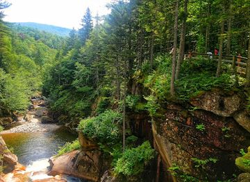
Flume Gorge
Experience the breathtaking beauty of Flume Gorge in New Hampshire, a stunning park with granite cliffs, waterfalls, and vibrant nature trails.
-
State park
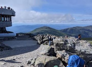
Mt. Washington State Park
Discover the breathtaking landscapes and diverse adventures at Mt. Washington State Park, a perfect destination for outdoor enthusiasts in New Hampshire.
-
Tourist attraction
Conway Scenic Railroad
Explore the scenic beauty of New Hampshire aboard the historic Conway Scenic Railroad, a journey through time in the heart of the White Mountains.
-
Resort hotel
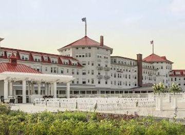
Omni Mount Washington Resort & Spa
Discover the elegance and adventure of Omni Mount Washington Resort & Spa, where history meets luxury amidst stunning White Mountain scenery.
Best landmarks in White Mountains National Forest
The defining natural landmark is Mount Washington, the 6,288-foot summit of the Presidential Range, whose exposed alpine environment and severe weather have shaped the identity of the region. Nearby Presidential summits, including Mount Adams and Mount Jefferson, form a dramatic high ridge, while the Franconia Range gives the western forest a different outline around Mount Lafayette and Mount Lincoln. The Kancamagus Highway is a landmark scenic route through the central mountains, and Crawford Notch and Pinkham Notch are major natural gateways carved through rugged terrain. Sabbaday Falls, Rocky Gorge and Lower Falls provide accessible examples of the forest’s rivers and sculpted rock. Human landmarks include the Appalachian National Scenic Trail, historic road corridors and the long-established mountain infrastructure associated with Mount Washington, though some major attractions lie beside rather than within federal forest boundaries.
-
National forest
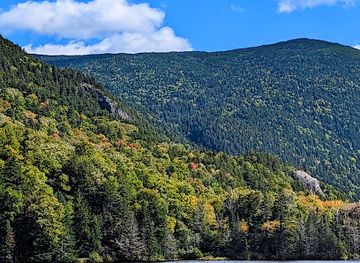
White Mountain National Forest
Experience the majestic landscapes and diverse outdoor activities at White Mountain National Forest, a must-visit destination in New Hampshire for nature lovers.
-
State park
Franconia Notch State Park
Experience the breathtaking beauty of Franconia Notch State Park, an outdoor paradise in New Hampshire's White Mountains, perfect for hiking and exploring.
-
State park
Crawford Notch State Park
Discover the breathtaking landscapes and outdoor adventures at Crawford Notch State Park in New Hampshire, a must-visit for nature lovers and explorers.
-
Scenic spot
Rocky Gorge Scenic Area
Explore the stunning Rocky Gorge Scenic Area in New Hampshire, a breathtaking destination for nature lovers and outdoor enthusiasts along Kancamagus Highway.


Explore White Mountains National Forest on the map
Plan your trip on one map. See where the top attractions, landmarks, restaurants and hotels are, and book hotels and experiences in a few clicks.
Best hotels in White Mountains National Forest
Best restaurants in White Mountains National Forest
White Mountain National Forest itself has few dining facilities beyond what may be available at established recreation areas, so meals are generally organised in the surrounding gateway towns. Lincoln and North Woodstock offer the broadest choice on the western side, while Conway, North Conway, Bartlett and Gorham serve visitors exploring other parts of the forest. Local menus commonly draw on New England traditions, with soups, chowders, baked goods, maple products, locally produced beer and hearty food suited to a mountain climate. Village diners, cafés, brewpubs, inns and independent restaurants are more useful bases for meals than remote trailheads, where visitors should carry adequate provisions. Farm stands and specialist food shops in the wider Mount Washington Valley and Pemigewasset Valley can add regional produce to self-catering trips, although opening patterns and seasonal availability vary.
-
American
Muddy Moose Restaurant & Pub
Experience delicious American cuisine in a cozy pub atmosphere at Muddy Moose Restaurant & Pub, North Conway's favorite dining destination.
-
Hamburger
Black Mtn. Burger Co.
Savor gourmet burgers made from fresh local ingredients at Black Mtn. Burger Co., Lincoln's favorite dining destination.
-
Grill
Delaney's Hole In the Wall
Discover the flavors of North Conway at Delaney's Hole In the Wall - where delicious grilled dishes meet warm hospitality.
-
Grill
The Common Man Lincoln
Experience the heartwarming flavors of America at The Common Man Lincoln - where comfort food meets New England charm.



Best bars in White Mountains National Forest
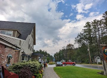
Evening entertainment around White Mountain National Forest is concentrated in its gateway communities rather than within the forest. Lincoln and North Woodstock have a selection of pubs, restaurants and seasonal evening venues, while North Conway and the wider Mount Washington Valley offer a broader choice of bars, brewpubs and occasional live entertainment. Gorham provides a quieter northern base with places to eat and drink after a day on the trails. Remote campgrounds and forest roads are not nightlife settings, and evening options may be sparse outside the main villages, particularly in winter or between tourist seasons. Visitors staying in rural inns, cabins or campgrounds generally experience dark skies, subdued roads and early starts rather than club-oriented entertainment, with local events and performances varying by season.
-
National forest
White Mountain National Forest
Discover the breathtaking beauty and adventure of White Mountain National Forest, a natural wonderland perfect for outdoor enthusiasts and nature lovers.
-
American
Muddy Moose Restaurant & Pub
Discover the rustic charm and hearty American fare at Muddy Moose Restaurant & Pub in North Conway, perfect for families and groups.
-
 Restaurant
Omni Mount Washington Resort
Discover the exquisite blend of luxury, history, and outdoor adventure at the Omni Mount Washington Resort, a stunning White Mountains destination.
-
Restaurant
Woodstock Inn Brewery
Discover Woodstock Inn Brewery: A perfect blend of craft brews, fine dining, and rustic charm in New Hampshire's scenic landscape.


Best nightclubs in White Mountains National Forest
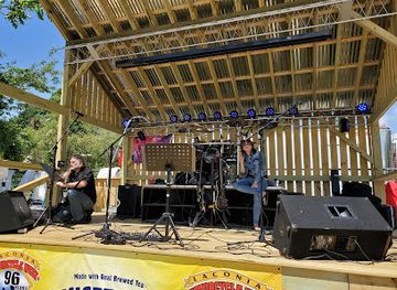
Evening entertainment around White Mountain National Forest is concentrated in its gateway communities rather than within the forest. Lincoln and North Woodstock have a selection of pubs, restaurants and seasonal evening venues, while North Conway and the wider Mount Washington Valley offer a broader choice of bars, brewpubs and occasional live entertainment. Gorham provides a quieter northern base with places to eat and drink after a day on the trails. Remote campgrounds and forest roads are not nightlife settings, and evening options may be sparse outside the main villages, particularly in winter or between tourist seasons. Visitors staying in rural inns, cabins or campgrounds generally experience dark skies, subdued roads and early starts rather than club-oriented entertainment, with local events and performances varying by season.
-
Recreation center
AMC Highland Center at Crawford Notch
Discover the AMC Highland Center at Crawford Notch - Your gateway to the stunning White Mountain National Forest and unforgettable outdoor adventures.
-
Lounge
Cigar Shenanigans Cigar & Cocktail Lounge
Experience the perfect blend of relaxation and indulgence at Cigar Shenanigans Cigar & Cocktail Lounge in North Conway, NH.
-
Cigar shop
The Original Cigar & Bar
Experience the perfect blend of relaxation and indulgence at The Original Cigar & Bar in North Conway, where fine cigars and a full bar await.
-
Live music bar
The Big House
Experience the pulse of Laconia at The Big House, where live music, great drinks, and unforgettable nights come together in a vibrant atmosphere.


Best shops in White Mountains National Forest
Shopping is centred on gateway settlements rather than the national forest itself. North Conway and the Mount Washington Valley have the largest concentration of shops, while Lincoln, North Woodstock, Bartlett and Gorham provide more modest local services and supplies. Visitors commonly look for New Hampshire maple products, locally made food, outdoor clothing and equipment, books, artwork, pottery and other crafts associated with the mountain region. Farm stands and small producers appear along roads in the wider valleys, with availability varying through the growing season. The area’s retail character combines practical equipment for hiking and winter sports with souvenirs and regional goods; remote scenic roads and trailheads generally have no shopping facilities, so food, fuel and essential equipment should be obtained in a town before travelling into the forest.
-
Gift shop
Zeb's General Store
Explore Zeb's General Store in North Conway, NH, for unique gifts, delicious candies, and the charm of New England all in one place.
-
Outlet mall
Settlers Green Outlet Village
Discover unbeatable deals and a charming shopping experience at Settlers Green Outlet Village in beautiful North Conway, New Hampshire.
-
Gift shop
The Old Country Store and Museum
Explore The Old Country Store and Museum, a unique gift shop and history museum in Moultonborough, NH, offering gourmet treats and local souvenirs.
-
Gift shop
The Christmas Loft
Discover The Christmas Loft in North Conway, NH - a whimsical gift shop filled with festive decorations, toys, and seasonal treasures for the whole family.


Get your free copy of our complete guide to White Mountains National Forest, delivered straight to you.
Everything on this page, from attractions and restaurants to essentials and local phrases, in one PDF you can read offline, print or share.
Already have an account? Sign in
Your White Mountains National Forest guide is ready.
We'll send it to · Not you? Sign out

Getting your guide ready…
We are putting together a fresh copy of the White Mountains National Forest guide. This can take up to a minute.
This can take a few moments. If your browser asks, choose Allow so the download can start. You'll find the guide in your Downloads folder.
Nothing happened? Download it again
Sorry, the guide is taking longer than usual. Please try again in a minute, or get it by email instead.
White Mountains National Forest essentials
Currency and Payment
Safety
Emergency Situations
Do's and Don'ts
Local Tips
From Eve
Local phrases worth knowing
You don't need to get them perfect. A few words go a long way, and locals appreciate the effort.
Basics
| English | Local | Say it |
|---|---|---|
| Hello | Howdy | [haw-dee] |
| Goodbye | See ya later | [see yuh lay-tuh] |
| Yes | Yup | [yuhp] |
| No | Nah | [nah] |
| Please/You're welcome | Please and thank ya | [pleez and thank yuh] |
| Thank you | Much obliged | [muhch uh-blahy-jed] |
| Excuse me/Sorry | Pardon me | [pahr-dn me] |
| How are you? | Howdy, how ya doin'? | [haw-dee, how yuh doo-in] |
| Fine. And you? | Just swell. And yourself? | [just swel. And yur-self] |
| Do you speak English? | Ya speak English? | [yuh speak ing-glish] |
| I don't understand | I ain't catchin' what you're throwin' | [I aint kach-in whut yur throw-in] |
Eating & Drinking
| English | Local | Say it |
|---|---|---|
| I'd like to see the menu, please | Could I take a gander at the menu, please | [kood eye take uh gan-der at the menu, please] |
| I don't eat meat | I ain't no carnivore | [I aint no car-ni-vore] |
| Cheers! | Cheers! | [cheers] |
| I would like to pay, please | I reckon it's time to settle up | [I rek-un its time to set-ul up] |
Emergencies
| English | Local | Say it |
|---|---|---|
| Help! | Help! | [help] |
| Go away! | Shoo! | [shoo] |
| Call the Police! | Get the Sheriff! | [get the sher-iff] |
| Call a doctor! | Fetch the doc! | [fetch the doc] |
| I'm lost | I'm turned around | [I'm turned a-round] |
| I'm ill | I ain't feelin' so good | [I aint feel-in so good] |
Shopping
| English | Local | Say it |
|---|---|---|
| I'd like to buy... | I reckon I'll take... | [I rek-un aill take] |
| I'm just looking | I'm just browsin' | [I'm just brow-zin] |
| How much is it? | How much ya askin' for it? | [how much yuh ask-in for it] |
| That's too expensive | That's a bit rich for my blood | [thats uh bit rich for my blud] |
| Can you lower the price? | Can ya do a bit of hagglin'? | [can yuh do uh bit of hag-glin] |
Time & Numbers
| English | Local | Say it |
|---|---|---|
| What time is it? | What's the hour? | [whuts the hour] |
| It's one o'clock | It's one | [its one] |
| Half past (10) | Half past ten | [half past ten] |
| Morning | Mornin' | [morn-in] |
| Afternoon | Afternoon | [after-noon] |
| Evening | Evenin' | [even-in] |
| Yesterday | Yest'day | [yes-t-day] |
| Today | Today | [to-day] |
| Tomorrow | Tomorra | [tom-or-rah] |
| 1 | One | [wun] |
| 2 | Two | [too] |
| 3 | Three | [three] |
| 4 | Four | [four] |
| 5 | Five | [five] |
| 6 | Six | [six] |
| 7 | Seven | [seven] |
| 8 | Eight | [eight] |
| 9 | Nine | [nine] |
| 10 | Ten | [ten] |
Transport & Directions
| English | Local | Say it |
|---|---|---|
| Where's a/the...? | Where's the... | [wheres the] |
| What's the address? | What's the location? | [whuts the loh-kay-shun] |
| Can you show me (on the map)? | Can ya point it out (on the map)? | [can ya point it out (on the map)] |
| When's the next (bus)? | When's the next one (bus)? | [whens the next one (bus)] |
| A ticket (to ....) | A pass (to ....) | [uh pass (to)] |
History of White Mountains National Forest
A Landscape Shaped by Ice
The White Mountains were profoundly reshaped during the Ice Age, when advancing glaciers carved valleys, broadened passes and left deposits that still influence the region’s rivers and ponds. The resulting terrain includes steep-sided notches, rounded summits, glacial cirques and large boulder fields. Mount Washington and the surrounding Presidential Range are part of an ancient mountain system whose rocks have been altered and uplifted over immense geological periods. This geological foundation explains the sharp contrast between exposed alpine ridges and the deep, heavily forested valleys that define the New Hampshire portion of the national forest.
Indigenous Homelands and Early Routes
The White Mountains lie within the traditional homelands of Native peoples, including the Abenaki, whose communities travelled through the valleys and passes, hunted, fished and maintained relationships with the region’s forests and waterways. European settlement expanded gradually from the seventeenth century, with rivers and mountain passes becoming routes into the interior. Indigenous place names and later translated names survive across the landscape, although colonial mapping and settlement altered long-established patterns of land use. The mountains were initially regarded by many European settlers as difficult country rather than as a recreational destination.
Timber, Mills and Mountain Communities
From the nineteenth century, logging became a defining force in the White Mountains. Timber harvesting expanded into the uplands, and sawmills, railways and logging camps supported settlements in valleys such as the Pemigewasset, Saco and Androscoggin. Severe floods, fires and clear-cut hillsides drew attention to the environmental consequences of intensive forestry. Railway connections also brought visitors, artists and tourists, helping towns including North Conway, Bartlett, Lincoln and Gorham develop as gateways to the mountains. The visible forest of today therefore reflects both natural regeneration and a long history of human intervention.
The Rise of Mountain Tourism
Organised tourism grew during the nineteenth century, encouraged by hotels, carriage roads, railways and guide services. Mount Washington became an emblem of New England mountain travel, while routes through Crawford Notch and Franconia Notch attracted visitors seeking scenery, cooler summer air and vigorous walking. The Mount Washington Auto Road and the Mount Washington Cog Railway, both outside the national forest’s direct management in their respective operating corridors, became notable examples of infrastructure built to take visitors into the high mountains. Tourism increasingly shaped the region’s economy and public understanding of the landscape.
National Forest Protection and Recreation
White Mountain National Forest was established in 1918 after concerns about erosion, flooding and the loss of mountain forests led to federal acquisition and management of damaged lands. Reforestation, watershed protection and professional forestry gradually changed the character of many slopes. Roads, campgrounds, trail systems and designated recreation sites later expanded public access, while the Appalachian National Scenic Trail and wilderness areas introduced additional layers of protection. Modern management balances recreation, habitat conservation, timber interests, fire safety and the protection of fragile alpine environments, with seasonal restrictions and local conditions shaping how visitors use the forest.
White Mountains National Forest in Photos
Browse through our photo collection highlighting the charm and character of the destination.
Cities in White Mountains National Forest
The towns and cities of White Mountains National Forest, and the easiest places to base yourself.
-

-


Swipe for more cities
Neighbouring destination travel guides
The closest destinations to White Mountains National Forest, if you have time for more than one.
-

-

-

-

-


Swipe for more destinations
Explore more

Explore more of White Mountains
Explore New Hampshire's White Mountains through high peaks, scenic notches, forest trails, historic railways, skiing and four-season mountain towns.
Explore White Mountains
Explore more of New Hampshire
Discover New Hampshire: Explore the majestic White Mountains, serene lakes, and historic towns in the heart of New England's enchanting landscapes.
Explore New Hampshire