

Free Fort Berthold Indian Reservation Travel Guide & Mobile App
Explore Fort Berthold Indian Reservation with free travel guides. Discover regional history, expert tips, proposed trips, and audio guides on web or mobile app.


Fort Berthold Indian Reservation in North Dakota combines Lake Sakakawea landscapes, prairie travel and the living heritage of the Mandan, Hidatsa and Arikara Nation.
Read more about Fort Berthold Indian Reservation
Getting to and around Fort Berthold Indian Reservation
How to get there
Transportation
Destinations in Fort Berthold Indian Reservation
Resorts, valleys and scenic spots worth a trip of their own.

Swipe for more destinations
Best attractions in Fort Berthold Indian Reservation
Fort Berthold's attractions are shaped by the Missouri River, the reservoir landscape and the living heritage of the Mandan, Hidatsa and Arikara Nation. In New Town, the MHA Interpretive Center provides essential context through exhibitions and interpretation focused on the Three Affiliated Tribes, their communities and the changes brought by the Garrison Dam project. The Four Bears Bridge is both a functional crossing and a major visual expression of MHA identity. Around Lake Sakakawea, visitors can pursue boating, fishing, camping, birdwatching and shoreline recreation where public facilities and regulations permit. The reservation's prairie roads offer broad views, working landscapes and access to small communities rather than a dense sequence of attractions. Cultural gatherings, including public powwows when scheduled, are significant opportunities to encounter contemporary Indigenous life, but they should be attended as hosted events and according to local protocols. The most rewarding approach is deliberate and geographically aware: combine the interpretive centre with the lake and bridge, then allow time for the quiet scale of the prairie and for conversations with local visitor or tribal authorities about appropriate access.
-
Tourist attraction
Crow Flies High State Recreation Area
Explore the breathtaking landscapes, diverse wildlife, and outdoor adventures at Crow Flies High State Recreation Area in New Town, North Dakota.
-
Museum
MHA Interpretive Center
Explore the MHA Interpretive Center in New Town, ND, for an immersive experience into the legacy of the Mandan, Hidatsa, and Arikara Nations.
-
Park
New Town Public Use Area
Explore the natural beauty and tranquility of New Town Public Use Area, a perfect spot for picnics, walking trails, and relaxation in North Dakota.
-
Museum
Three Affiliated Tribes Museum
Explore the vibrant heritage of the Mandan, Hidatsa, and Arikara tribes at the Three Affiliated Tribes Museum in New Town, North Dakota.


Best landmarks in Fort Berthold Indian Reservation
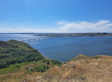
The Four Bears Bridge is Fort Berthold's most recognisable modern landmark. Crossing an arm of Lake Sakakawea near New Town, it links communities separated by the reservoir and incorporates visual references to Mandan, Hidatsa and Arikara heritage, making it both infrastructure and a statement of contemporary identity. The MHA Interpretive Center is an important cultural landmark rather than merely a museum: its purpose is to centre the history and continuing presence of the Three Affiliated Tribes. Lake Sakakawea itself is the region's defining geographical landmark, transforming the former Missouri River valley into a vast network of bays and shorelines after the construction of Garrison Dam. Across the reservation, the open prairie, river bluffs and reservoir edges form a dispersed landscape of significance. Historic village and burial locations connected with the Missouri River may be culturally sensitive, private or inaccessible, so visitors should not search for or enter such places without clear permission. The strongest landmarks are therefore best understood together: the bridge and centre express the present, while the lake records a profound twentieth-century transformation of the ancestral landscape.
-
Tourist attraction
Crow Flies High State Recreation Area
Explore the breathtaking views and outdoor adventures at Crow Flies High State Recreation Area in New Town, North Dakota, a perfect retreat for nature enthusiasts.
-
Historical landmark
Killdeer Mountain Battlefield State Historic Site
Explore the historical depths of Killdeer Mountain Battlefield State Historic Site, a landmark of significance in North Dakota's rich Native American history.


Explore Fort Berthold Indian Reservation on the map
Plan your trip on one map. See where the top cities, national parks and sights are, and book hotels and experiences in a few clicks.
Best hotels in Fort Berthold Indian Reservation
Best restaurants in Fort Berthold Indian Reservation
Dining on Fort Berthold Indian Reservation is primarily community-based, with cafés, diners, convenience stores and informal establishments concentrated in New Town and the other principal communities rather than in a formal restaurant district. Visitors should plan meals around opening arrangements and distance, particularly when travelling to rural areas or lakeside recreation sites. Regional food culture reflects the wider northern Plains, including agricultural produce, beef, game where legally and appropriately sourced, breads and filling home-style meals. Corn, beans and squash are important to the historical foodways of the Mandan, Hidatsa and Arikara peoples, although contemporary dining is varied and should not be reduced to a single traditional menu. Community events and powwows may include locally prepared foods, but availability and public access differ by occasion. Buying provisions before a long drive is sensible, while farmers' produce, baked goods or event foods can provide a more local encounter when offered openly for visitors.
-
Sandwich
Subway
Discover fresh and customizable meals at Subway in New Town - perfect for tourists seeking quick bites with healthy options.

Best bars in Fort Berthold Indian Reservation
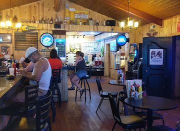
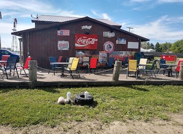
Evening life on Fort Berthold Indian Reservation is low-key and dispersed, centred on community establishments, casual dining and private or event-based gatherings rather than a large nightclub scene. New Town provides the broadest concentration of services, while Mandaree, Parshall and White Shield have smaller local social environments. Visitors should not expect late-night entertainment, extensive taxi availability or a continuous bar district, and should arrange transport before drinking or attending an event. Public powwows, community celebrations and cultural programmes can be more significant than commercial nightlife when they are scheduled and open to visitors. The reservoir and prairie also create quiet evening activities such as sunset viewing and stargazing, subject to safe access and weather. Any licensed premises, tribal event or community venue should be approached according to its own rules, age requirements and closing arrangements.
-
Bar
4 Bears Casino & Lodge
Discover the thrill of gaming and the comfort of lodging at 4 Bears Casino & Lodge in New Town, North Dakota, a top destination for relaxation and excitement.
-
Bar
Ranchman's 23 Saloon and Steakhouse
Savor the flavors of the American West at Ranchman's 23 Saloon and Steakhouse, a premier destination for steak lovers in New Town, North Dakota.
-
Grill
Totten Trail
Discover delicious grilled cuisine and scenic camping at Totten Trail, a perfect North Dakota getaway for food lovers and outdoor adventurers.
-
Grill
Harbor Bar
Discover the best grill experience at Harbor Bar in Coleharbor, ND, where delicious food meets friendly service in a cozy atmosphere.


Best nightclubs in Fort Berthold Indian Reservation
-
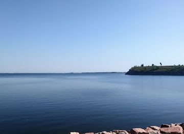
Lake
Lake Sakakawea
Experience the serene beauty of Lake Sakakawea in North Dakota, a perfect destination for fishing, boating, and relaxation amidst stunning landscapes.
-
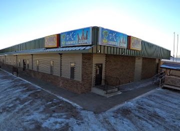
Night club
DK's Lounge
Immerse yourself in the lively nightlife at DK's Lounge in Williston, ND – a perfect blend of bar, casino, and sports entertainment.
Best shops in Fort Berthold Indian Reservation
Shopping on Fort Berthold Indian Reservation is practical and locally focused rather than built around large retail centres. New Town and the other principal communities provide opportunities for everyday supplies, fuel and basic provisions, while small businesses and community events may offer locally made food, crafts or artwork when available. Visitors should distinguish authentic, tribally produced work from generic items labelled with broad Plains imagery and should ask about the maker and the cultural context of a piece, particularly for beadwork, artwork, clothing or other Indigenous designs. Powwows and public gatherings can sometimes include craft or food vendors, but dates, vendors and payment arrangements vary. Buy enough supplies before travelling into rural areas, and treat any cultural materials connected with graves, archaeological sites or ceremonies as strictly off-limits. The most appropriate purchases are those openly offered by local artists, community organisations or established businesses, with respectful interest rather than bargain-hunting.
-
Gift shop
4 Bears Casino & Lodge
Discover endless fun and relaxation at 4 Bears Casino & Lodge, where gaming, dining, and outdoor adventures await in New Town, North Dakota.
-
Truck stop
On The Run Travel Center
Explore New Town's On The Run Travel Center - the ultimate truck stop and liquor store for weary travelers and adventurers alike.
-
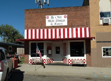
American
Ye Olde Malt Shoppe
Experience delightful American cuisine at Ye Olde Malt Shoppe, a charming breakfast spot and ice cream haven in Garrison, North Dakota.
-
Grocery store
New Town Jack & Jill
Explore local flavors and essentials at New Town Jack & Jill, your go-to grocery store in the heart of New Town, North Dakota.



Get your free copy of our complete guide to Fort Berthold Indian Reservation, delivered straight to you.
Everything on this page, from attractions and restaurants to essentials and local phrases, in one PDF you can read offline, print or share.
Already have an account? Sign in
Your Fort Berthold Indian Reservation guide is ready.
We'll send it to · Not you? Sign out

Getting your guide ready…
We are putting together a fresh copy of the Fort Berthold Indian Reservation guide. This can take up to a minute.
This can take a few moments. If your browser asks, choose Allow so the download can start. You'll find the guide in your Downloads folder.
Nothing happened? Download it again
Sorry, the guide is taking longer than usual. Please try again in a minute, or get it by email instead.
Fort Berthold Indian Reservation essentials
Currency and Payment
Safety
Emergency Situations
Do's and Don'ts
Local Tips
From Eve
Local phrases worth knowing
You don't need to get them perfect. A few words go a long way, and locals appreciate the effort.
Basics
| English | Local | Say it |
|---|---|---|
| Hello | Hau | [How] |
| Goodbye | Haw kin | [Haw kin] |
| Yes | Ee | [Ee] |
| No | Na | [Nah] |
| Please/You're welcome | T'ahk'e | [T'ahk-e] |
| Thank you | Pilamaya | [Pee-la-ma-ya] |
| Excuse me/Sorry | Neh'k'eh | [Neh-kay] |
| How are you? | T'ah'k'e na? | [T'ah-kay nah?] |
| Fine. And you? | Wíiyuk. T'ah'k'e na? | [Wee-yook. T'ah-kay nah?] |
| Do you speak English? | Na wíiyuk inízi? | [Nah wee-yook ee-nee-zee?] |
| I don't understand | Neh'k'eh inízi | [Neh-kay ee-nee-zee] |
Eating & Drinking
| English | Local | Say it |
|---|---|---|
| I'd like to see the menu, please | T'ah'k'e wíiyuk menu | [T'ah-kay wee-yook menu] |
| I don't eat meat | Neh'k'eh wíiyuk meat | [Neh-kay wee-yook meat] |
| Cheers! | Wíiyuk! | [Wee-yook!] |
| I would like to pay, please | T'ah'k'e wíiyuk pay | [T'ah-kay wee-yook pay] |
Emergencies
| English | Local | Say it |
|---|---|---|
| Help! | T'ah'k'e! | [T'ah-kay!] |
| Go away! | Píyit! | [Pee-yit!] |
| Call the Police! | Wíiyuk Police! | [Wee-yook Police!] |
| Call a doctor! | Wíiyuk doctor! | [Wee-yook doctor!] |
| I'm lost | Neh'k'eh wíiyuk lost | [Neh-kay wee-yook lost] |
| I'm ill | Neh'k'eh wíiyuk ill | [Neh-kay wee-yook ill] |
Shopping
| English | Local | Say it |
|---|---|---|
| I'd like to buy... | T'ah'k'e wíiyuk buy... | [T'ah-kay wee-yook buy...] |
| I'm just looking | Neh'k'eh wíiyuk just looking | [Neh-kay wee-yook just looking] |
| How much is it? | T'ah'k'e ki wíiyuk? | [T'ah-kay kee wee-yook?] |
| That's too expensive | Kí t'ah wíiyuk a'k'eh | [Kee t'ah wee-yook ah-kay] |
| Can you lower the price? | T'ah'k'e wíiyuk price? | [T'ah-kay wee-yook price?] |
Time & Numbers
| English | Local | Say it |
|---|---|---|
| What time is it? | T'ah'k'e ki wíiyuk? | [T'ah-kay kee wee-yook?] |
| It's one o'clock | T'ah wíiyuk 1 | [T'ah wee-yook one] |
| Half past (10) | T'ah'k'e 10 wíiyuk | [T'ah-kay ten wee-yook] |
| Morning | Wíiyuk | [Wee-yook] |
| Afternoon | Wíiyuk wíiyuk | [Wee-yook wee-yook] |
| Evening | Wíiyuk wíiyuk | [Wee-yook wee-yook] |
| Yesterday | Wíiyuk wíiyuk | [Wee-yook wee-yook] |
| Today | Wíiyuk wíiyuk | [Wee-yook wee-yook] |
| Tomorrow | Wíiyuk wíiyuk | [Wee-yook wee-yook] |
| 1 | Nin | [Nin] |
| 2 | Nin'ka | [Nin-ka] |
| 3 | Nin'k'ah | [Nin-kah] |
| 4 | Nin'k'ahk | [Nin-kahk] |
| 5 | Nin'k'ahk'eh | [Nin-kahk-eh] |
| 6 | Nin'k'ahk'ehk | [Nin-kahk-ehk] |
| 7 | Nin'k'ahk'ehk'eh | [Nin-kahk-ehk-eh] |
| 8 | Nin'k'ahk'ehk'ehk | [Nin-kahk-ehk-ehk] |
| 9 | Nin'k'ahk'ehk'ehk'eh | [Nin-kahk-ehk-ehk-eh] |
| 10 | Nin'k'ahk'ehk'ehk'ehk | [Nin-kahk-ehk-ehk-ehk] |
Transport & Directions
| English | Local | Say it |
|---|---|---|
| Where's a/the...? | T'ah'k'e wíiyuk a/the...? | [T'ah-kay wee-yook a/the...?] |
| What's the address? | T'ah'k'e ki wíiyuk address? | [T'ah-kay kee wee-yook address?] |
| Can you show me (on the map)? | T'ah'k'e wíiyuk map? | [T'ah-kay wee-yook map?] |
| When's the next (bus)? | T'ah'k'e ki wíiyuk next (bus)? | [T'ah-kay kee wee-yook next bus?] |
| A ticket (to ....) | Wíiyuk ticket (to ....) | [Wee-yook ticket to ....] |
History of Fort Berthold Indian Reservation
Mandan Earth-Lodge Communities Before European Contact
For centuries, Mandan communities established villages along the Missouri River and its tributaries in what is now central and western North Dakota. Their earth-lodge settlements supported intensive agriculture, especially the cultivation of corn, beans and squash, alongside hunting, fishing and regional trade. The river connected communities across the northern Plains, and Mandan towns became important centres of exchange and diplomacy. Archaeological and cultural evidence from the Missouri corridor remains essential to understanding the region before the creation of the modern reservation and reservoir.
Hidatsa and Arikara Peoples on the Missouri
Hidatsa communities developed a closely related village-and-agriculture tradition along the upper Missouri, while Arikara communities lived farther south before moving north during the pressures and disruptions of the eighteenth and nineteenth centuries. Mandan, Hidatsa and Arikara people maintained separate identities while forming close alliances through trade, intermarriage and shared residence. Their combined history explains why the modern reservation is associated with three nations rather than a single tribal community.
Early Trade and the Fort Berthold Name
The reservation's name derives from Fort Berthold, a fur-trading post established by the American Fur Company in 1837 near the Missouri River. The post became part of a wider network linking Indigenous trading communities with American and European commercial interests. Trade brought new goods and political relationships, but it also intensified dependence on outside markets and exposure to epidemic disease. The fort's name survived even as the post disappeared and the reservation's communities changed location.
The Lewis and Clark Era and Sakakawea's Legacy
The Lewis and Clark expedition reached the Mandan and Hidatsa villages in the winter of 1804–05, before continuing west with Sakakawea, a Hidatsa woman, among its guides and interpreters. Her connection to the region is historically important, but later national narratives often simplified her life and identity. Within Fort Berthold, her legacy forms part of a much broader Mandan, Hidatsa and Arikara history that includes agriculture, diplomacy, trade, displacement and survival.
Reservation Consolidation and the Three Affiliated Tribes
Treaties and federal policies during the nineteenth century confined Mandan, Hidatsa and Arikara communities to a shrinking reservation environment. The three peoples became increasingly linked in their dealings with the United States, while retaining distinct histories and identities. The name Three Affiliated Tribes reflects this political relationship. Federal allotment, missionary activity, changing land tenure and pressure on Indigenous governance reshaped life on the Missouri, yet community institutions and cultural knowledge continued.
Garrison Dam, Lake Sakakawea and Displacement
Construction of Garrison Dam after the Second World War created one of the largest reservoirs in the United States, Lake Sakakawea, and flooded much of the Missouri River bottomland associated with Fort Berthold communities. Homes, farms, burial places, village sites and other culturally important places were affected, and many families had to relocate. The resulting economic and social disruption remains a major part of local memory. New Town and the present settlement pattern developed in the era of this transformation.
Contemporary MHA Nation
The Mandan, Hidatsa and Arikara Nation continues to exercise tribal sovereignty and to govern community affairs on the reservation. Contemporary life combines agriculture, energy-related employment, public administration, education, cultural work and recreation around Lake Sakakawea. The MHA Interpretive Center and cultural events help communicate the Nation's history on its own terms, while modern infrastructure such as the Four Bears Bridge reflects ongoing investment and connection between communities divided by the reservoir.
Fort Berthold Indian Reservation in Photos
Browse through our photo collection highlighting the charm and character of the destination.
Neighbouring regions of Fort Berthold Indian Reservation
The closest regions to Fort Berthold Indian Reservation, if you have time for more than one.
-

-
-

-

-


Swipe for more regions
Explore more
Explore more of North Dakota
Discover the rugged beauty, rich history, and warm hospitality of North Dakota, the untamed frontier of the United States.
Explore North Dakota