

Free Killdeer Mountains Travel Guide & Mobile App
Explore Killdeer Mountains with free travel guides. Discover regional history, expert tips, proposed trips, and audio guides on web or mobile app.


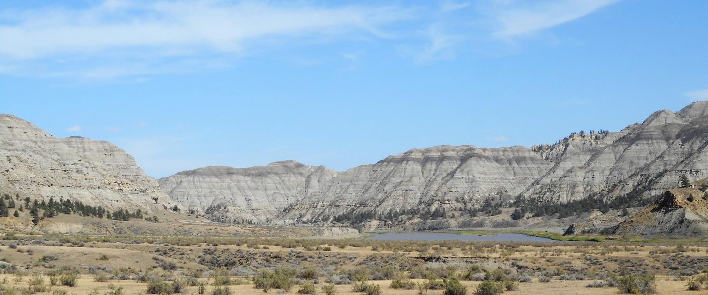


Explore the Killdeer Mountains of North Dakota for open prairie, rugged ridges, Indigenous and frontier history, wildlife and quiet back-country travel.
Read more about Killdeer Mountains
Getting to and around Killdeer Mountains
How to get there
Transportation
Best attractions in Killdeer Mountains
The Killdeer Mountains’ attractions are based on landscape, history and outdoor observation rather than a dense collection of visitor facilities. Killdeer Mountain Battlefield is the region’s principal historical destination, offering a tangible setting for understanding the 1864 conflict and the wider consequences of United States military expansion across Indigenous homelands. The surrounding uplands and grasslands are suited to scenic driving, photography, birdwatching and wildlife observation, with broad views across ridges, coulees and open prairie. Public hunting lands and wildlife habitat contribute to the area’s seasonal outdoor appeal, although visitors must check current regulations, access arrangements and land ownership. The nearby town of Killdeer supplies basic services and provides a useful point from which to explore the countryside. Travellers should not expect formal visitor centres, extensive signed walking networks or a guaranteed range of facilities at remote sites; the attraction lies in the combination of quiet terrain, historical interpretation and the scale of the northern Plains. The wider region also offers rural views and working-landscape experiences, but private ranches and energy infrastructure mean that visitors must distinguish public access from land that is closed or permission-only.
-
State park
Little Missouri State Park
Discover the stunning landscapes and diverse wildlife at Little Missouri State Park, a hidden gem in North Dakota for nature lovers and adventurers.
-
Historical landmark
Killdeer Mountain Battlefield State Historic Site
Explore the historical significance of the Killdeer Mountain Battlefield, a key site of the Great Sioux War in North Dakota's stunning landscape.


Best landmarks in Killdeer Mountains
Killdeer Mountain Battlefield is the defining historical landmark of the region. Its importance lies not in elaborate surviving architecture but in the preserved relationship between open ground, elevated positions and the routes used during the 1864 battle. The site connects the physical landscape with the histories of Native American communities, United States military campaigns and the accelerating transformation of the northern Plains. The Killdeer Mountains themselves are also geographical landmarks, standing as prominent uplands above surrounding prairie and ranch country. Their ridges and coulees show the erosive forces that have shaped western North Dakota and provide the region’s most recognisable scenery. Around them, the contrast between native grassland, cultivated fields, working ranches and modern energy infrastructure illustrates successive phases of regional development. The town of Killdeer has a more modest civic scale, but it serves as the contemporary settlement associated with the mountains and the battlefield. Together these places create a landscape landmark rather than a monumental one: the meaning is carried by distance, elevation, memory and the continuing presence of open grassland.
-
State park
Little Missouri State Park
Discover the breathtaking landscapes and diverse wildlife at Little Missouri State Park, a natural haven in North Dakota perfect for outdoor adventures.
-
Historical landmark
Killdeer Mountain Battlefield State Historic Site
Discover the historical legacy of the Killdeer Mountain Battlefield, a significant site of Native American history and U.S. military conflict in North Dakota.

Explore Killdeer Mountains on the map
Plan your trip on one map. See where the top cities, national parks and sights are, and book hotels and experiences in a few clicks.
Best hotels in Killdeer Mountains
Best restaurants in Killdeer Mountains
Dining in and around the Killdeer Mountains is centred on the town of Killdeer and reflects the practical food culture of a small North Dakota service community. Visitors can expect casual cafés, family-style restaurants and bar-and-grill establishments rather than a concentrated fine-dining scene. Menus commonly draw on familiar American staples, including burgers, sandwiches, steaks, fried foods and hearty breakfasts, with portions and service shaped by local residents, workers and passing motorists. The surrounding ranching country gives beef a natural place in the regional food identity, while North Dakota’s wider agricultural economy supports grains, potatoes and other prairie produce. Pack provisions before visiting the battlefield or remote roads, since there are few opportunities to buy food outside settled areas. Farmers’ markets and seasonal community events may provide locally produced goods when operating, but arrangements vary and should be checked locally. Dining is generally informal, and evening options are more limited than in the state’s larger cities.
-
Grill
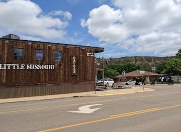
Little Missouri Saloon & Dining Room
Discover authentic Western cuisine at Little Missouri Saloon & Dining Room in Medora—where great food meets local culture.
-
Steak
Pitchfork Steak Fondue
Discover a unique dining experience at Pitchfork Steak Fondue in Medora – savor delicious steaks amidst breathtaking Badlands views.
-
Family-friendly
Cowboy Cafe
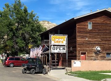
Discover Cowboy Cafe in Medora for a family-friendly dining experience filled with hearty meals inspired by the Wild West.
-
American
Nana Lil's Cafe
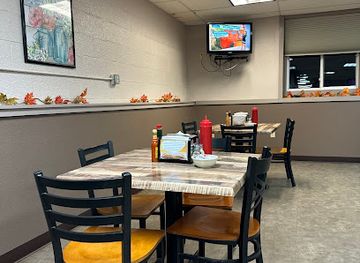
Discover the warmth and flavor of traditional American breakfasts at Nana Lil's Cafe in Killdeer - your cozy culinary retreat.

Best bars in Killdeer Mountains
Evening life in the Killdeer Mountains is low-key and concentrated in Killdeer rather than spread across a series of nightlife districts. Traditional pubs, bar-and-grill venues and community-oriented establishments provide places for a meal, conversation and locally focused socialising, while occasional live music or seasonal events may add variety. There is no substantial nightclub scene in the mountains, and opening arrangements can change according to local demand, staffing and community calendars. Travellers staying in the area should plan evening transport carefully, particularly on rural roads where distances, wildlife and weather can make driving after dark demanding. The landscape itself becomes the main evening attraction: open skies, low light pollution and quiet horizons are well suited to stargazing, provided visitors remain on authorised land and observe local fire and safety restrictions.
-
American
Nana Lil's Cafe
Discover Nana Lil's Cafe in Killdeer, ND - a cozy breakfast haven serving hearty American classics and friendly smiles.
-
Grill
The Pipe
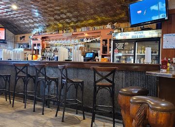
Experience the vibrant atmosphere and delectable flavors at The Pipe Grill & Bar in Killdeer, North Dakota.
-
Brewery
Buckskin
Discover the rich flavors of craft beer and gourmet cuisine at Buckskin Brewery, a top destination in Killdeer, North Dakota.
-
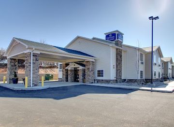
Hotel
Cobblestone Hotel & Suites - Killdeer
Discover comfort and charm at Cobblestone Hotel & Suites - Killdeer, your ideal retreat for exploring North Dakota's beautiful landscapes.
Best nightclubs in Killdeer Mountains
Evening life in the Killdeer Mountains is low-key and concentrated in Killdeer rather than spread across a series of nightlife districts. Traditional pubs, bar-and-grill venues and community-oriented establishments provide places for a meal, conversation and locally focused socialising, while occasional live music or seasonal events may add variety. There is no substantial nightclub scene in the mountains, and opening arrangements can change according to local demand, staffing and community calendars. Travellers staying in the area should plan evening transport carefully, particularly on rural roads where distances, wildlife and weather can make driving after dark demanding. The landscape itself becomes the main evening attraction: open skies, low light pollution and quiet horizons are well suited to stargazing, provided visitors remain on authorised land and observe local fire and safety restrictions.
-
Grill
The Pipe
Discover The Pipe in Killdeer, ND, where delicious grilled dishes and a vibrant bar atmosphere await every visitor.
-
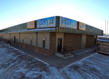
Night club
DK's Lounge
Discover the vibrant nightlife at DK's Lounge, your ultimate destination for fun, drinks, and entertainment in Williston, North Dakota.
-
Bar
The Herald Bar
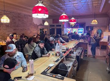
Experience the charm of Killdeer at The Herald Bar, where local spirits and friendly faces create unforgettable moments.

Best shops in Killdeer Mountains
Shopping in the Killdeer Mountains is limited and practical, with most opportunities concentrated in Killdeer rather than in isolated rural areas. Local shops and convenience businesses are useful for fuel, food, basic outdoor supplies and provisions before travelling into the hills. Visitors may find regional gifts, western-style clothing, locally made items or community-produced goods through small businesses and seasonal events, though stock and availability are not comparable with larger North Dakota towns. The area’s most representative purchases are likely to be food products, ranch- and prairie-themed souvenirs, books or interpretive material connected with local history. Travellers interested in craftwork, antiques or a broader selection of independent retailers should plan such shopping in a larger regional centre outside the mountains. Because markets and community sales are seasonal, local noticeboards and businesses are the best way to learn about current opportunities without relying on permanent retail claims.
-
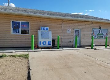
Liquor store
Big George's Liquor Store
Discover an impressive selection of wines and craft beers at Big George's Liquor Store in Killdeer, North Dakota, where local flavors await.
-
Hotel
Mountain View Hotel
Experience the tranquility and charm of Mountain View Hotel in Killdeer, ND, offering stunning views and extended stay comforts for every traveler.
-
Grocery store
Hinrich’s SUPERVALU
Discover the finest grocery shopping experience at Hinrich's SUPERVALU in Killdeer, offering quality local products and friendly service.
-
Convenience store
Cenex - Western Choice Cooperative C-Store
Discover the convenience of Cenex - Western Choice Cooperative C-Store in Killdeer, your all-in-one stop for snacks, fuel, and more.

Get your free copy of our complete guide to Killdeer Mountains, delivered straight to you.
Everything on this page, from attractions and restaurants to essentials and local phrases, in one PDF you can read offline, print or share.
Already have an account? Sign in
Your Killdeer Mountains guide is ready.
We'll send it to · Not you? Sign out

Getting your guide ready…
We are putting together a fresh copy of the Killdeer Mountains guide. This can take up to a minute.
This can take a few moments. If your browser asks, choose Allow so the download can start. You'll find the guide in your Downloads folder.
Nothing happened? Download it again
Sorry, the guide is taking longer than usual. Please try again in a minute, or get it by email instead.
Killdeer Mountains essentials
Currency and Payment
Safety
Emergency Situations
Do's and Don'ts
Local Tips
From Eve
Local phrases worth knowing
You don't need to get them perfect. A few words go a long way, and locals appreciate the effort.
Basics
| English | Local | Say it |
|---|---|---|
| Hello | Hau | [Hau] |
| Goodbye | K'lah | [K'lah] |
| Yes | Eya | [Eya] |
| No | Na | [Na] |
| Please/You're welcome | T'ahk'wa | [T'ahk'wa] |
| Thank you | Ahéhee | [Ahéhee] |
| Excuse me/Sorry | E’k'wa | [E’k'wa] |
| How are you? | T'ahk'wa e'k'wa? | [T'ahk'wa e'k'wa?] |
| Fine. And you? | Néé, t'ahk'wa? | [Néé, t'ahk'wa?] |
| Do you speak English? | T'ahk'wa e’k'wa English? | [T'ahk'wa e’k'wa English?] |
| I don't understand | Né'é e'k'wa t'ahk'wa | [Né'é e'k'wa t'ahk'wa] |
Eating & Drinking
| English | Local | Say it |
|---|---|---|
| I'd like to see the menu, please | Né'é k'lah menu, t'ahk'wa | [Né'é k'lah menu, t'ahk'wa] |
| I don't eat meat | Né'é e'k'wa meat | [Né'é e'k'wa meat] |
| Cheers! | T'ahk'wa ch'í | [T'ahk'wa ch'í] |
| I would like to pay, please | Né'é k'lah pay, t'ahk'wa | [Né'é k'lah pay, t'ahk'wa] |
Emergencies
| English | Local | Say it |
|---|---|---|
| Help! | K'lah! | [K'lah!] |
| Go away! | K'lah t'ahk'wa! | [K'lah t'ahk'wa!] |
| Call the Police! | Né'é k'lah Police! | [Né'é k'lah Police!] |
| Call a doctor! | Né'é k'lah doctor! | [Né'é k'lah doctor!] |
| I'm lost | Né'é e'k'wa lost | [Né'é e'k'wa lost] |
| I'm ill | Né'é e'k'wa ill | [Né'é e'k'wa ill] |
Shopping
| English | Local | Say it |
|---|---|---|
| I'd like to buy... | Né'é k'lah buy... | [Né'é k'lah buy...] |
| I'm just looking | Né'é t'ahk'wa k'lah | [Né'é t'ahk'wa k'lah] |
| How much is it? | T'ahk'wa k'lah? | [T'ahk'wa k'lah?] |
| That's too expensive | K'lah e'k'wa expensive | [K'lah e'k'wa expensive] |
| Can you lower the price? | T'ahk'wa e'k'wa lower price? | [T'ahk'wa e'k'wa lower price?] |
Time & Numbers
| English | Local | Say it |
|---|---|---|
| What time is it? | T'ahk'wa t'ahk'wa? | [T'ahk'wa t'ahk'wa?] |
| It's one o'clock | T'ahk'wa e'k'wa one | [T'ahk'wa e'k'wa one] |
| Half past (10) | K'lah e'k'wa half past 10 | [K'lah e'k'wa half past 10] |
| Morning | Wíiyá | [Wíiyá] |
| Afternoon | Wíiyá t'í | [Wíiyá t'í] |
| Evening | Wíiyá a'k'wa | [Wíiyá a'k'wa] |
| Yesterday | T'ahk'wa wíiyá | [T'ahk'wa wíiyá] |
| Today | T'ahk'wa wíiyá | [T'ahk'wa wíiyá] |
| Tomorrow | T'ahk'wa t'í wíiyá | [T'ahk'wa t'í wíiyá] |
| 1 | Né | [Né] |
| 2 | Néé | [Néé] |
| 3 | Néé né | [Néé né] |
| 4 | Néé néé | [Néé néé] |
| 5 | Néé néé né | [Néé néé né] |
| 6 | Néé néé néé | [Néé néé néé] |
| 7 | Néé néé néé né | [Néé néé néé né] |
| 8 | Néé néé néé néé | [Néé néé néé néé] |
| 9 | Néé néé néé néé né | [Néé néé néé néé né] |
| 10 | Néé néé néé néé néé | [Néé néé néé néé néé] |
Transport & Directions
| English | Local | Say it |
|---|---|---|
| Where's a/the...? | T'ahk'wa e'k'wa...? | [T'ahk'wa e'k'wa...?] |
| What's the address? | T'ahk'wa k'lah address? | [T'ahk'wa k'lah address?] |
| Can you show me (on the map)? | T'ahk'wa e'k'wa show me (on the map)? | [T'ahk'wa e'k'wa show me (on the map)?] |
| When's the next (bus)? | T'ahk'wa k'lah next (bus)? | [T'ahk'wa k'lah next (bus)?] |
| A ticket (to ....) | T'ahk'wa k'lah ticket (to ...) | [T'ahk'wa k'lah ticket (to ...)] |
History of Killdeer Mountains
Indigenous Plains Homelands
The Killdeer Mountains lie within a wider northern Plains landscape used, travelled through and understood by Indigenous peoples long before the arrival of the United States military. Dakota and Lakota communities, as well as other Native nations connected through trade, seasonal movement and diplomacy, hunted across the grasslands and occupied the region in changing patterns. The hills, water sources and routes through the prairie formed part of a lived cultural geography rather than an empty frontier. Any interpretation of later military events needs to recognise that the area was Indigenous homeland and that federal expansion brought displacement, violence and the loss of political and economic autonomy.
The 1864 Killdeer Mountain Battle
On 28 July 1864, troops under Brigadier General Alfred Sully fought Native American forces near the Killdeer Mountains during the United States’ military campaigns in the northern Plains. Sully’s expedition had moved west from the Missouri region, and the battle formed part of a broader conflict shaped by the breakdown of treaties, military expansion and pressure on Indigenous hunting grounds. United States forces attacked a large encampment and then destroyed property and supplies. The battlefield’s open ridges and approaches remain important to understanding the geography of the engagement, while the event’s consequences extended far beyond the immediate fighting.
Military Routes and Frontier Expansion
After the Civil War, military expeditions, freighting routes, surveying and expanding settlement increasingly connected western North Dakota to the United States economy. The Killdeer Mountains stood within a larger corridor between the Missouri River and the interior Plains, where movement depended on rough trails, water availability and seasonal conditions. Forts and military campaigns reinforced federal authority, while settlers, livestock operators and traders followed. This transformation was not simply a story of empty land being opened: it involved the restriction of Indigenous mobility, the reservation system and the replacement of established land relationships with surveyed property and federal administration.
Ranching, Homesteading and County Settlement
During the late nineteenth and early twentieth centuries, homesteading and ranching altered the countryside around the Killdeer Mountains. Some farming ventures struggled with limited rainfall, harsh winters and fluctuating markets, while cattle production proved better suited to extensive grassland in many parts of Dunn County. Small settlements, schools, churches and local businesses developed around the needs of dispersed communities. The resulting landscape remains a mixture of working ranches, cultivated fields and public or undeveloped grasslands, with long distances and small service centres still shaping everyday travel.
Roads, Automobiles and Regional Connection
Improved roads and motor travel gradually changed access to the Killdeer Mountains. Earlier journeys depended on trails, horses and the seasonal reliability of prairie routes; later highways connected Killdeer with larger towns and the wider road network of western North Dakota. Automobiles made remote historical sites and grazing country more accessible, but they did not remove the region’s basic scale. Travellers still need to plan fuel, weather and road conditions carefully. The modern visitor experience is therefore built on infrastructure that makes the area reachable while preserving much of its spacious, lightly settled character.
Energy Development in Western North Dakota
The western North Dakota energy economy, especially the expansion of oil production associated with the Bakken formation, brought major economic and demographic changes to nearby counties in the twenty-first century. Killdeer and surrounding communities experienced increased demand for housing, services, transport and industrial support, alongside pressures associated with heavy vehicles, infrastructure and changing land use. The Killdeer Mountains remain a grassland and historical landscape, but they are part of a region where ranching, energy production, conservation and community development now coexist, sometimes uneasily.
Killdeer Mountains in Photos
Browse through our photo collection highlighting the charm and character of the destination.
Neighbouring regions of Killdeer Mountains
The closest regions to Killdeer Mountains, if you have time for more than one.
-

-

-

-

-


Swipe for more regions
Explore more
Explore more of North Dakota
Discover the rugged beauty, rich history, and warm hospitality of North Dakota, the untamed frontier of the United States.
Explore North Dakota