

Free Malheur County Travel Guide & Mobile App
Explore Malheur County with free travel guides. Discover regional history, expert tips, proposed trips, and audio guides on web or mobile app.


Malheur County pairs Snake River farms, Basque heritage and Ontario culture with remote Owyhee canyons, lava fields and wide-open Oregon high desert.
Read more about Malheur County
Getting to and around Malheur County
How to get there
Transportation
Best attractions in Malheur County
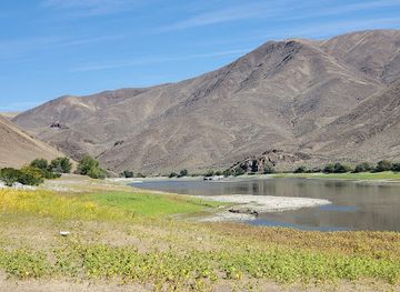
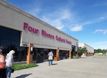
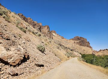
Malheur County's attractions are spread between the settled Snake River valley and a large expanse of high desert. Ontario provides the strongest concentration of museums, cultural programming, shopping and visitor services, while the Four Rivers Cultural Center presents regional history and the experiences of communities connected with the eastern Oregon and western Idaho borderlands. Vale offers local heritage in a smaller county-seat setting, and Jordan Valley adds a distinctive Basque cultural dimension. Outdoors, the county's Owyhee country is the principal draw: Leslie Gulch is known for sculpted volcanic formations beside the Owyhee Reservoir, while Succor Creek State Natural Area offers cliffs, creekside scenery and accessible desert landscapes. Jordan Craters preserves dark basaltic lava and unusual volcanic terrain in a remote setting. Boating, fishing, wildlife observation, photography, camping and hiking are possible in suitable areas, though facilities vary greatly and many sites are not serviced destinations. Irrigated farmland, orchards and river scenery around Ontario, Nyssa and the Malheur River valley provide a contrasting experience, especially during the growing season. Visitors should research road surfaces, land ownership, seasonal closures and water requirements before entering remote country.
-
State park
Farewell Bend State Recreation Area
Discover the natural beauty and historical significance of Farewell Bend State Recreation Area in Oregon, a perfect getaway for outdoor enthusiasts and history buffs alike.
-
Cultural center
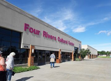
Four Rivers Cultural Center & Museum
Discover the vibrant cultural heritage of Ontario, Oregon at the Four Rivers Cultural Center & Museum, where history and community come together.
-
State park
Succor Creek State Natural Area
Discover the breathtaking landscapes and wildlife of Succor Creek State Natural Area, a hidden gem in Oregon's wilderness.
-
Museum
Stone House Museum
Explore the fascinating history of Vale, Oregon at the Stone House Museum, a captivating destination for culture and heritage enthusiasts.

Best landmarks in Malheur County
The Owyhee Dam is one of Malheur County's most significant twentieth-century engineering landmarks, an imposing concrete structure associated with the irrigation project that transformed farming in the Snake River plain. The Owyhee Reservoir and its surrounding volcanic canyon country form a natural landmark of a different kind, with steep walls, unusual rock formations and broad, dry horizons. Leslie Gulch is especially recognisable for its pale and dark volcanic formations rising around the reservoir, although access is remote and road conditions demand preparation. Jordan Craters is a notable geological landmark: a broad field of black basalt created by relatively recent volcanic activity, set within open high desert. Along the county's northern edge, the Snake River and irrigated valley landscapes provide a historic geographical frame for Ontario, Nyssa and the surrounding agricultural communities. The Malheur River valley near Vale is another defining landscape, linking ranching, transport and settlement history. These landmarks are valued for geological, agricultural or engineering significance rather than dense monumental architecture, and many require visitors to travel responsibly through exposed country with limited facilities.
-
State park
Farewell Bend State Recreation Area
Discover the breathtaking beauty and rich history of Farewell Bend State Recreation Area, the hidden gem of Oregon's outdoor adventures.
-
Museum
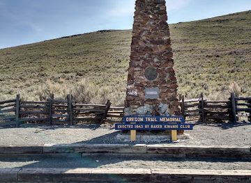
National Historic Oregon Trail Interpretive Center
Explore the Oregon Trail's rich history at the National Historic Oregon Trail Interpretive Center in Baker City, where engaging exhibits bring the pioneer experience to life.
-
National forest
Malheur National Forest
Explore the breathtaking beauty of Malheur National Forest, Oregon - a haven for outdoor enthusiasts and nature lovers with endless recreational opportunities.
-
Cultural center
Four Rivers Cultural Center & Museum
Explore the vibrant culture and history of Ontario, Oregon at the Four Rivers Cultural Center & Museum – a hub for art, heritage, and community events.

Explore Malheur County on the map
Plan your trip on one map. See where the top cities, national parks and sights are, and book hotels and experiences in a few clicks.
Best hotels in Malheur County
Best restaurants in Malheur County
Dining in Malheur County reflects its agricultural valleys, borderland location and rural communities. Ontario has the broadest selection of restaurants, cafés and everyday international dining, while Nyssa, Vale and Adrian offer smaller local scenes shaped by farm life and highway travel. Regional produce is important: onions, sugar beets, fruit, vegetables and other crops from the Snake River plain appear in local markets and household cooking, although menus vary by season and establishment. Basque influence is most evident around Jordan Valley, where lamb, beans, bread, peppers and communal dining traditions form part of a longer ranching and immigrant story; visitors should check local availability rather than assume a permanent restaurant schedule. Pubs, family cafés, Mexican restaurants, diners and bakeries are generally more characteristic than a large fine-dining circuit. Farmers' markets and farm stands, where operating, offer opportunities to buy local produce, while food shopping in Ontario is useful for self-catering before heading into the Owyhee country. Regional Idaho connections also influence the wider food culture without making it exclusively Oregonian.
-
Steak
Mackey's Public House
Experience the best steakhouse in Ontario at Mackey's Public House – where great food meets family-friendly vibes.
-
Restaurant
WINGERS Restaurant
Discover delicious American fare at WINGERS Restaurant in Ontario - famous for chicken wings and burgers in a casual setting.
-
Fast Food
McDonald's
Experience iconic fast food at McDonald's in Ontario, Oregon – where comfort meets convenience for every traveler.
-
American
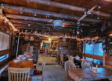
Cowboy Dinner Tree
Discover Cowboy Dinner Tree: A historic restaurant serving hearty American meals in Silver Lake's picturesque landscape.


Best bars in Malheur County
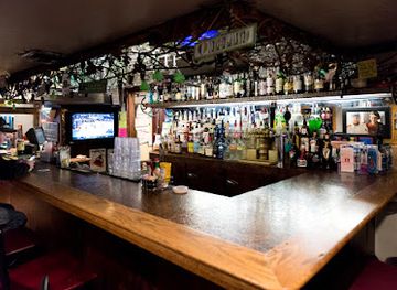
Nightlife in Malheur County is modest and concentrated in Ontario, with evenings generally centred on restaurants, traditional bars, breweries or community events rather than a large club scene. Vale and Nyssa have smaller local options, while rural communities such as Jordan Valley are more associated with social gatherings, seasonal celebrations and established local establishments than late-night entertainment. Live music, sports viewing and conversation-led pub culture are more typical than purpose-built nightclubs. The county's cultural venues may provide performances or events at particular times, but schedules change and should be checked locally. After dark, the open countryside offers exceptionally dark skies, although visitors should treat remote roads and public land as wilderness-like settings with limited services. Alcohol is not necessary to experience the region: an early dinner, a community cultural event or quiet observation of the high-desert night can be equally appropriate, particularly when driving long distances or staying outside the main towns.
-
Steak
Mackey's Public House
Discover the heart of Ontario dining at Mackey's Public House, where flavorful steaks and a friendly atmosphere await you.
-
Restaurant
WINGERS Restaurant
Discover WINGERS Restaurant in Ontario, famous for its delicious wings, burgers, and vibrant atmosphere that promises a memorable dining experience.
-
American
Country Kitchen Restaurant
Experience homestyle American cuisine at Country Kitchen Restaurant, the perfect family-friendly dining spot in Ontario, Oregon.
-
Bar
Brewsky's Broiler
Experience the best of American cuisine and craft beer at Brewsky's Broiler in Ontario, Oregon, perfect for families and food lovers alike.



Best nightclubs in Malheur County
Nightlife in Malheur County is modest and concentrated in Ontario, with evenings generally centred on restaurants, traditional bars, breweries or community events rather than a large club scene. Vale and Nyssa have smaller local options, while rural communities such as Jordan Valley are more associated with social gatherings, seasonal celebrations and established local establishments than late-night entertainment. Live music, sports viewing and conversation-led pub culture are more typical than purpose-built nightclubs. The county's cultural venues may provide performances or events at particular times, but schedules change and should be checked locally. After dark, the open countryside offers exceptionally dark skies, although visitors should treat remote roads and public land as wilderness-like settings with limited services. Alcohol is not necessary to experience the region: an early dinner, a community cultural event or quiet observation of the high-desert night can be equally appropriate, particularly when driving long distances or staying outside the main towns.
-
Night club
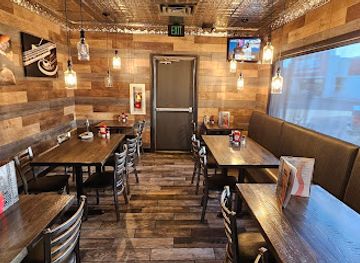
Damian's night club
Discover the energy of Ontario's nightlife at Damian's Night Club, where music, dance, and drinks come together for an unforgettable experience.

Best shops in Malheur County
Shopping is concentrated in Ontario, the county's principal retail and service centre, where visitors can find supermarkets, practical travel supplies, independent businesses and everyday American high-street retail. Nyssa and Vale offer smaller town shopping, local services and seasonal agricultural connections rather than extensive specialist districts. Produce markets, farm stands and community markets may provide onions, fruit, vegetables, preserves and other regional goods when in season, but availability varies. In Jordan Valley, Basque-influenced food products and cultural items may be found through local establishments or events, although visitors should not expect a permanent souvenir marketplace. Galleries, craft sales and community fundraisers can offer work by regional makers, while local history venues may provide books or educational material about the county. Practical supplies are particularly important before journeys into the Owyhee country, where retail facilities are absent. The most meaningful purchases are often agricultural or food-related products and locally produced items, rather than a standardised range of tourist souvenirs.
-
Department store
Walmart Supercenter
Discover convenience and variety at Walmart Supercenter in Ontario, Oregon—a perfect stop for all your shopping needs.
-
Shopping mall
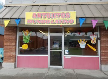
Ontario Marketplace
Explore the Ontario Marketplace - your go-to shopping destination in Oregon filled with diverse stores, dining options, and family-friendly entertainment.
-
Glass shop
Old School
Explore handcrafted glass art, unique tobacco products, and vaporizers at Old School in Ontario, Oregon, a must-visit destination for art lovers.
-
Coffee shop
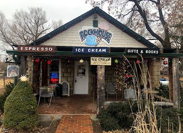
Skinner's Rockhouse Coffee
Experience the best coffee in Jordan Valley at Skinner's Rockhouse Coffee, a cozy spot offering unique items and a warm atmosphere.


Get your free copy of our complete guide to Malheur County, delivered straight to you.
Everything on this page, from attractions and restaurants to essentials and local phrases, in one PDF you can read offline, print or share.
Already have an account? Sign in
Your Malheur County guide is ready.
We'll send it to · Not you? Sign out

Getting your guide ready…
We are putting together a fresh copy of the Malheur County guide. This can take up to a minute.
This can take a few moments. If your browser asks, choose Allow so the download can start. You'll find the guide in your Downloads folder.
Nothing happened? Download it again
Sorry, the guide is taking longer than usual. Please try again in a minute, or get it by email instead.
Malheur County essentials
Currency and Payment
Safety
Emergency Situations
Do's and Don'ts
Local Tips
From Eve
Local phrases worth knowing
You don't need to get them perfect. A few words go a long way, and locals appreciate the effort.
Basics
| English | Local | Say it |
|---|---|---|
| Hello | Howdy | [How-dee] |
| Goodbye | See ya | [See yah] |
| Yes | Yep | [Yep] |
| No | Nah | [Nah] |
| Please/You're welcome | Please/No problem | [Please/No prob-lem] |
| Thank you | Thanks | [Thanks] |
| Excuse me/Sorry | Excuse me/Sorry | [Excuse me/Sorry] |
| How are you? | How's it going? | [How's it goin'?] |
| Fine. And you? | Good. And you? | [Good. An' you?] |
| Do you speak English? | You speakin' English? | [You speakin' English?] |
| I don't understand | I don't get it | [I don't get it] |
Eating & Drinking
| English | Local | Say it |
|---|---|---|
| I'd like to see the menu, please | Can I see the menu, please? | [Can I see the menu, please?] |
| I don't eat meat | I’m a vegetarian | [I'm a vege-tarian] |
| Cheers! | Cheers! | [Cheers!] |
| I would like to pay, please | Can I get the check, please? | [Can I get the check, please?] |
Emergencies
| English | Local | Say it |
|---|---|---|
| Help! | Help! | [Help!] |
| Go away! | Leave me alone! | [Leave me alone!] |
| Call the Police! | Call the cops! | [Call the cops!] |
| Call a doctor! | Get a doctor! | [Get a doctor!] |
| I'm lost | I’m lost | [I’m lost] |
| I'm ill | I’m not feelin' well | [I’m not feelin' well] |
Shopping
| English | Local | Say it |
|---|---|---|
| I'd like to buy... | I wanna buy... | [I wanna buy...] |
| I'm just looking | Just browsing | [Just browsing] |
| How much is it? | What's the price? | [What's the price?] |
| That's too expensive | That’s too pricey | [That’s too pricey] |
| Can you lower the price? | Can you bring the price down? | [Can you bring the price down?] |
Time & Numbers
| English | Local | Say it |
|---|---|---|
| What time is it? | What time is it? | [What time is it?] |
| It's one o'clock | It's one o'clock | [It's one o'clock] |
| Half past (10) | Half past ten | [Half past ten] |
| Morning | Morning | [Morning] |
| Afternoon | Afternoon | [Afternoon] |
| Evening | Evening | [Evening] |
| Yesterday | Yesterday | [Yesterday] |
| Today | Today | [Today] |
| Tomorrow | Tomorrow | [Tomorrow] |
| 1 | One | [One] |
| 2 | Two | [Two] |
| 3 | Three | [Three] |
| 4 | Four | [Four] |
| 5 | Five | [Five] |
| 6 | Six | [Six] |
| 7 | Seven | [Seven] |
| 8 | Eight | [Eight] |
| 9 | Nine | [Nine] |
| 10 | Ten | [Ten] |
Transport & Directions
| English | Local | Say it |
|---|---|---|
| Where's a/the...? | Where's the...? | [Where's the...?] |
| What's the address? | What's the address? | [What's the address?] |
| Can you show me (on the map)? | Can you point it out on the map? | [Can you point it out on the map?] |
| When's the next (bus)? | When's the next bus? | [When's the next bus?] |
| A ticket (to ....) | A ticket to ... | [A ticket to ...] |
History of Malheur County
Indigenous Homelands Before American Settlement
Malheur County lies within a wider cultural landscape long used by Indigenous peoples, including Northern Paiute and Western Shoshone communities. River valleys, springs, grasslands and upland routes supported seasonal movement, hunting, fishing and gathering. The Snake and Owyhee river systems were important corridors, while knowledge of water and desert ecology shaped travel across the region. Later settlement and federal policies disrupted Indigenous lifeways, but Native presence and cultural connections remain part of the county's history and contemporary identity.
Fur Trade, Exploration and the Oregon Trail Era
During the nineteenth century, fur traders, explorers and emigrants travelled through the wider Snake River and Malheur River country. The Oregon Trail followed routes along the Snake River and through parts of what is now Malheur County, linking the interior Northwest with settlements farther west. Travel was difficult because of arid conditions, limited water and rugged terrain. The movement of emigrants also brought profound disruption to Indigenous communities and helped establish the transport patterns later used by roads, ranchers and commercial settlements.
County Formation and Early Towns
Malheur County was created by the Oregon legislature in 1887, as ranching, farming and transport connections expanded in southeastern Oregon. Vale became the county seat, while Ontario developed as an important settlement and trading centre near the Snake River and the Idaho border. Nyssa and other communities grew around agricultural land, rail connections, irrigation and local commerce. The county's name comes from the Malheur River, a name derived from French-speaking fur traders and commonly interpreted as referring to misfortune or an unfortunate circumstance.
Basque Immigration and Ranching Communities
From the late nineteenth century into the twentieth, Basque immigrants became an important presence in southeastern Oregon, particularly around Jordan Valley. Many worked in sheep ranching and related rural industries, and community life developed around family networks, language, food, music, dance and social gatherings. Basque identity in the county is not simply a historical curiosity: it remains visible through cultural organisations, celebrations and regional cuisine. Jordan Valley offers one of the clearest points of entry into this part of Malheur County's immigrant history.
Irrigation and the Transformation of the Snake River Plain
Large-scale irrigation changed the agricultural geography of northern Malheur County during the early twentieth century. The Owyhee Project, including the Owyhee Dam and associated canals and reservoirs, was developed during the New Deal era and completed in the 1930s. Water made it possible to expand cultivated areas in an otherwise dry environment, supporting crops such as onions, sugar beets, fruit and other produce. The project also altered river systems and landscapes, illustrating both the economic importance and environmental consequences of Western water development.
Agriculture, Railways and a Diverse Modern Economy
Railways, highways and irrigation connected Malheur County's farms with markets across Oregon and the wider Pacific Northwest. Ontario, Nyssa and surrounding communities became centres for agricultural processing, storage, shipping and services. Farm labour migration also contributed to the county's cultural diversity, particularly in the fertile Snake River valley. Today agriculture remains fundamental, but the county's economy and identity also include public-land recreation, retail, education, logistics and cross-border connections with neighbouring Idaho.
Public Lands and High-Desert Conservation
In the later twentieth and early twenty-first centuries, the Owyhee country and other high-desert landscapes gained wider recognition for their geological, ecological and recreational value. Management has had to balance access for hiking, hunting, boating and exploration with ranching, wildlife habitat, cultural resources and the protection of fragile desert soils. Places such as Leslie Gulch, Jordan Craters and Succor Creek illustrate the county's continuing transition from a landscape known mainly through working uses and transport routes to one also valued for careful, low-impact outdoor travel.
Malheur County in Photos
Browse through our photo collection highlighting the charm and character of the destination.
Neighbouring regions of Malheur County
The closest regions to Malheur County, if you have time for more than one.
-
-
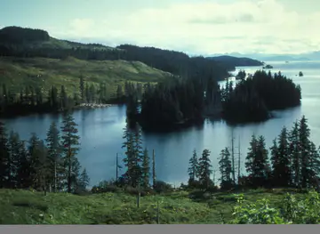
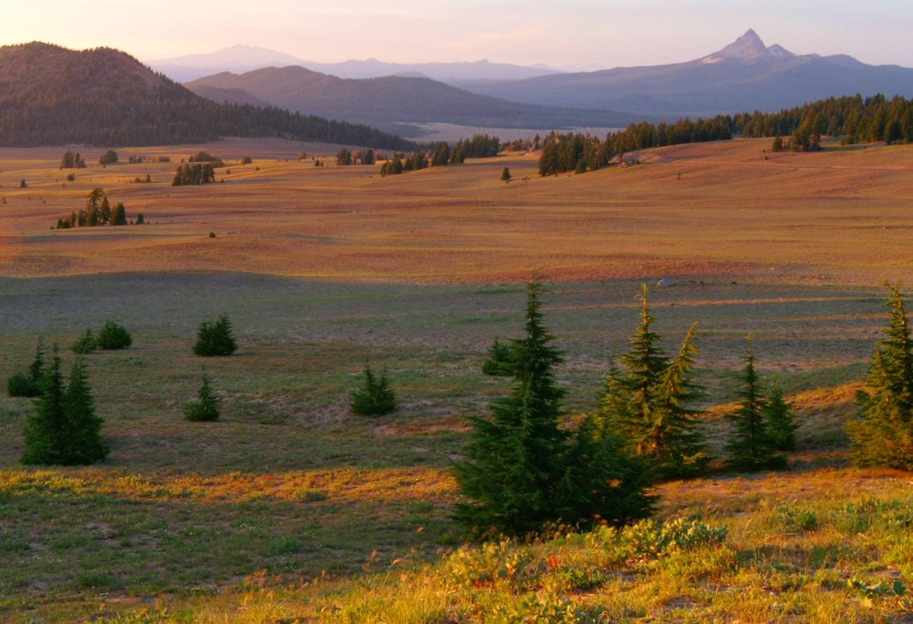 Eastern Oregon
Explore Eastern Oregon for fossil beds, mountain valleys, high-desert roads, historic towns, canyon country and wide-open landscapes shaped by geology and ranching.
-
-

-


Swipe for more regions
Explore more

Explore more of Oregon
Discover Oregon's diverse landscapes, vibrant cities, and rich culture. From stunning coastlines to lush forests, this Pacific Northwest gem offers endless adventures.
Explore Oregon