

Free Wallowa Mountains Travel Guide & Mobile App
Explore Wallowa Mountains with free travel guides. Discover regional history, expert tips, proposed trips, and audio guides on web or mobile app.


Explore Oregon’s Wallowa Mountains for alpine lakes, granite peaks, Nez Perce history, small-town arts and wilderness trails.
Read more about Wallowa Mountains
Getting to and around Wallowa Mountains
How to get there
Transportation
Destinations in Wallowa Mountains
Resorts, valleys and scenic spots worth a trip of their own.

Swipe for more destinations
Best attractions in Wallowa Mountains
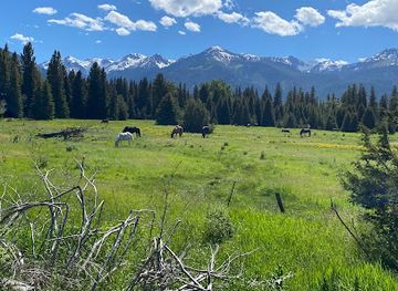
The Wallowa Mountains offer a strong contrast between accessible valley recreation and demanding alpine wilderness. Wallowa Lake State Park provides shoreline walking, boating, camping and mountain views at the southern end of the lake, while the Wallowa Lake Tramway climbs Mount Howard for a high-elevation panorama without requiring a full wilderness trek. Around Joseph and Enterprise, galleries, foundries, small museums and local cultural organisations reflect the area’s contemporary arts scene and ranching heritage. The Eagle Cap Wilderness is the region’s major outdoor attraction, with trails to Ice Lake, Mirror Lake, Lakes Basin, high passes and remote granite country; conditions and difficulty vary considerably. Lower-elevation roads and trails offer opportunities for wildlife watching, photography, cycling and scenic driving, while winter brings snowshoeing and cross-country possibilities in suitable areas. The Nez Perce National Historical Park’s Joseph site and nearby interpretive locations provide essential historical context, although visitors should remember that the park’s wider network extends beyond the Wallowa Mountains. Together, these attractions make the region particularly suited to travellers who want to combine landscape, cultural learning and small-town exploration rather than concentrate solely on a resort-style itinerary.
-
State park
Wallowa Lake State Park
Explore the stunning beauty and outdoor adventures at Wallowa Lake State Park in Oregon's breathtaking Wallowa Valley.
-
State park
Farewell Bend State Recreation Area
Explore Farewell Bend State Recreation Area, a natural gem in Oregon, offering stunning views, outdoor activities, and historical significance along the Snake River.
-
Tourist attraction
Joseph Branch Railriders
Experience the breathtaking beauty of Oregon with a pedal-powered adventure on the scenic Joseph Branch Railriders.
-
Museum
National Historic Oregon Trail Interpretive Center
Explore the rich heritage of the Oregon Trail at the National Historic Oregon Trail Interpretive Center, where history comes alive through engaging exhibits and scenic trails.



Best landmarks in Wallowa Mountains
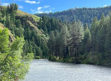
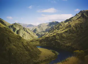
Wallowa Lake is the region’s most recognisable natural landmark, a long glacial lake framed by steep, forested slopes and the higher granite mass of the Wallowa Mountains. Mount Howard, reached from the Wallowa Lake Tramway or by trail, provides a distinctive elevated viewpoint over the lake and valley. Above the tree line, Sacajawea Peak is the range’s highest summit, while the serrated ridges and glacial basins of the Eagle Cap Wilderness define its best-known mountain profile. In the valley, Joseph’s historic town centre and bronze sculpture installations express the community’s unusual relationship with public art and local metalworking. The Joseph site of the Nez Perce National Historical Park is a smaller but important cultural landmark, linking the modern landscape to the history of the Nimiipuu and the forced removal of 1877. Wallowa Lake’s shoreline, the mountain passes and the broad agricultural valley together explain the region’s visual identity: a meeting of glaciated high country, working ranch land and communities shaped by difficult historical change.
-
State park
Wallowa Lake State Park
Discover the breathtaking beauty and outdoor adventures at Wallowa Lake State Park, a nature lover's paradise in Oregon's stunning Wallowa Valley.
-
Tourist attraction
Joseph Branch Railriders
Experience the breathtaking landscapes of Oregon with a unique pedal-powered adventure on the Joseph Branch Railriders.
-
Museum
National Historic Oregon Trail Interpretive Center
Explore the rich history of the Oregon Trail at the National Historic Oregon Trail Interpretive Center, where engaging exhibits meet breathtaking scenery.
-
Hotel
Wallowa Lake Lodge
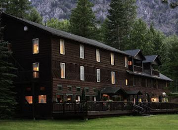
Discover the historic Wallowa Lake Lodge, a charming retreat nestled in Oregon's picturesque Wallowa Valley, surrounded by breathtaking natural beauty.

Explore Wallowa Mountains on the map
Plan your trip on one map. See where the top cities, national parks and sights are, and book hotels and experiences in a few clicks.
Best hotels in Wallowa Mountains
Best restaurants in Wallowa Mountains
Dining in the Wallowa Mountains is shaped by the scale of the communities and the surrounding ranching country. Joseph and Enterprise provide the widest choice, from cafés and bakeries to pubs, family restaurants and more contemporary kitchens, while rural stops tend to have limited and seasonal opening arrangements. Menus commonly draw on north-western ingredients such as beef, lamb, trout, berries, apples and locally grown vegetables, alongside the American comfort food found throughout eastern Oregon. Local breweries and craft beverages may appear with meals, and farmers’ markets or farm shops can be useful places to find produce, preserves and baked goods when in season. Food linked to the Nez Perce should not be presented as a restaurant theme unless it is specifically and respectfully interpreted; the region’s Indigenous history is better explored through cultural and historical institutions. Travellers heading to remote trailheads should buy provisions in the towns rather than expect mountain dining, and should check current service arrangements because the local food scene is small and some businesses operate seasonally.
-
Restaurant
Embers Brewhouse
Discover Embers Brewhouse in Joseph, Oregon - where local flavors meet exceptional hospitality amidst stunning mountain views.
-
Restaurant
Stubborn Mule Saloon & Steak
Experience delectable steaks and unique burgers in the heart of Joseph at Stubborn Mule Saloon & Steak - A culinary gem in Oregon.
-
Grill
Summit Grill
Experience mouthwatering grilled dishes amidst breathtaking views at Summit Grill in Joseph, Oregon.
-
Hamburger
Little Bear Drive-In
Discover Little Bear Drive-In in Wallowa: A charming spot serving mouthwatering burgers and classic fast food delights.


Best bars in Wallowa Mountains
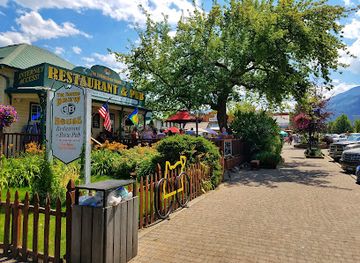
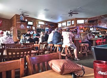
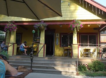
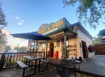
Evening life in the Wallowa Mountains is centred on the small-town communities rather than a large club scene. Joseph and Enterprise have pubs, taverns, restaurants and occasional live-music or community events, with conversation, local drinks and early dinners more characteristic than late-night dancing. Joseph’s galleries and cultural activity can give summer evenings an arts-oriented dimension, while Wallowa Lake accommodation and campgrounds create a quieter, outdoors-focused atmosphere after dark. Breweries and other licensed venues may offer locally produced drinks, but opening arrangements and entertainment change with the season. In the rural valleys, distances and dark roads make driving after drinking especially unwise, so plan a safe return or stay within walking distance. The region’s clear skies also make stargazing and quiet evenings outdoors a natural alternative to nightlife, subject to fire restrictions and private-land boundaries.
-
Brewpub
Terminal Gravity Brewery & Pub
Experience the best of craft brewing and local cuisine at Terminal Gravity Brewery & Pub in Enterprise, Oregon, surrounded by stunning mountain views.
-
Restaurant
Embers Brewhouse
Discover the flavors of Joseph, Oregon at Embers Brewhouse – where culinary excellence meets local charm in a beautiful setting.
-
Family-friendly
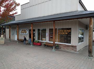
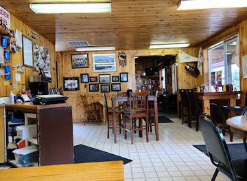
Cheyenne Cafe
Discover Cheyenne Cafe in Joseph, Oregon - a delightful family-friendly restaurant serving fresh, delicious meals in a cozy ambiance.
-
Hamburger
R&R Drive In
Discover the heart of Joseph, Oregon, at R&R Drive In, where mouthwatering burgers and a friendly atmosphere await your visit.
Best nightclubs in Wallowa Mountains
-
Lake
Wallowa Lake
Explore the stunning beauty of Wallowa Lake, a glacial gem in Oregon's Wallowa Mountains, perfect for outdoor adventures and serene relaxation.

Best shops in Wallowa Mountains
Shopping is concentrated in Joseph and Enterprise and is best approached as a search for local character rather than extensive retail variety. Joseph is particularly associated with galleries, bronze and metal sculpture, paintings, ceramics, jewellery and other work made by regional artists; its historic streets make browsing part of the experience. Enterprise provides practical shops and services as well as gifts, books, outdoor equipment and locally produced foods. Farmers’ markets and farm stands, when operating, may offer fruit, vegetables, honey, preserves, baked goods and other products from the valleys, while local breweries and food producers provide portable reminders of eastern Oregon. Outdoor shops are useful for last-minute equipment and provisions, but specialist backcountry supplies should be purchased before reaching the most remote roads. Visitors should distinguish genuinely local craft and produce from generic mountain souvenirs, and should respect any restrictions on collecting natural or archaeological objects from public land.
-
State park
Wallowa Lake State Park
Experience the breathtaking scenery and outdoor adventures at Wallowa Lake State Park, a premier destination for nature lovers in Oregon.
-
Chocolate shop
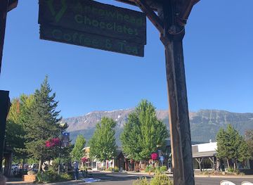
Arrowhead Chocolates
Discover the enchanting world of Arrowhead Chocolates in Joseph, Oregon, where handcrafted sweets meet cozy café vibes for a delightful treat.
-
Hiking area
Wallowa Lake Trailhead
Explore the breathtaking beauty of Wallowa Lake Trailhead in Oregon, a premier hiking destination surrounded by stunning mountains and serene lakes.
-
Grocery store
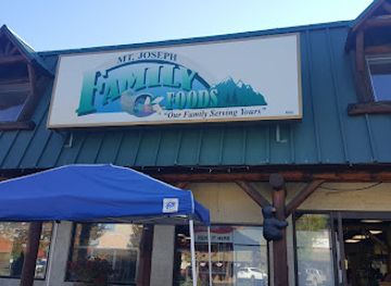
Market Place Fresh Foods
Explore the flavors of Joseph, Oregon at Market Place Fresh Foods, your destination for local produce and artisanal delights.


Get your free copy of our complete guide to Wallowa Mountains, delivered straight to you.
Everything on this page, from attractions and restaurants to essentials and local phrases, in one PDF you can read offline, print or share.
Already have an account? Sign in
Your Wallowa Mountains guide is ready.
We'll send it to · Not you? Sign out

Getting your guide ready…
We are putting together a fresh copy of the Wallowa Mountains guide. This can take up to a minute.
This can take a few moments. If your browser asks, choose Allow so the download can start. You'll find the guide in your Downloads folder.
Nothing happened? Download it again
Sorry, the guide is taking longer than usual. Please try again in a minute, or get it by email instead.
Wallowa Mountains essentials
Currency and Payment
Safety
Emergency Situations
Do's and Don'ts
Local Tips
From Eve
Local phrases worth knowing
You don't need to get them perfect. A few words go a long way, and locals appreciate the effort.
Basics
| English | Local | Say it |
|---|---|---|
| Hello | Howdy | [Hau-dee] |
| Goodbye | See ya later | [See ya lay-ter] |
| Yes | Yep | [Yep] |
| No | Nope | [Nope] |
| Please/You're welcome | Sure thing | [Shur thing] |
| Thank you | Thanks a lot | [Thangs a lot] |
| Excuse me/Sorry | Pardon me | [Par-don me] |
| How are you? | How's it going? | [How's it goin'?] |
| Fine. And you? | Good. You? | [Good. You?] |
| Do you speak English? | Can you talk English? | [Kan you talk English?] |
| I don't understand | I ain't following | [I ain't followin'] |
Eating & Drinking
| English | Local | Say it |
|---|---|---|
| I'd like to see the menu, please | Can I see the menu? | [Kan I see thuh menu?] |
| I don't eat meat | I ain't into meat | [I ain't into meat] |
| Cheers! | Cheers! | [Cheers!] |
| I would like to pay, please | Can I settle up? | [Kan I settle up?] |
Emergencies
| English | Local | Say it |
|---|---|---|
| Help! | Help! | [Help!] |
| Go away! | Leave me alone! | [Leev me alone!] |
| Call the Police! | Call the cops! | [Call thuh cops!] |
| Call a doctor! | Get a doctor! | [Get a doctor!] |
| I'm lost | I'm turned around | [I'm turned around] |
| I'm ill | I'm not feeling well | [I'm not feelin' well] |
Shopping
| English | Local | Say it |
|---|---|---|
| I'd like to buy... | I wanna buy... | [I wanna buy...] |
| I'm just looking | Just browsing | [Just browsin'] |
| How much is it? | What’s the price? | [What’s thuh price?] |
| That's too expensive | That's a bit pricey | [That's a bit pricy] |
| Can you lower the price? | Can you knock it down? | [Kan you knock it down?] |
Time & Numbers
| English | Local | Say it |
|---|---|---|
| What time is it? | What’s the time? | [What’s thuh time?] |
| It's one o'clock | It's one | [It's one] |
| Half past (10) | Half past ten | [Half past ten] |
| Morning | Mornin' | [Mornin'] |
| Afternoon | Afternoon | [Afternoon] |
| Evening | Evenin' | [Evenin'] |
| Yesterday | Yesterday | [Yesterday] |
| Today | Today | [Today] |
| Tomorrow | Tomorrow | [Tomorrow] |
| 1 | One | [One] |
| 2 | Two | [Two] |
| 3 | Three | [Three] |
| 4 | Four | [Four] |
| 5 | Five | [Five] |
| 6 | Six | [Six] |
| 7 | Seven | [Seven] |
| 8 | Eight | [Eight] |
| 9 | Nine | [Nine] |
| 10 | Ten | [Ten] |
Transport & Directions
| English | Local | Say it |
|---|---|---|
| Where's a/the...? | Where’s the...? | [Where’s thuh...?] |
| What's the address? | What’s the address? | [What’s thuh address?] |
| Can you show me (on the map)? | Can you point it out? | [Kan you point it out?] |
| When's the next (bus)? | When's the next bus? | [When's thuh next bus?] |
| A ticket (to ....) | A ticket to... | [A ticket to...] |
History of Wallowa Mountains
Geological formation and glacial landscapes
The Wallowa Mountains are built largely from uplifted granitic rock associated with the Wallowa batholith. Later mountain glaciers carved the deep U-shaped valleys, cirques and basins that define the range, including the valley occupied by Wallowa Lake. Glacial erosion also helped create the dramatic combination of steep walls, hanging valleys and alpine lakes visible along the region’s higher trails. This geological history remains central to the visitor experience: many of the range’s most prominent landmarks are not constructed monuments but granite ridges, polished rock, moraines and glacially shaped valleys.
Wallowa Valley as Nez Perce homeland
The Wallowa Valley and adjoining country formed part of the homeland of the Nez Perce, known in their own language as the Nimiipuu. Seasonal movement, fishing, hunting and gathering connected the mountain valleys with a much wider cultural landscape. The name Wallowa is commonly linked to a Nez Perce term, although its precise interpretation is debated. The landscape should therefore be understood not as an empty wilderness discovered by later visitors, but as country with long-standing Indigenous relationships, routes and meanings.
Treaty-making and the loss of ancestral land
In 1855, the United States negotiated a treaty with the Nez Perce that recognised a large reservation, but subsequent pressure for land and the discovery of gold led to further negotiations. The 1863 treaty greatly reduced the reservation and was not accepted by all Nez Perce bands, including those associated with the Wallowa Valley. Non-treaty families remained on their ancestral lands for a time, creating an increasingly tense situation as settlers, officials and Native communities contested land ownership and movement.
The Nez Perce War and the 1877 removal
In 1877, the United States Army ordered non-treaty Nez Perce to leave the Wallowa Valley for the reduced reservation. Violence followed, and the Nez Perce retreat covered roughly 1,170 miles towards the northern Plains before the group surrendered in present-day Montana. Chief Joseph, or Hin-mah-too-yah-lat-kekt, became the most widely known spokesman of the displaced people, though the campaign involved many leaders and families. The event remains a defining part of Wallowa Valley history and a reminder of the consequences of federal removal policy.
Settlement, ranching and the growth of local towns
After the forced removal of many Nez Perce families, Euro-American settlement expanded through the Wallowa Valley. Agriculture, cattle ranching, timber and small-scale commerce became major parts of the local economy. Joseph and Enterprise developed as service and trading centres for scattered farms and ranches, while roads and later motor travel connected the valleys with eastern Oregon’s wider network. The region’s present character still reflects this combination of working landscapes, small-town institutions and a strong dependence on seasonal visitors.
Forest management, recreation and wilderness protection
Much of the mountain range became part of the Wallowa-Whitman National Forest, bringing formal management of forests, grazing, roads and recreation. The Eagle Cap Wilderness was designated in 1940, protecting a large area from road construction and intensive development; it was later administered within the framework of the 1964 National Wilderness Act. Wilderness protection helped retain the range’s remote character while allowing carefully managed hiking and horse trails. Recreation now sits alongside ranching, forestry and conservation as one of the area’s important economic and cultural influences.
Modern cultural identity and heritage interpretation
In the late twentieth and early twenty-first centuries, Joseph became known for galleries, metalwork and public sculpture, adding an arts economy to the area’s older ranching base. At the same time, museums, interpretive sites and the Nez Perce National Historical Park have encouraged visitors to engage more thoughtfully with Indigenous history and the 1877 conflict. The result is a regional identity that joins mountain recreation with arts, agriculture and an ongoing effort to present the Wallowa Valley’s past with greater historical depth.
Wallowa Mountains in Photos
Browse through our photo collection highlighting the charm and character of the destination.
Neighbouring regions of Wallowa Mountains
The closest regions to Wallowa Mountains, if you have time for more than one.
-

-

-
-

-


Swipe for more regions
Explore more

Explore more of Oregon
Discover Oregon's diverse landscapes, vibrant cities, and rich culture. From stunning coastlines to lush forests, this Pacific Northwest gem offers endless adventures.
Explore Oregon