

Free Wallowa County Travel Guide & Mobile App
Explore Wallowa County with free travel guides. Discover regional history, expert tips, proposed trips, and audio guides on web or mobile app.


Wallowa County pairs Oregon’s alpine Wallowa Mountains with ranching valleys, Nez Perce heritage, Wallowa Lake and expansive canyon country.
Read more about Wallowa County
Getting to and around Wallowa County
How to get there
Transportation
Destinations in Wallowa County
Resorts, valleys and scenic spots worth a trip of their own.

Swipe for more destinations
Best attractions in Wallowa County
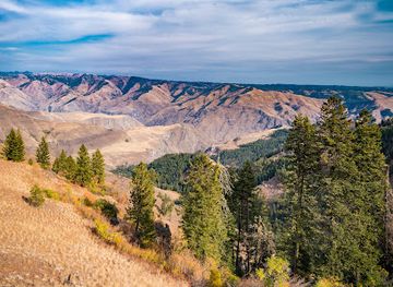
Wallowa County’s attractions are shaped by the meeting of high mountains, open ranching valleys and canyon country. Wallowa Lake and Wallowa Lake State Park provide the most accessible combination of scenery and recreation, with boating, fishing, camping and paths beside the glacial lake. The Wallowa Lake Tramway offers a route towards the high country and trail access near the Eagle Cap Wilderness, where hiking, backpacking, horseback riding and mountain scenery become the focus. Joseph contributes galleries, bronze foundries, public art and the Josephy Center for Arts and Culture, while Enterprise is a practical base for museums, local events and excursions through the valley. Roads towards Imnaha and the Snake River reveal more remote landscapes, with viewpoints and access to the broader Hells Canyon country. Historic town centres, ranching landscapes, wildlife habitat, winter recreation and dark-sky conditions add variety, although many experiences are seasonal and require advance preparation, reliable transport and awareness that facilities become scarce outside the principal communities.
-
State park
Wallowa Lake State Park
Experience the stunning beauty and outdoor adventures at Wallowa Lake State Park, a perfect destination for nature lovers in Oregon.
-
Brewpub
Terminal Gravity Brewery & Pub
Experience the best of local craft beer at Terminal Gravity Brewery & Pub in Enterprise, Oregon, where flavors meet community spirit.
-
Tourist attraction
Joseph Branch Railriders
Experience the stunning beauty of Oregon on the Joseph Branch Railriders, a picturesque ride through the Wallowa Valley's breathtaking landscapes.
-
Vista point
Hells Canyon Overlook
Experience the breathtaking views of Hells Canyon Overlook, a stunning vista point in Oregon that showcases nature's grandeur.


Best landmarks in Wallowa County
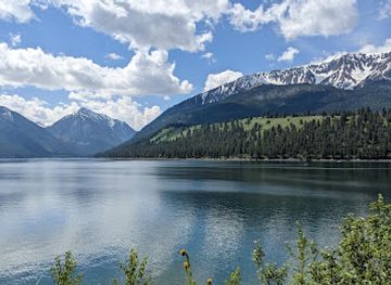
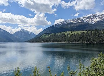
Wallowa Lake is the county’s most recognisable natural landmark, a long mountain-framed body of water whose steep walls reflect its glacial origins. Above it, the Wallowa Mountains form a distinctive alpine skyline and include the Eagle Cap Wilderness, a protected landscape of peaks, lakes, forests and high valleys. The Wallowa Lake Tramway provides an especially visible connection between the developed lakeshore and the mountain terrain. Joseph’s historic commercial streets, bronze sculptures and public art form a cultural landmark within the county, while the town’s name recalls the region’s association with Old Chief Joseph. Joseph Canyon, reached from the northern and eastern road network, is significant both as a dramatic canyon landscape and for its connection with Nimiipuu history. Enterprise’s historic civic and commercial buildings, the agricultural valley around Lostine and the open approaches towards Imnaha express different aspects of the county’s settlement pattern. Rather than a single monumental structure, Wallowa County’s identity is carried by the relationship between Indigenous heritage, working communities, mountain horizons and deeply cut river country.
-
State park
Wallowa Lake State Park
Discover the natural beauty and outdoor adventures waiting for you at Wallowa Lake State Park in Oregon's scenic Wallowa Valley.
-
Brewpub
Terminal Gravity Brewery & Pub
Discover the best of craft brewing at Terminal Gravity Brewery & Pub in Enterprise, Oregon, where exceptional beers and hearty meals await.
-
State park
Farewell Bend State Recreation Area
Explore the stunning landscapes and rich history of Farewell Bend State Recreation Area, a must-visit destination for nature lovers in Oregon.
-
 RV park
Grande Hot Springs RV Resort
Discover relaxation and adventure at Grande Hot Springs RV Resort in La Grande, Oregon – a perfect getaway for nature lovers and families.

Explore Wallowa County on the map
Plan your trip on one map. See where the top cities, national parks and sights are, and book hotels and experiences in a few clicks.
Best hotels in Wallowa County
Best restaurants in Wallowa County
Dining in Wallowa County reflects the region’s agricultural setting and small-town scale. Enterprise and Joseph have the broadest choice of cafés, restaurants, bakeries, pubs and casual places to eat, while Wallowa and Lostine provide additional local options. Menus may draw on beef, lamb, poultry, locally grown vegetables, orchard fruit and other products associated with north-eastern Oregon, alongside familiar American regional cooking. Around Wallowa Lake, seasonal businesses serve visitors during the main recreation period, but choices and opening arrangements can vary outside summer. Farmers’ markets and direct-from-producer sales are useful ways to encounter local produce when operating, while craft beer, cider and Oregon wine may appear alongside non-alcoholic drinks. The county is better approached as a place for relaxed café meals, hearty food after outdoor activities and community-oriented restaurants than as a concentrated fine-dining destination; booking ahead is sensible when accommodation and seasonal events bring extra demand.
-
Brewpub
Terminal Gravity Brewery & Pub
Experience the best of Oregon's craft beer culture at Terminal Gravity Brewery & Pub in Enterprise - where great brews meet delicious bites.
-
Restaurant
Embers Brewhouse
Discover Embers Brewhouse in Joseph, Oregon - where local flavors meet warm hospitality in a charming setting.
-
Tourist attraction
Joseph Branch Railriders
Experience breathtaking landscapes on unique rail bikes at Joseph Branch Railriders in Oregon's scenic Wallowa Valley.
-
Breakfast
Smokehouse Restaurant
Discover delicious breakfast delights at Smokehouse Restaurant in La Grande – where every bite feels like home.


Best bars in Wallowa County
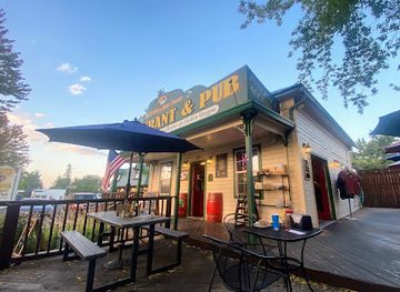
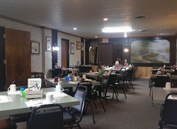
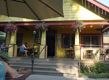
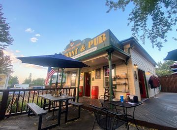
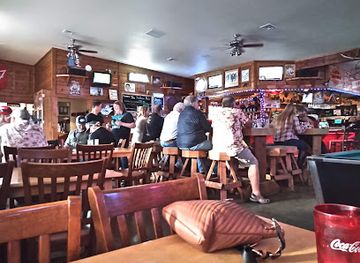
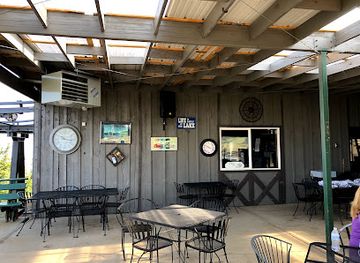
Evening life in Wallowa County is centred on traditional pubs, restaurants, cafés, community events and occasional live music rather than a large nightclub scene. Enterprise and Joseph offer the greatest concentration of places to eat and have a drink, with a quieter, conversational atmosphere than Oregon’s larger cities. Some establishments may showcase regional beer, cider or wine, but alcohol is not necessary to participate in local evening culture. In summer, Wallowa Lake adds seasonal activity, while winter evenings are generally subdued and shaped by the weather. Visitors should check current arrangements locally because small businesses can have changing schedules and limited late-night service. Outside the towns, dark skies and the quiet of the valleys are often the main attractions after sunset; plan transport in advance and never drive after drinking.
-
Brewpub
Terminal Gravity Brewery & Pub
Experience the best of Oregon craft brewing at Terminal Gravity Brewery & Pub, offering unique beers and delicious bites in a welcoming atmosphere.
-
Restaurant
Embers Brewhouse
Discover Embers Brewhouse in Joseph, Oregon, where delicious food meets local craft brews in a cozy and inviting atmosphere.
-
Restaurant
Stubborn Mule Saloon & Steak
Experience the vibrant culinary scene at Stubborn Mule Saloon & Steak in Joseph, Oregon, where local flavors meet lively atmosphere.
-
Grill
Summit Grill
Experience the essence of Oregon’s flavors at Summit Grill, where every meal is grilled to perfection amidst stunning mountain views.
Best nightclubs in Wallowa County
-
Lake
Wallowa Lake
Explore the stunning beauty of Wallowa Lake, a glacial gem in Oregon's Wallowa Mountains, perfect for outdoor adventures and serene relaxation.

Get your free copy of our complete guide to Wallowa County, delivered straight to you.
Everything on this page, from attractions and restaurants to essentials and local phrases, in one PDF you can read offline, print or share.
Already have an account? Sign in
Your Wallowa County guide is ready.
We'll send it to · Not you? Sign out

Getting your guide ready…
We are putting together a fresh copy of the Wallowa County guide. This can take up to a minute.
This can take a few moments. If your browser asks, choose Allow so the download can start. You'll find the guide in your Downloads folder.
Nothing happened? Download it again
Sorry, the guide is taking longer than usual. Please try again in a minute, or get it by email instead.
Wallowa County essentials
Currency and Payment
Safety
Emergency Situations
Do's and Don'ts
Local Tips
From Eve
Local phrases worth knowing
You don't need to get them perfect. A few words go a long way, and locals appreciate the effort.
Basics
| English | Local | Say it |
|---|---|---|
| Hello | Howdy | [haʊdi] |
| Goodbye | See ya | [si jə] |
| Yes | Yep | [jɛp] |
| No | Nope | [noʊp] |
| Please/You're welcome | Sure thing | [ʃʊr θɪŋ] |
| Thank you | Thanks a lot | [θæŋks ə lɑt] |
| Excuse me/Sorry | Pardon me | [ˈpɑrdən mi] |
| How are you? | How ya doin'? | [haʊ jə ˈduɪn] |
| Fine. And you? | Good, and you? | [gʊd, ənd ju] |
| Do you speak English? | Do ya speak English? | [du jə spiːk ˈɪŋɡlɪʃ] |
| I don't understand | I ain't got it | [aɪ eɪnt ɡɑt ɪt] |
Eating & Drinking
| English | Local | Say it |
|---|---|---|
| I'd like to see the menu, please | Can I see the menu? | [kæn aɪ si ðə ˈmɛnju] |
| I don't eat meat | I'm a vegetarian | [aɪm ə ˌvɛdʒəˈtɛriən] |
| Cheers! | Cheers! | [ʧɪrz] |
| I would like to pay, please | Can I get the check? | [kæn aɪ ɡɛt ðə ʧɛk] |
Emergencies
| English | Local | Say it |
|---|---|---|
| Help! | Help! | [hɛlp] |
| Go away! | Get lost! | [ɡɛt lɔst] |
| Call the Police! | Call the cops! | [kɔl ðə kɑps] |
| Call a doctor! | Get a doctor! | [ɡɛt ə ˈdɑktər] |
| I'm lost | I'm turned around | [aɪm tɜrnd əˈraʊnd] |
| I'm ill | I'm not feeling well | [aɪm nɑt ˈfiːlɪŋ wɛl] |
Shopping
| English | Local | Say it |
|---|---|---|
| I'd like to buy... | I want to buy... | [aɪ wɑnt tə baɪ] |
| I'm just looking | Just browsing | [dʒʌst ˈbraʊzɪŋ] |
| How much is it? | What’s the price? | [wʌts ðə praɪs] |
| That's too expensive | That's a bit steep | [ðæts ə bɪt stip] |
| Can you lower the price? | Can ya cut the price? | [kæn jə kʌt ðə praɪs] |
Time & Numbers
| English | Local | Say it |
|---|---|---|
| What time is it? | What’s the time? | [wʌts ðə taɪm] |
| It's one o'clock | It's one | [ɪts wʌn] |
| Half past (10) | Half past ten | [hæf pæst tɛn] |
| Morning | Morning | [ˈmɔrnɪŋ] |
| Afternoon | Afternoon | [ˌæftərˈnun] |
| Evening | Evening | [ˈivnɪŋ] |
| Yesterday | Yesterday | [ˈjɛstərdeɪ] |
| Today | Today | [təˈdeɪ] |
| Tomorrow | Tomorrow | [təˈmɔroʊ] |
| 1 | One | [wʌn] |
| 2 | Two | [tu] |
| 3 | Three | [θri] |
| 4 | Four | [fɔr] |
| 5 | Five | [faɪv] |
| 6 | Six | [sɪks] |
| 7 | Seven | [ˈsɛvən] |
| 8 | Eight | [eɪt] |
| 9 | Nine | [naɪn] |
| 10 | Ten | [tɛn] |
Transport & Directions
| English | Local | Say it |
|---|---|---|
| Where's a/the...? | Where’s the...? | [wɛrz ðə] |
| What's the address? | What’s the address? | [wʌts ði əˈdrɛs] |
| Can you show me (on the map)? | Can ya point it out? | [kæn jə pɔɪnt ɪt aʊt] |
| When's the next (bus)? | When’s the next bus? | [wɛnz ðə nɛkst bʌs] |
| A ticket (to ....) | One ticket to... | [wʌn ˈtɪkɪt tə] |
History of Wallowa County
Nimiipuu Homelands Before Settlement
Wallowa County lies within the traditional homeland of the Nimiipuu, commonly known as the Nez Perce. Their seasonal movements connected river corridors, valleys and mountain country, including places around Wallowa Lake and the Imnaha drainage. Fishing, hunting, gathering and social networks shaped a detailed knowledge of the landscape long before American settlement. Many place associations and cultural responsibilities remain important to the Nimiipuu today, so the county’s history cannot be understood solely through the later arrival of ranchers and towns.
Old Chief Joseph and the Wallowa Valley
Old Chief Joseph, a prominent Nimiipuu leader, is closely associated with the Wallowa Valley. In the nineteenth century, increasing settler pressure and competing interpretations of treaty boundaries threatened Nimiipuu use of their homeland. The name Joseph survives in the county, although the modern town and its commemorations represent only part of a much older Indigenous history. Sites around the valley and Joseph Canyon help visitors understand the continuing significance of land, memory and displacement.
The Nez Perce War and Forced Removal, 1877
In 1877, non-treaty Nimiipuu bands attempted to avoid removal to a reservation in Idaho and travelled west and north in a flight that became the Nez Perce War. The campaign passed through parts of the wider region and culminated in surrender in Montana after a long retreat. The forced removal severed communities from their Wallowa homeland and remains one of the most consequential events in the county’s history. Joseph Canyon and local interpretation connect visitors with this painful legacy.
Ranching, Farming and Permanent Settlement
After the era of frontier conflict, Euro-American settlement expanded through the county’s valleys. Ranching, grain growing, orchards and other forms of agriculture developed where water and workable soils allowed, while small communities such as Wallowa, Lostine, Enterprise and Joseph became local centres. Fences, barns, irrigation works, homesteads and broad grazing landscapes still reflect this transformation. The agricultural economy also established the dispersed settlement pattern that continues to shape travel and everyday life.
Mining, Timber and Mountain Economies
The Wallowa Mountains and adjacent uplands supported prospecting, mining and timber activity, though the county never became a heavily industrialised region. Forest resources, sawmills, livestock and seasonal work all contributed to local economies. Roads and trails that once served extraction and ranching later became important routes for recreation and forest access. The surviving landscape shows both the economic value placed on natural resources and the limits imposed by rugged terrain and distance.
Rail Connections and the Growth of Towns
Railway development helped link Wallowa County’s agricultural communities with markets beyond the mountains. The Wallowa Union Railroad, associated with the lower valley and the town of Elgin, carried passengers and freight and supported the movement of timber, livestock and farm products. Although rail service no longer defines local travel, former railway corridors, historic buildings and town layouts preserve evidence of the period when transportation infrastructure strengthened the county’s commercial network.
Conservation and the Rise of Outdoor Recreation
The designation and management of national forest, wilderness and recreation lands gradually added conservation to the county’s economic and cultural story. The Eagle Cap Wilderness protects a large portion of the high Wallowa Mountains, while Wallowa Lake State Park provides a more accessible recreational setting. Hiking, fishing, hunting, camping, boating and winter activities now attract visitors alongside farming and ranching. This modern landscape depends on balancing public access, ecological protection, private land and the needs of local communities.
Wallowa County in Photos
Browse through our photo collection highlighting the charm and character of the destination.
Neighbouring regions of Wallowa County
The closest regions to Wallowa County, if you have time for more than one.
-

-

-
-

-


Swipe for more regions
Explore more

Explore more of Oregon
Discover Oregon's diverse landscapes, vibrant cities, and rich culture. From stunning coastlines to lush forests, this Pacific Northwest gem offers endless adventures.
Explore Oregon