

Taal Volcano Travel Guide - Free Web & App
Your ultimate guide to Taal Volcano. Discover top landmarks, proposed trips, and local tips. Free on the web or via the Evendo companion app.


Taal Volcano in the Philippines offers Taal Lake views, volcanic landscapes and Tagaytay panoramas shaped by eruptions, geology and local heritage.
A Volcanic Landscape in Batangas
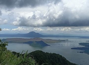
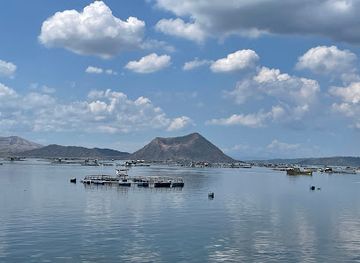
Taal Volcano lies in Batangas province on Luzon, within Taal Lake, a broad body of water occupying a much older volcanic caldera. The name describes a complex of volcanic features rather than a single simple cone: Volcano Island rises from the lake, while the active Main Crater sits within it. From high ground around Tagaytay, the volcano appears as a layered composition of water, green ridges, crater slopes and distant mountain horizons.Read more about Taal Volcano
Geology, Views and Local Character
Visiting Responsibly
When is the best time to visit Taal Volcano?
Best: December–February · 30°C| Month | High (°C) | Rainfall (mm) |
|---|---|---|
| January (best) | 30 | 25 |
| February (best) | 30 | 25 |
| March | 31 | 25 |
| April | 31 | 25 |
| May | 32 | 25 |
| June | 32 | 25 |
| July | 32 | 25 |
| August | 32 | 25 |
| September | 31 | 25 |
| October | 31 | 25 |
| November | 31 | 25 |
| December (best) | 30 | 25 |
Getting to and around Taal Volcano
How to get there
Transportation
Best attractions in Taal Volcano
-
Tourist attraction
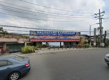
Sunflower Garden
Experience the breathtaking beauty of vibrant blooms at Sunflower Garden in Tagaytay, a must-visit tourist attraction for nature lovers and photographers.
Best landmarks in Taal Volcano
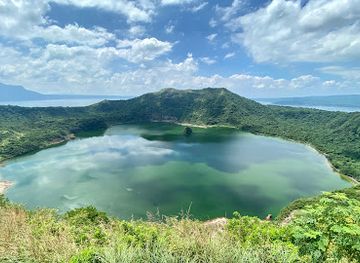
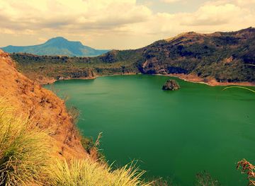
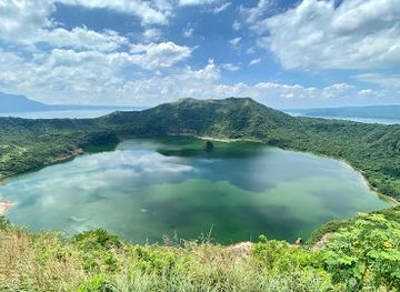
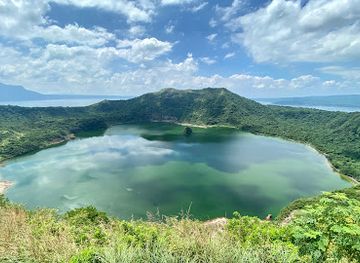
Taal Lake is the destination’s principal natural landmark, occupying a large volcanic caldera and encircling Volcano Island. Within the island, the Main Crater and its crater lake express the continuing activity of the Taal volcanic system, although access may be prohibited. Vulcan Point, historically noted for its unusual sequence of an island within a lake on an island within a lake, is part of the geography of Volcano Island but should not be treated as an automatically visitable viewpoint. The surrounding Tagaytay ridge is an important elevated landscape landmark, giving the classic outward view across the lake and volcanic island. Pansipit River, the lake’s outlet towards Balayan Bay, helps explain the wider hydrology of the basin. These features are geological and environmental landmarks first; nearby churches, town centres and heritage buildings belong to the surrounding Batangas communities rather than to the volcano itself.
-
Hiking area
Taal Volcano Trail
Experience the breathtaking views and unique geological features of Taal Volcano Trail in Batangas, an unforgettable hiking adventure for all nature lovers.
-
Lake
Taal Lake
Discover Taal Lake, a breathtaking natural wonder in the Philippines, known for its unique volcanic features and stunning landscapes, perfect for adventure and relaxation.
-
Island
Vulcan Point
Explore Vulcan Point, a stunning volcanic island in Taal Lake, offering breathtaking views, rich biodiversity, and peaceful hiking trails.
-
Volcano
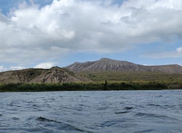
Binintiang Munti
Explore the breathtaking beauty of Binintiang Munti, a stunning volcano in San Nicolas, Batangas, perfect for adventure and nature enthusiasts.
Explore Taal Volcano on the map
Plan your trip on one map. See where the top attractions, landmarks, restaurants and hotels are, and book hotels and experiences in a few clicks.
Best hotels in Taal Volcano
Best restaurants in Taal Volcano
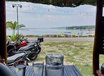
Dining associated with Taal Volcano is concentrated in Tagaytay and the surrounding Batangas towns rather than on Volcano Island itself. Tagaytay has the widest choice, from roadside cafés and family restaurants to establishments built around views of Taal Lake, while Talisay, Laurel and Tanauan offer more local eateries and everyday Filipino cooking. Batangas specialities commonly encountered in the wider region include bulalo, a beef-and-marrow soup, alongside grilled meats, rice dishes, freshwater fish and produce from the fertile uplands; menus vary by establishment and season. Coffee, fruit, pastries and locally produced farm goods are also part of the Tagaytay food scene. Lakeside dining should not be confused with facilities on the volcano, where services are limited and may be unavailable during restrictions. Carrying water and checking service arrangements is sensible when travelling beyond the main towns.
-
Fast Food
LUCIANO'S KITCHEN
Discover Luciano's Kitchen in Agoncillo - where fast food meets Filipino hospitality and flavor.
Best nightclubs in Taal Volcano
Evening entertainment around Taal Volcano is centred on Tagaytay rather than the volcanic island or rural lake shore. Tagaytay has a substantial hospitality scene, including restaurants, cafés and hotel bars where visitors can spend the evening overlooking the lake, although the atmosphere is generally dining-led rather than a concentrated nightclub culture. Talisay, Laurel and other lakeside communities are quieter, with local restaurants and modest drinking places serving residents and visitors rather than a large entertainment district. Some hotels and restaurants may offer music or evening programmes, but availability varies. After dark, rural roads around the lake can be poorly lit and transport options may be limited, so visitors staying outside Tagaytay should arrange their return journey in advance and avoid assuming that a scenic daytime location has an active nightlife scene.
-
Hiking area
Taal Volcano Trail
Explore the stunning Taal Volcano Trail, a breathtaking hiking destination with panoramic views and diverse ecosystems in the heart of Batangas.
Best shops in Taal Volcano
Shopping opportunities are concentrated in Tagaytay and the larger Batangas settlements surrounding Taal Lake, not on Volcano Island. Tagaytay is known for food-oriented retail, with farm shops, roadside stalls and small businesses selling local produce, fruit, coffee, pastries and regional delicacies, while established commercial areas provide everyday goods and souvenirs. Around Talisay, Laurel and Tanauan, visitors may find smaller shops and market stalls reflecting local life rather than a specialised volcanic craft industry. Batangas food products and locally made items can make more meaningful purchases than generic souvenirs, but stock varies between businesses. Shopping is limited in rural lakeside areas, and visitors travelling to viewpoints should not rely on finding supplies at the destination itself. Volcanic rocks and other natural material should not be collected from restricted or protected places.
-
Hiking area
Taal Volcano Trail
Explore the breathtaking Taal Volcano Trail, where stunning vistas meet vibrant local culture in the heart of Batangas.
-
Hiking area
Taal volcano
Discover Taal Volcano: A stunning hiking destination with breathtaking views and rich volcanic history in Batangas, Philippines.
-
Store
Gloria Medina's store
Explore the essence of Batangas at Gloria Medina's store, a haven for unique local crafts and warm hospitality.
-
 Grocery store
Taal
Discover Taal, a charming town in the Philippines celebrated for its rich culinary heritage, breathtaking landscapes, and historical significance.
Get your free copy of our complete guide to Taal Volcano, delivered straight to you.
Everything on this page, from attractions and restaurants to essentials and local phrases, in one PDF you can read offline, print or share.
Already have an account? Sign in
Your Taal Volcano guide is ready.
We'll send it to · Not you? Sign out

Getting your guide ready…
We are putting together a fresh copy of the Taal Volcano guide. This can take up to a minute.
This can take a few moments. If your browser asks, choose Allow so the download can start. You'll find the guide in your Downloads folder.
Nothing happened? Download it again
Sorry, the guide is taking longer than usual. Please try again in a minute, or get it by email instead.
Taal Volcano essentials
Currency and Payment
Safety
Emergency Situations
Do's and Don'ts
Local Tips
From Eve
Local phrases worth knowing
You don't need to get them perfect. A few words go a long way, and locals appreciate the effort.
Basics
| English | Local | Say it |
|---|---|---|
| Hello | Kamusta | [ka-mus-ta] |
| Goodbye | Paalam | [pa-a-lam] |
| Yes | Oo | [o-o] |
| No | Hindi | [hin-di] |
| Please/You're welcome | Mangyaring | [man-gya-ring] |
| Thank you | Salamat | [sa-la-mat] |
| Excuse me/Sorry | Paumanhin | [pa-u-man-hin] |
| How are you? | Kamusta ka? | [ka-mus-ta ka] |
| Fine. And you? | Mabuti. Ikaw? | [ma-bu-ti. i-kaw] |
| Do you speak English? | Nagsasalita ka ba ng Ingles? | [nag-sa-sa-li-ta ka ba ng ing-gles] |
| I don't understand | Hindi ko maintindihan | [hin-di ko main-tin-di-han] |
Eating & Drinking
| English | Local | Say it |
|---|---|---|
| I'd like to see the menu, please | Gusto ko sanang makita ang menu, pakiusap | [gus-to ko sa-nang ma-ki-ta ang me-nu, pa-ki-u-sap] |
| I don't eat meat | Hindi ako kumakain ng karne | [hin-di a-ko ku-ma-kain ng kar-ne] |
| Cheers! | Tagay! | [ta-gay] |
| I would like to pay, please | Gusto ko sanang magbayad, pakiusap | [gus-to ko sa-nang mag-ba-yad, pa-ki-u-sap] |
Emergencies
| English | Local | Say it |
|---|---|---|
| Help! | Tulong! | [tu-long] |
| Go away! | Lumayo ka! | [lu-ma-yo ka] |
| Call the Police! | Tawagin ang Pulis! | [ta-wa-gin ang pu-lis] |
| Call a doctor! | Tawagin ang doktor! | [ta-wa-gin ang dok-tor] |
| I'm lost | Nawawala ako | [na-wa-wa-la a-ko] |
| I'm ill | May sakit ako | [may sa-kit a-ko] |
Shopping
| English | Local | Say it |
|---|---|---|
| I'd like to buy... | Gusto ko sanang bumili ng... | [gus-to ko sa-nang bu-mi-li ng] |
| I'm just looking | Nagmamasid lang ako | [nag-ma-ma-sid lang a-ko] |
| How much is it? | Magkano ito? | [mag-ka-no i-to] |
| That's too expensive | Masyadong mahal iyan | [ma-sya-dong ma-hal i-yan] |
| Can you lower the price? | Pwede mo bang ibaba ang presyo? | [pu-we-de mo bang i-ba-ba ang pre-syo] |
Time & Numbers
| English | Local | Say it |
|---|---|---|
| What time is it? | Anong oras na? | [a-nong o-ras na] |
| It's one o'clock | Alas-una na | [a-las-u-na na] |
| Half past (10) | Alas-dyes y medya | [a-las-dyes y med-ya] |
| Morning | Umaga | [u-ma-ga] |
| Afternoon | Hapon | [ha-pon] |
| Evening | Gabi | [ga-bi] |
| Yesterday | Kahapon | [ka-ha-pon] |
| Today | Ngayon | [nga-yon] |
| Tomorrow | Bukas | [bu-kas] |
| 1 | Isa | [i-sa] |
| 2 | Dalawa | [da-la-wa] |
| 3 | Tatlo | [tat-lo] |
| 4 | Apat | [a-pat] |
| 5 | Lima | [li-ma] |
| 6 | Anim | [a-nim] |
| 7 | Pito | [pi-to] |
| 8 | Walo | [wa-lo] |
| 9 | Siyam | [si-yam] |
| 10 | Sampu | [sam-pu] |
Transport & Directions
| English | Local | Say it |
|---|---|---|
| Where's a/the...? | Nasaan ang...? | [na-sa-an ang] |
| What's the address? | Ano ang address? | [a-no ang ad-dres] |
| Can you show me (on the map)? | Pwede mo ba akong ipakita (sa mapa)? | [pu-we-de mo ba a-kong i-pa-ki-ta sa ma-pa] |
| When's the next (bus)? | Kailan ang susunod na (bus)? | [kai-lan ang su-su-nod na bus] |
| A ticket (to ....) | Isang tiket (papuntang ....) | [i-sang ti-ket pa-pun-tang] |
History of Taal Volcano
A Caldera Formed by Eruptions
Taal’s present landscape developed through major explosive eruptions that created a large caldera now occupied by Taal Lake. Later volcanic activity built Volcano Island and its smaller cones and craters inside the lake. This geological history explains the destination’s unusual arrangement of a volcano within a lake and helps account for its continuing activity. The lake basin is not simply a scenic body of water: it is the surface expression of a complex volcanic system whose vents and geothermal features remain active.
Early Settlement Around the Lake
Communities developed around the fertile shores and lowlands of Taal Lake, relying on agriculture, fishing and water-based movement. The wider Batangas area became associated with Tagalog-speaking communities whose cultural traditions remain visible in local food, religious life and town heritage. Settlement patterns have always been influenced by the volcano and the lake, with people drawing benefits from fertile land while facing the disruption caused by eruptions, ashfall and changing access conditions.
The Eruption of 1911
The January 1911 eruption was one of Taal’s most destructive historical events. Explosive activity from the Main Crater produced ash and other volcanic hazards that affected communities around the lake and caused extensive loss of life. The disaster demonstrated that the apparently tranquil landscape could change rapidly and encouraged closer scientific attention to Taal. Reports from the period also helped establish the volcano’s importance in the developing study of volcanic hazards in the Philippines.
Eruptions in the Twentieth Century
Taal remained intermittently active after 1911, with significant eruptive episodes including the 1965 eruption and later activity in the 1970s. These events repeatedly reshaped the Main Crater and prompted evacuations and restrictions around Volcano Island. The history of twentieth-century Taal is therefore one of recurring adjustment: communities returned to homes and livelihoods around the lake, while government and scientists refined systems for observation, hazard mapping and public warning.
The 2020 Eruption and Continuing Monitoring
In January 2020, Taal entered a major eruptive phase that sent ash high above the volcano, disrupted communities across Batangas and nearby provinces, and led to large-scale evacuations. Subsequent unrest, including episodes of volcanic smog and elevated activity, kept access restrictions under review. PHIVOLCS monitoring and local disaster-management measures are now central to visiting the area. Taal’s modern history is consequently inseparable from hazard communication, exclusion zones and the need to balance tourism with public safety.
Taal Volcano in Photos
Browse through our photo collection highlighting the charm and character of the destination.
Neighbouring destination travel guides
The closest destinations to Taal Volcano, if you have time for more than one.
-

-

-

-

-


Swipe for more destinations
Explore more

Explore more of Calabarzon
Explore Calabarzon’s volcanoes, heritage towns, diving coast, mountain scenery, regional food and historic sites south and east of Manila.
Explore Calabarzon
Explore more of Philippines
Discover the Philippines: A tropical paradise of islands, rich history, and warm hospitality, perfect for adventurers and relaxation seekers alike.
Explore Philippines