

Free Route 62 Travel Guide & Mobile App
Explore Route 62 with free travel guides. Discover regional history, expert tips, proposed trips, and audio guides on web or mobile app.


Travel Route 62 through South Africa’s Western and Eastern Cape for mountain passes, Karoo towns, vineyards, farm stalls and open-road scenery.
Read more about Route 62
When is the best time to visit Route 62?
Best: March, November–December · 24–26°C| Month | High (°C) | Rainfall (mm) |
|---|---|---|
| January | 27 | 15 |
| February | 27 | 15 |
| March (best) | 25 | 20 |
| April | 22 | 25 |
| May | 19 | 30 |
| June | 16 | 35 |
| July | 15 | 35 |
| August | 17 | 30 |
| September | 18 | 25 |
| October | 22 | 20 |
| November (best) | 24 | 15 |
| December (best) | 26 | 15 |
Getting to and around Route 62
How to get there
Transportation
Top city travel guides in Route 62
The cities of Route 62, and the easiest places to base yourself.
-

-


Swipe for more cities
Destinations in Route 62
Resorts, valleys and scenic spots worth a trip of their own.
-

-

-

-

-

-


Swipe for more destinations
Best attractions in Route 62
Route 62’s attractions are dispersed along a long scenic corridor, so the journey itself is part of the experience. Historic Montagu combines preserved Cape architecture, hot springs and access to rugged mountain landscapes, while Barrydale offers mission history, galleries, farm stalls and a distinctive Little Karoo setting. Ladismith and Calitzdorp provide quieter small-town stops, with vineyards, orchards and dry mountain country shaping the surrounding scenery. Near Oudtshoorn, the Cango Caves are the best-known natural attraction, presenting large limestone chambers beneath the Swartberg. The town also provides access to museums, ostrich-farming heritage and rural activities. East of the Little Karoo, the Langkloof brings a greener, more agricultural landscape of fruit farms and mountain views. Depending on the season and location, visitors can hike, cycle, observe birds, explore geological formations, taste wine or fortified wine, and browse farm stalls selling preserves, dried fruit and Karoo produce. Attractions are generally intimate and landscape-led rather than concentrated in large visitor complexes, making advance route planning important.
-
Market
Root44 Market
Experience the best of local flavors, crafts, and culture at Root44 Market in Stellenbosch, a vibrant hub for foodies and art lovers alike.
-
Tourist attraction
Cango Caves
Uncover the enchanting beauty of the Cango Caves in Oudtshoorn, South Africa, where natural wonder meets rich heritage.
-
Zoo
Cango Wildlife Ranch
Explore the Cango Wildlife Ranch in Oudtshoorn, South Africa, where adventure meets conservation in a captivating wildlife experience.
-
Monument
Rhodes Memorial
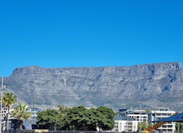
Explore Rhodes Memorial in Cape Town: a historic monument offering stunning views and hiking trails at the foot of Devil's Peak.



Best landmarks in Route 62
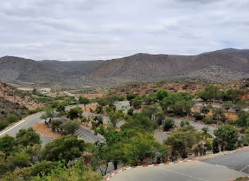
The defining landmarks of Route 62 are closely tied to its geology, historic transport routes and carefully preserved settlements. The Tradouw Pass is a major visual feature, cutting through the Langeberg between the western Cape districts and the Little Karoo. Montagu’s historic streets and Cape Dutch, Georgian and Victorian buildings reflect its development as a nineteenth-century settlement near springs and mountain routes. In Barrydale, the Rynse Kerk complex is an important reminder of mission history and the town’s religious institutions. Calitzdorp’s churches and early town buildings convey the architectural character of a wine-producing Karoo community, while Oudtshoorn’s large historic houses recall the prosperity generated by the ostrich-feather era. The Cango Caves, formed in the limestone of the Swartberg, are the corridor’s most renowned natural landmark. Farther east, the long mountain walls and cultivated valley of the Langkloof provide a different geographical signature, showing how Route 62 moves from dry interior plains towards a more productive mountain valley.
-
Shopping mall
V&A Waterfront
Visit the vibrant V&A Waterfront in Cape Town for a perfect blend of shopping, dining, and cultural experiences against stunning ocean views.
-
Tourist attraction
Cango Caves
Discover the awe-inspiring Cango Caves, a world-renowned natural wonder in South Africa, rich in history and breathtaking geological formations.
-
Zoo
Cango Wildlife Ranch
Explore the wonders of wildlife at Cango Wildlife Ranch, a premier zoo and conservation center in Oudtshoorn, South Africa, dedicated to endangered species and education.
-
Beach
uMhlanga Main Beach
Experience the idyllic beauty of uMhlanga Main Beach, where golden sands meet azure waters, offering a perfect blend of relaxation and adventure.


Explore Route 62 on the map
Plan your trip on one map. See where the top cities, national parks and sights are, and book hotels and experiences in a few clicks.
Best hotels in Route 62
Best restaurants in Route 62
Dining along Route 62 reflects the Cape interior’s farming traditions, dry climate and small-town scale. Farm stalls and country cafés are useful places to find preserves, dried fruit, fresh bread, locally grown produce and light meals, while rural inns and guesthouses often serve straightforward regional cooking with seasonal ingredients. In the Little Karoo, expect mutton, lamb, ostrich and game-related dishes to appear in some menus, although availability varies and visitors should ask how produce is sourced. Oudtshoorn has the broadest choice of restaurants, including establishments catering to visitors exploring the Cango and ostrich-farming areas. Montagu, Barrydale, Ladismith and Calitzdorp offer smaller selections ranging from cafés and bakeries to restaurants associated with wine farms or guest accommodation. Calitzdorp is particularly known for fortified wine, while vineyards and fruit-growing districts contribute wine, brandy and preserves to the regional table. Opening days can be limited in rural towns, so confirm meal arrangements when booking accommodation.
-
Family-friendly
Salinas Beach Restaurant
Experience delightful seafood and breathtaking ocean views at Salinas Beach Restaurant in Wilderness - perfect for families and beach lovers.
-
Restaurant
Diesel & Crème and The Karoo Moon Motel
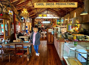
Discover the culinary delights at Diesel & Crème on Route 62, where gourmet meals meet quirky charm in the heart of the Karoo.
-
Restaurant
Pigalle Restaurant
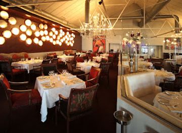
Experience exquisite seafood and fine dining at Pigalle Restaurant in Cape Town's vibrant Green Point area.
-
Restaurant
Nostalgie Restaurant
Discover Oudtshoorn's Nostalgie Restaurant - where authentic South African flavors meet warm hospitality in a charming setting.


Best bars in Route 62
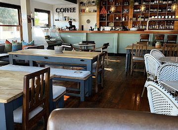
Nightlife on Route 62 is generally low-key and centred on country pubs, hotel bars, farm restaurants, wine-tasting rooms and informal social spaces rather than large clubs. Montagu, Barrydale and Oudtshoorn have the widest selection of places for an evening drink or meal, while smaller settlements often become quiet after dinner. Local wine, brandy and fortified wine are prominent in parts of the corridor, and some establishments offer tastings or relaxed live-music evenings, but programmes and opening arrangements change. Rural accommodation may be far from the nearest bar, making it sensible to arrange transport and avoid driving after drinking. The appeal of the evening lies largely in conversation, regional food and clear Karoo skies rather than a late-night entertainment circuit.
-
Restaurant
Foresters Arms
Experience the vibrant atmosphere and delicious cuisine at Foresters Arms, the heart of Newlands' dining scene in Cape Town.
-
Bar
Oblivion Bar & Kitchen
Discover Oblivion Bar & Kitchen, where vibrant nightlife meets delectable dining in the heart of Claremont, Cape Town.
-
Bar
Big Barrel Pub and Stables Restaurant
Discover the perfect blend of rustic charm and modern comfort at Big Barrel Pub and Stables Restaurant in Cape Town.
-
Bar
The Striped Horse - Bar, Grill & Music
Experience vibrant nightlife and delicious grill cuisine at The Striped Horse, Muizenberg's top bar and music venue.



Best nightclubs in Route 62
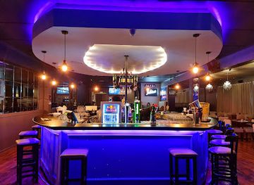
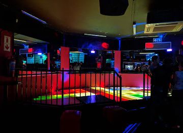
Nightlife on Route 62 is generally low-key and centred on country pubs, hotel bars, farm restaurants, wine-tasting rooms and informal social spaces rather than large clubs. Montagu, Barrydale and Oudtshoorn have the widest selection of places for an evening drink or meal, while smaller settlements often become quiet after dinner. Local wine, brandy and fortified wine are prominent in parts of the corridor, and some establishments offer tastings or relaxed live-music evenings, but programmes and opening arrangements change. Rural accommodation may be far from the nearest bar, making it sensible to arrange transport and avoid driving after drinking. The appeal of the evening lies largely in conversation, regional food and clear Karoo skies rather than a late-night entertainment circuit.
-
Night club
Havana Nights
Discover the vibrant nightlife of Cape Town at Havana Nights, where cocktails, live music, and dancing create an unforgettable experience.
-
Disco club
Galaxy Disco Restaurant
Galaxy Disco Restaurant in Cape Town: Where Dance Meets Culinary Delight in a Vibrant Nightlife Experience.
-
Night club
That 80s Club
Experience the ultimate 80s nostalgia at That 80s Club, where the music, dance, and fun come alive in Cape Town's vibrant nightlife.
-
Disco club
Club 169
Experience the vibrant nightlife of Cape Town at Club 169, a premier disco club and restaurant with electrifying music and a delectable menu.

Best shops in Route 62
Shopping on Route 62 is small-scale and strongly connected to local production. Farm stalls are the most characteristic stops, selling preserves, dried fruit, nuts, fresh produce, rusks, baked goods, wine and other items suited to a road journey. Montagu, Barrydale, Ladismith, Calitzdorp and Oudtshoorn have independent shops, galleries and craft outlets where visitors may find ceramics, textiles, leatherwork, artwork, books and locally made food products. Oudtshoorn offers the broadest retail choice, including goods linked to its ostrich-farming heritage, although quality and provenance vary between sellers. Wine farms and cellar outlets may sell bottles from the surrounding districts, while small-town markets and seasonal events provide opportunities to meet local producers. Carry fragile purchases carefully, check customs rules before exporting food or animal products, and remember that rural businesses may close earlier or accept cash when connectivity is poor.
-
Shopping mall
Lowveld Mall
Experience a unique shopping adventure at Lowveld Mall, Hazyview's vibrant hub for retail therapy and dining delights.
-
Bar
Ronnies Sex Shop
Experience the quirky charm of Ronnies Sex Shop, a unique bar on Route 62 where laughter meets local culture amidst stunning landscapes.
-
Shopping mall
Meadowridge Shopping Centre
Experience shopping, dining, and local culture at Meadowridge Shopping Centre, the perfect stop for tourists in Cape Town.
-
Restaurant
Kloof Farm Stall
Explore Kloof Farm Stall in Montagu for a unique blend of local cuisine and artisanal gifts, perfect for every traveler.


Get your free copy of our complete guide to Route 62, delivered straight to you.
Everything on this page, from attractions and restaurants to essentials and local phrases, in one PDF you can read offline, print or share.
Already have an account? Sign in
Your Route 62 guide is ready.
We'll send it to · Not you? Sign out

Getting your guide ready…
We are putting together a fresh copy of the Route 62 guide. This can take up to a minute.
This can take a few moments. If your browser asks, choose Allow so the download can start. You'll find the guide in your Downloads folder.
Nothing happened? Download it again
Sorry, the guide is taking longer than usual. Please try again in a minute, or get it by email instead.
Route 62 essentials
Currency and Payment
Safety
Emergency Situations
Do's and Don'ts
Local Tips
From Eve
Local phrases worth knowing
You don't need to get them perfect. A few words go a long way, and locals appreciate the effort.
Basics
| English | Local | Say it |
|---|---|---|
| Hello | Howdy | [/ˈhaʊ.di/] |
| Goodbye | See ya | [/si jə/] |
| Yes | Yup | [/jʌp/] |
| No | Nah | [/nɑː/] |
| Please/You're welcome | Sure thing | [/ʃʊr θɪŋ/] |
| Thank you | Thanks a lot | [/θæŋks ə lɒt/] |
| Excuse me/Sorry | Pardon me | [/ˈpɑːr.dən mi/] |
| How are you? | How's it going? | [/haʊz ɪt ˈɡoʊ.ɪŋ/] |
| Fine. And you? | Good. And you? | [/ɡʊd ənd ju/] |
| Do you speak English? | Do ya speak English? | [/du jə spiːk ˈɪŋ.ɡlɪʃ/] |
| I don't understand | I ain't got it | [/aɪ eɪnt ɡɒt ɪt/] |
Eating & Drinking
| English | Local | Say it |
|---|---|---|
| I'd like to see the menu, please | Can I see the menu, please? | [/kæn aɪ si ðə ˈmɛnjuː pliz/] |
| I don't eat meat | I'm a veggie | [/aɪm ə ˈvɛdʒ.i/] |
| Cheers! | Cheers! | [/tʃɪrz/] |
| I would like to pay, please | Can I get the check, please? | [/kæn aɪ ɡɛt ðə tʃɛk pliz/] |
Emergencies
| English | Local | Say it |
|---|---|---|
| Help! | Help! | [/hɛlp/] |
| Go away! | Get lost! | [/ɡɛt lɔst/] |
| Call the Police! | Call the cops! | [/kɔl ðə kɑps/] |
| Call a doctor! | Get a doctor! | [/ɡɛt ə ˈdɒk.tər/] |
| I'm lost | I'm turned around | [/aɪm tɜrnd əˈraʊnd/] |
| I'm ill | I'm feeling sick | [/aɪm ˈfiː.lɪŋ sɪk/] |
Shopping
| English | Local | Say it |
|---|---|---|
| I'd like to buy... | I wanna buy... | [/aɪ ˈwɑː.nə baɪ/] |
| I'm just looking | Just browsing | [/dʒʌst ˈbraʊ.zɪŋ/] |
| How much is it? | What's the damage? | [/wɒts ðə ˈdæm.ɪdʒ/] |
| That's too expensive | That's a bit pricey | [/ðæts ə bɪt ˈpraɪ.si/] |
| Can you lower the price? | Can ya cut me a deal? | [/kæn jə kʌt mi ə diːl/] |
Time & Numbers
| English | Local | Say it |
|---|---|---|
| What time is it? | What time ya got? | [/wɒt taɪm jə ɡɒt/] |
| It's one o'clock | It's one o'clock | [/ɪts wʌn əˈklɒk/] |
| Half past (10) | Half past ten | [/hɑːf pɑːst tɛn/] |
| Morning | Mornin' | [/ˈmɔːrn.ɪn/] |
| Afternoon | Afternoon | [/ˌɑːf.tərˈnuːn/] |
| Evening | Evenin' | [/ˈiːv.nɪŋ/] |
| Yesterday | Yesterday | [/ˈjɛs.tər.deɪ/] |
| Today | Today | [/təˈdeɪ/] |
| Tomorrow | Tomorrow | [/təˈmɔːr.oʊ/] |
| 1 | One | [/wʌn/] |
| 2 | Two | [/tuː/] |
| 3 | Three | [/θriː/] |
| 4 | Four | [/fɔːr/] |
| 5 | Five | [/faɪv/] |
| 6 | Six | [/sɪks/] |
| 7 | Seven | [/ˈsɛv.ən/] |
| 8 | Eight | [/eɪt/] |
| 9 | Nine | [/naɪn/] |
| 10 | Ten | [/tɛn/] |
Transport & Directions
| English | Local | Say it |
|---|---|---|
| Where's a/the...? | Where's the...? | [/wɛrz ðə.../] |
| What's the address? | What's the address? | [/wɑts ði ˈæd.res/] |
| Can you show me (on the map)? | Can ya point it out? | [/kæn jə pɔɪnt ɪt aʊt/] |
| When's the next (bus)? | When's the next bus? | [/wɛnəz ðə nɛkst bʌs/] |
| A ticket (to ....) | A ticket to... | [/ə ˈtɪk.ɪt tə/] |
History of Route 62
San Heritage and Early Karoo Settlement
The mountains, valleys and open plains crossed by Route 62 were inhabited and used by San communities long before colonial expansion. Rock art, stone artefacts and archaeological sites across the Cape interior record hunting, gathering, symbolic practice and changing patterns of movement. Visitors should treat rock-art locations with care, as many are fragile and culturally significant. Much of the surviving evidence is found in sheltered mountain areas, where natural rock formations also influenced later travel routes and settlement.
Colonial Expansion into the Interior
From the eighteenth century, Dutch and later British colonial authorities extended settler farming beyond the more closely settled Cape districts. Trekboer pastoralists moved through the interior with livestock, bringing conflict, trade and new political boundaries into regions already occupied by Indigenous communities. Springs, river valleys and passes became important points on routes between the coast and inland farms. The small towns associated with Route 62 developed gradually from these agricultural, administrative and transport networks.
Mission Communities and Religious Institutions
Christian mission activity played an important role in the social history of the Cape interior. Barrydale grew around the historic Rynse Kerk mission complex, while other towns along the corridor developed churches, schools and congregations that served farming districts. These institutions were not simply architectural landmarks: they shaped education, landholding, labour and community life under colonial and later segregationist systems. Their histories should be read alongside the experiences of Indigenous and Coloured communities whose work sustained the region’s farms and settlements.
Passes, Wagon Routes and Railway Connections
Before modern highways, mountain passes and wagon roads connected the Cape coast with inland markets. Tradouw Pass, linking the region around Barrydale and Swellendam, became an important route through the Langeberg, while other passes carried people and goods across the Little Karoo. Nineteenth- and early twentieth-century railway construction strengthened towns such as Oudtshoorn by improving access to agricultural markets. Although several railway services have declined or ceased, the route’s geography still reflects these earlier transport corridors.
Agriculture, Ostrich Farming and Karoo Trade
The economy of the Route 62 corridor has long depended on adapting agriculture to markedly different environments. Vineyards and fruit thrive where irrigation and suitable soils permit, while sheep, goats and hardy dryland crops suit the Little Karoo. Oudtshoorn became internationally associated with ostrich feathers during the late nineteenth and early twentieth centuries, creating substantial wealth and distinctive farm architecture before the boom declined. Wine, fortified wine, brandy, deciduous fruit and livestock remain important parts of the region’s economic identity.
Apartheid, Forced Removals and Contemporary Change
The towns and farming districts of Route 62 were profoundly shaped by apartheid legislation, racial segregation and forced removals. Access to land, employment, housing and education was organised through discriminatory systems whose effects remain visible in settlement patterns and economic inequality. Since 1994, the corridor has increasingly combined agriculture with tourism, conservation, craft production and small-scale hospitality. Contemporary travel is therefore best approached with an awareness that its picturesque landscapes contain complex histories of labour, dispossession and community resilience.
Route 62 in Photos
Browse through our photo collection highlighting the charm and character of the destination.
Neighbouring regions of Route 62
The closest regions to Route 62, if you have time for more than one.
-

-
-

-

-


Swipe for more regions
Explore more

Explore more of South Africa
Discover South Africa: A land of breathtaking landscapes, rich history, and diverse cultures, from bustling cities to world-renowned wildlife reserves.
Explore South Africa