From Eve
Know before you go
Hi, I'm Eve. Here are a few practical things to know before exploring Gombaniya ගොම්බානිය (1906m).
Local know-how to help you travel smarter and make the most of every moment.

Explore Gombaniya in Matale: A breathtaking hiking destination with stunning views and rich biodiversity, perfect for nature lovers and adventure seekers.
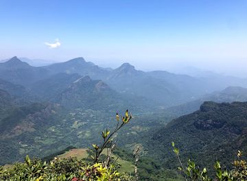
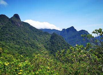
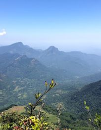
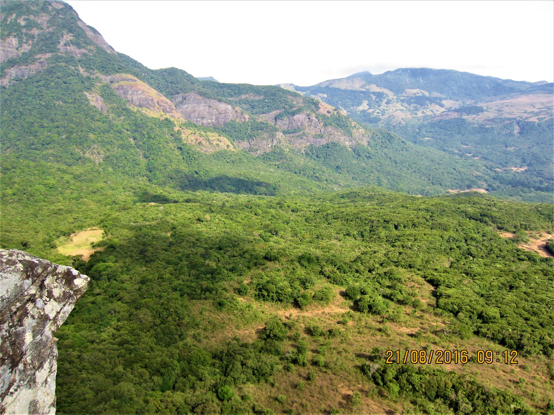
Nestled in the breathtaking Knuckles Range of Sri Lanka, Gombaniya is a hiker's paradise, offering stunning panoramic views and a rich tapestry of biodiversity. At 1906 meters, it is one of the highest peaks in the area, inviting adventurers to explore its lush landscapes and unique ecosystems. Whether you're an experienced trekker or a casual walker, Gombaniya provides an unforgettable experience amid nature's splendor.
Opening times, essentials, and a few local tips gathered into one calmer, easier-to-scan planning section.
Hi, I'm Eve. Here are a few practical things to know before exploring Gombaniya ගොම්බානිය (1906m).
Local know-how to help you travel smarter and make the most of every moment.
Car
If you are traveling by car, start your journey from Kandy. Take the A26 road towards Matale. Once you reach Matale, follow the signs to the Knuckles Mountain Range. The last part of the journey involves taking the Hunnasgiriya road. After approximately 15 km on Hunnasgiriya road, look for the FQ42+23F coordinates on your GPS. You may need to park your car at a designated area and prepare for the hike to Gombaniya.
Public Transportation
For those using public transportation, take a bus from Kandy to Matale. Buses are frequent and the cost is usually around LKR 50-100. Once in Matale, you can hire a tuk-tuk to take you to the Hunnasgiriya road area, which should cost approximately LKR 300-500. Instruct the driver to drop you off near the coordinates FQ42+23F. From there, you will need to hike to reach Gombaniya.
Hiking
Once you have parked your car or arrived by tuk-tuk, prepare for the hike to Gombaniya. The trail begins near the coordinates FQ42+23F. Ensure you have proper hiking gear, water, and snacks. The hike is steep and can take approximately 1.5 to 2 hours, depending on your fitness level. Follow marked trails and enjoy the stunning views as you ascend towards the peak at 1906 meters.
Use Gombaniya ගොම්බානිය (1906m) as your starting point for nearby food, family ideas, nightlife, and more local discoveries.

Explore expert travel guides, compare and book tours, experiences, hotels, and more—all from the palm of your hand. Download now for seamless trip planning wherever your wanderlust takes you.
Explore the Knuckles Mountain Range in Sri Lanka: A UNESCO World Heritage site teeming with biodiversity, hiking trails, and rich cultural heritage.
Tell me more about Knuckles Mountain Range