

Jämtlandstriangeln Travel Guide
Free Guide: A classic 3-day hut-to-hut mountain loop through birch forests and open fell, with dramatic views of the Sylarna peaks and reliable mountain stations.


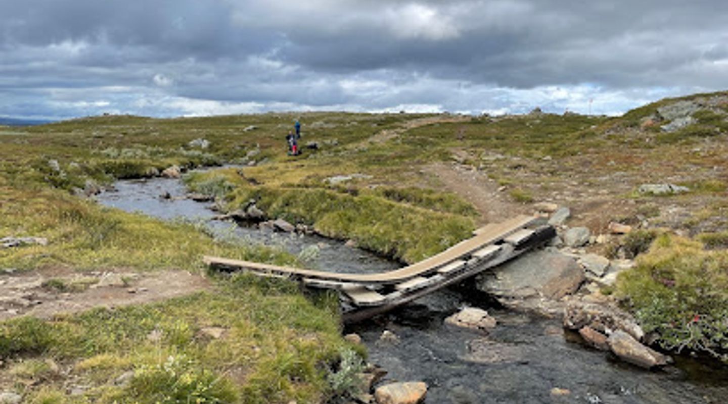
A brief summary of Jämtlandstriangeln
A classic 3-day hut-to-hut mountain loop through birch forests and open fell, with dramatic views of the Sylarna peaks and reliable mountain stations.
The Jämtland Triangle is a classic 3-day loop of high-country hiking in central Sweden that links three staffed mountain stations—Storulvån, Sylarna and Blåhammaren—across open tundra, birch forest and broad valley systems. About 40–50 km in total, the route suits day-hikers and multi-day backpackers alike and offers well-marked trails, simple mountain accommodation and dramatic views of the Sylarna massif and surrounding peaks.
On-site amenities
 Restrooms
 Food options
 Drink options
 Seating areas
 Information boards
Opening hours
- Every dayOpen 24 hours
Opening hours as listed on the venue’s Google Business Profile. Hours can change for services and special events, so check with the venue before you go.
- Address
- 831 41 STORULVÅN, Björkbackavägen 14, 831 43 Östersund
- Phone
- Website
Getting there
By car to Storulvån mountain station
Public transport plus transfer
Train + bus combination
Discover more about Jämtlandstriangeln
A compact high-country circuit with mountain-station anchors
The Jämtland Triangle is a distinct three-vertex route in the Swedish mountains that connects Storulvån, Sylarna and Blåhammaren mountain stations. Each station functions as a practical waypoint: staffed accommodation, simple dining or self-catering facilities, provision points and sheltered places to dry gear. The path between stations moves from mountain birch forest through the tree line and into wide, open fell country, meaning the character of the landscape changes noticeably across each day.
Landscape, geology and landmark silhouettes
You move through a mix of rolling valleys, gravel ridges, rippling streams and exposed plateaus. The route frames the steep profile of the Sylarna peaks for long stretches, and you pass features such as suspension bridges, wind shelters and shallow river crossings. Under clear skies the views are broad: rounded ridges, distant peaks and lakes that reflect the mountain light. In winter the same corridors become classic backcountry ski and snowshoe routes.
Trail character and difficulty
Trails are typically well-marked and mostly straightforward, with a mixture of gentle ascents, longer uphill sections and easy downhill stretches. Walking surfaces vary from forest paths to boggy boardwalks and exposed rock or scree where drainage is poor; some river crossings may require wading in summer. The route is often described as accessible to both beginners and more experienced hikers, but weather and wind at altitude can change conditions quickly and add challenge.
Seasonality and visitor rhythm
The main hiking season runs through the warmer months when mountain stations are staffed and trails are free of deep snow; however, the area is also used for winter ski touring when conditions permit. Weather changes fast in this region—sun, wind, fog and rain can all arrive within hours—so flexible plans and layered clothing are essential. Mountain stations offer the advantage of shelter and basic services on each night of the circuit.
Facilities and on-route services
Each mountain station provides differing levels of service: from self-catering kitchens and simple shops to full meals and saunas at larger stations. There are wind shelters and emergency huts scattered along the route. Water is generally available from streams but should be treated or filtered; night accommodation varies from shared rooms to private rooms depending on the station and booking.
What you’ll actually experience
Expect long visual exposures, changing light and a rhythm of days that begins with breakfast at a station and ends with drying boots and warm food in communal spaces. Mornings can be hushed and cool, mid-day offers extensive panoramas, and evenings bring a different hush as clouds settle. The Triangle’s compact scale makes it possible to tackle as a three-day hut-to-hut journey or to extend stays for summit excursions, photography or a slower exploration of alpine features.
Evendo Review Centre
 Google
Guest reviews
Best time to go
Quietest: Jan, Feb & Dec · before 6am
Busy times are Evendo estimates for a typical year, to help you plan. Actual crowds vary with events, school holidays and the weather.
Explore Jämtlandstriangeln on the map
A handpicked selection of must-see spots near Jämtlandstriangeln, mapped for you.
Get your free copy of our complete guide to Jämtlandstriangeln, delivered straight to you.
Everything on this page, from opening hours and how to get there to Eve’s tips and the best time to go, in one PDF you can read offline, print or share.
Already have an account? Sign in
Your Jämtlandstriangeln guide is ready.
We'll send it to · Not you? Sign out

Getting your guide ready…
We are putting together a fresh copy of the Jämtlandstriangeln guide. This can take up to a minute.
This can take a few moments. If your browser asks, choose Allow so the download can start. You'll find the guide in your Downloads folder.
Nothing happened? Download it again
Sorry, the guide is taking longer than usual. Please try again in a minute, or get it by email instead.
Other nearby places you may find interesting
The closest places of the same kind, if this one is not quite what you had in mind.
-
-
-
-
-


Swipe for more places
More to explore near Jämtlandstriangeln

 Best experiences near Jämtlandstriangeln
 Best hotels near Jämtlandstriangeln
 Best landmarks near Jämtlandstriangeln
 Best attractions near Jämtlandstriangeln
 Best shops near Jämtlandstriangeln
 Best restaurants near Jämtlandstriangeln
 Best bars near Jämtlandstriangeln
Do you manage this location?
Take control to get all the benefits, like improved information, better appearance, and stronger visibility across AI-powered discovery.
Explore more

Explore more of Jämtland
Explore Jämtland: A Swedish gem where natural beauty, outdoor adventure, and rich cultural heritage blend seamlessly.
Explore Jämtland
Explore more of Sweden
Discover Sweden's breathtaking landscapes, vibrant cities, and rich cultural heritage. From the Northern Lights to historic castles, experience the essence of Scandinavia.
Explore Sweden
