Stadsgårdsleden, Stockholm Travel Guide
Free Guide: A historic working waterfront on Södermalm where quays, reclaimed land and skyline views reveal Stockholm’s maritime past and urban edge.


A brief summary of Stadsgårdsleden
A historic working waterfront on Södermalm where quays, reclaimed land and skyline views reveal Stockholm’s maritime past and urban edge.
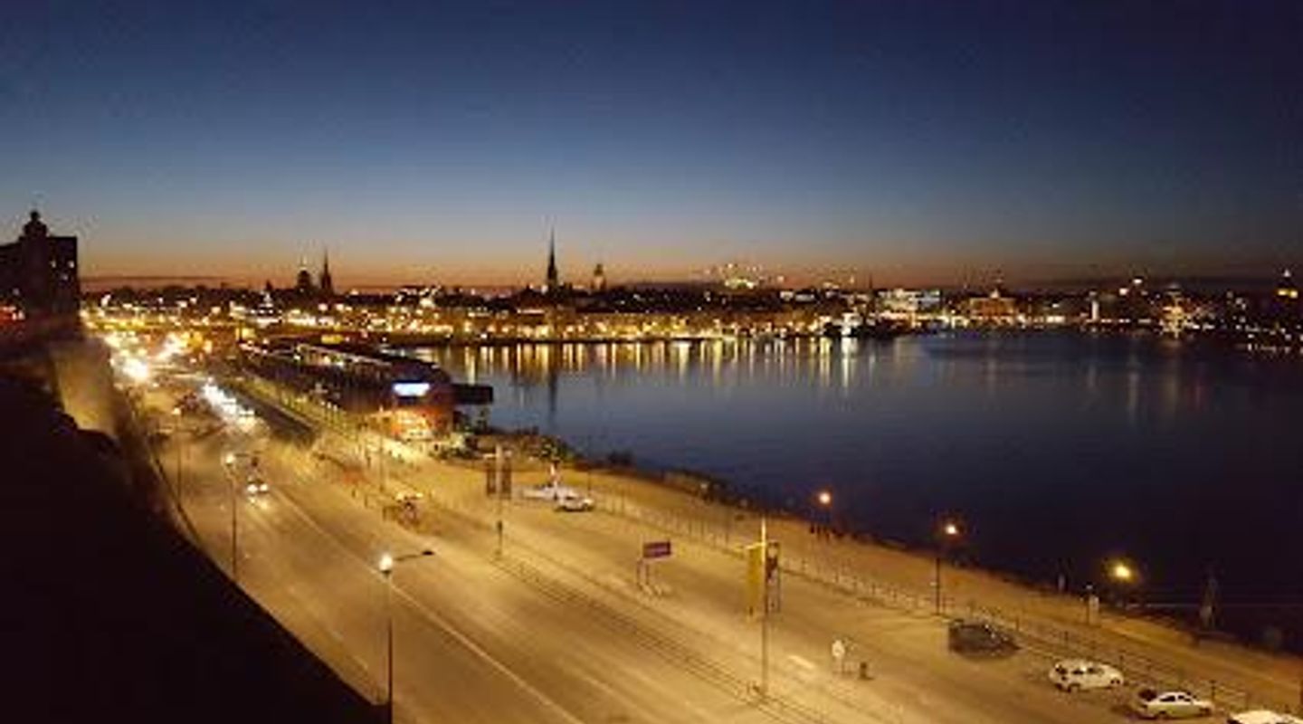
Stadsgårdsleden traces the waterfront edge of Stadsgården on Södermalm, a stretch where Stockholm’s long maritime story is visible in quays, old warehouses and layered cityworks. Once a working export quay and ferry approach, the area now presents a hard-edged urban shoreline: traffic-bearing roadway, promenades, remnants of harbour infrastructure and dramatic sightlines across Saltsjön toward Gamla Stan and Djurgården. The place balances industrial traces with city views and everyday movement.
On-site amenities
 Seating areas
 Information boards
 Trash bins
- Address
- Södermalm, Stockholm
Getting there
Local bus
Ferry / commuter boat
Walking from Södermalm centre
Discover more about Stadsgårdsleden
A shoreline shaped by centuries of trade
Stadsgårdsleden occupies land that has been part of Stockholm’s harbour economy since at least the 1500s; the quay and adjacent storage areas were used for processing ship stores, tar and whale oil in earlier centuries and grew into an important export quay for iron in the 17th and 18th centuries. Reclaimed stretches and engineering works from the late 19th and early 20th centuries produced the broad, reinforced quays and freight yards that defined the area’s character into the motor age.
Visible layers: piers, cranes and railway traces
Walking the stretch you’ll notice architectural and infrastructural evidence of successive phases: solid masonry storehouses, the traces of cranes and goods-handling yards, and the alignment of former rail connections that linked the quay to the city’s broader rail network. These remnants are not restored as museum pieces but remain part of an active urban edge where road, rail and sea have met for generations.
Cityscape and opening views
From Stadsgårdsleden the view opens across Saltsjön with Gamla Stan’s low silhouette and Djurgården’s treeline punctuating the horizon. The orientation of the quay offers compelling sightlines at sunrise and dusk when the water mirrors the sky; even in grey weather the juxtaposition of industrial shore and historic skyline creates a clear sense of place unique to Stockholm’s working waterfronts.
Human scale: routes, crossings and the old lifts
The area’s human story is legible in features such as former passenger lifts and stair connections linking the higher Södermalm plateau to the quays below. These vertical connectors—some disused, some reworked—speak to the daily rhythms of dockworkers, merchants and travellers who moved between ship and street. The contrast between the elevated neighbourhoods and the lower harbour strip is an important part of Stadsgårdsleden’s identity.
Contemporary life beside the water
Today the waterfront functions as a mixed urban corridor: a busy traffic route for vehicles and buses, an arrival zone for ferries at times, and a place where residents and visitors pass through to reach waterfront promenades, piers or nearby cultural sites. The hard-paved quays, occasional benches and vantage points make it a location for brief stops, photography and watching ferries and freighters come and go rather than a long recreational park.
When the city and sea meet
Stadsgårdsleden is best experienced as a meeting of scales: the engineering of harbour works, the sweep of maritime vistas and the compact urban blocks of Södermalm above. Its atmosphere is utilitarian and panoramic at once, offering a direct sense of Stockholm’s maritime backbone—an edge where commerce, infrastructure and city life have intertwined for centuries.
Evendo Review Centre
 Google
Guest reviews
Best time to go
Quietest: Jan, Feb & Mar · before 6am or at 10pm
Busy times are Evendo estimates for a typical year, to help you plan. Actual crowds vary with events, school holidays and the weather.
Explore Stadsgårdsleden on the map
A handpicked selection of must-see spots near Stadsgårdsleden, mapped for you.
Get your free copy of our complete guide to Stadsgårdsleden, delivered straight to you.
Everything on this page, from opening hours and how to get there to Eve’s tips and the best time to go, in one PDF you can read offline, print or share.
Already have an account? Sign in
Your Stadsgårdsleden guide is ready.
We'll send it to · Not you? Sign out

Getting your guide ready…
We are putting together a fresh copy of the Stadsgårdsleden guide. This can take up to a minute.
This can take a few moments. If your browser asks, choose Allow so the download can start. You'll find the guide in your Downloads folder.
Nothing happened? Download it again
Sorry, the guide is taking longer than usual. Please try again in a minute, or get it by email instead.
Other nearby places you may find interesting
The closest places of the same kind, if this one is not quite what you had in mind.
-
-
-
-
-


Swipe for more places
More to explore near Stadsgårdsleden

 Best experiences near Stadsgårdsleden
 Best hotels near Stadsgårdsleden
 Best landmarks near Stadsgårdsleden
 Best attractions near Stadsgårdsleden
 Best shops near Stadsgårdsleden
 Best restaurants near Stadsgårdsleden
 Best bars near Stadsgårdsleden
Do you manage this location?
Take control to get all the benefits, like improved information, better appearance, and stronger visibility across AI-powered discovery.
Explore more

Explore more of Stockholm
Discover Stockholm: A captivating blend of history, culture, and natural beauty spread across 14 picturesque islands in Sweden's stunning capital city.
Explore Stockholm
Explore more of Sweden
Discover Sweden's breathtaking landscapes, vibrant cities, and rich cultural heritage. From the Northern Lights to historic castles, experience the essence of Scandinavia.
Explore Sweden