

Free Central River Region Travel Guide & Mobile App
Explore Central River Region with free travel guides. Discover regional history, expert tips, proposed trips, and audio guides on web or mobile app.


Explore Central River Region for ancient stone circles, river wildlife, rural communities and The Gambia’s most revealing inland landscapes.
Read more about Central River Region
When is the best time to visit Central River Region?
Best: December–February · 28–30°C| Month | High (°C) | Rainfall (mm) |
|---|---|---|
| January (best) | 28 | 1 |
| February (best) | 30 | 1 |
| March | 33 | 2 |
| April | 35 | 2 |
| May | 36 | 4 |
| June | 33 | 8 |
| July | 31 | 12 |
| August | 30 | 16 |
| September | 31 | 13 |
| October | 34 | 7 |
| November | 32 | 4 |
| December (best) | 29 | 2 |
Getting to and around Central River Region
How to get there
Transportation
Top city travel guides in Central River Region
The cities of Central River Region, and the easiest places to base yourself.

Swipe for more cities
Destinations in Central River Region
Resorts, valleys and scenic spots worth a trip of their own.
-
-


Swipe for more destinations
Best attractions in Central River Region
The Central River Region’s attractions centre on archaeology, river ecology and rural landscape rather than large purpose-built visitor complexes. Near Kuntaur, the River Gambia National Park protects river islands and wooded banks where boat excursions may reveal hippopotamuses, crocodiles, monkeys and numerous waterbirds. Wildlife viewing depends on season, water levels and the patience of both visitors and guides. The park is best appreciated as a quiet river environment rather than a guaranteed safari encounter. The Wassu Stone Circles provide the region’s most important archaeological visit, with upright laterite stones and burial mounds interpreted within the wider Senegambian monumental tradition. Janjanbureh offers a contrasting experience through its island setting, colonial-era associations and cultural encounters, while Bansang provides a glimpse of inland commercial and agricultural life. Beyond formal sites, the region’s attractions include mangrove and floodplain scenery, village markets, fishing activity, seasonal cultivation and bird-rich wetlands. Visits are more rewarding when arranged with local guides, who can explain the relationship between the river, farming communities, sacred places and conservation areas.
-
Tourist attraction
Stone Circles of Gambia
Discover the ancient mysteries of the Stone Circles of Gambia, a UNESCO World Heritage site that reveals the rich history and culture of the region.
-
Bird watching area
Sapu Rice Fields
Experience the serene beauty of Sapu Rice Fields in Brikama Ba, a birdwatcher's paradise surrounded by lush landscapes and rich local culture.
-
 Hiking area
Banta island ️
Explore the natural wonders of Banta Island, an idyllic hiking destination in Gambia, rich in biodiversity and cultural experiences.
-
Tourist attraction
Fallys boat trips
Experience the breathtaking beauty of the Gambia with Fallys Boat Trips, an unforgettable adventure amidst stunning landscapes and rich wildlife.


Best landmarks in Central River Region
The Wassu Stone Circles are the Central River Region’s most recognisable historic landmarks. Their tall laterite pillars, arranged around burial mounds and associated with the wider Senegambian Stone Circles, represent a major archaeological legacy and give the surrounding landscape a powerful sense of historical depth. On the river, the islands and wooded channels protected within the River Gambia National Park form an important natural landmark system, especially around Kuntaur, where the waterway defines both the scenery and the wildlife experience. Janjanbureh itself is a landmark settlement because of its island position and its association with the former colonial name McCarthy Island. Its streets, river approaches and surviving colonial-era traces are best understood in relation to the wider history of administration and trade along the Gambia River. The river’s broad floodplain, seasonal wetlands and ferry crossings are also defining geographical features, even where they do not take the form of a single monument. Together, these places express the region’s distinctive combination of ancient stone architecture, living river landscape and layered colonial and post-colonial history.
-
National park
Bijilo National Park
Discover the natural beauty of Bijilo National Park, a must-visit destination in The Gambia for wildlife lovers and outdoor enthusiasts.
-
Market
Albert Market
Discover the vibrant culture and local flavors of The Gambia at Banjul's Albert Market, a bustling hub for tourists and locals alike.
-
Historical landmark
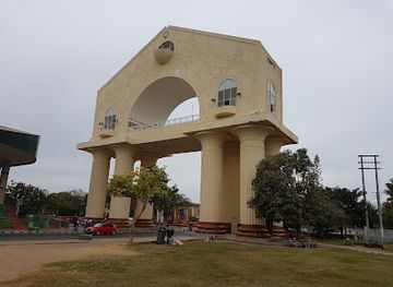
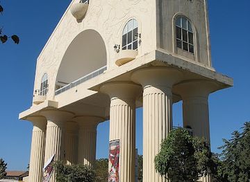
Arch 22
Discover the historical significance and stunning views from Arch 22, a monumental landmark in Banjul, The Gambia, embodying the spirit of resilience.
-
Tourist attraction
The Gambian Reptiles Farm
Explore The Gambian Reptiles Farm for an unforgettable encounter with The Gambia's fascinating reptilian wildlife in a family-friendly environment.

Explore Central River Region on the map
Plan your trip on one map. See where the top cities, national parks and sights are, and book hotels and experiences in a few clicks.
Best hotels in Central River Region
Best restaurants in Central River Region
Dining in the Central River Region is generally informal and locally focused, with meals shaped by rice, millet, maize, groundnuts, vegetables, fish and seasonal produce. Visitors are likely to encounter dishes such as benachin, a rice-based one-pot meal, domoda with a groundnut sauce, and grilled or stewed fish, although recipes and names vary between households and communities. Small restaurants, guesthouse kitchens and roadside eateries tend to offer the most practical choices in towns such as Bansang, Janjanbureh and Kuntaur. Fresh river fish may be available, but supply is seasonal and menus are not uniform. Meals can be accompanied by baobab or ginger drinks, while tea is a common part of social and commercial life. Travellers staying in rural areas should arrange meals in advance where possible, carry snacks for long journeys and avoid assuming that every settlement will have a broad menu or reliable refrigeration. Market visits provide an opportunity to see local grains, vegetables, fruit and groundnuts, but food should be chosen carefully and drinking water should come from a trusted source.
-
Restaurant
John Raymond'S Beach Bar And Restaurant
Experience authentic Gambian cuisine at John Raymond's Beach Bar & Restaurant in Serrekunda with stunning ocean views.
-
Restaurant
Mo2 Jamaican Bar & Restaurant Gambia (Mosiah's)
Savor authentic Jamaican cuisine at Mo2 Jamaican Bar & Restaurant in Gambia—an unforgettable culinary adventure awaits!
-
Restaurant
Darboe's Bar and Restaurant
Experience authentic Gambian flavors at Darboe's Bar and Restaurant in Serrekunda, where delicious cuisine meets vibrant culture.
-
Restaurant
Ngala Lodge
Discover luxury and tranquility at Ngala Lodge - your perfect escape in Bakau with fine dining, spa services, and breathtaking ocean views.


Best bars in Central River Region
Evening life in the Central River Region is modest and generally centred on guesthouses, local restaurants, small bars and community gatherings rather than nightclubs. Janjanbureh and Bansang offer the widest choice of places to sit, eat and meet people, while smaller settlements may close early and have few dedicated visitor venues. Music and conversation are often more significant than a formal nightlife circuit, and evening activity can be seasonal or linked to local events. Some accommodation providers may serve beer or soft drinks, but availability varies and alcohol should not be treated as central to the region’s culture. In rural areas, darkness, road conditions and limited transport make it sensible to remain near one’s accommodation after nightfall. Visitors should respect local religious and community customs, keep noise under control and check arrangements locally rather than expecting fixed opening hours or a late-night entertainment scene.
-
Restaurant
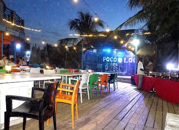
Poco Loco Beachbar Gambia
Experience the vibrant beachside atmosphere at Poco Loco Beachbar, where delicious cuisine meets stunning ocean views in Gambia.
-
Restaurant
John Raymond'S Beach Bar And Restaurant
Experience the vibrant flavors and stunning sea views at John Raymond's Beach Bar and Restaurant in Serrekunda, The Gambia.
-
Restaurant
Mo2 Jamaican Bar & Restaurant Gambia (Mosiah's)
Experience the vibrant flavors of Jamaica at Mo2 Jamaican Bar & Restaurant in Serrekunda, a must-visit culinary treasure for tourists.
-
Bar
Solomon’s Beach Bar & Restaurant
Experience the vibrant atmosphere and delicious cuisine at Solomon's Beach Bar & Restaurant, a coastal gem in Serrekunda, The Gambia.


Best nightclubs in Central River Region
Evening life in the Central River Region is modest and generally centred on guesthouses, local restaurants, small bars and community gatherings rather than nightclubs. Janjanbureh and Bansang offer the widest choice of places to sit, eat and meet people, while smaller settlements may close early and have few dedicated visitor venues. Music and conversation are often more significant than a formal nightlife circuit, and evening activity can be seasonal or linked to local events. Some accommodation providers may serve beer or soft drinks, but availability varies and alcohol should not be treated as central to the region’s culture. In rural areas, darkness, road conditions and limited transport make it sensible to remain near one’s accommodation after nightfall. Visitors should respect local religious and community customs, keep noise under control and check arrangements locally rather than expecting fixed opening hours or a late-night entertainment scene.
-
Night club
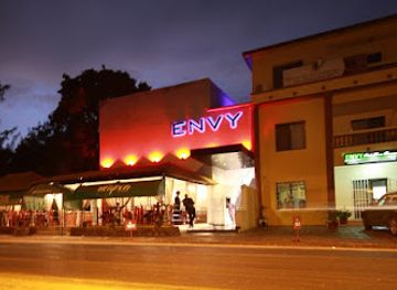
Envy Night Club
Dive into the electrifying nightlife at Envy Night Club, a premier destination in Serrekunda for dancing, drinks, and unforgettable memories.
-
Night club
Aquarius Nightclub
Dive into the energetic nightlife at Aquarius Nightclub, Serrekunda's top destination for vibrant music, dancing, and unforgettable moments.
-
Night club
Ningki Nangka Bar & Night Club
Unleash your nightlife spirit at Ningki Nangka Bar & Night Club, the heart of Serrekunda's vibrant entertainment scene.
-
Night club
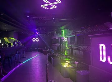
Club Infinity
Discover the electrifying nightlife of Club Infinity in Serrekunda, a vibrant night club where music and energy come alive.


Best shops in Central River Region
Shopping in the Central River Region is primarily local and practical, with market stalls, small shops and roadside sellers serving residents rather than offering a concentrated tourist retail scene. Bansang and Janjanbureh are useful places to look for everyday produce, clothing, household goods, fruit, vegetables, grains and groundnuts, while markets and informal stalls may carry woven items, carved objects or handmade souvenirs. Purchases should be made respectfully and bargaining should remain courteous. Regional food products such as groundnuts, dried goods and locally grown produce can be more meaningful souvenirs than mass-produced items, provided they are safely packed and permitted for transport. Craft availability varies by town and season, so visitors should avoid assuming that a particular item will be stocked. It is worth carrying small dalasi notes for modest purchases, since card payments are uncommon outside larger establishments. Buying directly from makers or through reputable community-based initiatives can help ensure that payment reaches the people producing the work.
-
Grocery store
Halabaid Trading Enterprises paradise supermarket
Explore local flavors and essentials at Halabaid Trading Enterprises, a vibrant supermarket in Farafenni, Gambia.
-
Shopping mall
Bansang Market
Discover the essence of Gambian culture at Bansang Market, a bustling hub of shopping, local flavors, and vibrant community life.
-
Grocery store
Costa road
Explore local flavors and unique products at Costa Road, Bureng’s vibrant grocery store, a true taste of Gambian culture.
-
Store
Al Islam shopping father &son
Experience the vibrant culture and unique products at Al Islam Shopping Father & Son in Gambia, a perfect stop for tourists.


Get your free copy of our complete guide to Central River Region, delivered straight to you.
Everything on this page, from attractions and restaurants to essentials and local phrases, in one PDF you can read offline, print or share.
Already have an account? Sign in
Your Central River Region guide is ready.
We'll send it to · Not you? Sign out

Getting your guide ready…
We are putting together a fresh copy of the Central River Region guide. This can take up to a minute.
This can take a few moments. If your browser asks, choose Allow so the download can start. You'll find the guide in your Downloads folder.
Nothing happened? Download it again
Sorry, the guide is taking longer than usual. Please try again in a minute, or get it by email instead.
Central River Region essentials
Currency and Payment
Safety
Emergency Situations
Do's and Don'ts
Local Tips
From Eve
Local phrases worth knowing
You don't need to get them perfect. A few words go a long way, and locals appreciate the effort.
Basics
| English | Local | Say it |
|---|---|---|
| Hello | Naka | [Nah-kah] |
| Goodbye | Jaama | [Jah-mah] |
| Yes | Aye | [Eye] |
| No | Nay | [Nay] |
| Please/You're welcome | Faal | [Fahl] |
| Thank you | Jerejef | [Je-reh-jehf] |
| Excuse me/Sorry | Soo baara | [Soo bah-rah] |
| How are you? | Nangadef? | [Nahn-gah-def] |
| Fine. And you? | Nangadef. Awa? | [Nahn-gah-def. Ah-wah?] |
| Do you speak English? | Nangiy jango English? | [Nahn-gee jahng-oh Eng-lish?] |
| I don't understand | Maa jooje | [Mah joo-jeh] |
Eating & Drinking
| English | Local | Say it |
|---|---|---|
| I'd like to see the menu, please | Nangay fota menu, faal | [Nahn-gah-ee foh-tah meh-noo, fahl] |
| I don't eat meat | Maa nyan jooje | [Mah nyahn joo-jeh] |
| Cheers! | Jooje! | [Joo-jeh!] |
| I would like to pay, please | Nangay fota pay, faal | [Nahn-gah-ee foh-tah pay, fahl] |
Emergencies
| English | Local | Say it |
|---|---|---|
| Help! | Jombul! | [Jom-bool!] |
| Go away! | Faal jom! | [Fahl jom!] |
| Call the Police! | Nangay jango Police! | [Nahn-gah-ee jahng-oh Po-leec!] |
| Call a doctor! | Nangay jango doctor! | [Nahn-gah-ee jahng-oh doc-tor!] |
| I'm lost | Maa jooje jombul | [Mah joo-jeh jom-bool] |
| I'm ill | Maa jooje banta | [Mah joo-jeh bahn-tah] |
Shopping
| English | Local | Say it |
|---|---|---|
| I'd like to buy... | Nangay fota buy... | [Nahn-gah-ee foh-tah buy...] |
| I'm just looking | Maa just loooking | [Mah just loo-king] |
| How much is it? | Nangay banta? | [Nahn-gah-ee bahn-tah?] |
| That's too expensive | O banta leela | [Oh bahn-tah leh-lah] |
| Can you lower the price? | Nangay fota banta leela? | [Nahn-gah-ee foh-tah bahn-tah leh-lah?] |
Time & Numbers
| English | Local | Say it |
|---|---|---|
| What time is it? | Nangay janga? | [Nahn-gah-ee jahng-ah?] |
| It's one o'clock | O jango koto | [Oh jahng-oh koh-toh] |
| Half past (10) | Jango koto leela | [Jahng-oh koh-toh leh-lah] |
| Morning | Nangadef | [Nahn-gah-def] |
| Afternoon | Dajum | [Dah-jum] |
| Evening | Saan | [Sahn] |
| Yesterday | Kono | [Koh-noh] |
| Today | Nangadef | [Nahn-gah-def] |
| Tomorrow | Lafi | [Lah-fee] |
| 1 | Koto | [Koh-toh] |
| 2 | Nibbi | [Nih-bee] |
| 3 | Tati | [Tah-tee] |
| 4 | Nay | [Nay] |
| 5 | Jom | [Johm] |
| 6 | Jung | [Juhng] |
| 7 | Jombu | [Johm-boo] |
| 8 | Jento | [Jen-toh] |
| 9 | Jabi | [Jah-bee] |
| 10 | Jango | [Jahng-oh] |
Transport & Directions
| English | Local | Say it |
|---|---|---|
| Where's a/the...? | Nangay janga ...? | [Nahn-gah-ee jahng-ah ...?] |
| What's the address? | Nangay janga address? | [Nahn-gah-ee jahng-ah ad-dress?] |
| Can you show me (on the map)? | Nangay fota jango mi (na map)? | [Nahn-gah-ee foh-tah jahng-oh mee (nah map)?] |
| When's the next (bus)? | Nangay janga next (bus)? | [Nahn-gah-ee jahng-ah next (bus)?] |
| A ticket (to ....) | Koto ticket (to ...) | [Koh-toh tee-ket (to ...)] |
History of Central River Region
Early riverine societies and the Wassu stone circles
The middle Gambia River supported settled communities, farming and long-distance exchange for many centuries. The Wassu Stone Circles, near Kuntaur, belong to the wider Senegambian Stone Circles tradition, whose laterite pillars and associated burial mounds were created over a long period in the first and second millennia CE. Their builders had the organisation to quarry, transport and arrange heavy stone monuments, although the exact identities and beliefs of the communities involved remain the subject of archaeological study. The site demonstrates that the region possessed complex social and ritual traditions long before European colonial influence.
Mandinka states and inland trade
The Gambia River formed a natural corridor linking the coast with the interior of West Africa. Mandinka-speaking communities and political formations influenced much of the river basin, while trade connected local producers with wider networks carrying goods such as grain, livestock, hides, textiles and kola. Authority was often distributed among rulers, village leaders and extended families rather than organised as a single modern territorial state. The river’s navigability helped settlements in the Central River Region develop as places of exchange, movement and agricultural production.
European trade and the Atlantic slave trade
From the fifteenth century onward, Portuguese, English, French and other European traders entered the Gambia River system. Commercial activity increasingly became tied to the Atlantic slave trade, which affected communities along the river as well as wider areas of Senegambia. The historical legacy is complex: some local authorities participated in trading systems, while many people were captured in warfare or raids and transported against their will. The region’s river ports and settlements therefore belong to a wider history of commerce, coercion and African resistance that shaped the Atlantic world.
British colonial rule and McCarthy Island
During the nineteenth century, British authority expanded along the Gambia River, and McCarthy Island became an important administrative and commercial centre. The settlement later known as Georgetown developed around colonial institutions, river transport and agricultural trade. Its position inland made it useful for governing and connecting communities along the middle river, although the reach of colonial power remained uneven beyond the principal settlements. Buildings, street layouts and the island’s relationship with the river still provide reminders of this period.
Agriculture, river transport and the colonial economy
Colonial and post-colonial economic life in the region relied heavily on agriculture and the movement of produce by road and river. Groundnuts became particularly important within The Gambia’s export economy, while rice, millet, maize, livestock and fishing sustained local communities. River transport linked inland markets with the coast, even as roads and motor vehicles gradually changed patterns of movement. These economic developments shaped towns such as Bansang and Janjanbureh and continue to influence settlement, land use and seasonal work across the Central River Region.
Janjanbureh and The Gambia after independence
The Gambia became independent from Britain in 1965, and the former colonial name McCarthy Island was increasingly reassessed within the country’s post-colonial identity. In 2015, the island and town were officially renamed Janjanbureh, a name associated with local historical usage. The change reflected a broader effort to place Gambian and African perspectives more prominently in public heritage. Today, Janjanbureh combines colonial-era traces with contemporary Gambian life and serves as a focal point for cultural tourism, environmental visits and historical interpretation.
The River Gambia National Park
The River Gambia National Park was established to protect islands and riverine habitats in the central part of the country, including areas near Kuntaur. Its conservation work focuses on forest, wetland and aquatic environments that support hippopotamuses, crocodiles, primates and abundant birdlife. The park also reflects a changing relationship between conservation and local communities, since the river and surrounding lands remain important for fishing, farming and daily livelihoods. Boat-based tourism has helped make the area better known while highlighting the need for careful management of wildlife and visitor activity.
Central River Region in Photos
Browse through our photo collection highlighting the charm and character of the destination.
Neighbouring regions of Central River Region
The closest regions to Central River Region, if you have time for more than one.
-

-

-

-

-


Swipe for more regions
Explore more

Explore more of The Gambia
Discover The Gambia: a treasure trove of cultural richness, stunning beaches, and diverse wildlife. An unforgettable journey awaits you in Africa's Smiling Coast.
Explore The Gambia