

Free Niamina East Travel Guide & Mobile App
Explore Niamina East with free travel guides. Discover regional history, expert tips, proposed trips, and audio guides on web or mobile app.


Explore Niamina East in The Gambia for rural landscapes, farming communities, Manding heritage and a quieter inland travel experience.
Read more about Niamina East
When is the best time to visit Niamina East?
Best: December–February · 30–32°C| Month | High (°C) | Rainfall (mm) |
|---|---|---|
| January (best) | 30 | 1 |
| February (best) | 32 | 1 |
| March | 33 | 2 |
| April | 34 | 1 |
| May | 36 | 6 |
| June | 35 | 40 |
| July | 32 | 100 |
| August | 32 | 200 |
| September | 32 | 160 |
| October | 33 | 40 |
| November | 32 | 2 |
| December (best) | 31 | 0 |
Getting to and around Niamina East
How to get there
Transportation
Destinations in Niamina East
Resorts, valleys and scenic spots worth a trip of their own.

Swipe for more destinations
Best attractions in Niamina East
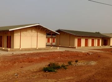
Niamina East is suited to travellers interested in rural landscapes and community-based cultural observation rather than a concentration of ticketed attractions. The principal experiences are journeys through farming country, visits arranged with local permission, seasonal views of cultivated fields and low-lying green areas, and encounters with the everyday architecture of village compounds, wells, mosques and market stalls. Birdlife can be rewarding around wooded farmland and seasonal wetlands, although sightings vary with weather, habitat and local disturbance. The district’s agricultural character also provides an opportunity to understand groundnut production, cereal cultivation and household gardens. Visitors who want a wider Central River itinerary can combine Niamina East with nearby destinations such as Janjanbureh, outside the district, where the regional historical story is more formally presented. Such excursions require advance planning and should not be treated as short local diversions. The attraction landscape here is defined by place, people and seasonal change: quiet roads, village hospitality arranged through appropriate introductions, sunsets over open countryside and the gradual transition from dry-season dust to rainy-season vegetation. Because formal visitor infrastructure is limited, responsible guiding, patience and realistic expectations are more important than a packed sightseeing schedule.
Best landmarks in Niamina East
Niamina East is not known for a dense collection of monumental landmarks; its most representative landmarks are the village settings, mosques, wells, family compounds, cultivated landscapes and road networks that express the district’s rural history. Individual buildings and community spaces should be visited only with local permission, since their importance may be social or religious rather than obvious to an outsider. The broad agricultural landscape is itself a defining geographic feature, changing markedly between the dry season and the rains as fields, grasses and seasonal depressions respond to rainfall. Historic interpretation is best understood within the wider Central River Region, which preserves connections to Manding political traditions, river-basin trade and colonial administration. Janjanbureh, formerly MacCarthy Island, is a prominent regional historical landmark near the wider area but lies outside Niamina East and should be planned as a separate destination. Travellers should not expect castle-like ruins or a formal monument trail in the district; the significance here lies in the continuity of settlement, farming and community institutions across an inland Gambian landscape.
-
History museum
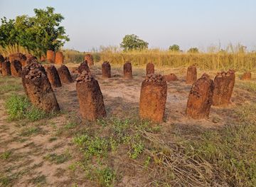
Stone Circles of Gambia
Discover the ancient wonders of the Stone Circles of Gambia, a UNESCO World Heritage site showcasing the region's rich history and culture.
-
 Lodging
Kairoh Garden Kuntaur
Discover tranquility at Kairoh Garden in Kuntaur - the perfect lodging destination for a serene Gambian escape amidst lush surroundings.
-
Farmers' market
Wassu Market
Discover the vibrant Wassu Market, a local farmers' market offering fresh produce, artisanal crafts, and a taste of authentic Gambian culture.
-
Historical landmark
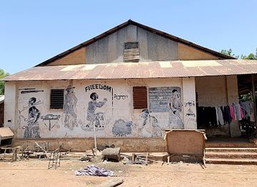
Slave House
Discover the poignant history of the slave trade at the Slave House in Janjanbureh, a must-visit historical landmark in The Gambia.

Explore Niamina East on the map
Plan your trip on one map. See where the top cities, national parks and sights are, and book hotels and experiences in a few clicks.
Best hotels in Niamina East
Best restaurants in Niamina East
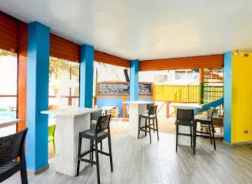
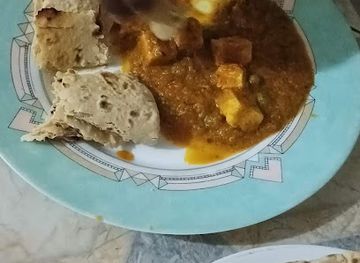
Dining in Niamina East is principally home- and community-based, with food prepared around locally available crops rather than a conventional restaurant scene. Visitors may encounter dishes based on rice, millet, maize, groundnuts, beans and seasonal vegetables, often served with sauces and sometimes accompanied by fish, chicken or meat. Benachin, a one-pot rice dish widely eaten in The Gambia, and domoda, a groundnut-based stew, are part of the broader Gambian culinary tradition, although preparation differs between households and regions. Small shops and informal food sellers in larger settlements may provide simple meals, bread, tea or refreshments, but opening arrangements and availability are not dependable. Travellers staying in guesthouses or visiting through a local host should arrange meals in advance and explain dietary requirements clearly. Bottled or treated water is advisable, and produce should be washed or cooked appropriately. The most meaningful food experiences are usually shared meals or market purchases arranged respectfully, rather than formal dining venues.
-
Restaurant
Poco Loco Beachbar Gambia
Discover the vibrant charm of Poco Loco Beachbar in Serrekunda, where delicious food meets stunning ocean views for an unforgettable experience.
-
Restaurant
John Raymond'S Beach Bar And Restaurant
Discover delicious seafood and tropical cocktails at John Raymond's Beach Bar and Restaurant in Serrekunda – a paradise for food lovers.
-
Restaurant
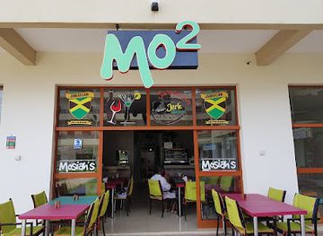
Mo2 Jamaican Bar & Restaurant Gambia (Mosiah's)
Savor the vibrant tastes of Jamaica at Mo2 Jamaican Bar & Restaurant in Gambia - an unforgettable culinary adventure awaits!
-
Restaurant
Vineyard Restaurant
Discover exquisite dining at Vineyard Restaurant in Serrekunda - where local flavors meet international cuisine in a vibrant atmosphere.

Best bars in Niamina East
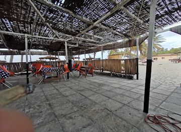
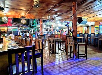
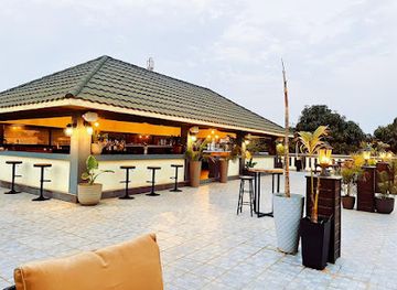
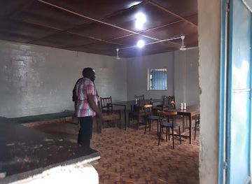
Niamina East has no concentrated nightclub or late-night entertainment district. Evening social life is more likely to centre on family compounds, tea gatherings, community conversations, local shops and modest eateries, with religious and agricultural routines shaping the pace after dark. In larger settlements, informal drinking places may exist, but alcohol should not be assumed to be available or appropriate in every community because The Gambia is predominantly Muslim and local attitudes vary. Nightlife is also limited by lighting, transport and the need to travel safely on rural roads. Visitors seeking a broader choice of bars, live music and evening venues will find more options in the coastal tourism zone or larger urban centres outside the district. Within Niamina East, the most suitable evening activities are arranged cultural visits, quiet stargazing where conditions permit, and conversations with hosts rather than late-night venue-hopping. Always arrange a return journey before dark and respect local religious observance and household privacy.
-
Bar
Solomon’s Beach Bar & Restaurant
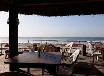
Discover the vibrant beachside ambiance of Solomon's Beach Bar & Restaurant, a perfect oasis for relaxation and entertainment in Serrekunda.
-
Bar
Time-Inn
Discover the lively essence of Serrekunda at Time-Inn, where vibrant drinks and a welcoming atmosphere await every traveler.
-
Bar
Cassy's Lounge
Experience the vibrant spirit of Gambia at Cassy's Lounge, where delightful drinks meet a lively atmosphere in Serrekunda.
-
Restaurant
Bendula Bar
Experience the essence of Gambian cuisine at Bendula Bar in Janjanbureh, where local flavors meet warm hospitality.
Best nightclubs in Niamina East
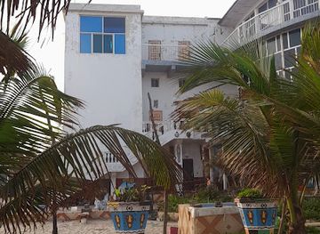
Niamina East has no concentrated nightclub or late-night entertainment district. Evening social life is more likely to centre on family compounds, tea gatherings, community conversations, local shops and modest eateries, with religious and agricultural routines shaping the pace after dark. In larger settlements, informal drinking places may exist, but alcohol should not be assumed to be available or appropriate in every community because The Gambia is predominantly Muslim and local attitudes vary. Nightlife is also limited by lighting, transport and the need to travel safely on rural roads. Visitors seeking a broader choice of bars, live music and evening venues will find more options in the coastal tourism zone or larger urban centres outside the district. Within Niamina East, the most suitable evening activities are arranged cultural visits, quiet stargazing where conditions permit, and conversations with hosts rather than late-night venue-hopping. Always arrange a return journey before dark and respect local religious observance and household privacy.
-
Night club
Envy Night Club
Experience the electrifying nightlife at Envy Night Club, Serrekunda's premier destination for music, dance, and unforgettable nights out.
-
Jamaican
Jamaica Jamaica restaurant and night club
Discover the vibrant flavors and rhythms of Jamaica at Jamaica Jamaica Restaurant and Night Club in Serrekunda, Gambia.
-
Night club
Aquarius Nightclub
Experience the vibrant nightlife at Aquarius Nightclub in Serrekunda, where electrifying music meets a lively atmosphere for unforgettable nights.
-
Night club
Ningki Nangka Bar & Night Club
Experience the vibrant nightlife of Serrekunda at Ningki Nangka Bar & Night Club, where music, dance, and local culture come together.



Best shops in Niamina East
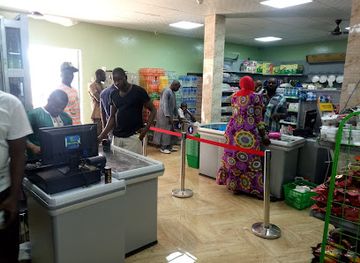
Shopping in Niamina East is local and practical rather than centred on large retail premises. Village shops and periodic markets may offer rice, millet, groundnuts, vegetables, fruit, household necessities, clothing and basic travel supplies, although the range and trading days vary between settlements. Groundnuts and other agricultural products are important to the regional economy, but visitors should buy food products through established sellers and check any restrictions when carrying produce across borders. Useful purchases can include locally made baskets, woven items, simple pottery or other crafts when these are genuinely produced in the community; ask about prices respectfully and avoid treating handmade goods as disposable souvenirs. Travellers should obtain specialist medicine, toiletries, power banks and substantial cash before travelling into the district, as rural shops cannot be expected to stock them. Larger selections of clothing, crafts, books and packaged goods are available in bigger Gambian towns outside Niamina East, while the district’s own shopping experience is best understood through everyday markets and direct support for local producers.
-
Souvenir store
TOP-SHOP
Explore TOP-SHOP, a vibrant souvenir store in Serrekunda, offering authentic Gambian handicrafts, art, and unique gifts to remember your journey.
-
Grocery store
Halabaid Trading Enterprises paradise supermarket
Explore Halabaid Trading Enterprises in Farafenni for an authentic Gambian grocery experience, offering local and international products in a welcoming atmosphere.
-
Grocery store
Costa road
Experience Bureng's local culture through its bustling grocery store, Costa Road - a true gem for tourists seeking authentic Gambian flavors.
-
General store
Soma Saremawdou Market
Experience the vibrant local culture and unique shopping at Soma Saremawdou Market in the heart of Gambia.

Get your free copy of our complete guide to Niamina East, delivered straight to you.
Everything on this page, from attractions and restaurants to essentials and local phrases, in one PDF you can read offline, print or share.
Already have an account? Sign in
Your Niamina East guide is ready.
We'll send it to · Not you? Sign out

Getting your guide ready…
We are putting together a fresh copy of the Niamina East guide. This can take up to a minute.
This can take a few moments. If your browser asks, choose Allow so the download can start. You'll find the guide in your Downloads folder.
Nothing happened? Download it again
Sorry, the guide is taking longer than usual. Please try again in a minute, or get it by email instead.
Niamina East essentials
Currency and Payment
Safety
Emergency Situations
Do's and Don'ts
Local Tips
From Eve
Local phrases worth knowing
You don't need to get them perfect. A few words go a long way, and locals appreciate the effort.
Basics
| English | Local | Say it |
|---|---|---|
| Hello | Naka | [Nah-kah] |
| Goodbye | Taw | [Taw] |
| Yes | Aye | [Eye] |
| No | Naa | [Nah] |
| Please/You're welcome | Jërëjëf | [Jair-jayf] |
| Thank you | Sukran | [Soo-kraan] |
| Excuse me/Sorry | Njaaxum | [Nyah-xum] |
| How are you? | Naka to? | [Nah-kah toe?] |
| Fine. And you? | Bene. A na? | [Beh-neh. Ah nah?] |
| Do you speak English? | Naa jango English? | [Nah jahn-go English?] |
| I don't understand | Naa jëfandikoo | [Nah jeh-fahn-dee-koh] |
Eating & Drinking
| English | Local | Say it |
|---|---|---|
| I'd like to see the menu, please | Naa be na menu, jërëjëf | [Nah beh nah meh-noo, jair-jayf] |
| I don't eat meat | Naa jëfandi nyam | [Nah jeh-fahn-dee nyahm] |
| Cheers! | Na njar! | [Nah njar!] |
| I would like to pay, please | Naa be na pay, jërëjëf | [Nah beh nah pay, jair-jayf] |
Emergencies
| English | Local | Say it |
|---|---|---|
| Help! | Kafu! | [Kah-foo!] |
| Go away! | Gëj joon! | [Guhj joon!] |
| Call the Police! | Naw Police! | [Nah-oo Police!] |
| Call a doctor! | Naw doctor! | [Nah-oo doctor!] |
| I'm lost | Naa jëfandi laalu | [Nah jeh-fahn-dee lah-loo] |
| I'm ill | Naa jëfandi joom | [Nah jeh-fahn-dee joom] |
Shopping
| English | Local | Say it |
|---|---|---|
| I'd like to buy... | Naa be na buy... | [Nah beh nah buy...] |
| I'm just looking | Naa jëfandi yaa | [Nah jeh-fahn-dee yah] |
| How much is it? | Naka koto? | [Nah-kah koh-to?] |
| That's too expensive | O jëfandi tan | [Oh jeh-fahn-dee tahn] |
| Can you lower the price? | Naa laa jëfandi koto? | [Nah lah jeh-fahn-dee koh-to?] |
Time & Numbers
| English | Local | Say it |
|---|---|---|
| What time is it? | Naka koto si? | [Nah-kah koh-to see?] |
| It's one o'clock | Si koto | [See koh-to] |
| Half past (10) | Dëgë dju (10) | [Duh-guh joo (10)] |
| Morning | Soo | [Soo] |
| Afternoon | Njaay | [Njah-ee] |
| Evening | Baat | [Baht] |
| Yesterday | Dëgë yéy | [Duh-guh yay] |
| Today | Dëgë jëfandi | [Duh-guh jeh-fahn-dee] |
| Tomorrow | Dëgë yaa | [Duh-guh yah] |
| 1 | Keen | [Keen] |
| 2 | Nje | [Nje] |
| 3 | Nja | [Njah] |
| 4 | Njaay | [Njah-ee] |
| 5 | Jum | [Joom] |
| 6 | Jum jëfandi | [Joom jeh-fahn-dee] |
| 7 | Jum nja | [Joom njah] |
| 8 | Jum njaay | [Joom njah-ee] |
| 9 | Jum jëfandi jéy | [Joom jeh-fahn-dee yay] |
| 10 | Jum koto | [Joom koh-to] |
Transport & Directions
| English | Local | Say it |
|---|---|---|
| Where's a/the...? | Naka laa ...? | [Nah-kah lah ...?] |
| What's the address? | Naka njaay? | [Nah-kah njah-ee?] |
| Can you show me (on the map)? | Naa jëfandi laa (sén map)? | [Nah jeh-fahn-dee lah (sen map)?] |
| When's the next (bus)? | Naka jéy (bus)? | [Nah-kah jay (bus)?] |
| A ticket (to ....) | Baat (to ...) | [Baht (to ...)] |
History of Niamina East
Manding and Kaabu Foundations
The wider inland area that includes modern Niamina East was shaped by Manding-speaking communities and the historical influence of Kaabu, a major Manding political tradition in the Upper Guinea region. Political authority was expressed through family lineages, local leaders, farming settlements and networks linking the Gambia River basin with neighbouring territories. Much of this history survives through oral traditions, place names, genealogies and local customs rather than monumental ruins. The district’s present communities therefore form part of a much older cultural landscape.
River-Basin Trade and Settlement
The Gambia River and its tributaries created routes for movement, exchange and communication long before the modern state was established. Inland settlements were connected to trading networks that carried agricultural produce, livestock and locally made goods between villages, market centres and river ports. Niamina East is not a major river port, but its historical development belongs to this wider river-basin economy. Seasonal farming, access to water and proximity to transport routes influenced where communities grew and how they maintained links with neighbouring districts.
Islamic Learning and Local Authority
Islam spread gradually through commerce, scholarship, family connections and the work of religious teachers across the inland Gambia. Muslim practice became deeply woven into community life, while local political structures continued to operate through village leaders, elders and established lineages. In the area of present-day Niamina East, Islamic education and religious observance developed alongside farming and customary forms of social organisation. Mosques, prayer spaces, family histories and community ceremonies remain visible reminders of this long process of cultural change.
Colonial Protectorate and Administrative Change
Britain consolidated control over the interior of The Gambia during the nineteenth and early twentieth centuries, administering the region as part of the protectorate rather than the small coastal colony around Bathurst, now Banjul. Colonial rule altered taxation, labour patterns, policing and the organisation of local authority, while leaving many everyday rural institutions intact. Administrative boundaries changed over time, and Niamina East became part of the modern district system that places it within the Central River Region.
Groundnuts and the Rural Economy
Groundnut cultivation became one of the most important foundations of The Gambia’s colonial and post-colonial economy. Inland communities expanded production for household use and commercial sale, linking village fields to buying stations, roads and river transport. Other crops, including millet, maize, rice in suitable areas and vegetables, have remained important for food security. The agricultural landscape around Niamina East still reflects this history, although farming is influenced by rainfall variability, access to inputs, changing prices and the availability of labour.
Independence and Local Government
The Gambia became independent in 1965, and later administrative reforms strengthened the role of local councils and district-level institutions. Niamina East is now one of the rural districts of the Central River Region, with public services and economic activity distributed among villages rather than concentrated in a large town. Roads, schools, health facilities, telecommunications and agricultural projects have gradually changed daily life, but seasonal conditions and limited infrastructure continue to influence travel and development.
Niamina East in Photos
Browse through our photo collection highlighting the charm and character of the destination.
Neighbouring regions of Niamina East
The closest regions to Niamina East, if you have time for more than one.
-

-

-

-

-


Swipe for more regions

