

Free Niamina Dankunku Travel Guide & Mobile App
Explore Niamina Dankunku with free travel guides. Discover regional history, expert tips, proposed trips, and audio guides on web or mobile app.


Niamina Dankunku reveals rural Gambia through river landscapes, farming communities, seasonal wetlands and unhurried journeys in the Central River Region.
Read more about Niamina Dankunku
When is the best time to visit Niamina Dankunku?
Best: December–February · 31–33°C| Month | High (°C) | Rainfall (mm) |
|---|---|---|
| January (best) | 31 | 0 |
| February (best) | 33 | 1 |
| March | 35 | 1 |
| April | 37 | 2 |
| May | 37 | 5 |
| June | 34 | 50 |
| July | 32 | 200 |
| August | 32 | 250 |
| September | 32 | 200 |
| October | 33 | 100 |
| November | 33 | 5 |
| December (best) | 31 | 1 |
Getting to and around Niamina Dankunku
How to get there
Transportation
Best attractions in Niamina Dankunku
Niamina Dankunku’s attractions are primarily landscape- and community-based rather than concentrated in formal visitor sites. Rural roads and footpaths pass through cultivated fields, woodlands and settlements whose appearance changes markedly between the dry and rainy seasons. The Gambia River and associated wetlands provide opportunities for quiet observation of agricultural and riverine life, although access to banks, boats and private land should be arranged locally. Birdwatching can be rewarding in suitable habitats, but visitors should use an informed guide rather than expect a developed wildlife facility. Village visits, craft demonstrations and introductions to farming life are possible when arranged respectfully through local hosts. The district also works well for travellers seeking an understanding of inland Gambian geography, including the relationship between rainfall, crops, livestock and settlement. There are no major clusters of museums, theme parks or ticketed monuments in Niamina Dankunku, so itineraries should be built around seasonal conditions, conversation, walking and observation. Travellers wanting large historic sites or more formal cultural institutions will generally need to add destinations elsewhere in the Central River Region or beyond, rather than assuming they are located within the district.
-
 Island
Dankunku Island
Explore the natural wonders and serene beauty of Dankunku Island, a hidden gem off The Gambia's coast, perfect for relaxation and adventure.
Best landmarks in Niamina Dankunku
The most significant landmarks in Niamina Dankunku are environmental and communal rather than monumental. The Gambia River is the district’s defining geographical feature, linking villages and farmland to the wider inland history of the country. River approaches, seasonal wetlands and cultivated floodplain areas illustrate how water, rainfall and agriculture shape local life, although many viewpoints lie beside working land rather than formal promenades. Village mosques, compounds, wells and meeting spaces may be visually and socially important within individual communities, but they should be approached as living places and only photographed with permission. Rural tracks, mature trees and the changing boundary between fields and woodland also form part of the district’s recognisable character. Niamina Dankunku should not be promoted as a place of grand castles or monumental ruins: its significance lies in the ordinary infrastructure and landscapes through which Gambian communities have maintained settlement, farming and river connections. For historic stone monuments and major heritage sites, travellers need to plan visits outside the district.
-
Tourist attraction
Kachikally Crocodile Pool
Discover the enchanting Kachikally Crocodile Pool in Bakau, where nature and culture intertwine with the majestic Nile crocodiles.
-
National park
Bijilo National Park
Explore Bijilo National Park: A Natural Retreat with Lush Trails, Diverse Wildlife, and Serenity Near Serrekunda, Gambia.
-
Market
Albert Market
Explore the vibrant Albert Market in Banjul, a must-visit destination for tourists seeking authentic Gambian culture, delicious street food, and unique local crafts.
-
Historical landmark
Arch 22
Experience the grandeur of Arch 22, a historical landmark in Banjul that showcases Gambian culture and offers stunning views of the capital.


Explore Niamina Dankunku on the map
Plan your trip on one map. See where the top cities, national parks and sights are, and book hotels and experiences in a few clicks.
Best hotels in Niamina Dankunku
Best restaurants in Niamina Dankunku
Dining in Niamina Dankunku is mainly home-based or provided through simple local eateries and accommodation arranged in advance, rather than through a developed restaurant scene. Meals commonly reflect Gambian staples such as rice served with vegetable, fish, meat or groundnut-based sauces, alongside seasonal produce and locally prepared drinks. Fish may be available in river communities, while farming supports crops including groundnuts, millet and other grains. Visitors should expect straightforward cooking, limited menus and meals planned around local supply rather than restaurant-style choice. A shared meal with a host can be an important cultural experience, but dietary requirements should be explained before arrival and travellers should carry suitable snacks for long journeys. Larger towns on the route into the Central River Region offer more options, including cafés, roadside food stalls and provisions for self-catering. Bottled or treated drinking water is advisable, and food should be chosen from clean, busy establishments or trusted hosts.
-
Restaurant
Poco Loco Beachbar Gambia
Experience vibrant nightlife and delicious cuisine at Poco Loco Beachbar in Serrekunda, Gambia's ultimate beachside destination.
-
Restaurant
John Raymond'S Beach Bar And Restaurant
Experience delightful dining at John Raymond's Beach Bar & Restaurant in Serrekunda - where exquisite flavors meet breathtaking ocean views.
-
Restaurant
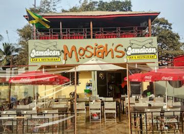
Mo2 Jamaican Bar & Restaurant Gambia (Mosiah's)
Savor authentic Jamaican cuisine in Serrekunda at Mo2 Jamaican Bar & Restaurant—an unforgettable dining experience infused with vibrant culture.
-
Restaurant
Vineyard Restaurant
Experience the essence of Gambian cuisine at Vineyard Restaurant in Serrekunda - where tradition meets taste.


Best bars in Niamina Dankunku
Niamina Dankunku does not have a conventional nightclub or late-night entertainment scene. Evening life is more likely to centre on family compounds, conversation, community gatherings and occasional local music than on dedicated bars or clubs. Small informal drinking places may exist in larger settlements, but their opening arrangements and atmosphere are local and changeable; visitors should ask their host rather than search for a formal nightlife district. Alcohol is not central to every community’s social life, and religious and personal practices vary, so restraint and courtesy are important. After dark, limited lighting and rural roads make walking between settlements impractical. Those seeking a broader choice of restaurants, cafés or evening entertainment will generally find it in larger Gambian towns outside the district, but Niamina Dankunku is better suited to quiet evenings, early starts and locally arranged cultural encounters.
-
Restaurant
Poco Loco Beachbar Gambia
Experience the vibrant culture and stunning beachfront views at Poco Loco Beachbar Gambia, a perfect getaway for relaxation and fun.
-
Restaurant
John Raymond'S Beach Bar And Restaurant
Experience the best of Gambian cuisine with stunning ocean views at John Raymond's Beach Bar and Restaurant in Serrekunda.
-
Restaurant
Mo2 Jamaican Bar & Restaurant Gambia (Mosiah's)
Discover the authentic taste of Jamaica at Mo2 Jamaican Bar & Restaurant in Gambia, where vibrant flavors meet a lively atmosphere.
-
Bar
Solomon’s Beach Bar & Restaurant
Discover the vibrant atmosphere of Solomon’s Beach Bar & Restaurant, where delicious food meets breathtaking ocean views in Serrekunda, Gambia.



Best nightclubs in Niamina Dankunku
Niamina Dankunku does not have a conventional nightclub or late-night entertainment scene. Evening life is more likely to centre on family compounds, conversation, community gatherings and occasional local music than on dedicated bars or clubs. Small informal drinking places may exist in larger settlements, but their opening arrangements and atmosphere are local and changeable; visitors should ask their host rather than search for a formal nightlife district. Alcohol is not central to every community’s social life, and religious and personal practices vary, so restraint and courtesy are important. After dark, limited lighting and rural roads make walking between settlements impractical. Those seeking a broader choice of restaurants, cafés or evening entertainment will generally find it in larger Gambian towns outside the district, but Niamina Dankunku is better suited to quiet evenings, early starts and locally arranged cultural encounters.
-
Night club
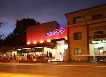
Envy Night Club
Discover the electrifying nightlife at Envy Night Club, a premier destination in Serrekunda for unforgettable music, dancing, and socializing.
-
Night club
Aquarius Nightclub
Experience the vibrant nightlife of Gambia at Aquarius Nightclub, where great music, lively ambiance, and unforgettable moments await.
-
Night club
Ningki Nangka Bar & Night Club
Discover the vibrant nightlife of Serrekunda at Ningki Nangka Bar & Night Club, where music, dance, and local flavor come together for an unforgettable evening.
-
Night club
ONYX
Discover the vibrant nightlife at ONYX, Serrekunda's premier night club with electrifying music, cocktails, and an unforgettable atmosphere.

Best shops in Niamina Dankunku
Shopping in Niamina Dankunku is small-scale and practical, centred on village shops, local stalls and periodic markets rather than established retail streets. Visitors may find household goods, basic food supplies, seasonal produce and locally made items, but selection and opening arrangements vary. Groundnuts, grains and other agricultural products are important to the regional economy, although packaged or regulated products are easier to purchase in larger towns. A locally arranged visit may provide access to baskets, textiles, carved objects or other handmade goods, but these should be bought directly and respectfully, with prices agreed clearly before purchase. Carrying dalasi in small denominations is essential, as card payments are unlikely. Travellers should stock up on medicines, toiletries, snacks and specialist supplies before entering the district. Niamina Dankunku is not a destination for extensive fashion or luxury shopping; its retail character reflects rural commerce, local production and the practical needs of dispersed communities.
-
Souvenir store
TOP-SHOP
Explore TOP-SHOP in Serrekunda for unique Gambian souvenirs, handicrafts, and art that embody the spirit of The Gambia.
-
Grocery store
Halabaid Trading Enterprises paradise supermarket
Explore the flavors of Gambia at Halabaid Trading Enterprises, your go-to supermarket in Farafenni for fresh produce and local delicacies.
-
Grocery store
Costa road
Explore the local flavors and vibrant atmosphere at Costa Road Grocery Store in Bureng, Gambia, a must-visit for every traveler.
-
General store
Soma Saremawdou Market
Explore the vibrant Soma Saremawdou Market, a treasure trove of local culture, crafts, and delectable Gambian flavors.


Get your free copy of our complete guide to Niamina Dankunku, delivered straight to you.
Everything on this page, from attractions and restaurants to essentials and local phrases, in one PDF you can read offline, print or share.
Already have an account? Sign in
Your Niamina Dankunku guide is ready.
We'll send it to · Not you? Sign out

Getting your guide ready…
We are putting together a fresh copy of the Niamina Dankunku guide. This can take up to a minute.
This can take a few moments. If your browser asks, choose Allow so the download can start. You'll find the guide in your Downloads folder.
Nothing happened? Download it again
Sorry, the guide is taking longer than usual. Please try again in a minute, or get it by email instead.
Niamina Dankunku essentials
Currency and Payment
Safety
Emergency Situations
Do's and Don'ts
Local Tips
From Eve
Local phrases worth knowing
You don't need to get them perfect. A few words go a long way, and locals appreciate the effort.
Basics
| English | Local | Say it |
|---|---|---|
| Hello | Naka | [nah-kah] |
| Goodbye | Taw | [tah-oo] |
| Yes | Aye | [eye] |
| No | Naa | [nah] |
| Please/You're welcome | Jerejef | [jeh-reh-jehf] |
| Thank you | Jerejef | [jeh-reh-jehf] |
| Excuse me/Sorry | Sama | [sah-mah] |
| How are you? | Naka saama | [nah-kah sah-mah] |
| Fine. And you? | Nyaata, a saama? | [nyah-tah, ah sah-mah?] |
| Do you speak English? | Naa doo English? | [nah doo in-glish?] |
| I don't understand | Naa jamaa faala | [nah jah-mah fah-lah] |
Eating & Drinking
| English | Local | Say it |
|---|---|---|
| I'd like to see the menu, please | Naa joo menu, jerejef | [nah joo meh-nu, jeh-reh-jehf] |
| I don't eat meat | Naa jamaa ngel | [nah jah-mah ngel] |
| Cheers! | Bismillah! | [biss-mil-lah] |
| I would like to pay, please | Naa joo pay, jerejef | [nah joo pay, jeh-reh-jehf] |
Emergencies
| English | Local | Say it |
|---|---|---|
| Help! | Naa joo help! | [nah joo help!] |
| Go away! | Jaa joo! | [jah joo!] |
| Call the Police! | Naa joo Police! | [nah joo po-lees!] |
| Call a doctor! | Naa joo doctor! | [nah joo dok-tah!] |
| I'm lost | Naa joo lost | [nah joo lost] |
| I'm ill | Naa joo ill | [nah joo ill] |
Shopping
| English | Local | Say it |
|---|---|---|
| I'd like to buy... | Naa joo buy... | [nah joo buy...] |
| I'm just looking | Naa joo jamaa | [nah joo jah-mah] |
| How much is it? | Naa ki a? | [nah kee ah?] |
| That's too expensive | Taa a joo expensive | [tah ah joo ex-pen-siv] |
| Can you lower the price? | Naa laaw price? | [nah laaw prais?] |
Time & Numbers
| English | Local | Say it |
|---|---|---|
| What time is it? | Naa ki time? | [nah kee taim?] |
| It's one o'clock | A a kolo | [ah ah koh-loh] |
| Half past (10) | Half past 10 | [half past ten] |
| Morning | Jang | [jang] |
| Afternoon | Dun | [dun] |
| Evening | Jang duni | [jang doo-nee] |
| Yesterday | Baal | [baal] |
| Today | Naa joo | [nah joo] |
| Tomorrow | Jang joo | [jang joo] |
| 1 | Kolo | [koh-loh] |
| 2 | Jang | [jang] |
| 3 | Tati | [tah-tee] |
| 4 | Nayi | [nah-yee] |
| 5 | Jumbo | [jum-bo] |
| 6 | Nayi kolo | [nah-yee koh-loh] |
| 7 | Nayi jang | [nah-yee jang] |
| 8 | Nayi tati | [nah-yee tah-tee] |
| 9 | Nayi nayi | [nah-yee nah-yee] |
| 10 | Nayi jumbo | [nah-yee jum-bo] |
Transport & Directions
| English | Local | Say it |
|---|---|---|
| Where's a/the...? | Naa ki a...? | [nah kee ah...?] |
| What's the address? | Naa ki address? | [nah kee ad-dress?] |
| Can you show me (on the map)? | Naa joo show me (on the map)? | [nah joo show me (on the map)?] |
| When's the next (bus)? | Naa ki next (bus)? | [nah kee next (bus)?] |
| A ticket (to ....) | Naa joo ticket (to ...) | [nah joo tik-it (to ...)] |
History of Niamina Dankunku
Early Settlement and Senegambian Societies
The area now called Niamina Dankunku forms part of the wider Senegambian cultural zone, where communities developed along river corridors and in agriculturally productive inland areas. Settlement patterns were shaped by access to cultivable land, seasonal water and routes connecting villages to the Gambia River. Mandinka, Fula and other Senegambian traditions have contributed to the social and linguistic history of the Central River Region. Much of this early history survives through oral tradition, family knowledge and customary relationships with land rather than through large visible monuments.
The Gambia River Trade Corridor
For centuries, the Gambia River provided a natural route linking inland communities with the coast and with neighbouring parts of Senegambia. Goods, people and ideas moved along its banks, while local agricultural production supported village economies. Political authority in the region changed over time as larger Mandinka states and other local powers influenced trade and settlement. Niamina Dankunku’s riverine position must be understood within this wider network: the district was part of an inland landscape connected to, but distinct from, the major commercial centres farther downriver.
Colonial Rule and the Protectorate
British influence in The Gambia expanded during the nineteenth century, and the inland territories were gradually incorporated into the colonial Protectorate. Administration relied heavily on existing settlement patterns, local authorities and taxation arrangements, while river transport and agricultural production remained important. Colonial rule altered political relationships and tied the region more closely to export-oriented commerce, particularly the groundnut economy. The physical legacy is less monumental in rural Niamina Dankunku than in the capital, but the administrative and economic patterns established during this period continued into independence.
Groundnuts, Farming and Rural Change
Groundnut cultivation became central to The Gambia’s economy during the colonial and post-colonial periods, alongside millet, sorghum, rice, livestock keeping and subsistence crops. In districts such as Niamina Dankunku, farming has remained closely linked to rainfall, soil conditions and access to markets. The seasonal agricultural cycle continues to shape work, migration and household finances. Changes in rainfall, transport, market prices and agricultural support have all affected rural life, making the countryside a record of both long-established practices and continuing economic adjustment.
Independence and the Modern Gambian State
The Gambia became independent from Britain in 1965 and later became a republic in 1970. Niamina Dankunku has since formed part of the country’s decentralised local-government system within the Central River Region. National investment in roads, schools, health services and communications has gradually altered connections between inland communities, although provision remains more limited than in the urban and coastal west. The district’s modern identity is therefore tied to both local village institutions and its participation in the wider Gambian state.
Contemporary Rural and Environmental Pressures
In recent decades, rural communities in the Central River Region have faced pressures associated with variable rainfall, land use, food security, employment and migration. The Gambia River and surrounding wetlands remain important for agriculture, fishing, wildlife and local movement, but their use must balance household needs with environmental resilience. Niamina Dankunku’s contemporary story is consequently not only historical but also practical: communities continue to adapt farming, transport and livelihoods to changing economic conditions and seasonal weather.
Neighbouring regions of Niamina Dankunku
The closest regions to Niamina Dankunku, if you have time for more than one.
-

-

-

-

-


Swipe for more regions
Explore more

Explore more of The Gambia
Discover The Gambia: a treasure trove of cultural richness, stunning beaches, and diverse wildlife. An unforgettable journey awaits you in Africa's Smiling Coast.
Explore The Gambia