

Kizilay (Ankara) Travel Guide - Free
Explore Kizilay in Ankara with Evendo's free guide. Find the best shops, historic streets, restaurants, and gems on web or mobile.


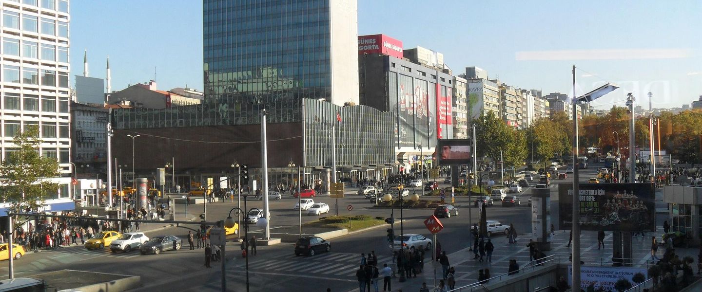


Kizilay, Ankara’s central district, combines metro-linked city life with Güvenpark, bookshops, cafés, cultural venues and lively streets near Kocatepe Mosque.
Central Ankara in Motion
Kizilay is Ankara’s most recognisable central neighbourhood, a dense meeting point where government workers, students, shoppers, commuters and long-established residents cross paths throughout the day. Its name is often used broadly for the surrounding central area, while the formal administrative setting belongs to Çankaya district. At its core, Kizilay Square and Güvenpark provide the clearest orientation, surrounded by major avenues, metro entrances, bus stops and the commercial streets that radiate towards Kavaklıdere, Sıhhiye and Kolej.Read more about Kizilay
Streets, Squares and Everyday Culture
A Base for Exploring Ankara
Best attractions in Kizilay
Kizilay’s attractions are largely urban and cultural rather than monumental. Güvenpark is the neighbourhood’s principal public space, offering mature trees, paths and the prominent Güven Monument amid the transport activity of the central square. The surrounding streets provide a more intimate way to explore the district: Karanfil Sokak and Konur Sokak are lined with cafés, bookshops and small businesses, while Yüksel Caddesi has long been associated with pedestrian movement and city-centre social life. Sakarya Caddesi introduces a denser restaurant and bar scene, and the nearby streets towards Meşrutiyet contain theatres, offices and cultural venues. Kocatepe Mosque stands just beyond the southern commercial core and is readily reached on foot, although its immediate setting is better understood as adjoining central Kizilay rather than as the neighbourhood’s sole landmark. The area’s appeal lies in observing Ankara’s everyday civic and commercial life at close range.
-
Tourist attraction
Güvenpark
Discover Güvenpark, Ankara's serene urban oasis offering lush greenery, community spirit, and a perfect escape in the heart of the city.
4 min walk · 0.3 km from neighbourhood centre
-
Park
Abdi İpekçi Park
Discover the tranquility of Abdi İpekçi Park, a lush green sanctuary in Ankara perfect for relaxation, recreation, and enjoying nature's beauty.
9 min walk · 0.7 km from neighbourhood centre


Best landmarks in Kizilay
Güvenpark is Kizilay’s defining landmark: its landscaped public space, central monument and position beside the city’s principal transport junction express Ankara’s planned-capital identity. The Güven Monument, associated with security and civic confidence in the early Republic, gives the otherwise heavily trafficked square a symbolic focus. Kızılay Square itself is less an architectural ensemble than an important urban reference point, repeatedly reshaped by transport, commercial development and public life. The surrounding avenues preserve the scale of central republican Ankara through broad roads, office buildings and mixed-use blocks, while Kocatepe Mosque forms a striking religious landmark on the southern edge of the area. It is commonly visited from Kizilay but lies in the adjoining Kocatepe locality. Together, these places show the district’s layered character: civic planning, mass transport, commercial growth and religious architecture sharing a compact central setting.
-
Monument
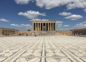
Anıtkabir
Discover Anıtkabir, the iconic mausoleum of Atatürk, a must-visit monument in Ankara that embodies the spirit of modern Turkey.
18 min walk · 1.5 km from neighbourhood centre
-
Park
Güvenpark
Discover Güvenpark, a beautiful urban oasis in Ankara's Kızılay district, blending tranquility with vibrant local culture and stunning greenery.
4 min walk · 0.3 km from neighbourhood centre
-
Sculpture
Ataturk Statue
Explore the Ataturk Statue in Ankara, a magnificent tribute to the founder of modern Turkey, surrounded by vibrant culture and history.
7 min drive · 2.2 km from neighbourhood centre
-
Monument
Mareşal Atatürk Anıtı
Discover the legacy of Mustafa Kemal Atatürk at Mareşal Atatürk Anıtı, a monumental tribute in Ankara's heart, rich in history and cultural significance.
4 min walk · 0.3 km from neighbourhood centre


Explore Kizilay on the map
A handpicked selection of must-see spots in Kizilay, mapped for you.
Best hotels in Kizilay
Best restaurants in Kizilay
Kizilay offers one of Ankara’s broadest central selections of informal dining, shaped by commuters, students, office workers and evening visitors. Around Sakarya Caddesi and the adjoining streets, restaurants and eateries serve familiar Turkish dishes, grilled meats, soups, pide, döner and home-style plates, alongside bakeries, cafés and quick snacks suited to the district’s constant movement. Karanfil Sokak, Konur Sokak and the streets around Meşrutiyet provide a more café-led atmosphere, with places for tea, coffee and light meals between shopping or cultural visits. The dining scene is generally practical and varied rather than concentrated around a single local speciality; menus change as independent businesses open, close or relocate. Visitors should distinguish the busy central restaurant streets from the quieter office and residential edges, and should check menus and service charges before ordering when a venue is unfamiliar.
-
Restaurant
Düveroğlu
Experience authentic Turkish flavors at Düveroğlu in Kızılay, Ankara - where every dish tells a story.
2 min walk · 0.1 km from neighbourhood centre
-
Restaurant
FLZ Cafe & Restaurant
Discover FLZ Cafe & Restaurant in Ankara - where delightful flavors meet warm hospitality in the heart of Kızılay.
2 min walk · 0.2 km from neighbourhood centre
-
Russian
Наше Кафе(Nashe Kafe)
Discover the heart of Russian cuisine at Наше Кафе in Kızılay – where tradition meets flavor in every dish.
5 min walk · 0.4 km from neighbourhood centre
-
 Restaurant
Taraça Restaurant Et ve Balik Lokantasi
Discover Taraça Restaurant in Kızılay, Ankara - where fresh seafood meets exquisite meat dishes in a cozy setting.
3 min walk · 0.2 km from neighbourhood centre


Best bars in Kizilay
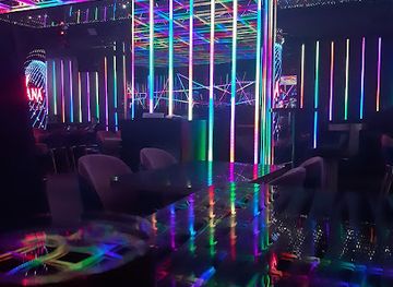
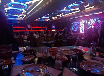
Kizilay remains active after office hours, particularly around Sakarya Caddesi, Karanfil Sokak, Konur Sokak and nearby side streets. Its evening scene is associated more with student-friendly bars, casual pubs, cafés and small music-oriented venues than with a concentrated nightclub strip. Some streets become sociable meeting places for Ankara’s university population, while others retain a daytime commercial character once shops and offices close. Live performances and cultural evenings may be found in the broader central area, but specific programmes and venues change, so current information should be checked locally. The district is well connected by public transport compared with many outer neighbourhoods, yet visitors should still plan their return route, especially if travelling beyond the metro and Ankaray network. Noise levels vary sharply between entertainment streets and nearby residential blocks.
-
Bar
Always Rock Bar
Experience the energy of Ankara's nightlife at Always Rock Bar, where live music meets a vibrant atmosphere and diverse drink options.
2 min walk · 0.2 km from neighbourhood centre
-
Bar
Ahır Pub & Bistro
Experience the vibrant nightlife at Ahır Pub & Bistro, where locals and tourists gather for great drinks and lively entertainment in Ankara.
4 min walk · 0.3 km from neighbourhood centre
-
Pub
Babel Pub
Discover the lively Babel Pub in Çankaya, Ankara - a perfect blend of local culture, vibrant atmosphere, and an extensive drink selection.
5 min walk · 0.4 km from neighbourhood centre
-
Pub
Valley Bar
Experience the lively atmosphere and vibrant nightlife at Valley Bar, a must-visit pub in Kızılay, Ankara, offering great drinks and entertainment.
3 min walk · 0.2 km from neighbourhood centre


Best nightclubs in Kizilay
Kizilay remains active after office hours, particularly around Sakarya Caddesi, Karanfil Sokak, Konur Sokak and nearby side streets. Its evening scene is associated more with student-friendly bars, casual pubs, cafés and small music-oriented venues than with a concentrated nightclub strip. Some streets become sociable meeting places for Ankara’s university population, while others retain a daytime commercial character once shops and offices close. Live performances and cultural evenings may be found in the broader central area, but specific programmes and venues change, so current information should be checked locally. The district is well connected by public transport compared with many outer neighbourhoods, yet visitors should still plan their return route, especially if travelling beyond the metro and Ankaray network. Noise levels vary sharply between entertainment streets and nearby residential blocks.
-
Night club
Nirvana Night Club
Discover Ankara's premier nightlife destination at Nirvana Night Club, where music, style, and unforgettable experiences come together.
6 min walk · 0.5 km from neighbourhood centre
-
Night club
Reyna Show
Dive into Ankara's nightlife at Reyna Show, a vibrant night club where music, dance, and entertainment unite for an unforgettable experience.
2 min walk · 0.2 km from neighbourhood centre
-
Night club
Sehrazat
Discover the vibrant nightlife of Ankara at Sehrazat, a premier night club known for its electrifying atmosphere and exceptional entertainment.
3 min walk · 0.2 km from neighbourhood centre
-
Night club
Monamour
Experience the vibrant nightlife at Monamour, Çankaya's premier night club, featuring electrifying music and an unforgettable atmosphere.
6 min walk · 0.5 km from neighbourhood centre


Best shops in Kizilay
Shopping in Kizilay is concentrated along its dense central streets rather than in a single enclosed retail complex. Around Kızılay Square, Meşrutiyet Caddesi and İzmir Caddesi, visitors encounter everyday fashion, footwear, services and convenience retail, while Karanfil Sokak, Konur Sokak and Yüksel Caddesi are better suited to browsing independent shops, bookshops, cafés and small specialist businesses. Sakarya and its neighbouring lanes are more strongly associated with food and casual evening trade than with souvenir shopping. The area’s retail character reflects Ankara’s working city centre: practical, mixed and continually changing, with student-oriented businesses alongside long-established commercial premises. Visitors looking for traditional crafts and historic-market atmosphere should continue towards Ulus rather than expecting Kizilay to reproduce the old bazaar district. In Kizilay, the pleasure lies in exploring the connected streets and observing the capital’s contemporary everyday commerce.
-
Department store
Ülkealan Passage
Explore Ülkealan Passage in Kızılay, Ankara - your one-stop destination for shopping and local culture.
1 min walk · 0.1 km from neighbourhood centre
-
Gift shop
Guvercin Av Malzemeleri
Explore Guvercin Av Malzemeleri in Kızılay, Ankara, for unique gifts that capture the essence of Turkish culture and craftsmanship.
3 min walk · 0.2 km from neighbourhood centre
-
Gift shop
Elif Hediyelik
Discover unique gifts and authentic Turkish treasures at Elif Hediyelik in the heart of Ankara's Kızılay district.
3 min walk · 0.2 km from neighbourhood centre
-
Gift shop
Melanie Art Gallery
Explore the vibrant art scene at Melanie Art Gallery in Kızılay, Ankara - a perfect spot for unique gifts and cultural treasures.
2 min walk · 0.2 km from neighbourhood centre


Kizilay essentials
Getting There
Getting Around
Safety
Emergency Situations
Do's and Don'ts
Local Tips

From Eve
Local phrases worth knowing
You don't need to get them perfect. A few words go a long way, and locals appreciate the effort.
Basics
| English | Local | Say it |
|---|---|---|
| Hello | Merhaba | [Mer-ha-ba] |
| Goodbye | Hoşçakal | [Hosh-cha-kal] |
| Yes | Evet | [Ev-et] |
| No | Hayır | [Ha-yur] |
| Please/You're welcome | Lütfen | [Loot-fen] |
| Thank you | Teşekkür ederim | [Te-shek-kur ed-er-im] |
| Excuse me/Sorry | Özür dilerim | [O-zur di-le-rim] |
| How are you? | Nasılsınız? | [Na-sul-sun-uz] |
| Fine. And you? | İyiyim. Ya siz? | [Ee-yee-yim. Ya siz?] |
| Do you speak English? | İngilizce konuşabilir misiniz? | [Ing-i-liz-je ko-nu-sha-bil-ir mi-si-niz] |
| I don't understand | Anlamıyorum | [An-la-mi-yor-um] |
Eating & Drinking
| English | Local | Say it |
|---|---|---|
| I'd like to see the menu, please | Menüyü görmek istiyorum, lütfen | [Me-nu-yu ger-mek is-tee-yor-um, loot-fen] |
| I don't eat meat | Et yemem | [Et ye-mem] |
| Cheers! | Şerefe! | [She-re-fe] |
| I would like to pay, please | Ödemek istiyorum, lütfen | [O-de-mek is-tee-yor-um, loot-fen] |
Emergencies
| English | Local | Say it |
|---|---|---|
| Help! | Yardım edin! | [Yar-dum ed-in] |
| Go away! | Uzaklaşın! | [Oo-zak-la-shin] |
| Call the Police! | Polisi arayın! | [Po-li-si a-ry-un] |
| Call a doctor! | Doktor çağırın! | [Dok-tor cha-ee-run] |
| I'm lost | Kayboldum | [Kay-bol-dum] |
| I'm ill | Hastaım | [Has-ta-um] |
Shopping
| English | Local | Say it |
|---|---|---|
| I'd like to buy... | Satın almak istiyorum... | [Sat-un al-mak is-tee-yor-um] |
| I'm just looking | Sadece bakıyorum | [Sa-de-ce ba-ku-yor-um] |
| How much is it? | Ne kadar? | [Ne ka-dar] |
| That's too expensive | Çok pahalı | [Chok pa-ha-luh] |
| Can you lower the price? | Fiyatı düşürebilir misiniz? | [Fee-yat-uh du-shu-re-bil-ir mi-si-niz] |
Time & Numbers
| English | Local | Say it |
|---|---|---|
| What time is it? | Saat kaç? | [Sa-at kach] |
| It's one o'clock | Saat bir | [Sa-at beer] |
| Half past (10) | On buçuk | [On boo-chuk] |
| Morning | Sabah | [Sa-bah] |
| Afternoon | Öğleden sonra | [O-le-den af-ter-na] |
| Evening | Akşam | [Ak-sham] |
| Yesterday | Dün | [Doon] |
| Today | Bugün | [Boo-gun] |
| Tomorrow | Yarın | [Ya-run] |
| 1 | Bir | [Beer] |
| 2 | İki | [Ee-kee] |
| 3 | Üç | [Ooch] |
| 4 | Dört | [Dort] |
| 5 | Beş | [Besh] |
| 6 | Altı | [Al-tuh] |
| 7 | Yedi | [Yed-ee] |
| 8 | Sekiz | [Se-keez] |
| 9 | Dokuz | [Do-kooz] |
| 10 | On | [On] |
Transport & Directions
| English | Local | Say it |
|---|---|---|
| Where's a/the...? | ... nerede? | [... ner-e-de] |
| What's the address? | Adres nedir? | [Ad-res ne-dir] |
| Can you show me (on the map)? | Haritada gösterebilir misiniz? | [Ha-ree-ta-da ger-ste-re-bil-ir mi-si-niz] |
| When's the next (bus)? | Sonraki ne zaman? | [Son-ra-ki ne za-man] |
| A ticket (to ....) | Bir bilet (....'ya) | [Beer bee-let (...-ya)] |
History of Kizilay
From Rural Edge to Planned Capital
Before Ankara became the capital of the Republic of Türkiye in 1923, the area now associated with Kizilay lay south of the old town and outside its historic core. Its transformation followed the decision to develop a modern administrative capital and the implementation of new urban plans during the early republican period. Roads, public buildings and residential districts extended southwards from Ulus, gradually creating the central urban corridor that would later become Kizilay. The neighbourhood’s modern identity therefore belongs largely to twentieth-century capital-building rather than to Ankara’s ancient settlement history.
The Red Crescent and Güvenpark
Kizilay takes its name from the Turkish Red Crescent, Türk Kızılay, whose headquarters and institutional presence became closely associated with the central square. The name replaced earlier references to the area and became established in everyday usage as Ankara expanded. Güvenpark, opened in the early republican era as part of the planned central city, provided a public green space beside the principal transport routes. Its monument, fountains and mature trees helped give the district a civic focus, even as the surrounding streets became increasingly commercial and congested.
A Growing Commercial Centre
From the mid-twentieth century onwards, Kizilay developed into one of Ankara’s main commercial and transport centres. Offices, cinemas, department stores, cafés and restaurants filled the avenues around the square, while bus services and later rail connections made the area a natural meeting point for people travelling from across the capital. The surrounding streets also gained a strong association with students, civil servants, booksellers and cultural organisations. This mixture of commerce, public administration and everyday social life gave Kizilay a distinctly metropolitan role within Ankara, even though much of its built fabric remained utilitarian.
Metro Modernisation and Changing Streets
The opening of Ankara’s metro and the continued development of the Ankaray light-rail system reinforced Kizilay’s position as the capital’s principal interchange. Improved rail connections brought more visitors and commuters through the square, while pedestrian streets such as Karanfil, Konur and Yüksel evolved as important settings for cafés, independent retail and cultural activity. The area has also experienced the pressures common to central districts: redevelopment, changing rents, traffic management and the replacement of older businesses. Its contemporary character remains defined by movement and mixed uses rather than by a single preserved architectural style.
Kizilay in Photos
Browse through our photo collection highlighting the charm and character of the destination.
Neighbourhoods near Kizilay
The closest neighbourhoods to Kizilay, if you have time for more than one stop.
-

-

-

-


Swipe for more neighbourhoods
Explore more
Explore more of Ankara
Explore Ankara, where ancient history meets modern vibrancy in the heart of Turkey.
Explore Ankara