

Free Cedar Valley Travel Guide & Mobile App
Explore Cedar Valley with free travel guides. Discover regional history, expert tips, proposed trips, and audio guides on web or mobile app.


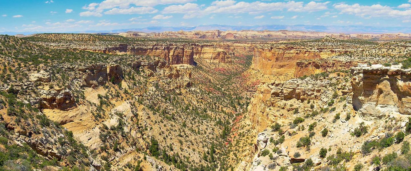


Explore Cedar Valley, Utah, for high-desert scenery, frontier history, open trails and growing communities west of Utah Lake.
Read more about Cedar Valley
Getting to and around Cedar Valley
How to get there
Transportation
Best attractions in Cedar Valley
Cedar Valley’s attractions combine frontier history with open high-desert recreation. Camp Floyd State Park at Fairfield is the region’s principal heritage destination, interpreting the 1858–1861 army post through the surviving Stagecoach Inn, museum displays and the remains of a once substantial military settlement. Cedar Fort provides another perspective on the nineteenth-century settlement story, although the community is primarily residential and local in character rather than a large museum complex. Around Eagle Mountain and the valley’s foothills, visitors will find parks, open-space areas, equestrian country and routes suited to walking, cycling and wildlife observation, subject to land access and seasonal conditions. The eastern side offers approaches towards Utah Lake, while the basin itself is best appreciated for its expansive views, sagebrush landscape and changing mountain light. Birdwatching can be rewarding around suitable wetlands and water bodies, and winter brings a different character to the surrounding ranges. Many recreational opportunities are informal rather than heavily developed, so maps, water, sun protection and careful attention to property boundaries are important. The region’s appeal lies less in a dense sequence of attractions than in the contrast between a historical site, growing suburban communities and a broad landscape still shaped by agriculture and open land.
-
Non-profit organization
Thanksgiving Point
Explore the enchanting Thanksgiving Point in Lehi, Utah, where nature, history, and fun come together for an unforgettable experience.
-
Museum
Museum of Natural Curiosity at Thanksgiving Point
Explore the Museum of Natural Curiosity, a family-friendly attraction in Lehi, Utah, where education and fun merge through interactive exhibits and experiences.
-
Museum
Mountain America Museum of Ancient Life at Thanksgiving Point
Experience the thrill of prehistoric life at the Mountain America Museum of Ancient Life in Lehi, Utah, where education and adventure come together.
-
Tourist attraction
Margaret Wines Park
Discover the serene beauty of Margaret Wines Park, a perfect blend of recreation and relaxation in Lehi, Utah.


Best landmarks in Cedar Valley
Camp Floyd State Park’s Stagecoach Inn is Cedar Valley’s most recognisable historic structure. Built to serve travellers and the military community near Camp Floyd, it anchors a landscape that once contained a large frontier army post and remains the clearest physical reminder of the Utah War era. The nearby Fairfield area also preserves the setting of stage and overland routes that crossed the basin during the nineteenth century. Cedar Fort is significant for a different reason: its name and settlement pattern recall the defensive agricultural communities established by Mormon settlers during the tense territorial years of the 1850s. Beyond built heritage, the valley itself functions as a geographical landmark. Its wide, elevated floor, sagebrush plains and enclosing mountain ranges create a distinctive Great Basin panorama, particularly when viewed from roads and foothill elevations. The eastern horizon opens towards Utah Lake and the densely settled Wasatch Front, while the quieter western and southern reaches retain a more rural appearance. Modern Eagle Mountain’s planned streets and expanding neighbourhoods are not historic monuments, but they are important symbols of the valley’s transformation from an agricultural and military landscape into a growing part of metropolitan Utah County.
-
National park
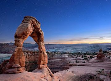
Arches National Park
Explore the breathtaking beauty of Arches National Park, home to over 2,000 stunning natural stone arches and magnificent desert landscapes.
-
Historical landmark
Temple Square
Discover the spiritual and historical beauty of Temple Square in Salt Lake City, a must-visit destination for tourists exploring Utah's rich cultural heritage.
-
Aquarium
Loveland Living Planet Aquarium
Explore the vibrant marine life and engaging exhibits at Loveland Living Planet Aquarium, a top tourist attraction in Utah that promotes conservation and education.
-
National park
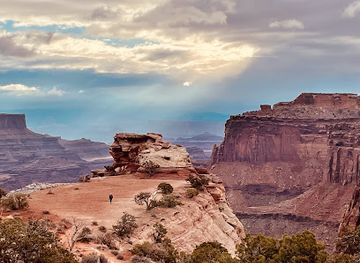
Canyonlands National Park
Explore the stunning landscapes and outdoor adventures that await in Canyonlands National Park, a natural gem in Utah's wilderness.


Explore Cedar Valley on the map
Plan your trip on one map. See where the top cities, national parks and sights are, and book hotels and experiences in a few clicks.
Best hotels in Cedar Valley
Best restaurants in Cedar Valley
Cedar Valley’s dining scene reflects its expanding suburban population rather than a narrowly defined regional cuisine. Eagle Mountain and Saratoga Springs contain the greatest concentration of casual restaurants, cafés, takeaway food and family-oriented dining, with choices ranging from American staples to widely available international styles. Fairfield and Cedar Fort have fewer places to eat, so visitors exploring the historic sites should plan meals and fuel in advance rather than expect a continuous restaurant strip. Utah food traditions are visible in familiar American-Western fare, bakery items, burgers, barbecue and hearty café cooking, while nearby farms and ranches contribute to the wider county’s agricultural identity. Farmers’ markets and seasonal produce stalls may provide a better opportunity to seek local food than formal destination dining, depending on the time of year. Alcohol service and restaurant licensing follow Utah law, which differs in some respects from other US states; check current venue requirements rather than assuming every establishment operates in the same way. For a practical itinerary, eat in one of the larger communities before or after visiting Fairfield and carry water and snacks for rural excursions.
-
Diner
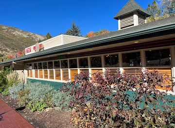
Ruth's Diner
Experience the flavors of America amidst stunning canyon views at Ruth's Diner – where comfort food meets nature's beauty.
-
Hawaiian
Mo' Bettahs Hawaiian Style Food
Indulge in authentic Hawaiian flavors at Mo' Bettahs - where every meal is a delicious escape to paradise.
-
Amusement park
Boondocks Food and Fun - Draper
Discover endless fun at Boondocks Food and Fun - Draper: Go-karts, laser tag, mini-golf & more await your adventurous spirit!
-
Japanese
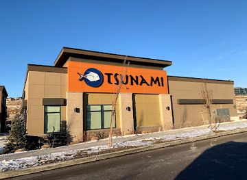
Tsunami Restaurant & Sushi Bar - Traverse Mountain
Experience exquisite sushi and innovative Asian fusion dishes at Tsunami Restaurant & Sushi Bar in Traverse Mountain, Utah.


Best bars in Cedar Valley
Nightlife in Cedar Valley is modest and dispersed, reflecting the region’s family-oriented suburbs and rural settlements. Eagle Mountain and Saratoga Springs provide the widest choice of evening restaurants, casual meeting places and occasional live entertainment, while Cedar Fort and Fairfield are quieter and generally close earlier than a major city centre. Visitors are more likely to find a relaxed meal, sports-oriented venue, café or community event than a dedicated nightclub district. Utah’s alcohol regulations apply throughout the region, so service arrangements, identification requirements and drink availability may differ from those familiar to international visitors. Evening walks and scenic drives should be planned carefully because roads outside the main communities can be dark and services are limited. The valley’s open horizons make sunset viewing and stargazing appealing alternatives to late-night entertainment, provided visitors use safe pull-offs, respect private land and avoid restricted areas.
-
Brewpub
Bohemian Brewery
Discover the essence of craft brewing at Bohemian Brewery in Midvale, Utah, where great beer meets delicious food in a welcoming atmosphere.
-
Bar
Prohibition
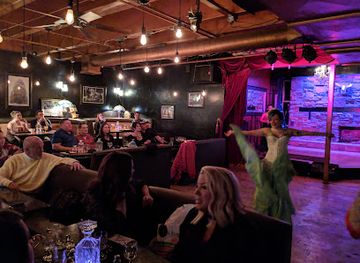
Discover Prohibition in Salt Lake City: a unique bar and brunch restaurant blending fine dining with an enchanting speakeasy atmosphere.
-
Cocktail bar
Whiskey Street Cocktails & Dining
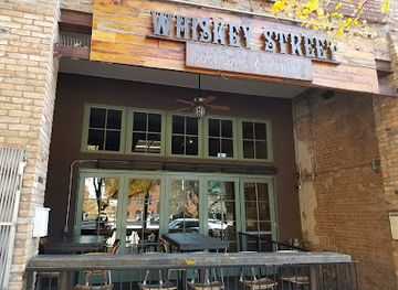
Discover the vibrant atmosphere and exceptional cocktails at Whiskey Street Cocktails & Dining, Salt Lake City's premier cocktail bar and restaurant.
-
Bar
Ice Haus
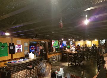
Discover the vibrant atmosphere of Ice Haus in Murray, where creative cocktails, delicious vegan dishes, and live music come together for unforgettable experiences.

Best shops in Cedar Valley
Shopping in Cedar Valley is concentrated in the newer commercial areas of Eagle Mountain and Saratoga Springs, where visitors will find everyday retail, supermarkets, cafés, services and practical supplies for travelling through the wider basin. These communities are more useful for fuel, provisions and outdoor essentials than for a specialised souvenir-shopping experience. Cedar Fort and Fairfield have a smaller retail presence, so do not rely on historic areas for extensive browsing or last-minute equipment. Seasonal farmers’ markets, community markets and local produce stands, when operating, offer opportunities to buy fruit, baked goods and other goods connected with Utah County’s agricultural surroundings. Regional souvenirs are more likely to be found through museums, heritage sites, galleries or independent makers in the broader county than in a dedicated Cedar Valley craft quarter. Visitors interested in the area’s history should prioritise interpretive material and locally produced items at Camp Floyd State Park where available, while those seeking antiques, specialist crafts or a larger choice of independent shops may need to travel outside Cedar Valley to the established commercial centres of Utah County.
-
Gift shop
The Holiday co
Explore The Holiday Co in Lehi, Utah for unique gifts and local crafts that capture the essence of your travels in a charming gift shop.

Get your free copy of our complete guide to Cedar Valley, delivered straight to you.
Everything on this page, from attractions and restaurants to essentials and local phrases, in one PDF you can read offline, print or share.
Already have an account? Sign in
Your Cedar Valley guide is ready.
We'll send it to · Not you? Sign out

Getting your guide ready…
We are putting together a fresh copy of the Cedar Valley guide. This can take up to a minute.
This can take a few moments. If your browser asks, choose Allow so the download can start. You'll find the guide in your Downloads folder.
Nothing happened? Download it again
Sorry, the guide is taking longer than usual. Please try again in a minute, or get it by email instead.
Cedar Valley essentials
Currency and Payment
Safety
Emergency Situations
Do's and Don'ts
Local Tips
From Eve
Local phrases worth knowing
You don't need to get them perfect. A few words go a long way, and locals appreciate the effort.
Basics
| English | Local | Say it |
|---|---|---|
| Hello | Howdy | [haʊdi] |
| Goodbye | See ya | [si jə] |
| Yes | Yep | [jɛp] |
| No | Nope | [noʊp] |
| Please/You're welcome | Please/No problem | [pliz/noʊ ˈprɒbləm] |
| Thank you | Thanks | [θæŋks] |
| Excuse me/Sorry | Excuse me/Sorry | [ɪkˈskjuz mi/ˈsɔri] |
| How are you? | How's it going? | [haʊz ɪt ˈgoʊɪŋ] |
| Fine. And you? | Good. And you? | [ɡʊd. ənd ju] |
| Do you speak English? | Do ya speak English? | [du jə spiːk ˈɪŋɡlɪʃ] |
| I don't understand | I don't get it | [aɪ doʊnt ɡɛt ɪt] |
Eating & Drinking
| English | Local | Say it |
|---|---|---|
| I'd like to see the menu, please | Can I see the menu, please? | [kæn aɪ si ðə ˈmɛnju, pliz] |
| I don't eat meat | I don't eat meat | [aɪ doʊnt it miːt] |
| Cheers! | Cheers! | [tʃɪrz] |
| I would like to pay, please | Can I get the check, please? | [kæn aɪ ɡɛt ðə tʃɛk, pliz] |
Emergencies
| English | Local | Say it |
|---|---|---|
| Help! | Help! | [hɛlp] |
| Go away! | Leave me alone! | [liːv mi əˈloʊn] |
| Call the Police! | Call the cops! | [kɔl ðə kɑps] |
| Call a doctor! | Get a doctor! | [ɡɛt ə ˈdɑktər] |
| I'm lost | I'm lost | [aɪm lɔst] |
| I'm ill | I’m not feeling well | [aɪm nɒt ˈfiːlɪŋ wɛl] |
Shopping
| English | Local | Say it |
|---|---|---|
| I'd like to buy... | I want to buy... | [aɪ wɑnt tə baɪ] |
| I'm just looking | Just browsing | [dʒʌst ˈbraʊzɪŋ] |
| How much is it? | What’s the price? | [wʌts ðə praɪs] |
| That's too expensive | That’s a bit pricey | [ðæts ə bɪt ˈpraɪsi] |
| Can you lower the price? | Can you give me a better price? | [kæn jə ɡɪv mi ə ˈbɛtər praɪs] |
Time & Numbers
| English | Local | Say it |
|---|---|---|
| What time is it? | What time is it? | [wʌt taɪm ɪz ɪt] |
| It's one o'clock | It's one o'clock | [ɪts wʌn əˈklɑk] |
| Half past (10) | Half past ten | [hæf pæst tɛn] |
| Morning | Morning | [ˈmɔrnɪŋ] |
| Afternoon | Afternoon | [ˈæftərˌnun] |
| Evening | Evening | [ˈivnɪŋ] |
| Yesterday | Yesterday | [ˈjɛstərˌdeɪ] |
| Today | Today | [təˈdeɪ] |
| Tomorrow | Tomorrow | [təˈmɔroʊ] |
| 1 | One | [wʌn] |
| 2 | Two | [tu] |
| 3 | Three | [θri] |
| 4 | Four | [fɔr] |
| 5 | Five | [faɪv] |
| 6 | Six | [sɪks] |
| 7 | Seven | [ˈsɛvən] |
| 8 | Eight | [eɪt] |
| 9 | Nine | [naɪn] |
| 10 | Ten | [tɛn] |
Transport & Directions
| English | Local | Say it |
|---|---|---|
| Where's a/the...? | Where's the...? | [wɛrz ðə] |
| What's the address? | What’s the address? | [wʌt ðə əˈdrɛs] |
| Can you show me (on the map)? | Can you point it out? | [kæn jə pɔɪnt ɪt aʊt] |
| When's the next (bus)? | When's the next bus? | [wɛn ðə nɛkst bʌs] |
| A ticket (to ....) | A ticket to... | [ə ˈtɪkɪt tə] |
History of Cedar Valley
Lake Bonneville and the Ancient Basin
Cedar Valley’s landforms were shaped in part by Lake Bonneville, the large Ice Age lake that covered much of western Utah before retreating roughly 13,000 years ago. Former shorelines and deposits around the wider Great Basin help explain the valley’s broad, relatively level floor and surrounding benches. Long before modern settlement, Indigenous peoples used the springs, wetlands and travel corridors of this region. The valley lies within the wider cultural landscape of Great Basin and Ute country, and its archaeological record reflects an environment that supported seasonal movement, hunting and gathering.
Indigenous Homelands and Early Contact
Before Euro-American settlement, the wider Utah Valley and Cedar Valley region was associated particularly with Ute peoples, including bands whose economies and seasonal movements followed water, grassland and mountain resources. Contact, trade, disease and changing political control intensified during the nineteenth century as explorers, trappers and emigrants crossed the interior West. Later settlement narratives often centred on the arrival of Mormon colonists, but the region’s history also includes the displacement and marginalisation of Indigenous communities as farms, roads and military installations expanded.
Cedar Fort and Mormon Settlement in the 1850s
Cedar Fort was established in 1857 by Mormon settlers as part of a defensive agricultural settlement in Cedar Valley. Its name refers to the juniper trees found in the surrounding country, commonly called cedars in local usage. The settlement reflected the pressures of the Utah War period, when conflict between the federal government and Utah’s territorial authorities created anxiety among communities. Fortified layouts and communal organisation were intended to provide security while settlers developed farms, irrigation and livestock operations in an arid environment.
Camp Floyd and the Utah War, 1858–1861
Camp Floyd, near present-day Fairfield, was established in 1858 for the United States Army during the Utah War. Its purpose was to maintain a federal military presence in Utah Territory after tensions over territorial administration, federal authority and local governance. At its height, the camp housed thousands of soldiers and support personnel and became a substantial settlement in an otherwise sparsely developed basin. The army departed in 1861 after the outbreak of the American Civil War, but the site’s surviving Stagecoach Inn and museum preserve the story of the post and its surrounding community.
Stage Routes, Pony Express and Overland Travel
Cedar Valley stood along important nineteenth-century travel corridors linking settlements in Utah with routes across the Great Basin. The Camp Floyd area was connected to stage and freight traffic, and the Pony Express and Overland Stage systems used routes through the broader region during the brief period before transcontinental rail travel transformed western transport. These routes brought soldiers, mail, merchants and emigrants through the valley, reinforcing Fairfield’s importance beyond its agricultural population. Traces of the era survive most clearly through the Camp Floyd historic complex and local road patterns.
Agriculture, Water and Rural Continuity
After the army left, Cedar Valley’s communities continued as agricultural settlements supported by wells, springs and irrigation. Hay, grains, livestock and other farm activities suited the basin’s dry climate, though water availability has always restricted what could be cultivated. Cedar Fort and Fairfield retained rural identities while nearby Utah County developed more densely. The contrast between irrigated fields and open sagebrush is a visible reminder that settlement in the valley depended on managing scarce water rather than simply occupying empty land.
Suburban Expansion in the Late Twentieth and Early Twenty-First Centuries
Cedar Valley entered a new phase as improved roads, housing demand and population growth spread westwards from Utah County’s older urban corridor. Eagle Mountain, incorporated in 1996, became the most prominent example of planned suburban development in the basin, while Saratoga Springs expanded along the eastern side near Utah Lake. New schools, neighbourhoods, parks and commercial areas have altered the valley’s settlement pattern, yet large undeveloped tracts, working agricultural land and historic communities remain. The region’s current character is therefore defined by the meeting of rapid growth and an older rural landscape.
Cedar Valley in Photos
Browse through our photo collection highlighting the charm and character of the destination.
Neighbouring regions of Cedar Valley
The closest regions to Cedar Valley, if you have time for more than one.
-
-

-

-

-


Swipe for more regions
Explore more

Explore more of Utah
Explore Utah's stunning national parks, rich cultural heritage, and year-round outdoor adventures. Discover why this diverse state is a top destination for travelers.
Explore Utah