

Free Great Salt Lake Desert Travel Guide & Mobile App
Explore Great Salt Lake Desert with free travel guides. Discover regional history, expert tips, proposed trips, and audio guides on web or mobile app.


Explore Utah's Great Salt Lake Desert for Bonneville salt flats, open skies, historic trails, stark mountain ranges and remote Great Basin scenery.
Read more about Great Salt Lake Desert
Getting to and around Great Salt Lake Desert
How to get there
Transportation
Best attractions in Great Salt Lake Desert
The Great Salt Lake Desert's attractions are defined by geology, distance and historical traces rather than a concentration of visitor facilities. The Bonneville Salt Flats provide the region's signature landscape, with a broad white playa that changes character according to moisture, light and season. Nearby Bonneville Speedway is associated with organised land-speed events, although access and activity are conditional and should be checked before travelling. In the wider desert, isolated mountain ranges such as the Silver Island Mountains offer stark contrasts to the level basin and opportunities for experienced four-wheel-drive travellers, geology enthusiasts and photographers. Simpson Springs preserves a Pony Express and overland-travel connection, while the former Lake Bonneville shoreline explains the basin's unusual landforms. Archaeological sites, including the vicinity of Danger Cave near the western Utah border, reflect much older human use but may have limited access and should be treated respectfully. Stargazing is rewarding because artificial light is sparse, while permitted off-highway routes appeal to visitors prepared for self-reliant travel. The desert's scale is itself an attraction, but it also means that recreation must be balanced with water planning, weather awareness and strict respect for military and land-management restrictions.
-
Tourist attraction
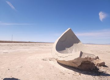
The Tree of Utah
Discover the iconic Tree of Utah, a stunning desert sculpture that blends art and nature into a breathtaking experience.
Best landmarks in Great Salt Lake Desert
The Bonneville Salt Flats are the defining natural landmark of the Great Salt Lake Desert, an exceptionally broad remnant of Lake Bonneville whose white surface creates a powerful visual boundary between earth and sky. The flats also carry an important modern association with the Bonneville Speedway and the pursuit of land-speed records. Around the basin, the Silver Island Mountains rise as isolated rocky masses above the level playa, demonstrating the desert's basin-and-range geology and providing particularly strong landscape contrasts. Simpson Springs is a more modest but historically meaningful landmark: its surviving station recalls the Pony Express and the overland routes that made this difficult crossing part of American migration history. Ancient Lake Bonneville shorelines can be read in terraces and sedimentary forms along surrounding ranges, while the largely empty horizon is itself a defining geographical feature. These landmarks are not arranged as a compact sightseeing circuit; some require remote-road travel, and all demand attention to weather, access conditions, water supply and restrictions around military land.
-
Historical landmark
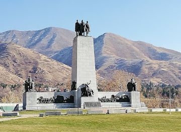
This Is The Place Heritage Park
Immerse yourself in Utah's pioneering past at This Is The Place Heritage Park, a captivating historical landmark and family-friendly destination.
-
Historical landmark
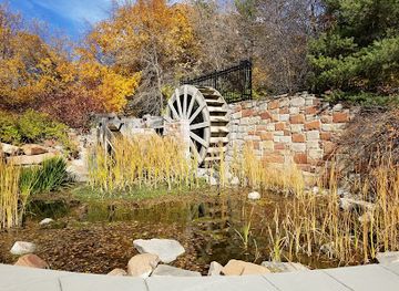
Brigham Young Historic Park
Discover the serene beauty and historical significance of Brigham Young Historic Park in Salt Lake City, a testament to early Mormon heritage.
-
Historical landmark
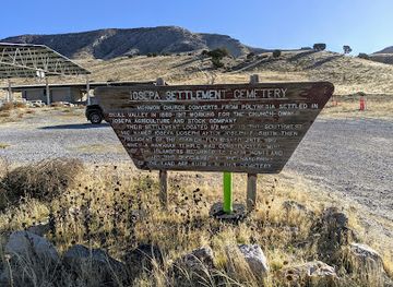
Iosepa
Explore the haunting beauty of Iosepa, a historical landmark in Utah that reveals the rich cultural heritage of Hawaiian settlers amid stunning desert landscapes.
-
Historical landmark
Anderson Tower Monument
Discover the historical essence of Salt Lake City at the Anderson Tower Monument, where stunning views meet rich cultural significance.
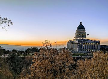
Explore Great Salt Lake Desert on the map
Plan your trip on one map. See where the top cities, national parks and sights are, and book hotels and experiences in a few clicks.
Best hotels in Great Salt Lake Desert
Best restaurants in Great Salt Lake Desert
There is no established restaurant scene within the open Great Salt Lake Desert, so dining is primarily a matter of preparation rather than spontaneous discovery. Travellers should obtain water, packed food and fuel in the Salt Lake City area, Tooele or Wendover, which lies largely outside the Utah region across the Nevada border. Highway services are limited and should not be treated as guaranteed at every journey stage. The broader Utah surroundings offer American diner food, cafés, bakeries, burgers and Mexican-influenced cooking, while small communities may have convenience stores and informal takeaways rather than destination dining. A picnic is often the most practical way to eat beside the salt flats, but visitors should take all waste away and avoid leaving food exposed in the heat. The culinary interest here lies in the logistics of travelling through a remote desert, not in a distinctive local cuisine concentrated within the region.
-
American
The Copper Onion
Experience exquisite New American cuisine at The Copper Onion in Downtown Salt Lake City – where local flavors meet culinary innovation.
-
Grill
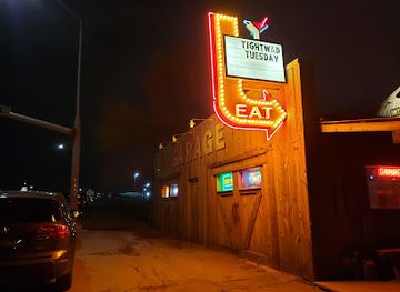
Garage on Beck
Experience the best of American cuisine at Garage on Beck in Salt Lake City—where great food meets live music in a vibrant setting.
-
American
Log Haven
Experience exquisite American cuisine amidst breathtaking natural beauty at Log Haven - your ultimate dining retreat near Salt Lake City.
-
Cocktail bar
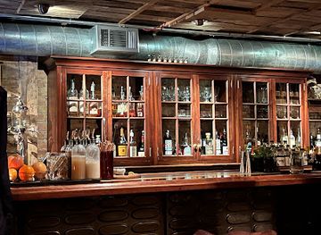
Bodega and The Rest
Discover Bodega and The Rest: A premier cocktail bar offering exquisite New American cuisine in downtown Salt Lake City.


Best bars in Great Salt Lake Desert
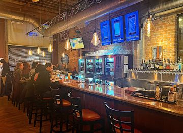
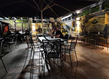
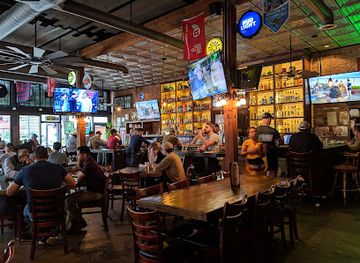
Nightlife within the Great Salt Lake Desert is effectively absent, reflecting its lack of permanent settlements and entertainment districts. Evenings are more likely to involve stargazing, quiet driving routes or resting at accommodation outside the desert than visiting bars or clubs. Wendover, mostly in Nevada and outside the Utah region, provides the nearest concentration of hotels, casinos, restaurants and licensed evening venues, while communities east of the desert offer a more conventional small-town selection of pubs and dining establishments. Visitors should not rely on reaching a venue after a long day in the open desert: distances are substantial, roads can be dark and mobile coverage variable. Alcohol should never be combined with remote driving, off-highway travel or high-temperature exposure. The region's most appropriate evening culture is the natural darkness and silence of the Great Basin, experienced with adequate clothing, water and a reliable return plan.
-
Grill
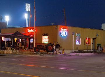
Lucky 13
Experience the vibrant flavors of Lucky 13, an American grill and bar in Salt Lake City, where delicious food and friendly service create unforgettable moments.
-
American
The Bayou
Experience authentic Cajun cuisine and a vibrant atmosphere at The Bayou in Salt Lake City, featuring a wide selection of craft beers and delicious American dishes.
-
Bar
Gracie's
Discover Gracie's in Salt Lake City - an exciting gastropub blending delicious American cuisine, craft beers, and live music for an unforgettable night out.
-
Bar
The Green Pig Pub
Discover The Green Pig Pub in Downtown Salt Lake City: Where great food, drinks, and lively entertainment come together in a vibrant pub atmosphere.
Best nightclubs in Great Salt Lake Desert
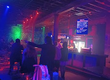
Nightlife within the Great Salt Lake Desert is effectively absent, reflecting its lack of permanent settlements and entertainment districts. Evenings are more likely to involve stargazing, quiet driving routes or resting at accommodation outside the desert than visiting bars or clubs. Wendover, mostly in Nevada and outside the Utah region, provides the nearest concentration of hotels, casinos, restaurants and licensed evening venues, while communities east of the desert offer a more conventional small-town selection of pubs and dining establishments. Visitors should not rely on reaching a venue after a long day in the open desert: distances are substantial, roads can be dark and mobile coverage variable. Alcohol should never be combined with remote driving, off-highway travel or high-temperature exposure. The region's most appropriate evening culture is the natural darkness and silence of the Great Basin, experienced with adequate clothing, water and a reliable return plan.
-
Night club
Area 51
Discover Salt Lake City's nightlife at Area 51, a lively night club featuring diverse music and an energetic atmosphere for memorable experiences.
-
Night club
Sky SLC
Discover the energetic nightlife of Sky SLC, a premier nightclub in Salt Lake City offering dance, live music, and vibrant ambiance.
-
Night club
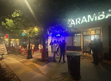
Club Karamba
Discover Salt Lake City's vibrant nightlife at Club Karamba, the go-to destination for dancing, drinks, and unforgettable memories.
-
Night club
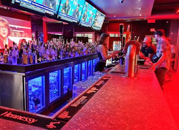
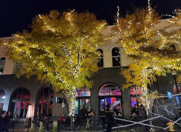
Echo Nightclub
Immerse yourself in Salt Lake City's nightlife at Echo Nightclub, where live music, vibrant atmosphere, and creative cocktails come together.
Best shops in Great Salt Lake Desert
Shopping opportunities within the Great Salt Lake Desert are limited to roadside provisions and practical supplies rather than a regional retail scene. Buy fuel, water, food, sun protection, maps and vehicle essentials before leaving larger towns such as Salt Lake City or Tooele; Wendover, largely outside the region in Nevada, is another nearby service base. There are no substantial shopping streets, craft centres or dependable market towns in the open desert. Visitors seeking Utah-made foods, books, outdoor equipment, Native American art or locally produced crafts will find a broader selection in urban and established communities outside the desert, where provenance and cultural permissions can be discussed properly. The most appropriate souvenirs from the region are durable, legally purchased items such as books about Lake Bonneville, the Pony Express, geology or land-speed history, rather than collected salt, rocks or archaeological materials. Leave the playa and surrounding public land as found, and do not remove natural or historic objects.
-
Shopping mall
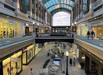
City Creek Center
Discover the vibrant shopping and dining experience at City Creek Center in the heart of Salt Lake City, where luxury meets charm.
-
Shopping mall
Fashion Place
Discover a vibrant shopping experience at Fashion Place, where retail therapy meets culinary delights and entertainment in one dynamic hub.
-
Shopping mall
The Gateway
Explore The Gateway in Salt Lake City, a vibrant shopping mall with unique stores, delicious dining, and cultural attractions in one exciting location.
-
Shopping mall
The Shops at South Town
Explore The Shops at South Town: A vibrant shopping mall in Sandy, Utah, featuring diverse stores, dining, and entertainment for all.
Get your free copy of our complete guide to Great Salt Lake Desert, delivered straight to you.
Everything on this page, from attractions and restaurants to essentials and local phrases, in one PDF you can read offline, print or share.
Already have an account? Sign in
Your Great Salt Lake Desert guide is ready.
We'll send it to · Not you? Sign out

Getting your guide ready…
We are putting together a fresh copy of the Great Salt Lake Desert guide. This can take up to a minute.
This can take a few moments. If your browser asks, choose Allow so the download can start. You'll find the guide in your Downloads folder.
Nothing happened? Download it again
Sorry, the guide is taking longer than usual. Please try again in a minute, or get it by email instead.
Great Salt Lake Desert essentials
Currency and Payment
Safety
Emergency Situations
Do's and Don'ts
Local Tips
From Eve
Local phrases worth knowing
You don't need to get them perfect. A few words go a long way, and locals appreciate the effort.
Basics
| English | Local | Say it |
|---|---|---|
| Hello | Howdy | [Hau-dee] |
| Goodbye | See ya | [See yah] |
| Yes | Yep | [Yep] |
| No | Nah | [Nah] |
| Please/You're welcome | Please/No problem | [Pleez/No prob-lum] |
| Thank you | Thanks | [Thangs] |
| Excuse me/Sorry | Pardon me/Sorry | [Par-don mee/Sor-ree] |
| How are you? | How's it going? | [How's it goin'?] |
| Fine. And you? | Good. And you? | [Good. An' you?] |
| Do you speak English? | Do ya speak English? | [Doo ya speak Ing-lish?] |
| I don't understand | I don't get it | [I don't get it] |
Eating & Drinking
| English | Local | Say it |
|---|---|---|
| I'd like to see the menu, please | Can I see the menu, please? | [Can I see the men-you, pleez?] |
| I don't eat meat | I don't eat meat | [I don't eat meat] |
| Cheers! | Cheers! | [Cheers!] |
| I would like to pay, please | Can I get the check, please? | [Can I get the chek, pleez?] |
Emergencies
| English | Local | Say it |
|---|---|---|
| Help! | Help! | [Help!] |
| Go away! | Leave me alone! | [Leave me a-lone!] |
| Call the Police! | Call the cops! | [Call the cops!] |
| Call a doctor! | Get a doctor! | [Get a doc-tor!] |
| I'm lost | I can't find my way | [I can't find my way] |
| I'm ill | I'm not feeling well | [I'm not feelin' well] |
Shopping
| English | Local | Say it |
|---|---|---|
| I'd like to buy... | I wanna buy... | [I wanna buy...] |
| I'm just looking | Just browsing | [Just browsin'] |
| How much is it? | What’s the price? | [What's the price?] |
| That's too expensive | That costs too much | [That costs too much] |
| Can you lower the price? | Can ya give me a better deal? | [Can ya give me a bet-ter deal?] |
Time & Numbers
| English | Local | Say it |
|---|---|---|
| What time is it? | What time ya got? | [What time ya got?] |
| It's one o'clock | It's one | [It's one] |
| Half past (10) | Half past ten | [Half past ten] |
| Morning | Morning | [Morning] |
| Afternoon | Afternoon | [Afternoon] |
| Evening | Evening | [Evening] |
| Yesterday | Yesterday | [Yesterday] |
| Today | Today | [Today] |
| Tomorrow | Tomorrow | [Tomorrow] |
| 1 | One | [One] |
| 2 | Two | [Two] |
| 3 | Three | [Three] |
| 4 | Four | [Four] |
| 5 | Five | [Five] |
| 6 | Six | [Six] |
| 7 | Seven | [Seven] |
| 8 | Eight | [Eight] |
| 9 | Nine | [Nine] |
| 10 | Ten | [Ten] |
Transport & Directions
| English | Local | Say it |
|---|---|---|
| Where's a/the...? | Where's the...? | [Where's the...?] |
| What's the address? | What's the address? | [What's the ad-dress?] |
| Can you show me (on the map)? | Can ya point it out on the map? | [Can ya point it out on the map?] |
| When's the next (bus)? | When's the next bus? | [When's the next bus?] |
| A ticket (to ....) | A ticket to ... | [A ticket to ...] |
History of Great Salt Lake Desert
Lake Bonneville and the Ancient Basin
During the late Ice Age, much of northern Utah was covered by Lake Bonneville, a vast freshwater lake that reached far beyond the modern Great Salt Lake. As the climate became warmer and drier, the lake shrank, leaving behind shorelines, sediments and salt deposits across the Great Salt Lake Desert. The Bonneville Salt Flats are among the clearest surviving expressions of this geological history. Ancient shore terraces remain visible on surrounding mountain slopes and help explain the desert's broad, level form.
Indigenous Great Basin Homelands
The desert lies within the wider cultural landscape of Great Basin Indigenous peoples, including Goshute and Western Shoshone communities. Knowledge of springs, seasonal resources, plants and routes was essential in an environment that later outsiders often regarded only as an obstacle. Archaeological evidence around the basin records human presence extending deep into prehistory. Contemporary tribal connections remain important, and visitors should treat archaeological materials, springs and culturally sensitive places with care.
Emigrant Trails and the Donner-Reed Party
In the nineteenth century, emigrant routes connected the settlements of the American West with California, crossing the Great Salt Lake Desert on difficult stretches where water was scarce. The Donner-Reed party's 1846 journey across the desert became one of the best-known episodes in overland migration history, illustrating the consequences of inadequate supplies and delayed progress. Their route formed part of a broader network used by wagon parties, guides and later stage services.
The Pony Express and Overland Travel
The Pony Express operated from 1860 to 1861, carrying mail rapidly between Missouri and California through the Great Basin. Its riders and support stations depended on carefully spaced water sources and relay points across the desert. Simpson Springs, along the old route west of the modern Salt Lake Valley, preserves a tangible reminder of this short-lived but influential system. The Pony Express also foreshadowed the more durable transport networks that followed.
Railways, Mining and Western Infrastructure
Railways transformed movement across western Utah, linking mining districts, settlements and national markets while reducing dependence on wagon roads. The wider desert became a corridor for tracks, telegraph lines, roads and later motor traffic. Mineral extraction, particularly salt and other evaporite resources, developed wherever the arid basin made them commercially practical. Although the landscape can appear empty, its infrastructure history reflects the steady effort to move people, goods and information across the interior West.
Military Testing in the Desert
The remoteness of western Utah made the desert useful for military training and research. Dugway Proving Ground was established during the Second World War and has continued as a restricted United States Army testing area. Its presence is part of the modern history of the desert, but it also means that some roads and land are closed to the public. Visitors must obey signs, gates and boundary warnings rather than attempting to explore restricted terrain.
Bonneville Speedway and Land-Speed Records
The hard salt surface attracted automotive and motorcycle engineers seeking a long, level course for high-speed testing. Organised speed events at Bonneville helped make the flats internationally recognised, with pioneering vehicles and drivers pursuing land-speed records during the twentieth century. The salt is both a sporting venue and a fragile natural surface, so events depend on suitable conditions and management arrangements. Its reputation has given an otherwise remote Utah landscape a global technological association.
Neighbouring regions of Great Salt Lake Desert
The closest regions to Great Salt Lake Desert, if you have time for more than one.
-

-

-

-

-


Swipe for more regions
Explore more

Explore more of Utah
Explore Utah's stunning national parks, rich cultural heritage, and year-round outdoor adventures. Discover why this diverse state is a top destination for travelers.
Explore Utah