

Free Southwest Wisconsin Travel Guide & Mobile App
Explore Southwest Wisconsin with free travel guides. Discover regional history, expert tips, proposed trips, and audio guides on web or mobile app.


Explore Southwest Wisconsin for Driftless hills, Mississippi River towns, mining heritage, local food and scenic cycling, hiking and paddling.
Read more about Southwest Wisconsin
Getting to and around Southwest Wisconsin
How to get there
Transportation
Top city travel guides in Southwest Wisconsin
The cities of Southwest Wisconsin, and the easiest places to base yourself.
-

-


Swipe for more cities
Destinations in Southwest Wisconsin
Resorts, valleys and scenic spots worth a trip of their own.

Swipe for more destinations
Best attractions in Southwest Wisconsin
Southwest Wisconsin's attractions are spread through a landscape rather than concentrated in one resort centre. Historic town visits can begin in Mineral Point, whose nineteenth-century mining heritage survives in stone buildings and museums, or in Platteville, where the Mining & Rollo Jamison Museums interpret the region's lead-mining past. Spring Green brings visitors to Taliesin, Frank Lloyd Wright's home and studio complex, as well as the wider Wisconsin River valley, while Prairie du Chien offers Mississippi River history through Fort Crawford Museum and nearby historic sites. Outdoor choices include Governor Dodge State Park's wooded hills and lakes, Wyalusing State Park's high river overlooks, Blue Mound State Park's ridges and the Kickapoo Valley's winding waterways. Rail trails support walking and cycling, and rivers provide opportunities for paddling, fishing and wildlife observation when conditions permit. Vernon and Richland counties are particularly suited to scenic drives through coulees, farms and small communities, with local food venues and seasonal markets adding a contemporary dimension. The region's appeal lies in combining modest museums, important historic places and accessible countryside rather than relying on a single headline attraction.
-
State park
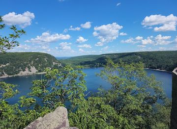
Devil's Lake State Park
Experience the breathtaking landscapes and outdoor adventures at Devil's Lake State Park, Wisconsin's largest state park, perfect for nature lovers and outdoor enthusiasts.
-
Tourist attraction
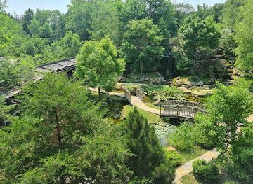
The House on the Rock
Explore the enchanting world of The House on the Rock in Spring Green, where creativity meets architectural wonder amidst stunning landscapes.
-
Tourist attraction
Cave of the Mounds
Experience the breathtaking beauty of the Cave of the Mounds in Wisconsin, a geological wonder with stunning formations and outdoor adventures.
-
Tourist attraction
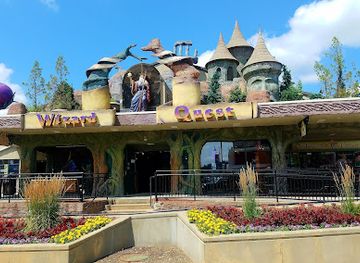
Wizard Quest
Experience the magic of adventure at Wizard Quest in Wisconsin Dells, where interactive quests and enchanting characters await every visitor.

Best landmarks in Southwest Wisconsin
The defining landmarks of Southwest Wisconsin are closely tied to its geology, rivers and history. Taliesin near Spring Green is a major architectural landmark: Frank Lloyd Wright's home, studio and working estate illustrate the architect's long relationship with the Wisconsin landscape. Mineral Point's stone cottages and commercial buildings, associated with its lead-mining era, form one of the region's most recognisable historic townscapes. Prairie du Chien's position at the meeting of the Mississippi and Wisconsin river systems gives it a powerful geographical identity, reinforced by the surviving history of Fort Crawford. In Platteville, the old mining district and the city's civic buildings recall the mineral boom that helped shape southwest settlement. Governor Dodge State Park's wooded ridges and lagoons, Wyalusing State Park's elevated views across the Mississippi and Wisconsin confluence, and the steep bluffs of the Driftless Area serve as natural landmarks rather than isolated monuments. Courthouse squares in Lancaster and other county seats complete the picture, expressing the region's nineteenth-century political and agricultural development.
-
Tourist attraction
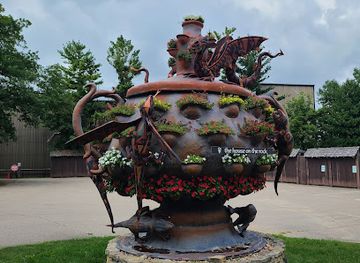
The House on the Rock
Discover the surreal beauty and whimsical charm of The House on the Rock, an architectural marvel and eclectic museum in Spring Green, Wisconsin.
-
History museum
Circus World | A Wisconsin Historic Site
Experience the captivating history of circus arts at Circus World in Baraboo, Wisconsin - a must-visit destination for families and history enthusiasts alike.
-
Historical place museum
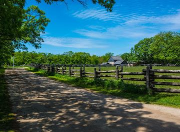
Old World Wisconsin
Discover the rich history of 19th-century America at Old World Wisconsin, a captivating historical museum featuring authentic buildings and immersive experiences.
-
Tourist attraction
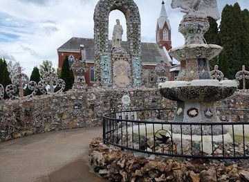
Dickeyville Grotto & Shrines
Discover the artistic and spiritual marvel of Dickeyville Grotto, a unique shrine blending faith and creativity in the heart of Wisconsin.
Explore Southwest Wisconsin on the map
Plan your trip on one map. See where the top cities, national parks and sights are, and book hotels and experiences in a few clicks.
Best hotels in Southwest Wisconsin
Best restaurants in Southwest Wisconsin
Dining in Southwest Wisconsin reflects both the state's dairy traditions and the fertile, varied conditions of the Driftless landscape. Cheese, butter, seasonal vegetables, apples, maple products, locally raised meat, trout and freshwater fish appear in restaurants, cafés, farm shops and seasonal markets. Old-fashioned supper clubs remain part of the regional landscape, generally offering generous American cooking and a relaxed evening meal, while small-town diners, bakeries and coffee shops provide useful stops on rural drives. Around Viroqua and other farming communities, visitors will find a strong interest in organic produce, heirloom crops, local grains and direct farm sales, although availability changes with the season. River towns add fish, burgers and straightforward café cooking rather than a single distinctive cuisine. Local breweries and Wisconsin-made dairy products are common accompaniments, and farmers' markets are among the best places to sample the region's current food culture. In very rural districts, restaurant choice can be limited and closing days vary, so planning meals around larger towns is sensible.
-
Restaurant
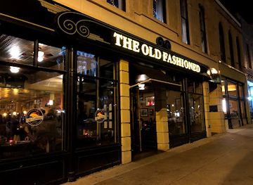
The Old Fashioned
Discover The Old Fashioned in Madison - where traditional American cuisine meets local flavors in a charming setting.
-
Fondue
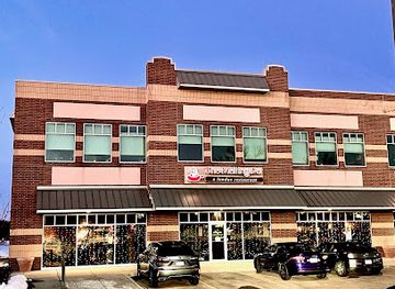
The Melting Pot
Discover the art of fondue at The Melting Pot in Madison—a fine dining experience that blends culinary creativity with interactive enjoyment.
-
Fine Dining
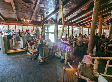
Ishnala Supper Club
Discover fine dining at Ishnala Supper Club - where exquisite cuisine meets breathtaking views in Lake Delton.
-
Restaurant
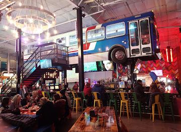
Grateful Shed
Discover unique flavors and vibrant atmosphere at Grateful Shed in Wisconsin Dells—a perfect dining spot for every traveler.
Best bars in Southwest Wisconsin
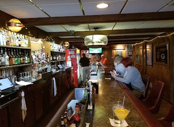
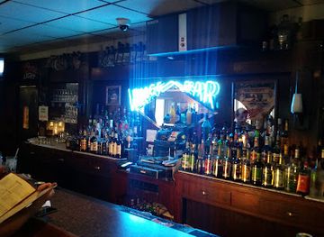
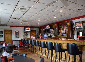
Evening life in Southwest Wisconsin is primarily based in traditional pubs, supper clubs, brewery taprooms, café-bars and live-music settings rather than large nightclubs. Platteville's university population gives it a more concentrated social scene than many surrounding towns, while La Crosse, outside the core region, is a larger nearby nightlife centre for some western itineraries. Mineral Point, Spring Green, Viroqua, Prairie du Chien and other county-seat communities offer places for a drink or meal, but their evening options are modest and often dispersed. Local breweries provide tastings and conversation, and historic inns or taverns can be atmospheric without operating as late-night clubs. Rural venues sometimes host music, theatre or seasonal events, though schedules change and should be checked locally. Visitors travelling between valleys should not assume that a chosen bar or restaurant will be open late, and a designated driver is especially important on winding country roads.
-
Bar
Yardarm Riverfront Bar & Grill
Enjoy delicious food, refreshing drinks, and live music at Yardarm Riverfront Bar & Grill, a vibrant riverside destination in Dubuque.
-
Restaurant
3 Mile House Supper Club
Experience the best of American cuisine at 3 Mile House Supper Club in Hazel Green, WI, a perfect destination for food enthusiasts and travelers alike.
-
Grill
Village Bar Supper Club
Experience the heart of Wisconsin's culinary scene at Village Bar Supper Club, where delicious grilled dishes and cozy ambiance await you.
-
Pizza
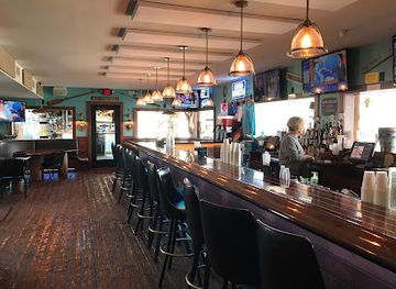
Gooch's Green House Tavern
Discover Gooch's Green House Tavern in Kieler, WI, where irresistible pizza and a warm atmosphere create the perfect dining experience.
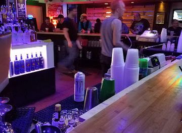
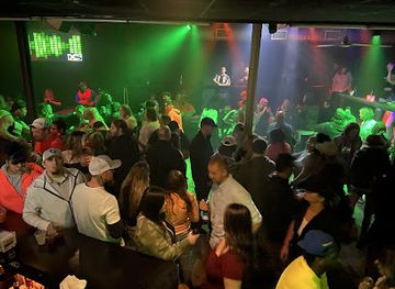
Best nightclubs in Southwest Wisconsin
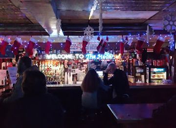
Evening life in Southwest Wisconsin is primarily based in traditional pubs, supper clubs, brewery taprooms, café-bars and live-music settings rather than large nightclubs. Platteville's university population gives it a more concentrated social scene than many surrounding towns, while La Crosse, outside the core region, is a larger nearby nightlife centre for some western itineraries. Mineral Point, Spring Green, Viroqua, Prairie du Chien and other county-seat communities offer places for a drink or meal, but their evening options are modest and often dispersed. Local breweries provide tastings and conversation, and historic inns or taverns can be atmospheric without operating as late-night clubs. Rural venues sometimes host music, theatre or seasonal events, though schedules change and should be checked locally. Visitors travelling between valleys should not assume that a chosen bar or restaurant will be open late, and a designated driver is especially important on winding country roads.
-
Grill
Village Bar Supper Club
Discover the flavors of Cuba City at Village Bar Supper Club, a grill offering delicious dishes and a warm, inviting atmosphere.
-
Bar
Sandy Hook Tavern
Experience local charm and great drinks at Sandy Hook Tavern in Hazel Green, Wisconsin - a perfect stop for relaxation and community spirit.
-
Gay night club
FIVE Nightclub
Experience the vibrant energy of FIVE Nightclub, Madison's premier gay nightclub, where fun and acceptance come together for an unforgettable night out.
-
Night club
XS Nightclub
Experience the vibrant nightlife of Green Bay at XS Nightclub, where electrifying music and a lively atmosphere await.

Best shops in Southwest Wisconsin
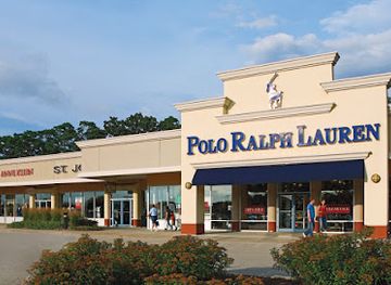
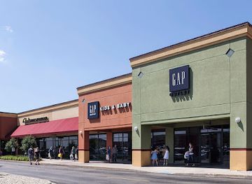
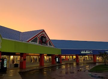
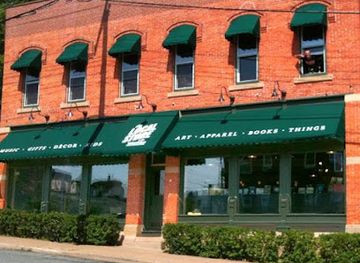
Shopping in Southwest Wisconsin is centred on small downtowns, historic main streets, farmers' markets and farm shops rather than large retail districts. Mineral Point is particularly associated with galleries, studios, antiques and locally made arts and crafts, while Spring Green and Viroqua offer independent shops, books, gifts, food products and contemporary craft. Platteville, Lancaster, Prairie du Chien and other county seats provide practical high-street shopping alongside seasonal markets. Good regional purchases include Wisconsin cheese, maple products, preserves, honey, apples, locally roasted coffee and small-batch beer, subject to transport and customs rules for international travellers. Art galleries and pottery studios are common in communities with established creative scenes, while antiques and architectural salvage reflect the area's older buildings and rural heritage. Market days vary by season and town, so visitors should check locally rather than rely on a single fixed timetable. Outside the larger communities, retail hours can be limited, especially in winter.
-
Outlet mall
Pleasant Prairie Premium Outlets
Discover amazing deals at Pleasant Prairie Premium Outlets, Wisconsin's premier shopping destination with over 90 designer stores and a delightful atmosphere.
-
Outlet mall
Johnson Creek Premium Outlets
Uncover incredible savings at Johnson Creek Premium Outlets, your go-to destination for brand-name shopping in Wisconsin's beautiful countryside.
-
Outlet mall
The Outlet Shoppes at Oshkosh
Discover incredible savings and a diverse range of brands at The Outlet Shoppes at Oshkosh, your ultimate shopping destination in Wisconsin.
-
Gift shop
Volume One & The Local Store
Explore Eau Claire's cultural heart at Volume One & The Local Store, where local art and unique gifts come together in a vibrant atmosphere.
Get your free copy of our complete guide to Southwest Wisconsin, delivered straight to you.
Everything on this page, from attractions and restaurants to essentials and local phrases, in one PDF you can read offline, print or share.
Already have an account? Sign in
Your Southwest Wisconsin guide is ready.
We'll send it to · Not you? Sign out

Getting your guide ready…
We are putting together a fresh copy of the Southwest Wisconsin guide. This can take up to a minute.
This can take a few moments. If your browser asks, choose Allow so the download can start. You'll find the guide in your Downloads folder.
Nothing happened? Download it again
Sorry, the guide is taking longer than usual. Please try again in a minute, or get it by email instead.
Southwest Wisconsin essentials
Currency and Payment
Safety
Emergency Situations
Do's and Don'ts
Local Tips
From Eve
Local phrases worth knowing
You don't need to get them perfect. A few words go a long way, and locals appreciate the effort.
Basics
| English | Local | Say it |
|---|---|---|
| Hello | Howdy | [How-dee] |
| Goodbye | See ya later | [See ya lay-ter] |
| Yes | Yep | [Yep] |
| No | Nope | [Nope] |
| Please/You're welcome | Please/No problem | [Please/No prob-lem] |
| Thank you | Thanks a bunch | [Thanks a bunch] |
| Excuse me/Sorry | Pardon me/Sorry | [Par-don me/Sor-ry] |
| How are you? | How ya doin'? | [How ya doin'?] |
| Fine. And you? | Good, and you? | [Good, and you?] |
| Do you speak English? | Do ya speak English? | [Do ya speak English?] |
| I don't understand | I don't get it | [I don't get it] |
Eating & Drinking
| English | Local | Say it |
|---|---|---|
| I'd like to see the menu, please | Can I see the menu, please? | [Can I see the menu, please?] |
| I don't eat meat | I don't eat meat | [I don't eat meat] |
| Cheers! | Cheers! | [Cheers!] |
| I would like to pay, please | Could I get the check, please? | [Could I get the check, please?] |
Emergencies
| English | Local | Say it |
|---|---|---|
| Help! | Help! | [Help!] |
| Go away! | Get lost! | [Get lost!] |
| Call the Police! | Call the cops! | [Call the cops!] |
| Call a doctor! | Get a doctor! | [Get a doctor!] |
| I'm lost | I'm lost | [I'm lost] |
| I'm ill | I'm not feelin' well | [I'm not feelin' well] |
Shopping
| English | Local | Say it |
|---|---|---|
| I'd like to buy... | I wanna buy... | [I wanna buy...] |
| I'm just looking | Just looking around | [Just looking around] |
| How much is it? | How much's this? | [How much's this?] |
| That's too expensive | That's a bit pricey | [That's a bit pricey] |
| Can you lower the price? | Can ya give me a better price? | [Can ya give me a better price?] |
Time & Numbers
| English | Local | Say it |
|---|---|---|
| What time is it? | What time ya got? | [What time ya got?] |
| It's one o'clock | It's one o'clock | [It's one o'clock] |
| Half past (10) | Half past ten | [Half past ten] |
| Morning | Mornin' | [Mornin'] |
| Afternoon | Afternoon | [Afternoon] |
| Evening | Evenin' | [Evenin'] |
| Yesterday | Yesterday | [Yesterday] |
| Today | Today | [Today] |
| Tomorrow | Tomorrow | [Tomorrow] |
| 1 | One | [One] |
| 2 | Two | [Two] |
| 3 | Three | [Three] |
| 4 | Four | [Four] |
| 5 | Five | [Five] |
| 6 | Six | [Six] |
| 7 | Seven | [Seven] |
| 8 | Eight | [Eight] |
| 9 | Nine | [Nine] |
| 10 | Ten | [Ten] |
Transport & Directions
| English | Local | Say it |
|---|---|---|
| Where's a/the...? | Where's the...? | [Where's the...?] |
| What's the address? | What's the address? | [What's the address?] |
| Can you show me (on the map)? | Could ya show me on the map? | [Could ya show me on the map?] |
| When's the next (bus)? | When's the next bus? | [When's the next bus?] |
| A ticket (to ....) | A ticket to ... | [A ticket to ...] |
History of Southwest Wisconsin
Ho-Chunk, Menominee and Indigenous Landscapes
Southwest Wisconsin has long been home to Indigenous peoples, especially the Ho-Chunk, whose historic communities and cultural ties extend across the Driftless landscape and Wisconsin River country. The Menominee and other nations also have longstanding connections with the wider state. Rivers, ridges, prairies and wooded valleys supported travel, hunting, farming and exchange. European settlement did not erase these histories, although nineteenth-century United States policies brought dispossession, forced removals and profound disruption. Contemporary visitors should understand the landscape as Indigenous homeland rather than an empty frontier awaiting settlement.
French Trade and Mississippi River Forts
French explorers and traders entered the upper Mississippi region in the seventeenth century, building relationships and commercial networks with Indigenous nations. Prairie du Chien became an important meeting and trading site because it stood at the junction of river routes and overland paths. Under later British and United States control, the settlement's strategic value continued. Fort Crawford, established by the United States in the nineteenth century, reflects the military importance of the Mississippi corridor and remains part of Prairie du Chien's historic identity.
Lead Mining and the Mineral District
Lead deposits transformed southwest Wisconsin during the early nineteenth century. Miners, traders and immigrants gathered around settlements including Mineral Point, Platteville and Potosi, digging shallow shafts into the area's mineral-bearing hills. The industry connected the region to national markets and encouraged the growth of roads, commerce and government institutions. Mining declined as accessible deposits were exhausted and competition changed, but its legacy remains visible in restored buildings, mining museums, place names and the distinctive built heritage of the southwestern towns.
Territorial Government and Statehood
As settlement expanded, southwest Wisconsin became part of the organised political geography of the Wisconsin Territory, created in 1836, and then the state admitted to the Union in 1848. County seats such as Lancaster, Dodgeville and Viroqua developed courthouses, businesses and civic institutions that anchored surrounding farms. The town plans and public buildings of this period reveal how law, land administration and trade helped convert mining and agricultural settlements into enduring communities.
Agriculture, Dairy and Rural Communities
After mining's decline, agriculture became the central economic foundation of much of southwest Wisconsin. The region's hills and valleys favoured small and medium-sized farms, livestock, dairy production and diversified cropping rather than the broad, flat fields found elsewhere in the state. Creameries, local markets and rural cooperatives helped connect farms to larger economies. Dairy culture remains important, but contemporary agriculture also includes vegetables, fruit, herbs, maple products and other specialist production linked to farmers' markets and direct sales.
Railways, Highways and a New Rural Economy
Nineteenth-century railways linked inland towns and river ports with markets beyond Wisconsin, while twentieth-century highways changed how residents and visitors moved through the valleys. Some rail corridors later became recreational trails, including routes used for cycling and walking. Since the late twentieth century, heritage conservation, outdoor recreation, local food and cultural tourism have supplemented farming and manufacturing. Frank Lloyd Wright's Taliesin, historic town centres and the Driftless landscape now form part of a regional economy built as much around interpretation and access as around extraction.
Southwest Wisconsin in Photos
Browse through our photo collection highlighting the charm and character of the destination.
Neighbouring regions of Southwest Wisconsin
The closest regions to Southwest Wisconsin, if you have time for more than one.
-

-

-

-

-


Swipe for more regions
Explore more

Explore more of Wisconsin
Discover Wisconsin: A Midwestern gem offering stunning natural landscapes, rich cultural experiences, and a taste of America's finest dairy products.
Explore Wisconsin