

Free Cheaha Mountain Travel Guide & Mobile App
Explore Cheaha Mountain with free travel guides. Discover regional history, expert tips, proposed trips, and audio guides on web or mobile app.


Cheaha Mountain pairs Alabama’s highest summit with forested ridges, sandstone overlooks, hiking trails, camping and wide Appalachian foothill views.
Read more about Cheaha Mountain
Getting to and around Cheaha Mountain
How to get there
Transportation
Destinations in Cheaha Mountain
Resorts, valleys and scenic spots worth a trip of their own.

Swipe for more destinations
Best attractions in Cheaha Mountain
Cheaha Mountain’s attractions centre on protected landscapes and outdoor recreation rather than a dense collection of museums or commercial entertainment. Cheaha State Park provides the principal visitor base, with summit viewpoints, accommodation, camping, Cheaha Lake and a network of short and moderate walking routes. Bald Rock Boardwalk is especially accessible, leading to a broad sandstone overlook above the forested foothills. The park’s higher trails offer changing views through woodland and across ridges, while the surrounding Talladega National Forest expands the opportunities for hiking, wildlife observation, scenic driving and quiet picnicking. Sections of the Pinhoti Trail bring long-distance walking into the area, although they demand more planning than the summit paths. The mountain is also well suited to landscape photography, autumn foliage viewing and stargazing away from major urban lighting. Visitors should expect a natural recreation destination with limited commercial development; the appeal lies in elevation, forest, rock outcrops and the contrast between open viewpoints and shaded woodland.
-
State park
Cheaha State Park
Discover Alabama's highest point! Hike scenic trails, explore historic sites, and immerse yourself in the natural beauty of Cheaha State Park.
-
Tourist attraction
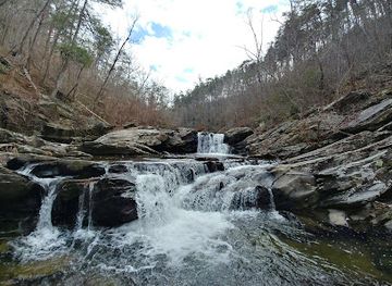
Devil's Den Falls
Discover a hidden gem in Alabama's Talladega National Forest: picturesque waterfalls, serene trails, and a peaceful natural escape near Lineville.
-
Tourist attraction
Highest Point in Alabama
Reach Alabama's highest point at Cheaha Mountain: panoramic views, historic landmarks, and hiking trails await in Cheaha State Park.


Best landmarks in Cheaha Mountain
Cheaha Mountain’s defining landmark is the summit area of Cheaha State Park, marking Alabama’s highest natural point and giving the destination its geographic significance. The summit’s elevated terrain, forested ridgelines and exposed sandstone create a distinctive visual identity within a state better known internationally for lowland landscapes and the Gulf Coast. Bald Rock is another prominent natural landmark: its broad rocky face and elevated overlook provide one of the clearest views across the southern Appalachian foothills. Cheaha Lake adds a contrasting lowland feature within the park, surrounded by woodland and recreation facilities. The historic character of the area is also expressed through surviving elements of the park’s early public-recreation design, including landscapes and structures associated with the Civilian Conservation Corps era. Beyond the park boundary, the long wooded ridges and trail corridors of Talladega National Forest form the mountain’s wider setting. Together these places are significant not because of monumental urban architecture, but because they show how Alabama’s highest summit, conservation history and Appalachian geography meet in one compact destination.
-
State park
Cheaha State Park
Discover Alabama's highest point at Cheaha State Park: Breathtaking views, hiking trails, and a rich history await in the heart of the Talladega National Forest.
-
Historical landmark
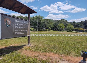
Freedom Riders National Monument
Explore the pivotal sites of the Freedom Riders National Monument in Anniston, AL, and honor the courageous fight for civil rights and equality.
-
Tourist attraction
Highest Point in Alabama
Discover breathtaking views and outdoor adventures at the Highest Point in Alabama, a must-visit natural landmark for every traveler.


Explore Cheaha Mountain on the map
Plan your trip on one map. See where the top cities, national parks and sights are, and book hotels and experiences in a few clicks.
Best hotels in Cheaha Mountain
Best restaurants in Cheaha Mountain
Dining on Cheaha Mountain is limited and oriented towards park visitors, self-catering and simple meals rather than a broad restaurant scene. Visitors staying in cabins or campsites should plan to bring groceries, picnic supplies and plenty of water, as the summit area does not offer the range of cafés, supermarkets and independent restaurants found in larger Alabama towns. The wider region reflects the food traditions of the American South, including barbecue, fried catfish, biscuits, cornbread, greens and sweet desserts, but individual options depend on the communities along the approach roads. Anniston, Oxford and other larger towns outside the mountain area provide more extensive choices for stocking up or dining before and after a visit. Farmers’ markets and roadside produce stalls may appear seasonally in nearby communities, offering a more local way to encounter regional fruit, vegetables and baked goods. Check current park and business arrangements before relying on an on-site meal.
-
State park
Cheaha State Park
Discover breathtaking views and outdoor adventures at Cheaha State Park - Alabama's highest point with hiking trails and scenic beauty.
-
Fast Food
Chick-fil-A
Experience delicious Southern-style fast food at Chick-fil-A in Oxford - home of the famous chicken sandwich and exceptional service.
-
American
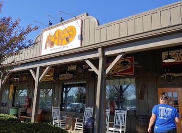
Cracker Barrel Old Country Store
Experience Southern hospitality at Cracker Barrel Old Country Store in Oxford, AL – where comfort food meets unique shopping.
-
Seafood
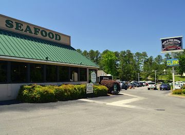
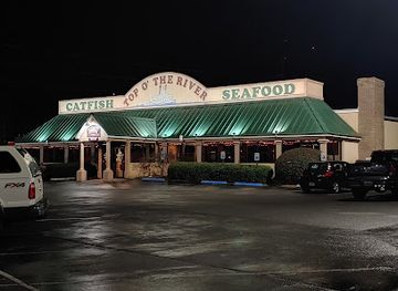
Top O' the River
Experience fresh seafood and Southern hospitality at Top O' the River in Anniston - where every meal is a celebration of flavor.


Best bars in Cheaha Mountain
Cheaha Mountain does not have a conventional nightlife district or a significant nightclub scene. Evenings are generally shaped by camping, cabin stays, quiet time at overlooks and the dark-sky quality of the forested setting rather than late-night entertainment. Visitors looking for a drink or a more social evening will find the most choice in larger towns outside the mountain area, where Alabama restaurants, neighbourhood bars and occasional live-music venues provide the principal options. Because roads are winding and distances between the summit and valley communities are substantial, drinking and driving should never be combined, and return transport should be arranged in advance. The mountain is better suited to an early start, sunset views where permitted, conversation around an authorised campsite and night-sky observation than to clubbing or bar-hopping.
-
Seafood
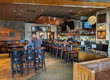
Top O' the River
Discover Top O' the River, Anniston's premier seafood restaurant, where fresh flavors and stunning river views meet for an unforgettable dining experience.
-
Steak
LongHorn Steakhouse
Experience the best of American cuisine at LongHorn Steakhouse in Oxford, Alabama, where every meal is a celebration of flavor and hospitality.
-
Grill
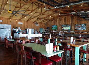
Decks and Docks
Experience the best of Southern cuisine at Decks and Docks, a charming grill in Leesburg, Alabama, known for its delicious food and scenic views.
-
American
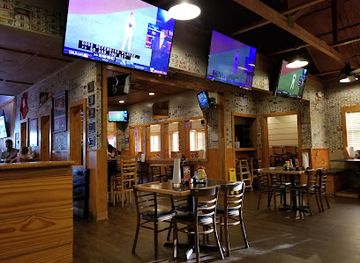
Jefferson's
Experience the best of American cuisine at Jefferson's in Oxford, Alabama – home to delicious chicken wings and gourmet hamburgers.
Best shops in Cheaha Mountain
Shopping on Cheaha Mountain is modest and primarily practical, with visitor purchases focused on park supplies, camping needs, maps, souvenirs and locally themed gifts where available. The summit area is not a shopping district, so visitors should obtain substantial groceries, fuel, outdoor equipment and medication in larger towns before driving into the mountain area. Communities along the approaches and in the surrounding foothills offer more conventional shops, supermarkets, farm stands and occasional independent retailers. Seasonal produce, preserves, baked goods and other food products may be available from roadside sellers or local markets, although opening arrangements vary. Alabama-themed crafts, books about regional nature and hiking, and small items connected with the state’s mountain landscape make more appropriate souvenirs than generic luxury goods. Those seeking antiques, galleries or a broader choice of regional products will find more options in nearby towns outside Cheaha Mountain, rather than at the summit itself.
-
Shopping mall
Oxford Exchange
Explore Oxford Exchange in Alabama for an unforgettable shopping and dining experience with diverse options for every taste.
-
Department store
Walmart Supercenter
Discover convenience and variety at Walmart Supercenter in Oxford, Alabama, your ultimate shopping destination for everything you need.
-
Electronics store
Best Buy
Explore Best Buy in Oxford for the latest electronics, appliances, and expert service in a modern shopping environment.
-
Clothing store
Ross Dress for Less
Discover unbeatable fashion deals at Ross Dress for Less in Oxford, AL, where style meets affordability for the whole family.



Get your free copy of our complete guide to Cheaha Mountain, delivered straight to you.
Everything on this page, from attractions and restaurants to essentials and local phrases, in one PDF you can read offline, print or share.
Already have an account? Sign in
Your Cheaha Mountain guide is ready.
We'll send it to · Not you? Sign out

Getting your guide ready…
We are putting together a fresh copy of the Cheaha Mountain guide. This can take up to a minute.
This can take a few moments. If your browser asks, choose Allow so the download can start. You'll find the guide in your Downloads folder.
Nothing happened? Download it again
Sorry, the guide is taking longer than usual. Please try again in a minute, or get it by email instead.
Cheaha Mountain essentials
Currency and Payment
Safety
Emergency Situations
Do's and Don'ts
Local Tips
From Eve
Local phrases worth knowing
You don't need to get them perfect. A few words go a long way, and locals appreciate the effort.
Basics
| English | Local | Say it |
|---|---|---|
| Hello | Hey | [Hey] |
| Goodbye | See ya | [See ya] |
| Yes | Yup | [Yup] |
| No | Nope | [Nope] |
| Please/You're welcome | Please/No problem | [Please/No problem] |
| Thank you | Thanks | [Thanks] |
| Excuse me/Sorry | Excuse me/Sorry | [Excuse me/Sorry] |
| How are you? | How ya doin'? | [How ya doin'?] |
| Fine. And you? | I'm good. And you? | [I'm good. And you?] |
| Do you speak English? | Do ya speak English? | [Do ya speak English?] |
| I don't understand | I ain't followin' | [I ain't followin'] |
Eating & Drinking
| English | Local | Say it |
|---|---|---|
| I'd like to see the menu, please | Can I see the menu, please? | [Can I see the menu, please?] |
| I don't eat meat | I don't do meat | [I don't do meat] |
| Cheers! | Cheers! | [Cheers!] |
| I would like to pay, please | I wanna pay, please | [I wanna pay, please] |
Emergencies
| English | Local | Say it |
|---|---|---|
| Help! | Help! | [Help!] |
| Go away! | Leave me be! | [Leave me be!] |
| Call the Police! | Call the cops! | [Call the cops!] |
| Call a doctor! | Call a doc! | [Call a doc!] |
| I'm lost | I'm turned around | [I'm turned around] |
| I'm ill | I'm feelin' bad | [I'm feelin' bad] |
Shopping
| English | Local | Say it |
|---|---|---|
| I'd like to buy... | I wanna buy... | [I wanna buy...] |
| I'm just looking | I'm just browsin' | [I'm just browsin'] |
| How much is it? | What's the price? | [What's the price?] |
| That's too expensive | That's way too high | [That's way too high] |
| Can you lower the price? | Can ya bring down the price? | [Can ya bring down the price?] |
Time & Numbers
| English | Local | Say it |
|---|---|---|
| What time is it? | What time is it? | [What time is it?] |
| It's one o'clock | It's one o'clock | [It's one o'clock] |
| Half past (10) | Half past ten | [Half past ten] |
| Morning | Mornin' | [Mornin'] |
| Afternoon | Afternoon | [Afternoon] |
| Evening | Evenin' | [Evenin'] |
| Yesterday | Yesterday | [Yesterday] |
| Today | Today | [Today] |
| Tomorrow | Tomorrow | [Tomorrow] |
| 1 | One | [One] |
| 2 | Two | [Two] |
| 3 | Three | [Three] |
| 4 | Four | [Four] |
| 5 | Five | [Five] |
| 6 | Six | [Six] |
| 7 | Seven | [Seven] |
| 8 | Eight | [Eight] |
| 9 | Nine | [Nine] |
| 10 | Ten | [Ten] |
Transport & Directions
| English | Local | Say it |
|---|---|---|
| Where's a/the...? | Where's the...? | [Where's the...?] |
| What's the address? | What's the address? | [What's the address?] |
| Can you show me (on the map)? | Can ya show me on the map? | [Can ya show me on the map?] |
| When's the next (bus)? | When's the next bus? | [When's the next bus?] |
| A ticket (to ....) | A ticket to ... | [A ticket to ...] |
History of Cheaha Mountain
Indigenous Landscapes and Muscogee History
The Cheaha Mountain area forms part of a wider Indigenous landscape occupied, travelled and used by Native peoples long before European settlement. The Muscogee (Creek) are particularly important to the historical context of east-central Alabama, although the region’s Indigenous history extends beyond a single modern tribal identity. Ridges, springs, forests and pathways supported movement, hunting and communication across the southern Appalachian foothills. European-American expansion, warfare, treaties and forced removal in the nineteenth century profoundly disrupted these communities and transferred control of the land to the United States and later private and public owners.
Early American Settlement and Changing Land Use
During the nineteenth century, roads and settlements expanded through the foothills around Cheaha Mountain as Alabama’s interior became more closely connected to regional markets. Farms, timber gathering and small-scale industry shaped the valleys and lower ridges, while the mountain itself remained comparatively forested and difficult to develop. The surrounding area was influenced by the broader growth of east-central Alabama, where iron production, agriculture and transport helped create towns in the foothills. These developments established the communities and road links now used to reach the mountain.
Timber, Erosion and Forest Conservation
Extensive timber cutting and farming across the southern Appalachian uplands contributed to soil erosion and the decline of forest quality in the late nineteenth and early twentieth centuries. In response, the United States developed a stronger public role in forest conservation, reforestation and watershed protection. Talladega National Forest was established in the 1930s as part of this movement. The forest surrounding Cheaha demonstrates the long-term results of conservation policies, with managed woodland, recreation areas and protected ridges replacing much of the earlier landscape of fragmented and heavily exploited forest.
The Civilian Conservation Corps Era
The Civilian Conservation Corps, created during the Great Depression, played a major role in building public recreational infrastructure across the United States. In Alabama, its workers constructed roads, trails, overlooks, camp facilities and other improvements in state parks and national forests. Cheaha State Park’s early development belongs to this wider conservation and employment programme. The period helped transform Cheaha Mountain from a remote high point into an accessible public recreation destination, while leaving a design and building legacy visible in the park’s landscape.
Cheaha State Park and Public Recreation
Cheaha State Park became one of Alabama’s principal mountain recreation areas in the twentieth century. Its summit setting, lake, cabins, campsites, trails and overlooks encouraged residents and visitors to experience a landscape unlike the state’s lowland and coastal environments. The park’s development also helped conserve a representative section of the southern Appalachian foothills. Although facilities and management have evolved, the central purpose remains consistent: protecting the summit landscape while providing public access to hiking, camping, scenic observation and outdoor education.
The Pinhoti Trail and Long-Distance Hiking
The Pinhoti Trail strengthened Cheaha Mountain’s importance within the regional hiking network. Its route follows the Appalachian highlands through Alabama and Georgia, linking forests, ridges and rural communities over a long distance. Sections around Cheaha provide a more demanding experience than the short summit walks, requiring preparation for elevation changes, uneven ground and variable weather. The trail also places the mountain within a broader cultural landscape of long-distance walking, conservation and community-based outdoor recreation across the southern Appalachian region.
Cheaha Mountain in Photos
Browse through our photo collection highlighting the charm and character of the destination.
Neighbouring regions of Cheaha Mountain
The closest regions to Cheaha Mountain, if you have time for more than one.
-

-

-

-

-


Swipe for more regions
Explore more

Explore more of Alabama
Discover Alabama: A Southern state rich in history, culture, and natural beauty, offering unforgettable experiences from vibrant cities to serene beaches and majestic mountains.
Explore Alabama