

Free Talladega National Forest Travel Guide & Mobile App
Explore Talladega National Forest with free travel guides. Discover regional history, expert tips, proposed trips, and audio guides on web or mobile app.


Talladega National Forest offers Alabama mountain trails, waterfalls, longleaf pine, quiet lakes, wildlife and the high ridges of Cheaha Mountain.
Read more about Talladega National Forest
When is the best time to visit Talladega National Forest?
Best: April–May, October · 22–26°C| Month | High (°C) | Rainfall (mm) |
|---|---|---|
| January | 13 | 120 |
| February | 15 | 110 |
| March | 18 | 130 |
| April (best) | 22 | 110 |
| May (best) | 26 | 100 |
| June | 30 | 110 |
| July | 31 | 130 |
| August | 31 | 130 |
| September | 28 | 110 |
| October (best) | 23 | 100 |
| November | 17 | 120 |
| December | 13 | 130 |
Getting to and around Talladega National Forest
How to get there
Transportation
Best attractions in Talladega National Forest
Talladega National Forest’s attractions are primarily landscapes and outdoor routes rather than a chain of built visitor sights. The Cheaha Wilderness protects some of Alabama’s highest and most rugged mountain terrain, with footpaths, rocky overlooks and hardwood forest around Cheaha Mountain. The Pinhoti National Recreation Trail provides both demanding long-distance hiking and shorter day-walk possibilities, while the Chinnabee Silent Trail follows a wooded stream towards cascades and waterfall scenery. Coleman Lake Recreation Area offers camping, fishing, boating and a more accessible base for families and visitors who prefer developed facilities. Dugger Mountain Wilderness provides another roadless Appalachian setting, with quiet ridges and limited infrastructure. In the western districts, longleaf-pine restoration creates a more open forest character and supports wildlife associated with fire-maintained pine habitat. Scenic drives, birdwatching, seasonal hunting, photography, stargazing and dispersed camping broaden the experience, but visitors should expect variable road surfaces, basic facilities and substantial distances between destinations.
-
Tuskegee National Forest
Discover Alabama's hidden gem: Tuskegee National Forest, a peaceful escape with hiking, fishing, and a rich history of restoration.

Best landmarks in Talladega National Forest
Cheaha Mountain is Talladega National Forest’s defining geographical landmark, rising above the surrounding foothills and giving the area its strongest sense of elevation and distance. The mountain landscape includes the protected Cheaha Wilderness, where rocky outcrops, wooded slopes and narrow paths express the character of the southern Appalachians. Dugger Mountain Wilderness forms another important roadless landmark, valued less for built architecture than for its undeveloped ridges and forest continuity. The Pinhoti Trail is a historic recreational landmark in its own right, linking Alabama’s mountain country with the wider southern Appalachian trail network. Coleman Lake provides a recognisable water landscape within the forest, contrasting with the upland ridges and wilderness routes. Farther west, longleaf-pine stands mark a different ecological identity, with open woodland shaped by restoration and prescribed fire. Roads, bridges and recreation works associated with the New Deal and Civilian Conservation Corps era are less monumental but help explain how this working forest became accessible to the public.
-
Historical landmark
Silk Stocking District (Talladega)
Explore the Silk Stocking District in Talladega, Alabama, where history meets Southern charm in beautifully preserved streetscapes.
-
 Historical landmark
The Governor’s House
Step back in time at The Governor's House in Talladega, Alabama, a historical landmark showcasing early 20th-century architecture and political heritage.

Explore Talladega National Forest on the map
Plan your trip on one map. See where the top cities, national parks and sights are, and book hotels and experiences in a few clicks.
Best hotels in Talladega National Forest
Best restaurants in Talladega National Forest
Talladega National Forest itself has little conventional dining, so meals are usually organised in nearby Alabama towns before or after a day outdoors. The surrounding countryside offers the state’s familiar barbecue traditions, fried catfish, burgers, biscuits, Southern vegetables and sweet baked goods, while cafés and family-run restaurants provide practical food near the principal approach roads. Picnic lunches are especially useful for trail days, as remote recreation areas may have no dependable food outlet and some campgrounds have only basic facilities. Visitors can supplement supplies with produce, baked goods and locally made items from shops or occasional farmers’ markets in surrounding communities. The forest setting also suits simple camp cooking, provided fire regulations are checked and food is stored securely. Dining choices are more varied in larger nearby towns, but the culinary experience here is best understood as part of rural Alabama’s everyday food culture rather than as a concentrated destination restaurant scene.
-
Car racing track
Talladega Superspeedway
Discover high-speed thrills and rich motorsport history at Talladega Superspeedway – where every race is an unforgettable experience!
-
Fast Food
Jack's
Discover the taste of the South at Jack's in Lincoln—where fast food meets warm hospitality.
-
Cajun
The Rougaroux
Experience authentic Cajun cuisine at The Rougaroux in Birmingham—where every dish tells a story from Louisiana's rich culinary heritage.
-
Grill
The Back Porch
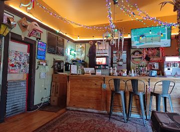
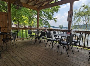
Discover The Back Porch: A delightful grill in Talladega offering fresh seafood and American cuisine with stunning marina views.


Best bars in Talladega National Forest
Evening life around Talladega National Forest is generally low-key and town-based. Nearby communities provide casual restaurants, traditional bars, cafés and occasional live music, while a night in the forest usually means camp cooking, conversation, stargazing or an early start for a trail. Talladega, Sylacauga, Anniston and other gateway towns have different local scenes, but none should be treated as a single nightlife district serving the entire national forest. Larger venues and more varied late-night entertainment are found in Birmingham or Atlanta outside the region, rather than at forest recreation areas. Alcohol is not permitted everywhere in public recreation settings, and visitors should check local rules, avoid drinking before driving on rural roads and respect quiet hours at campgrounds. Seasonal events in surrounding towns may add activity, but schedules and venue operations change.
-
Holiday Inn Express & Suites Talladega, an IHG Hotel
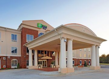
Experience Southern hospitality at its finest in Talladega, Alabama, with modern amenities and easy access to local attractions.
-
Sandwich
Subway
Savor fresh sandwiches and healthy options at Subway in Talladega, a must-visit for tourists seeking a quick and delicious meal.
-
Hotel
Super 8 by Wyndham Talladega AL
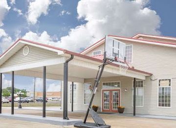
Discover comfort and convenience at Super 8 by Wyndham Talladega, your ideal home base for exploring Alabama's rich history and vibrant attractions.

Best nightclubs in Talladega National Forest
Evening life around Talladega National Forest is generally low-key and town-based. Nearby communities provide casual restaurants, traditional bars, cafés and occasional live music, while a night in the forest usually means camp cooking, conversation, stargazing or an early start for a trail. Talladega, Sylacauga, Anniston and other gateway towns have different local scenes, but none should be treated as a single nightlife district serving the entire national forest. Larger venues and more varied late-night entertainment are found in Birmingham or Atlanta outside the region, rather than at forest recreation areas. Alcohol is not permitted everywhere in public recreation settings, and visitors should check local rules, avoid drinking before driving on rural roads and respect quiet hours at campgrounds. Seasonal events in surrounding towns may add activity, but schedules and venue operations change.
-
Live Music
Saturn
Immerse yourself in the dynamic music scene at Saturn, Birmingham's premier live music venue for unforgettable performances and vibrant atmosphere.
-
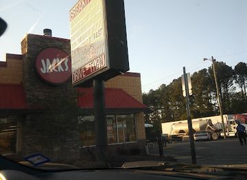
Jack's Family Restaurant
Experience the heart of Southern cuisine at Jack's Family Restaurant, where every meal is served with warmth and flavor in Lincoln, Alabama.
-
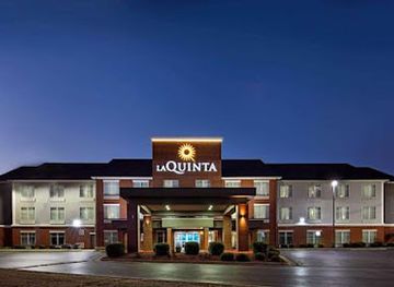
La Quinta Inn & Suites by Wyndham Oxford - Anniston
Discover comfort and convenience at La Quinta Inn & Suites by Wyndham Oxford - Anniston, your ideal base for exploring Alabama's beauty.
-
Hotel
Holiday Inn Express & Suites Talladega, an IHG Hotel
Experience comfort and modern amenities at Holiday Inn Express & Suites Talladega, your ideal base for exploring Alabama's local attractions.


Best shops in Talladega National Forest
Shopping within Talladega National Forest is limited to practical supplies and occasional basic items at recreation facilities, so visitors should buy fuel, food, maps, camping equipment and medication in surrounding towns. Talladega, Sylacauga, Anniston, Heflin and other gateway communities offer distinct local high streets, supermarkets, outdoor suppliers, independent retailers and places to pick up picnic provisions. Farmers’ markets and small roadside sellers, when operating, may offer seasonal fruit, vegetables, baked goods or locally produced items, although availability follows the agricultural calendar. Souvenirs are more likely to be Alabama-made food products, locally produced crafts, books about regional history or outdoor equipment than forest-specific merchandise. Visitors should not expect a large designer or luxury retail scene in the rural districts. Supporting independent shops in the communities around the forest can be a practical way to obtain supplies while contributing to the local economy.
-
Hotel
Super 8 by Wyndham Talladega AL
Discover the heart of Talladega, Alabama, with a comfortable stay at Super 8 by Wyndham, conveniently located near local attractions and dining options.
-
Clothing store
Citi Trends
Explore stylish and affordable clothing for the whole family at Citi Trends in Talladega, your go-to fashion destination.

Get your free copy of our complete guide to Talladega National Forest, delivered straight to you.
Everything on this page, from attractions and restaurants to essentials and local phrases, in one PDF you can read offline, print or share.
Already have an account? Sign in
Your Talladega National Forest guide is ready.
We'll send it to · Not you? Sign out

Getting your guide ready…
We are putting together a fresh copy of the Talladega National Forest guide. This can take up to a minute.
This can take a few moments. If your browser asks, choose Allow so the download can start. You'll find the guide in your Downloads folder.
Nothing happened? Download it again
Sorry, the guide is taking longer than usual. Please try again in a minute, or get it by email instead.
Talladega National Forest essentials
Currency and Payment
Safety
Emergency Situations
Do's and Don'ts
Local Tips
From Eve
Local phrases worth knowing
You don't need to get them perfect. A few words go a long way, and locals appreciate the effort.
Basics
| English | Local | Say it |
|---|---|---|
| Hello | Hey | [Hay] |
| Goodbye | See ya | [See yah] |
| Yes | Yep | [Yep] |
| No | Nah | [Nah] |
| Please/You're welcome | No problem | [No prob-luhm] |
| Thank you | Thanks | [Thanks] |
| Excuse me/Sorry | Pardon me | [Pardon me] |
| How are you? | How ya doin'? | [How yah doin'?] |
| Fine. And you? | Good. You? | [Good. Yoo?] |
| Do you speak English? | You speakin' English? | [Yoo speakin' English?] |
| I don't understand | I ain't gettin' it | [I ain't gettin' it] |
Eating & Drinking
| English | Local | Say it |
|---|---|---|
| I'd like to see the menu, please | Can I see the menu? | [Can I see the menu?] |
| I don't eat meat | I don't do meat | [I don't do meat] |
| Cheers! | Cheers! | [Cheers!] |
| I would like to pay, please | Can I get the check? | [Can I get the check?] |
Emergencies
| English | Local | Say it |
|---|---|---|
| Help! | Help! | [Help!] |
| Go away! | Leave me be! | [Leave me be!] |
| Call the Police! | Call the cops! | [Call the cops!] |
| Call a doctor! | Get a doctor! | [Get a doc-tuh!] |
| I'm lost | I’m lost | [I’m lost] |
| I'm ill | I ain't feelin' good | [I ain't feelin' good] |
Shopping
| English | Local | Say it |
|---|---|---|
| I'd like to buy... | I wanna buy... | [I wanna buy...] |
| I'm just looking | Just lookin' | [Just lookin'] |
| How much is it? | How much's it cost? | [How much's it cost?] |
| That's too expensive | That’s too high | [That’s too high] |
| Can you lower the price? | Can you bring it down? | [Can you bring it down?] |
Time & Numbers
| English | Local | Say it |
|---|---|---|
| What time is it? | What time's it? | [What time's it?] |
| It's one o'clock | It's one | [It's one] |
| Half past (10) | Half past ten | [Half past ten] |
| Morning | Mornin' | [Mornin'] |
| Afternoon | Afternoon | [Afternoon] |
| Evening | Evenin' | [Evenin'] |
| Yesterday | Yesterday | [Yesterday] |
| Today | Today | [Today] |
| Tomorrow | Tomorrow | [Tomorrow] |
| 1 | One | [One] |
| 2 | Two | [Two] |
| 3 | Three | [Three] |
| 4 | Four | [Four] |
| 5 | Five | [Five] |
| 6 | Six | [Six] |
| 7 | Seven | [Seven] |
| 8 | Eight | [Eight] |
| 9 | Nine | [Nine] |
| 10 | Ten | [Ten] |
Transport & Directions
| English | Local | Say it |
|---|---|---|
| Where's a/the...? | Where's the...? | [Where's the...?] |
| What's the address? | What’s the address? | [What’s the address?] |
| Can you show me (on the map)? | Can you show me on the map? | [Can you show me on the map?] |
| When's the next (bus)? | When's the next bus? | [When's the next bus?] |
| A ticket (to ....) | A ticket to... | [A ticket to...] |
History of Talladega National Forest
Indigenous Landscapes Before the National Forest
The Talladega region formed part of a wider Indigenous landscape used for travel, hunting, settlement and trade long before federal forest boundaries existed. Muscogee communities were especially important across much of central and eastern Alabama, while Cherokee influence and occupation were significant farther north and east. Rivers, mountain gaps and ridgelines shaped movement through the area. The forced removal of southeastern Indigenous peoples in the nineteenth century profoundly altered these communities and opened the way for expanding American settlement, although Indigenous place names and cultural connections remain part of Alabama’s wider historical record.
Farming, Iron and Frontier Settlement
During the nineteenth century, farms, small settlements, charcoal production and ironworking developed around the southern Appalachian foothills. The region’s forest supplied fuel and timber, while nearby ore deposits supported Alabama’s expanding iron industry. Communities such as Talladega, Sylacauga and Anniston grew in connection with agriculture, mineral extraction, transport and manufacturing, even though their urban centres lie outside some of the forest’s most remote tracts. These activities altered the original woodland through clearing, burning, mining and repeated timber cutting.
Railways, Timber and Industrial Expansion
Railways and improving roads linked the foothills to Alabama’s larger markets during the late nineteenth and early twentieth centuries. Timber became a major commercial resource, and extensive cutting changed the structure of forests that had previously included mature hardwoods, pine and mixed woodland. Development was uneven: some ridges remained difficult to reach, while valleys and transport corridors became more closely tied to mills, farms and towns. The modern forest is therefore both a protected landscape and a product of earlier industrial use and subsequent regeneration.
The Forest Service and Federal Protection
Talladega National Forest was established in 1936 as part of the United States’ expansion of federally managed forests during the New Deal era. Its purposes included watershed protection, timber management, wildlife conservation and public recreation. Federal acquisition brought previously fragmented and often heavily logged lands into a broader management system. The forest today remains a working national forest rather than an untouched wilderness, with decisions balancing ecological restoration, recreation, prescribed fire, roads and sustainable resource use.
The Civilian Conservation Corps Era
The Civilian Conservation Corps made a substantial contribution to the public infrastructure of Alabama’s national forests during the 1930s. Crews built or improved roads, trails, campgrounds, bridges and erosion-control works, often in difficult terrain and with basic equipment. Their projects helped make mountain recreation more accessible while supporting a wider programme of conservation and employment during the Great Depression. Some recreation landscapes and route patterns associated with Talladega National Forest still reflect this period, even where later work has replaced the original structures.
Wilderness, Trails and Longleaf Restoration
Late twentieth-century conservation placed greater emphasis on protecting undeveloped mountain country and restoring distinctive southern ecosystems. Cheaha Wilderness and Dugger Mountain Wilderness preserve roadless areas where natural processes and low-impact recreation take priority. The Pinhoti Trail connected Alabama’s mountain routes with a longer Appalachian trail system, giving the forest importance beyond local day trips. Elsewhere, prescribed burning and longleaf-pine restoration address the loss of open pine habitat caused by fire suppression, intensive forestry and land conversion.
Talladega National Forest in Photos
Browse through our photo collection highlighting the charm and character of the destination.
Neighbouring regions of Talladega National Forest
The closest regions to Talladega National Forest, if you have time for more than one.
-

-

-

-

-


Swipe for more regions
Explore more

Explore more of Alabama
Discover Alabama: A Southern state rich in history, culture, and natural beauty, offering unforgettable experiences from vibrant cities to serene beaches and majestic mountains.
Explore Alabama