From Eve
Know before you go
Hi, I'm Eve. Here are a few practical things to know before exploring Cape Taputapu.
Local know-how to help you travel smarter and make the most of every moment.
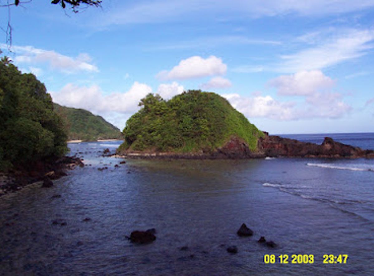
Discover Cape Taputapu: American Samoa's westernmost point, a National Natural Landmark with stunning sunsets and rich Samoan legends.
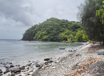
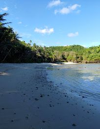
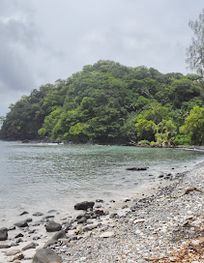
Cape Taputapu, the westernmost point of Tutuila Island in American Samoa, is a designated National Natural Landmark. It offers stunning views, rugged volcanic formations, and a glimpse into Samoan legends. Hike along the shoreline at low tide to witness the power of the ocean and the beauty of the setting sun.
Opening times, essentials, and a few local tips gathered into one calmer, easier-to-scan planning section.
Hi, I'm Eve. Here are a few practical things to know before exploring Cape Taputapu.
Local know-how to help you travel smarter and make the most of every moment.
Car
From Pago Pago, head west on Route 1 (Marine Drive). Continue past the airport, following signs for the Western District. After approximately 12 miles, you will arrive in Amanave. Look for signs directing you to Cape Taputapu as you approach Amanave. Parking is available near the site.
Public Transport
From Pago Pago, take a local bus heading towards the Western District. Ask the bus driver to drop you off in Amanave, a common stop. From Amanave, follow signs to Cape Taputapu, a short walk from the bus stop. Buses operate frequently, but without a fixed schedule. Bus services are reduced on Saturdays and do not operate on Sundays. A one-way fare from Pago Pago to Amanave will cost no more than $2.50.
Taxi/RideShare
Hire a taxi or use a ride-share service from anywhere on Tutuila. Provide the driver with the destination: Cape Taputapu in Amanave. The ride from Pago Pago takes approximately 30 minutes and costs an estimated $30-$50, depending on traffic. Confirm the fare with the driver before starting your journey.
Walking
After arriving in Amanave via car, bus, or taxi, the final approach to Cape Taputapu involves walking along the shoreline. From where the road makes a sharp right turn uphill, the cape is about a mile walk along the shoreline. This hike should only be attempted during low tide.
Use Cape Taputapu as your starting point for nearby food, family ideas, nightlife, and more local discoveries.

Explore expert travel guides, compare and book tours, experiences, hotels, and more—all from the palm of your hand. Download now for seamless trip planning wherever your wanderlust takes you.
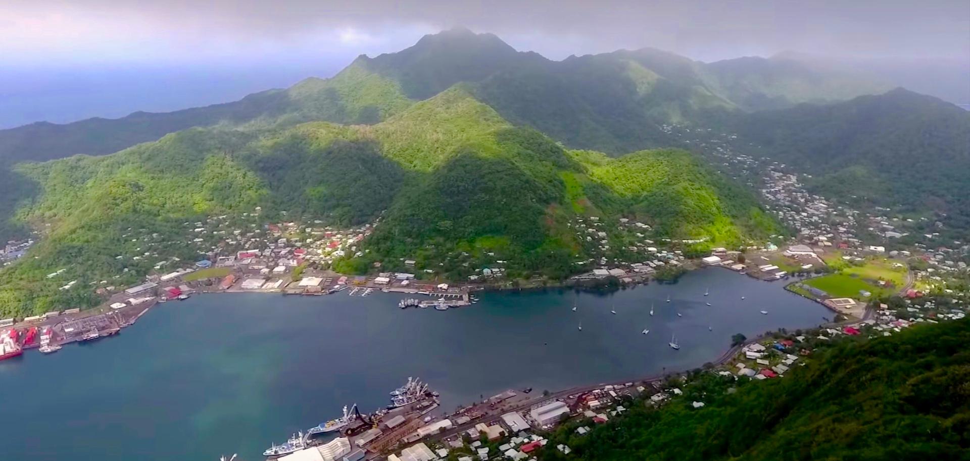
Explore Fagatogo, the vibrant heart of American Samoa, where rich traditions, cultural landmarks, and tropical beauty offer a unique and unforgettable experience.
Tell me more about Fagatogo