

Free Riverland Travel Guide & Mobile App
Explore Riverland with free travel guides. Discover regional history, expert tips, proposed trips, and audio guides on web or mobile app.


Explore Riverland's Murray River landscapes, wetlands, orchards, wineries and relaxed outdoor towns in South Australia's irrigated country.
Read more about Riverland
When is the best time to visit Riverland?
Best: April, September–October · 22–26°C| Month | High (°C) | Rainfall (mm) |
|---|---|---|
| January | 33 | 20 |
| February | 34 | 23 |
| March | 30 | 25 |
| April (best) | 25 | 29 |
| May | 20 | 32 |
| June | 16 | 36 |
| July | 16 | 38 |
| August | 17 | 37 |
| September (best) | 22 | 35 |
| October (best) | 26 | 31 |
| November | 29 | 27 |
| December | 32 | 24 |
Getting to and around Riverland
How to get there
Transportation
Best attractions in Riverland
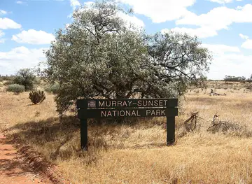
Riverland's attractions are organised around the Murray River and the irrigated landscapes that depend on it. Murray River National Park is divided into separate areas, including Katarapko, Lyrup Flats and Chowilla, each offering combinations of red-gum floodplain, creeks, lagoons, walking opportunities, paddling and birdwatching. Access and facilities vary, so visitors should check conditions before setting out. River towns provide contrasting experiences: Renmark explores irrigation and river heritage, Loxton interprets settlement and farming, and Waikerie and Berri give access to broad river scenery and local produce. Lake Bonney near Barmera is a prominent setting for boating, waterside recreation and seasonal birdlife. Beyond the water, vineyards, citrus groves, almond orchards and cellar doors reveal the region's agricultural character, while farm shops and food producers connect visitors with the harvest. Houseboat holidays and smaller river cruises offer a slower perspective, and cycling or short walking excursions can be combined with visits to galleries, museums and historic streets. The attraction landscape is less about a dense collection of ticketed sites than about experiencing a working river system through its wetlands, food production, recreation and town histories.
-
Tourist attraction
Murray Bridge Bunyip
Explore the mythical world of the bunyip at Murray Bridge Bunyip, a captivating attraction blending folklore with nature in South Australia.
-
Tourist attraction
Waikerie Silo Art
Explore the breathtaking Waikerie Silo Art, a stunning display of large-scale murals that celebrate local culture and creativity in South Australia's Riverland region.
-
Tourist attraction
Heading Cliffs Lookout
Experience the stunning vistas of the Murray River and colorful cliffs at Heading Cliffs Lookout in South Australia, a perfect spot for nature lovers and photographers.
-
Tourist attraction
The Loxton Historical Village
Discover the charm and history of Australia at The Loxton Historical Village, where the past comes alive through restored buildings and engaging exhibits.


Best landmarks in Riverland
The Murray River itself is Riverland's most important geographical landmark, particularly where it is framed by river red gums, red earth and broad floodplain channels. The riverfronts of Renmark, Berri and Loxton express the connection between settlement, irrigation and navigation, while historic structures and interpretive displays in these towns preserve aspects of the region's early agricultural and steamboat past. Murray River National Park provides a series of landscape landmarks rather than one single monument: Katarapko's waterways, the Lyrup Flats floodplain and the wetlands and forests of Chowilla demonstrate the variety of the Murray corridor. Lake Bonney near Barmera is a prominent inland-water setting whose appearance changes with water levels and weather. Irrigation channels, pumping infrastructure, orchards and vineyards are also significant cultural landmarks, showing how engineering created a productive landscape in a dry part of Australia. The most recognisable views often come from river bends, crossings, cliffs and elevated roads where the contrast between green floodplain and surrounding mallee is especially clear.
-
Tourist attraction
Big Rocking Horse
Experience joy and nostalgia at the Big Rocking Horse, a unique tourist attraction in Gumeracha, South Australia, featuring an animal park, café, and shopping.
-
Tourist attraction
Whispering Wall
Discover the Whispering Wall in South Australia, where whispers travel across a stunning acoustic marvel amid picturesque landscapes and rich history.
-
Tourist attraction
Coorong National Park
Explore the breathtaking landscapes of Coorong National Park, where diverse ecosystems meet stunning coastal views in South Australia.
-
 Holiday park
BIG4 Renmark Riverfront Holiday Park
Discover the serene beauty of BIG4 Renmark Riverfront Holiday Park, where nature meets comfort along the Murray River in South Australia.


Explore Riverland on the map
Plan your trip on one map. See where the top cities, national parks and sights are, and book hotels and experiences in a few clicks.
Best hotels in Riverland
Best restaurants in Riverland
Riverland dining reflects an irrigated agricultural economy and a warm inland climate. Citrus, grapes, stone fruit, almonds and other seasonal crops appear in farm-gate sales, markets, cafés and restaurant menus, while local wine is a natural accompaniment to contemporary Australian cooking. In Renmark, Berri, Loxton, Waikerie and Barmera, visitors will find a practical mix of cafés, bakeries, family restaurants, pubs and takeaway outlets, with more rural venues and cellar-door meals distributed along the surrounding roads. Menus vary by season rather than following one single regional cuisine, but produce-led dishes and locally grown fruit are recurring themes. River fish may be available in some settings, although visitors should distinguish commercial food from recreational fishing rules and protected species. Markets and farm shops are useful places to find dried fruit, citrus, wine, preserves, nuts and other products associated with the district. Book ahead for well-known cellar-door dining or small rural venues, especially at weekends, and do not assume every establishment operates daily outside the main town centres.
-
Pub
Pretoria Hotel & Cellars
Discover the Pretoria Hotel & Cellars in Mannum - A charming pub offering delightful dining, entertainment options, and local hospitality in South Australia.
-
Restaurant
Renmark Club
Discover vibrant dining and nightlife at Renmark Club – where delicious meals meet lively entertainment in South Australia.
-
Hotel
Hotel Renmark
Discover comfort at Hotel Renmark—a riverside retreat with exceptional dining and access to nature's beauty.
-
Coffee shop
Viewpoint Cafe
Discover culinary delights at Viewpoint Cafe in Waikerie - where great coffee meets stunning views!


Best bars in Riverland
Evenings in Riverland are centred on traditional pubs, club dining rooms, cafés and restaurants rather than a large nightclub circuit. Renmark, Berri, Loxton, Waikerie and Barmera provide the broadest choice of places for a meal or drink, while smaller settlements tend to become quiet earlier. Local wineries and cellar doors may offer tastings or occasional programmed events, but availability is seasonal and should be checked directly. Historic river-town pubs and community clubs are useful places to understand the region's social life without treating alcohol as the main attraction. Live music, especially at local venues or seasonal events, may add variety, although schedules change. Visitors staying on houseboats or in rural accommodation should respect neighbours, fire restrictions and river regulations, and should arrange transport before drinking rather than relying on late-night public services.
-
Pub
Pretoria Hotel & Cellars
Experience the perfect blend of relaxation and excitement at Pretoria Hotel & Cellars, a historic pub in beautiful Mannum, South Australia.
-
Bar
Renmark Club
Experience the lively blend of dining, nightlife, and community at Renmark Club, the heart of local entertainment in South Australia.
-
Pub
Fox & Firkin English Pub
Discover the Fox & Firkin English Pub: a vibrant haven in Tea Tree Gully offering authentic pub fare, a wide selection of drinks, and a warm atmosphere.
-
Pub
Overland Corner Hotel
Experience the historic charm and modern comforts of Overland Corner Hotel, a beloved pub and hotel in South Australia.


Best nightclubs in Riverland
Evenings in Riverland are centred on traditional pubs, club dining rooms, cafés and restaurants rather than a large nightclub circuit. Renmark, Berri, Loxton, Waikerie and Barmera provide the broadest choice of places for a meal or drink, while smaller settlements tend to become quiet earlier. Local wineries and cellar doors may offer tastings or occasional programmed events, but availability is seasonal and should be checked directly. Historic river-town pubs and community clubs are useful places to understand the region's social life without treating alcohol as the main attraction. Live music, especially at local venues or seasonal events, may add variety, although schedules change. Visitors staying on houseboats or in rural accommodation should respect neighbours, fire restrictions and river regulations, and should arrange transport before drinking rather than relying on late-night public services.
-
Restaurant
Renmark Club
Discover Renmark Club, a lively restaurant and nightlife hub in South Australia, offering great food, drinks, and entertainment for all.
-
Club
Mannum Community Club
Discover the vibrant atmosphere of the Mannum Community Club, where locals and tourists unite for unforgettable experiences in South Australia.
-
Night club
Fabric Nightclub Adelaide
Discover the heartbeat of Adelaide's nightlife at Fabric Nightclub, where live music and vibrant atmospheres create unforgettable experiences.
-
Country club
Renmark Country Club
Discover relaxation and recreation at Renmark Country Club, where golf, dining, and comfort converge in scenic South Australia.




Best shops in Riverland
Shopping in Riverland is concentrated in the high streets and service centres of Renmark, Berri, Loxton, Waikerie and Barmera, where visitors will find supermarkets, practical stores, cafés, galleries and independent retailers rather than extensive metropolitan-style malls. The region's strongest purchases are agricultural: seasonal citrus and stone fruit, dried fruit, almonds, preserves, wine and other locally produced goods can be found through farm shops, cellar doors and selected markets. Small galleries and craft outlets may offer paintings, ceramics, textiles, woodwork or locally themed gifts, while town museums and visitor centres sometimes stock regional books and interpretive material. Availability changes with harvests and business seasons, so a farm outlet may not operate every day. Choose produce that can travel safely, support legitimate local businesses and keep clear of private orchard land. For a wider range of mainstream retail, plan shopping in the larger regional centres before heading into the more dispersed river and mallee districts.
-
Department store
BIG W Renmark
Explore BIG W Renmark for unbeatable deals on a wide variety of products, from essentials to unique Australian souvenirs.
-
Shopping mall
Riverland Central Plaza
Discover Riverland Central Plaza in Berri, South Australia - your go-to shopping and dining hub for a delightful local experience.
-
Variety store
Woodys Variety Store
Explore Woodys Variety Store in Waikerie, a unique shopping destination for camping and fishing essentials in South Australia.
-
Gourmet grocery store
Illalangi Gourmet Foods
Discover the flavors of South Australia at Illalangi Gourmet Foods, where local produce meets artisanal craftsmanship in a cozy setting.


Get your free copy of our complete guide to Riverland, delivered straight to you.
Everything on this page, from attractions and restaurants to essentials and local phrases, in one PDF you can read offline, print or share.
Already have an account? Sign in
Your Riverland guide is ready.
We'll send it to · Not you? Sign out

Getting your guide ready…
We are putting together a fresh copy of the Riverland guide. This can take up to a minute.
This can take a few moments. If your browser asks, choose Allow so the download can start. You'll find the guide in your Downloads folder.
Nothing happened? Download it again
Sorry, the guide is taking longer than usual. Please try again in a minute, or get it by email instead.
Riverland essentials
Currency and Payment
Safety
Emergency Situations
Do's and Don'ts
Local Tips
From Eve
Local phrases worth knowing
You don't need to get them perfect. A few words go a long way, and locals appreciate the effort.
Basics
| English | Local | Say it |
|---|---|---|
| Hello | G'day | [guh-day] |
| Goodbye | Catch ya later | [kach yah lay-tah] |
| Yes | Yeah | [yeh] |
| No | Nah | [nah] |
| Please/You're welcome | No worries | [noh wuh-rees] |
| Thank you | Cheers | [cheers] |
| Excuse me/Sorry | Sorry mate | [saw-ree mate] |
| How are you? | How ya going? | [how yah go-ing] |
| Fine. And you? | Good. And you? | [good. and you?] |
| Do you speak English? | Do ya speak Aussie? | [do yah speak aw-zee] |
| I don't understand | I don’t get it | [I dont get it] |
Eating & Drinking
| English | Local | Say it |
|---|---|---|
| I'd like to see the menu, please | Can I see the menu, please? | [can I see the men-yu, pleez?] |
| I don't eat meat | I'm a vegetarian | [I'm a vege-ta-rian] |
| Cheers! | Cheers! | [cheers] |
| I would like to pay, please | Can I get the bill, please? | [can I get the bil, pleez?] |
Emergencies
| English | Local | Say it |
|---|---|---|
| Help! | Help! | [help] |
| Go away! | Get lost! | [get lost] |
| Call the Police! | Call the coppers! | [call the cop-pers] |
| Call a doctor! | Get a doctor! | [get a doc-tah] |
| I'm lost | I’m lost | [I'm lost] |
| I'm ill | I’m not well | [I'm not well] |
Shopping
| English | Local | Say it |
|---|---|---|
| I'd like to buy... | I wanna buy... | [I wanna buy...] |
| I'm just looking | Just browsing | [just brow-sing] |
| How much is it? | How much is this? | [how much is this?] |
| That's too expensive | That's a rip-off | [that's a rip-off] |
| Can you lower the price? | Can ya drop the price? | [can yah drop the price?] |
Time & Numbers
| English | Local | Say it |
|---|---|---|
| What time is it? | What’s the time? | [what's the time?] |
| It's one o'clock | It’s 1 o’clock | [it’s 1 o-clock] |
| Half past (10) | Half past 10 | [half past 10] |
| Morning | Morning | [morning] |
| Afternoon | Arvo | [ar-vo] |
| Evening | Evening | [evening] |
| Yesterday | Yesterday | [yes-ter-day] |
| Today | Today | [to-day] |
| Tomorrow | Tomorrow | [to-mor-row] |
| 1 | One | [won] |
| 2 | Two | [too] |
| 3 | Three | [three] |
| 4 | Four | [for] |
| 5 | Five | [five] |
| 6 | Six | [six] |
| 7 | Seven | [sev-en] |
| 8 | Eight | [eight] |
| 9 | Nine | [nine] |
| 10 | Ten | [ten] |
Transport & Directions
| English | Local | Say it |
|---|---|---|
| Where's a/the...? | Where's the...? | [where's the...?] |
| What's the address? | What’s the address? | [what's the ad-dress?] |
| Can you show me (on the map)? | Can ya show me on the map? | [can yah show me on the map?] |
| When's the next (bus)? | When’s the next bus? | [when's the next bus?] |
| A ticket (to ....) | A ticket to ... | [a ticket to ...] |
History of Riverland
First Peoples and the Murray River
The Riverland lies within the traditional lands of First Nations peoples, including communities connected with the River Murray and its floodplain. The river supported travel, food gathering, fishing, ceremony and exchange long before European colonisation, while wetlands and red-gum forests formed interconnected cultural and ecological landscapes. Visitors encounter a living cultural inheritance rather than a landscape whose history began with irrigation, and should respect access restrictions and cultural information at river and national-park sites.
Exploration and Pastoral Expansion
European exploration of the Murray in the nineteenth century was followed by pastoral expansion, river trade and the establishment of small settlements. The river became an important transport route through an otherwise dry interior, linking inland stations and communities with South Australia's commercial centres. Steam navigation later made the Murray more accessible to bulky goods and agricultural produce, leaving a legacy visible in river ports, historic buildings and the region's continuing association with paddle steamers.
Irrigation Settlement from the 1890s
The Riverland's modern economy took shape through irrigation schemes developed from the late nineteenth century, particularly around Renmark and later settlements such as Berri, Loxton and Waikerie. Water drawn from the Murray allowed orchards, vineyards and gardens to flourish in an arid climate. Cooperative settlement models, canals and pumping infrastructure required substantial labour and organisation, creating communities whose identity remains closely tied to horticulture and careful management of river water.
The Growth of Horticulture and River Towns
During the twentieth century, improved irrigation, refrigeration, roads and agricultural marketing expanded the Riverland's role as a producer of citrus, dried fruits, grapes, almonds and other crops. Towns developed processing, packing and service industries alongside farms, while houseboat and recreational tourism gradually added another economic strand. The resulting landscape of orchards, vineyards and riverfront reserves is a historical product of engineering and collective agricultural enterprise rather than natural rainfall alone.
River Transport and Paddle-Steamboat Heritage
Paddle steamers once carried wool, grain, timber and other goods along the Murray, and river transport helped link isolated inland districts with ports and railheads. Commercial navigation declined as roads and rail became more efficient, but the vessels remain important symbols of Riverland history. In towns such as Renmark and Loxton, riverfront interpretation and preserved or restored craft help explain how the Murray functioned as both a working highway and the region's principal geographic organiser.
Modern Water Management and Environmental Conservation
In recent decades, the Riverland's history has increasingly been understood through the pressures facing the Murray-Darling Basin: drought, salinity, altered flows, floodplain decline and competition for water. National parks, wetland restoration and environmental watering projects aim to protect river red gums, lagoons and wildlife while agriculture remains central to local livelihoods. This balance is visible in protected areas such as Murray River National Park, where recreation takes place within a carefully managed river ecosystem.
Riverland in Photos
Browse through our photo collection highlighting the charm and character of the destination.
Neighbouring regions of Riverland
The closest regions to Riverland, if you have time for more than one.
-
-

-
-

-


Swipe for more regions
Explore more

Explore more of Australia
Discover the diverse landscapes, vibrant cities, and unique wildlife of Australia, a captivating destination offering endless adventures and unforgettable experiences.
Explore Australia