Barendro Region, Modhupur Gorh, and Lalmai Hills: Ancient Terraces of Bangladesh
Discover Bangladesh's ancient Pleistocene uplands: Barendro, Modhupur, and Lalmai, offering unique landscapes, history, and biodiversity.
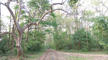
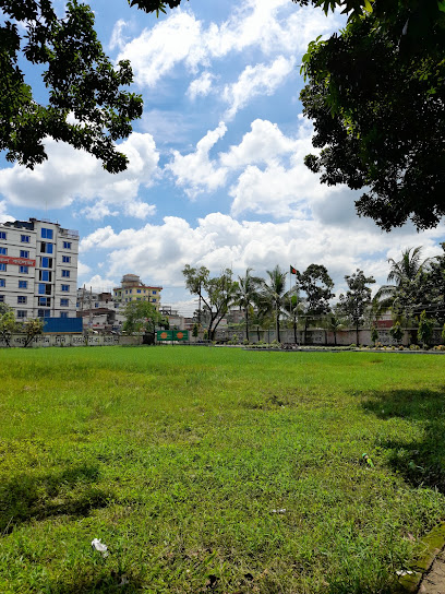
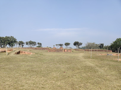
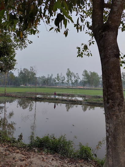
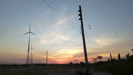
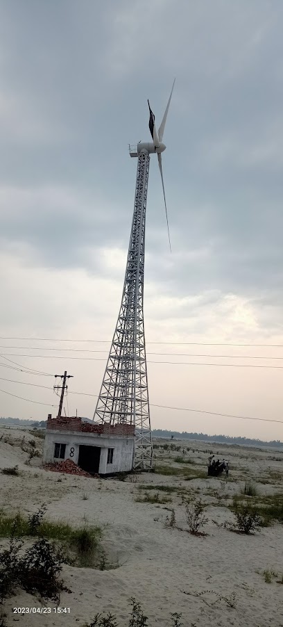
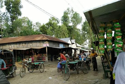
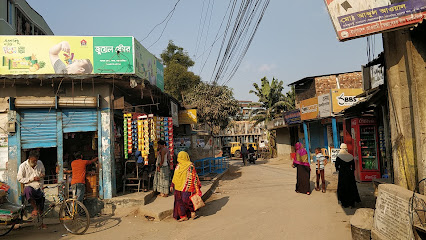
Explore the Barendro region, Modhupur Gorh, and Lalmai hills, three distinct Pleistocene uplands in Bangladesh. These elevated terraces offer unique landscapes, including the notable Shaal forests, and a glimpse into the country's geological history and biodiversity.
A brief summary to Barendro region, Modhupur Gorh and Lalmai hills
- J26J+PHX Gorh and Lalmai hills, Barendro region, Madhupur, BD
Local tips
- The best time to visit Lalmai Pahar is during the cooler months (November to February) for pleasant weather for hiking and exploring.
- Wear comfortable shoes if you plan to hike in the hilly areas.
- Carry water and snacks, as facilities may be limited in some areas.
Getting There
-
Road
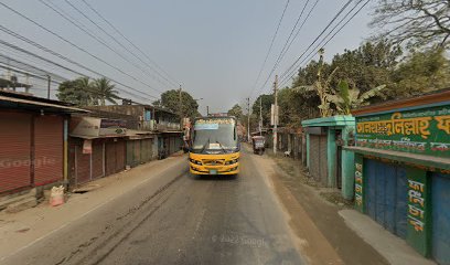
To reach Modhupur Gorh from Dhaka, you can take the Dhaka-Mymensingh Road. Modhupur National Park is about 125 km north of Dhaka. From Tangail city, Modhupur is about 47 km to the north. You can hire a car or bus from Dhaka or Tangail to reach Modhupur. Approximate cost for a bus from Dhaka to Sirajganj is unconfirmed, followed by a taxi to Modhupur. Driving from Dhaka to Modhupur covers a distance of 261 km and takes approximately 4 hours. The estimated cost of driving is $23-$33 USD.
-
Train
To reach Lalmai Hills, take a train from Dhaka, Chittagong, or other major cities to Comilla Railway Station. From there, hire a local vehicle to reach Lalmai Pahar, which is about 8 km from Comilla city. Train tickets from Dhaka to Gaibandha cost $2–19 USD.
Discover more about Barendro region, Modhupur Gorh and Lalmai hills
Iconic landmarks you can’t miss
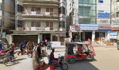
Madhupur tract
11.5 km
Explore the Madhupur Tract: Where natural beauty meets cultural heritage in the heart of Bangladesh. Discover forests, wildlife, and indigenous traditions.
Hasan Monjil
41.5 km
Discover Hasan Monjil in Mymensingh: A historical landmark showcasing Mughal-Colonial architecture, lush gardens, and the rich cultural heritage of Bangladesh, offering a serene escape.
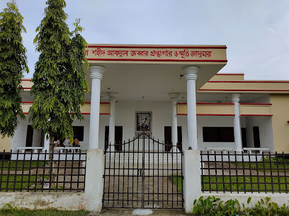
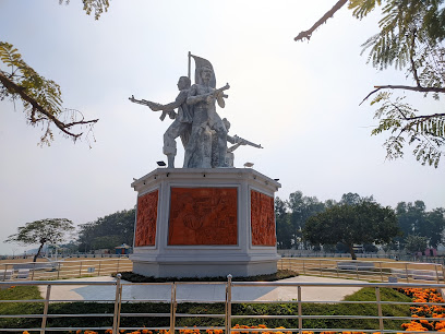
Shaheed Jabbar Memorial Library and Museum
51.9 km
Discover the legacy of language martyr Abdul Jabbar at this poignant memorial and library in Gafargaon, a tribute to the spirit of the 1952 Language Movement and Bengali identity.
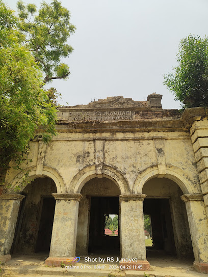
Bhawal Kachari
54.3 km
Explore Bhawal Kachari in Shilar Bazar: A window into Bangladesh's history and the architectural legacy of the Bhawal Estate.
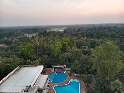
Bhawal Resort & Spa
66.2 km
Escape to tranquility at Bhawal Resort & Spa, a serene getaway nestled in the lush Bhawal forest near Dhaka.

Masterbari
71.1 km
Experience the vibrant culture and commerce of Gazipur at Masterbari, a bustling marketplace offering local crafts, street food, and the famous special tea.
Raja View Tower
74.7 km
Discover panoramic views and serene luxury at Raja View Tower, Gazipur, a perfect escape blending heritage with modern comfort, offering a unique retreat near Dhaka.
Bhawal College Playground
77.4 km
Escape to nature in the heart of Gazipur at Bhawal College Playground, a perfect spot for family fun and relaxation.
Bhramman kandi mor (ভ্রাম্যনকান্দি মোড়)
78.5 km
Discover the rich cultural heritage and architectural beauty of Bhramman Kandi Mor, a must-visit historical landmark in Bangladesh.
Boiragir Bhita
79.3 km
Explore ancient temple ruins at Boiragir Bhita near Mahasthangarh, revealing Bengal's rich Pala dynasty history and religious heritage.
Prantik Gate
83.9 km
Discover Prantik Gate, your entry to Jahangirnagar University's serene campus, rich history, and vibrant student life, a unique blend of nature and culture in Savar, Bangladesh.
Spot of Friends Group Uttara
87.6 km
Explore the historic Spot of Friends Group in Uttara, Dhaka - a cultural gem showcasing the city's rich architectural heritage.
শহীদ মিনার
89.0 km
A poignant symbol of Bangladesh's Language Movement, the Shaheed Minar honors linguistic pride and cultural identity, drawing visitors to reflect on history and heritage.
Uttara sector 13
89.8 km
Experience the vibrant local culture, delectable cuisine, and dynamic atmosphere of Uttara Sector 13, a must-visit tourist attraction in Dhaka.
হাসুর বটতলা
89.9 km
Escape the city's chaos at Hasur Bottota in Dhaka's Uttara, a tranquil haven offering a glimpse into local life and a refreshing break from the urban hustle.
Unmissable attractions to see
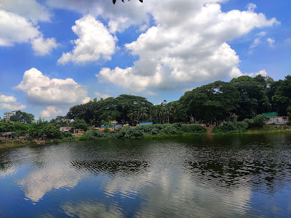
Lake Manda
2.9 km
Discover the tranquility of Lake Manda, a serene natural retreat in the heart of Bangladesh, perfect for relaxation and scenic views.
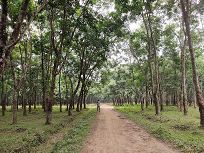
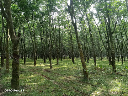
Madhupur Rubber Garden
8.8 km
Discover the serene beauty of Madhupur Rubber Garden: a sprawling plantation offering nature, culture, and a glimpse into sustainable agriculture in Bangladesh.
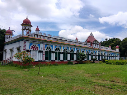
Dhanbari Nawab Palace
10.5 km
Explore the opulent Dhanbari Nawab Palace: A blend of Mughal and European architecture in a beautifully preserved heritage resort.
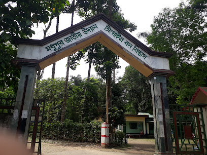
Madhupur National Park
11.2 km
Discover Bangladesh's natural beauty and cultural heritage at Madhupur National Park, a serene escape near Dhaka.
Sontospur Rubber Garden
12.6 km
Discover the serene beauty and agricultural heritage of Sontospur Rubber Garden, a tranquil escape in the heart of Madhupur, Bangladesh.
Muktagacha Jomidar Bari ~ Muktagacha,Mymensigh
28.6 km
Explore the historical Muktagacha Jomidar Bari in Mymensingh, Bangladesh, and discover the legacy of the Acharya Chowdhury zamindars.

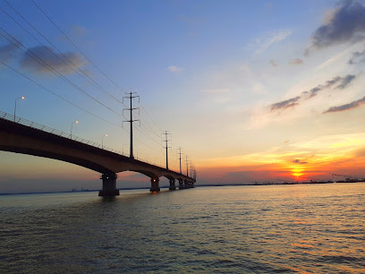
Bangabandhu Jamuna Bridge
34.9 km
Experience the grandeur of the Bangabandhu Jamuna Bridge, a symbol of Bangladesh's progress connecting the nation's east and west.
Hard point
35.4 km
Enjoy scenic riverside views and a relaxing atmosphere at Hard Point, a popular tourist spot in Sirajganj.
Sirajganj Cross Bar 3, BWDB
35.7 km
Escape to the serene banks of the Jamuna River at Sirajganj Cross Bar 3, a perfect spot for relaxation and scenic views.
Sirajganj Cross bar 3 ( chaina Badh)
35.7 km
Discover the scenic beauty and engineering marvel of Sirajganj Cross Bar 3, where the Jamuna River meets local culture in a tranquil riverside setting.
China badh
35.9 km
Discover the historic China Badh in Sirajganj: A scenic embankment offering stunning river views and a tranquil escape.
Priyokunjo Park - প্রিয়কুঞ্জ পার্ক, চুরখাই, ময়মনসিংহ
37.2 km
Escape to Priyokunjo Park in Mymensingh for a serene retreat amidst lush greenery and tranquil pathways, perfect for relaxation and nature connection.
Gunti muth par rail line
37.3 km
Explore the historic Gunti Muth Par Rail Line in Mymensingh, Bangladesh, and experience a captivating journey through the region's railway heritage.
Zila Parishad Lake
40.7 km
Escape to the tranquility of Zila Parishad Lake in Tangail, a scenic oasis for relaxation and natural beauty.
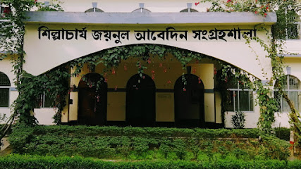
Shilpacharya Zainul Abedin Sangrahashala
40.7 km
Explore the art and legacy of Shilpacharya Zainul Abedin at this Mymensingh museum, showcasing his iconic paintings and contributions to Bangladeshi art.
Essential places to dine
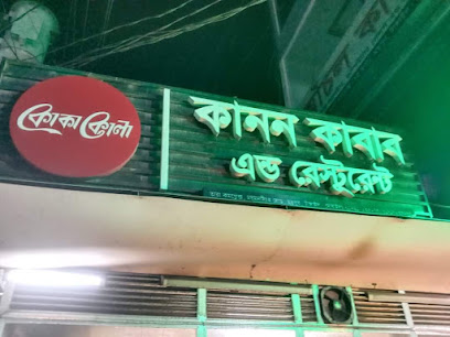
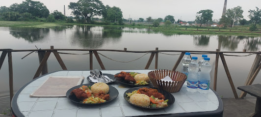
Kanon Kabab & Restaurant
0.5 km
Discover authentic Bangladeshi breakfast and kababs at Kanon Kabab & Restaurant in Madhupur - where flavors come alive!
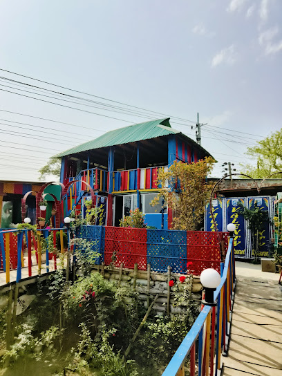
Boithok Khana / বৈঠকখানা
19.2 km
Discover authentic Bangladeshi flavors at Boithok Khana - the perfect family-friendly dining experience.
PARK Village Restaurant
32.6 km
Discover culinary delights at PARK Village Restaurant near Bongobondhu Bridge in Tangail - where taste meets scenic beauty.
Sky View Restaurant Sirajganj
36.8 km
Discover authentic Indian flavors at Sky View Restaurant Sirajganj with stunning views and vibrant ambiance.
City Bypass Restaurant & Sweetmeet
38.2 km
Experience the best of Bangladeshi cuisine and irresistible desserts at City Bypass Restaurant & Sweetmeet in Mymensingh.
Kababji Cafe & Restaurant
38.8 km
Experience authentic local cuisine at Kababji Cafe & Restaurant in Mymensingh—a serene culinary retreat with flavorful dishes.
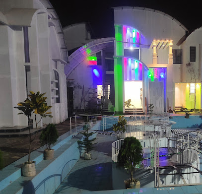
LUMINOUS Cafe & Restaurant
38.8 km
Experience delightful dining at LUMINOUS Cafe & Restaurant in Mymensingh with diverse menus and exceptional service.
Valenty Restaurant and Coffee House
39.1 km
Experience the rich flavors of Bangladesh at Valenty Restaurant and Coffee House in Mymensingh - a must-visit for food lovers.
Wabi Sabi
39.2 km
Discover Wabi Sabi in Mymensingh: A culinary journey blending local flavors with international delights in an inviting atmosphere.
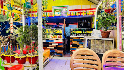
Unique Burger and Kabab Ghar.
39.6 km
Discover the best burgers and kebabs in Tangail at Unique Burger and Kabab Ghar – where every bite is a flavor adventure.
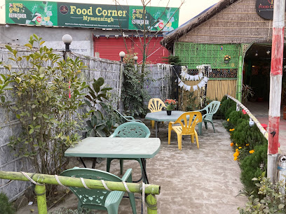
ফুড কর্ণার- Food Corner, Mymensingh
39.9 km
Experience authentic Bangladeshi cuisine at Food Corner in Mymensingh - where every dish tells a story.
Grameen restura
40.0 km
Savor the essence of Bangladeshi cuisine at Grameen Restaurant in Mymensingh - where tradition meets flavor.
Apon Hotel
40.3 km
Experience authentic Bangladeshi flavors at Apon Hotel in Mymensingh - a must-visit culinary gem for all food enthusiasts.
Desh Restaurant
40.4 km
Discover Mymensingh's culinary treasure at Desh Restaurant - where every bite tells a story of Bangladeshi tradition.
Chef Time Restaurant
40.5 km
Experience authentic Bangladeshi cuisine at Chef Time Restaurant in Mymensingh—where every dish tells a story of flavor.
Markets, malls and hidden boutiques
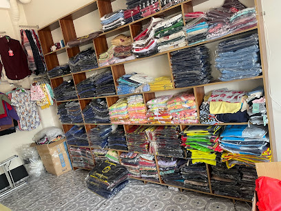
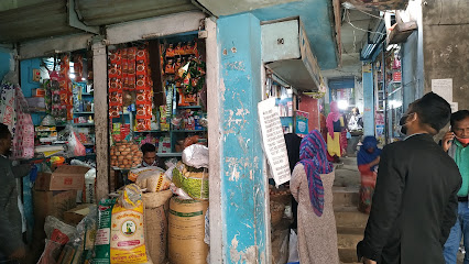
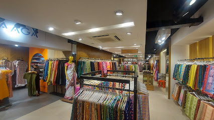
SK Unique Fashion Gallery
0.0 km
Explore the rich tapestry of Bangladeshi fashion at SK Unique Fashion Gallery, where unique styles meet local artistry for a shopping experience like no other.
Unique Collection
16.8 km
Discover local flavors and unique souvenirs at Unique Collection Supermarket in Shibgonj Puraton Bazar.
Viail Bazar
24.0 km
Experience the vibrant culture and shopping delights at Viail Bazar, the ultimate destination for tourists seeking local charm in the heart of the city.
Unique Gadgets Mymensingh
39.3 km
Discover a world of innovative electronics and unique gadgets in Mymensingh - a must-visit for tech lovers and tourists alike.
Bismillah gift and accessories shop
39.7 km
Discover the charm of Mymensingh with unique gifts at Bismillah Gift and Accessories Shop, where every item tells a story.
Gonshar Mor
39.9 km
Explore Gonshar Mor in Mymensingh for a delightful shopping and dining experience, blending local culture with modern retail.
RJ FASHION BD
39.9 km
RJ FASHION BD: Your one-stop destination for transportation services and local shopping in the heart of Mymensingh.
Kids & Mons
40.6 km
Explore Kids & Mons in Mymensingh for delightful toys and gifts that spark joy and creativity in every child.
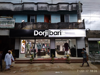
Dorjibari, Dhopakhola, Mymensingh
40.8 km
Discover the essence of local fashion at Dorjibari, a leading men's clothing store in Mymensingh, offering stylish attire for every occasion.
My Shopping BD
40.8 km
Experience local flavors and vibrant shopping culture at My Shopping BD in Tangail, offering a wide selection of products for every taste.
Miniso Mymensingh
40.8 km
Explore a vibrant world of unique gifts and trendy products at Miniso Mymensingh, the perfect shopping destination for tourists and locals alike.
Spark Gear
40.9 km
Discover unique styles and local fashion at Spark Gear, Mymensingh's trendy clothing store for stylish travelers.
MIlan lifestyle store
40.9 km
Explore the Milan Lifestyle Store in Mymensingh for trendy clothing that captures the spirit of local and contemporary fashion.
Notun Bazaar
40.9 km
Experience the vibrant culture and rich flavors of Mymensingh at Notun Bazaar, a must-visit market for all tourists.
Aarong
40.9 km
Experience the essence of Bangladeshi culture at Aarong, a premier clothing store in Mymensingh offering traditional and contemporary garments.
Essential bars & hidden hideouts
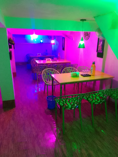
Ideal Cafe & Sweets
38.1 km
Experience the charm of Ideal Cafe & Sweets in Mymensingh, where delightful sweet treats and refreshing beverages await your taste buds.
ADDA BARI RESTAURANT & CAFÉ
39.8 km
Experience the rich flavors of Mymensingh at Adda Bari Restaurant & Café, where tradition meets culinary creativity in a charming setting.
Kashbon, Shankipara
39.9 km
Explore Kashbon Lounge in Shankipara for a tranquil escape, offering a cozy atmosphere and delightful beverages perfect for any traveler.
Xyz
40.2 km
Experience the vibrant nightlife of Mymensingh at Xyz Bar, where refreshing drinks and a lively atmosphere await.
HomeCity Network
40.7 km
Discover Mymensingh's vibrant nightlife at HomeCity Network - a modern bar offering exquisite drinks and a welcoming atmosphere.
শুভ দে
40.8 km
Discover the lively charm of শুভ দে, a bar in Mymensingh where local culture meets vibrant nightlife for an unforgettable experience.
The Minions
40.9 km
Experience a fun dining adventure at The Minions in Mymensingh, where delicious fast food meets delightful ambiance for the whole family.
Big Burger & Igloo Selecta Ice Cream Parlour
41.0 km
Explore the vibrant flavors of Mymensingh at Big Burger & Igloo Selecta Ice Cream Parlour, where delicious fast food meets delightful ice cream.
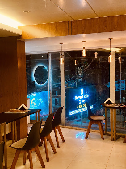
Revert Cafe
41.1 km
Experience the inviting ambiance and diverse menu at Revert Cafe, a hidden culinary gem in Mymensingh, Bangladesh.
Press Club Canteen
41.2 km
Experience authentic Bangladeshi cuisine at Press Club Canteen in Mymensingh, where local flavors and a warm atmosphere await every traveler.
Manik Vaier Store ( Manio)
41.3 km
Discover Mymensingh's vibrant nightlife at Manik Vaier Store (Manio), where great drinks and friendly vibes await you.
Monir
41.8 km
Experience Mymensingh's vibrant nightlife at Monir, a bar that immerses you in local culture with a lively atmosphere and delightful drinks.
মি চাজক? (Mi Chajok?)
41.9 km
Discover the vibrant flavors of Bangladeshi cuisine at Mi Chajok, a culinary haven in Mymensingh offering a unique dining experience.
Mokul
42.1 km
Discover Mokul, a vibrant bar in Mymensingh, offering a perfect blend of local flavors and a lively atmosphere for an unforgettable night out.
Sabbir Store
42.2 km
Discover the charm of Sabbir Store, a cozy bar in Mymensingh offering local beverages and a welcoming atmosphere for tourists and locals alike.