

Free Maya Mountains Travel Guide & Mobile App
Explore Maya Mountains with free travel guides. Discover regional history, expert tips, proposed trips, and audio guides on web or mobile app.


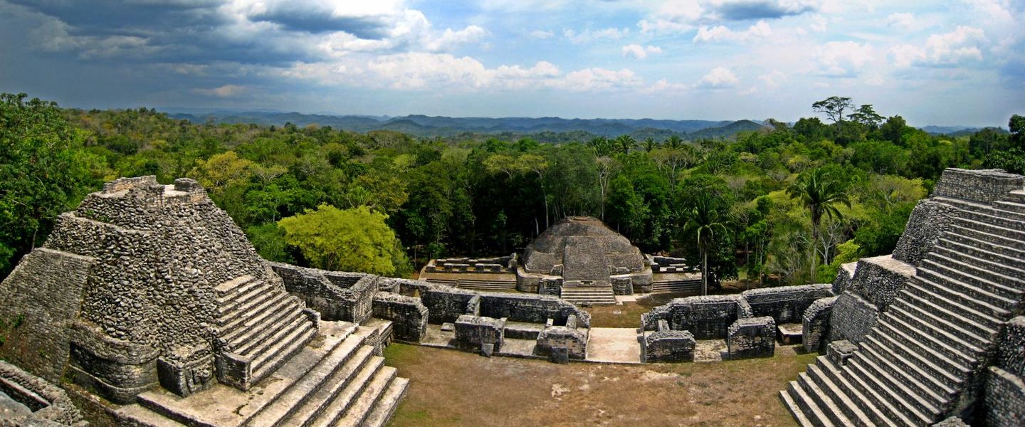


Explore Belize’s Maya Mountains for ancient Maya cities, limestone caves, waterfalls, rainforest trails and community-led experiences in the southern highlands.
Read more about Maya Mountains
When is the best time to visit Maya Mountains?
Best: January–March · 29–31°C| Month | High (°C) | Rainfall (mm) |
|---|---|---|
| January (best) | 29 | 80 |
| February (best) | 30 | 70 |
| March (best) | 31 | 60 |
| April | 32 | 80 |
| May | 33 | 120 |
| June | 32 | 170 |
| July | 32 | 180 |
| August | 32 | 180 |
| September | 31 | 170 |
| October | 31 | 140 |
| November | 29 | 110 |
| December | 29 | 90 |
Getting to and around Maya Mountains
How to get there
Transportation
Top city travel guides in Maya Mountains
The cities of Maya Mountains, and the easiest places to base yourself.
-

-

-

-

-


Swipe for more cities
Destinations in Maya Mountains
Resorts, valleys and scenic spots worth a trip of their own.
-

-

-

-


Swipe for more destinations
Best attractions in Maya Mountains
-
Tour operator
Mayawalk Tours
Explore the wonders of Belize with Mayawalk Tours - your adventure starts here in San Ignacio.
-
Tourist attraction
Rio On Pools
Experience the breathtaking beauty of Rio On Pools, a serene hotspot in Belize perfect for relaxation and adventure in nature's embrace.
-
Public beach
Placencia Municipal Pier & Plaza
Discover the lively atmosphere of Placencia Municipal Pier & Plaza, where local culture meets stunning Caribbean views in Belize's charming coastal village.
-
Chocolate artisan
AJAW Chocolate LTD.
Discover the rich flavors of artisanal chocolate at AJAW Chocolate LTD. in San Ignacio, Belize – a unique destination for chocolate enthusiasts.


Best landmarks in Maya Mountains
-
Grill
Tipsy Tuna Sports Bar
Experience vibrant flavors and a lively atmosphere at Tipsy Tuna Sports Bar in Placencia, where delicious food meets stunning seaside views.
-
Grill
Barefoot Beach Bar
Experience the perfect blend of beachfront relaxation and delicious grilled cuisine at Barefoot Beach Bar in Placencia, Belize.
-
Hotel
San Ignacio Resort Hotel
Discover luxury and adventure at San Ignacio Resort Hotel, your perfect gateway to the wonders of Belize's lush landscapes and rich cultural heritage.
-
Resort hotel
Hopkins Bay Belize, a Muy'Ono Resort
Experience the perfect blend of luxury and adventure at Hopkins Bay Belize, a tropical resort hotel that immerses you in Caribbean beauty and local culture.


Explore Maya Mountains on the map
Plan your trip on one map. See where the top cities, national parks and sights are, and book hotels and experiences in a few clicks.
Best hotels in Maya Mountains
Best restaurants in Maya Mountains
Dining in the Maya Mountains is closely connected with gateway towns, villages, lodges and community tourism rather than a single restaurant district. Around San Ignacio and Belmopan, visitors find Belizean cooking alongside international dishes, with rice and beans, stewed meats, soups, plantains, tortillas and fresh fruit forming common elements of the national table. In Maya communities of the southern foothills, locally prepared meals may include corn-based foods, beans, vegetables, chicken and traditional cacao drinks, though availability varies and should be arranged ahead for homestays or village visits. Mountain lodges and tour camps generally provide hearty breakfasts and packed lunches suitable for forest days, while roadside eateries offer practical meals near major routes. Markets and small shops are useful for fruit, water and snacks, but remote reserves have limited food services. Ask guides about local produce and community cooks rather than expecting extensive dining choices at trailheads or archaeological sites.
-
Restaurant
Ella's Restaurant/cool spot
Discover authentic Belizean cuisine at Ella's Restaurant in Hopkins – where flavor meets hospitality in a tropical paradise.
-
Restaurant
Las Palapas Belize Restaurant
Experience authentic Belizean cuisine at Las Palapas Restaurant in Armenia - where every meal tells a story.
-
Restaurant
J&J Cool Spot
Experience authentic Belizean cuisine at J&J Cool Spot in Hopkins – where flavor meets hospitality.
-
Restaurant
Luba Laruga Cool spot
Experience authentic Belizean cuisine at Luba Laruga in Hopkins - a culinary haven with stunning views and delightful dishes.


Best bars in Maya Mountains
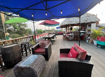
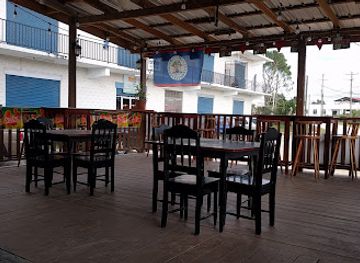
Nightlife in the Maya Mountains is low-key and concentrated in gateway communities rather than in the reserves themselves. San Ignacio has the broadest evening choice in the northern part of the region, with casual bars, restaurants, live music on selected evenings and places serving Belizean beer and rum-based drinks. Belmopan provides a smaller, more local town atmosphere, while southern foothill settlements generally centre on village bars, guesthouse dining and community events rather than late-night clubs. Lodges in Mountain Pine Ridge and remote areas are suited to quiet evenings, stargazing and conversation after outdoor activities, with limited transport after dark. Visitors should arrange a safe return journey before drinking, respect residential communities and avoid assuming that rural establishments keep fixed late hours. Cultural performances, food events and music may occur seasonally, but schedules are best confirmed locally.
-
Grill
Palapa Bar and Grill
Experience the vibrant flavors and lively atmosphere of Palapa Bar and Grill in San Pedro, Belize – a must-visit dining destination for every traveler.
-
Grill
Tipsy Tuna
Experience the vibrant flavors of Belize at Tipsy Tuna, a must-visit grill in Placencia offering delicious seafood, grilled meats, and stunning views.
-
Grill
Barefoot Beach Bar
Experience the vibrant atmosphere and delicious cuisine at Barefoot Beach Bar in Placencia, a perfect blend of Caribbean charm and culinary delight.
-
Sports bar
Mike's Cue Club.Bar & Restaurant
Discover the vibrant nightlife at Mike's Cue Club, Belmopan's premier sports bar and restaurant, offering great food, drinks, and entertainment.


Best nightclubs in Maya Mountains
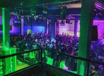
Nightlife in the Maya Mountains is low-key and concentrated in gateway communities rather than in the reserves themselves. San Ignacio has the broadest evening choice in the northern part of the region, with casual bars, restaurants, live music on selected evenings and places serving Belizean beer and rum-based drinks. Belmopan provides a smaller, more local town atmosphere, while southern foothill settlements generally centre on village bars, guesthouse dining and community events rather than late-night clubs. Lodges in Mountain Pine Ridge and remote areas are suited to quiet evenings, stargazing and conversation after outdoor activities, with limited transport after dark. Visitors should arrange a safe return journey before drinking, respect residential communities and avoid assuming that rural establishments keep fixed late hours. Cultural performances, food events and music may occur seasonally, but schedules are best confirmed locally.
-
Night club
Tequila Night Club
Dive into the vibrant nightlife at Tequila Night Club in Red Creek, where music, dancing, and flavorful drinks create an unforgettable experience.
Best shops in Maya Mountains
Shopping in the Maya Mountains is practical, local and closely associated with gateway towns and community tourism. San Ignacio has the widest selection in the northern approach, including small galleries, craft outlets, food shops and stalls selling Belizean souvenirs, while Belmopan provides everyday retail and access to produce markets rather than a major luxury-shopping scene. In southern foothill communities, visitors may find handcrafts, woven items, carved objects, local artwork, cacao products and foods made by community producers, although stock and opening arrangements vary. Farmers’ markets and roadside sellers are useful for fruit, vegetables, tortillas and other provisions for excursions. Responsible purchases should favour identifiable local makers and community enterprises, and visitors should not buy archaeological objects, plants or wildlife products. Packaged cacao, hot sauces, spices, coffee and locally made crafts travel more easily than fresh produce, but check any customs restrictions before taking food or natural materials abroad.
-
Gift shop
Art Box - Belize Artisan Store & Cafe
Discover Belizean artistry at Art Box, the ultimate gift shop, art gallery, and café experience in Belmopan.
-
Gift shop
The Orange Gallery
Explore the artistic heart of Belize at The Orange Gallery, where unique crafts and local artistry come together in a vibrant shopping experience.
-
Gift shop
Unique Co Ltd
Discover the essence of Belize at Unique Co Ltd, your go-to gift shop for authentic souvenirs and local treasures in Camalote.
-
Gift shop
Variety Gift Shop
Discover authentic Belizean gifts at Variety Gift Shop, where local art and culture come together in unique treasures.


Get your free copy of our complete guide to Maya Mountains, delivered straight to you.
Everything on this page, from attractions and restaurants to essentials and local phrases, in one PDF you can read offline, print or share.
Already have an account? Sign in
Your Maya Mountains guide is ready.
We'll send it to · Not you? Sign out

Getting your guide ready…
We are putting together a fresh copy of the Maya Mountains guide. This can take up to a minute.
This can take a few moments. If your browser asks, choose Allow so the download can start. You'll find the guide in your Downloads folder.
Nothing happened? Download it again
Sorry, the guide is taking longer than usual. Please try again in a minute, or get it by email instead.
Maya Mountains essentials
Currency and Payment
Safety
Emergency Situations
Do's and Don'ts
Local Tips
From Eve
Local phrases worth knowing
You don't need to get them perfect. A few words go a long way, and locals appreciate the effort.
Basics
| English | Local | Say it |
|---|---|---|
| Hello | Ba’ax ka wa’alik | [Bah-ash kah wah-leek] |
| Goodbye | K’i’ik’ | [Kee-kik] |
| Yes | Ja’ | [Hah] |
| No | Ma’ | [Mah] |
| Please/You’re welcome | Tux tu’ | [Toosh too] |
| Thank you | Yum bo’ | [Yoom boh] |
| Excuse me/Sorry | T’aan u k’i’ik’ | [Taan oo kee-kik] |
| How are you? | Bix a bel? | [Beesh ah bell] |
| Fine. And you? | Ma’ k’i’ik’! Bix a bel? | [Mah kee-kik! Beesh ah bell] |
| Do you speak English? | A t’aan u k’i’ik’ in English? | [Ah taan oo kee-kik in English] |
| I don’t understand | No’ in k’áat u t’aan | [Noh in kaat oo taan] |
Eating & Drinking
| English | Local | Say it |
|---|---|---|
| I’d like to see the menu, please | K’áat u k’i’ik’ in menú, tux tu’ | [Kaat oo kee-kik in menu, toosh too] |
| I don’t eat meat | No’ in k’áat u t’aan k’i’ik’ | [Noh in kaat oo taan kee-kik] |
| Cheers! | Túun k’i’ik’! | [Toon kee-kik] |
| I would like to pay, please | K’áat u k’i’ik’ in pagó, tux tu’ | [Kaat oo kee-kik in pah-go, toosh too] |
Emergencies
| English | Local | Say it |
|---|---|---|
| Help! | K’i’ik’! | [Kee-kik] |
| Go away! | T’aan u to’one’! | [Taan oo toh-neh] |
| Call the Police! | T’aan u k’i’ik’ u Policía! | [Taan oo kee-kik oo Policia] |
| Call a doctor! | T’aan u k’i’ik’ u médico! | [Taan oo kee-kik oo medico] |
| I’m lost | No’ in k’i’ik’ k’íik’ | [Noh in kee-kik kee-kik] |
| I’m ill | No’ in k’i’ik’ k’i’ab’ | [Noh in kee-kik kee-ab] |
Shopping
| English | Local | Say it |
|---|---|---|
| I’d like to buy... | K’áat u k’i’ik’ in báal... | [Kaat oo kee-kik in baal] |
| I’m just looking | No’ in k’i’ik’ a k’áat | [Noh in kee-kik ah kaat] |
| How much is it? | Bix k’i’ik’ u k’i’ik’? | [Beesh kee-kik oo kee-kik] |
| That’s too expensive | K’i’ik’ u k’i’ik’ ma’ k’u’uk’ | [Kee-kik oo kee-kik mah koo-ook] |
| Can you lower the price? | A k’i’ik’ u t’aan ma’ k’u’uk’? | [Ah kee-kik oo taan mah koo-ook] |
Time & Numbers
| English | Local | Say it |
|---|---|---|
| What time is it? | Bix k’i’ik’ u t’aan? | [Beesh kee-kik oo taan] |
| It’s one o’clock | U t’aan k’i’ik’ u k’i’ik’ | [Oo taan kee-kik oo kee-kik] |
| Half past (10) | K’i’ik’ k’i’ab’ (10) | [Kee-kik kee-ab (10)] |
| Morning | K’i’ik’ | [Kee-kik] |
| Afternoon | K’i’ik’ k’i’ab’ | [Kee-kik kee-ab] |
| Evening | K’i’ik’ k’i’ab’ | [Kee-kik kee-ab] |
| Yesterday | Bix tu’uk’ | [Beesh too-ook] |
| Today | Bix u t’aan | [Beesh oo taan] |
| Tomorrow | Bix u t’aan k’i’ik’ | [Beesh oo taan kee-kik] |
| 1 | Ja’ | [Hah] |
| 2 | Ka’ | [Kah] |
| 3 | Óok | [O-ok] |
| 4 | Béel | [Bay-el] |
| 5 | Péek | [Payk] |
| 6 | Wóol | [Wool] |
| 7 | Wóok | [Wook] |
| 8 | Bél | [Bayl] |
| 9 | K’íik’ | [Kee-kik] |
| 10 | K’a’ab’ | [Kah-ab] |
Transport & Directions
| English | Local | Say it |
|---|---|---|
| Where’s a/the...? | Bix u t’aan u...? | [Beesh oo taan oo...?] |
| What’s the address? | Bix u t’aan k’i’ik’? | [Beesh oo taan kee-kik?] |
| Can you show me (on the map)? | A k’i’ik’ u t’aan in (u mapa)? | [Ah kee-kik oo taan in (oo mapa)?] |
| When’s the next (bus)? | Bix k’i’ik’ u t’aan (bus)? | [Beesh kee-kik oo taan (bus)?] |
| A ticket (to ....) | U t’aan (to ...) | [Oo taan (to ...)] |
History of Maya Mountains
Early Maya Settlement and Agriculture
The Maya Mountains and their surrounding valleys have supported human settlement for more than two millennia. Communities farmed fertile pockets of land, used rivers and caves, and developed trade connections between the interior and the Caribbean lowlands. Caves were often treated as sacred places associated with water, rain and the underworld, leaving behind ceramics, human remains and ritual deposits. The mountainous terrain did not isolate these settlements; instead, rivers, passes and valleys helped connect them with larger Maya centres elsewhere in what is now Belize, Guatemala and Mexico.
Caracol and the Classic Maya World
Caracol, located in the Mountain Pine Ridge area of western Belize, became one of the most powerful Maya polities of the Classic period. Its monumental plazas, temples, reservoirs, causeways and extensive settlement show the scale of its political and economic influence. In the sixth and seventh centuries, Caracol was involved in major regional conflicts, including struggles with Tikal in present-day Guatemala. The city’s surviving monuments and hieroglyphic records provide important evidence of Maya statecraft, warfare and urban planning in the forested interior.
Southern Maya Centres
The southern foothills contain a group of important Maya sites connected with the political landscape of the ancient southeast. Uxbenka occupied a prominent hilltop in Toledo District, while Nim Li Punit is known for carved monuments and evidence of elite authority during the Late Classic period. Their locations demonstrate how communities used elevated terrain and natural routes through the foothills. Although smaller than Caracol, these centres reveal the diversity of Maya political organisation and the continuing importance of southern Belize within wider regional networks.
Caves, Ritual Life and Archaeological Discovery
The limestone caves of the Maya Mountains were places of ceremony as well as natural formations. Actun Tunichil Muknal, commonly known as ATM Cave, contains pottery, human remains and other evidence of ritual activity from the later Maya period. Archaeological work in the cave and elsewhere has shown how water-filled chambers and underground passages were incorporated into religious ideas. Many sites remain sensitive and partly unexplored, making controlled access and responsible guiding particularly important for protecting both physical remains and cultural meaning.
Colonial Encounters and Forest Industries
European colonial influence reached the interior unevenly, and the Maya Mountains remained difficult to control because of their terrain and dense forests. From the nineteenth century, British Honduras developed a timber economy based particularly on mahogany and other valuable woods. Logging roads opened parts of the interior, while extraction altered forest composition and affected rivers and wildlife. Later farming and settlement expanded around the foothills. The legacy of forestry is still visible in tracks, working landscapes and place names, even though conservation now plays a central role in the region’s economy.
Protected Areas and Community Conservation
During the twentieth century and after Belize’s independence in 1981, increasing attention was given to protecting watersheds, wildlife habitats, archaeological sites and culturally important forests. Mountain Pine Ridge Forest Reserve, St Herman’s Blue Hole National Park, Tapir Mountain Nature Reserve and other protected areas now form part of a wider conservation landscape. In southern Belize, Maya communities have also developed locally guided tourism, traditional agriculture and forest stewardship initiatives. These efforts reflect an ongoing balance between access, livelihoods, cultural rights and the protection of a fragile mountain environment.
Maya Mountains in Photos
Browse through our photo collection highlighting the charm and character of the destination.
Neighbouring regions of Maya Mountains
The closest regions to Maya Mountains, if you have time for more than one.
-

-

-

-

-


Swipe for more regions
Explore more
Explore more of Belize
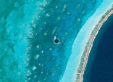
Discover Belize: A Caribbean paradise known for its stunning barrier reef, rich cultural heritage, and eco-friendly adventures in lush rainforests and pristine waters.
Explore Belize