

Free Mountain Pine Ridge Travel Guide & Mobile App
Explore Mountain Pine Ridge with free travel guides. Discover regional history, expert tips, proposed trips, and audio guides on web or mobile app.


Explore Mountain Pine Ridge in Belize for pine forests, waterfalls, granite pools, caves, wildlife and remote Maya landscapes near the Guatemalan border.
Read more about Mountain Pine Ridge
When is the best time to visit Mountain Pine Ridge?
Best: January–March · 25–28°C| Month | High (°C) | Rainfall (mm) |
|---|---|---|
| January (best) | 25 | 80 |
| February (best) | 26 | 70 |
| March (best) | 28 | 60 |
| April | 30 | 80 |
| May | 31 | 120 |
| June | 31 | 170 |
| July | 31 | 150 |
| August | 31 | 150 |
| September | 30 | 170 |
| October | 29 | 160 |
| November | 27 | 120 |
| December | 26 | 100 |
Getting to and around Mountain Pine Ridge
How to get there
Transportation
Destinations in Mountain Pine Ridge
Resorts, valleys and scenic spots worth a trip of their own.

Swipe for more destinations
Best attractions in Mountain Pine Ridge
Mountain Pine Ridge’s attractions are primarily natural and spread across a large protected forest rather than concentrated in one visitor centre. Rio On Pools is known for its granite shelves, shallow cascades and bathing basins, while Big Rock Falls provides a more dramatic waterfall setting and a deep pool below a high rock face. Rio Frio Cave offers an accessible mixture of geology, shade and flowing water, with a large entrance that allows daylight into the cavern. Thousand Foot Falls rewards a longer, more remote excursion with a broad valley view and a tall descending cascade. Pine woodland, broadleaf ravines and streams create opportunities for birdwatching, photography and quiet walks. In the southern reserve area, the Maya archaeological site of Caracol adds monumental plazas and temples to the landscape, although reaching it requires substantial road time. The attraction pattern changes with the weather: dry conditions generally make access easier, while rain can make roads slower and waterfalls more powerful. Lodges and local guides can help visitors match excursions to vehicle capability, river conditions and available daylight.
-
Archaeological site
Caracol Natural Monument Reservation
Explore the majestic ruins of Caracol Natural Monument Reservation, a treasure of the ancient Maya civilization nestled in the heart of Belize's lush jungles.
-
Hotel
Bocawina Rainforest Resort & Adventures
Discover the ultimate adventure at Bocawina Rainforest Resort & Adventures, where luxury meets nature in the heart of Belize's stunning rainforest.
-
National park
Guanacaste National Park
Explore the breathtaking landscapes and rich biodiversity of Guanacaste National Park, a must-visit destination in Belize for nature lovers and adventure seekers.
-
Nature preserve
Jaguar Reserve Nature Center
Explore the breathtaking beauty and biodiversity of the Jaguar Reserve Nature Center, a premier nature preserve in Belize, where adventure meets conservation.



Best landmarks in Mountain Pine Ridge
The most recognisable landmarks of Mountain Pine Ridge are shaped by water, rock and forest. Big Rock Falls is defined by its high rock wall and falling river, making it one of the reserve’s most visually prominent natural features. The granite channels and pools at Rio On Pools form a distinctive sequence of pale stone, flowing water and pine-covered slopes. Rio Frio Cave is notable for its broad, open entrance and cavernous interior, where rock formations and a stream create a cool contrast with the upland heat. Thousand Foot Falls commands a remote valley and is remembered for the height and scale of its descending watercourse. In the southern reserve landscape, Caracol’s Maya temples, plazas and carved monuments are the principal cultural landmarks, demonstrating the former urban importance of an area now dominated by forest. The reserve’s open pine ridges and recovering woodland are landmarks in a broader ecological sense, revealing the effects of fire, beetles, storms and conservation over time.
-
Tourist attraction
Xunantunich Mayan Ruins
Explore the majestic Xunantunich Mayan Ruins, a captivating archaeological site in Belize showcasing the grandeur of the ancient Maya civilization.
-
Zoo
The Belize Zoo and Tropical Education Center
Discover the beauty of Belize's wildlife at The Belize Zoo and Tropical Education Center, a conservation haven for native species and an educational gem.
-
National reserve
Cahal Pech Archaeological Reserve
Discover the ancient ruins and breathtaking views at Cahal Pech Archaeological Reserve, a hidden gem near San Ignacio, Belize.
-
 Resort hotel
Cahal Pech Village Resort
Discover the beauty and culture of Belize at Cahal Pech Village Resort, a tranquil escape in the heart of San Ignacio, with stunning views and rich experiences.


Explore Mountain Pine Ridge on the map
Plan your trip on one map. See where the top cities, national parks and sights are, and book hotels and experiences in a few clicks.
Best hotels in Mountain Pine Ridge
Best restaurants in Mountain Pine Ridge
Mountain Pine Ridge has no substantial restaurant district, and dining is usually connected to forest lodges, guesthouses or guided excursions rather than independent town-centre establishments. Meals may draw on Belizean staples such as rice and beans, stewed chicken, grilled meats, fresh vegetables, tortillas and spicy sauces, while lodge menus often adapt to what can be supplied in this remote upland setting. Visitors should not expect a choice of cafés beside every waterfall or cave; packed lunches, drinking water and snacks are practical for full-day routes. The nearby town of San Ignacio, outside Mountain Pine Ridge, offers a broader selection of restaurants, cafés and takeaway food, including Belizean, Caribbean and international cooking. Local produce and simple home-style meals are often more relevant here than formal dining, and advance arrangements are sensible when staying at a remote lodge, especially outside the busiest travel periods.
-
Restaurant
The Guava Limb Restaurant & Café
Experience authentic Belizean flavors at The Guava Limb Restaurant & Café—where culinary excellence meets vibrant culture in San Ignacio.
-
Restaurant
Ko-Ox Han Nah (Let's Go Eat)
Discover authentic flavors at Ko-Ox Han Nah in San Ignacio—where American meets Latin cuisine for an unforgettable dining experience.
-
Restaurant
Hode's Place
Experience authentic Belizean cuisine at Hode's Place, where flavorful dishes meet warm hospitality in the heart of San Ignacio.
-
Restaurant
Pop's Restaurant
Experience authentic Belizean flavors at Pop's Restaurant - your go-to breakfast spot in San Ignacio for delicious local dishes.


Best bars in Mountain Pine Ridge
Evening life in Mountain Pine Ridge is quiet and lodge-based rather than centred on nightclubs. After dark, visitors generally dine at their accommodation, share a drink in a lodge bar or spend time listening for nocturnal wildlife beneath the forest canopy. Some accommodation providers offer beer, rum drinks or wine, but selection and service hours vary and should not be assumed. There are no major nightlife streets within the reserve. For a wider choice of bars, restaurants, live music and social venues, visitors travel to San Ignacio outside Mountain Pine Ridge, where the evening scene is more developed. Remote roads, limited lighting and wildlife make late-night driving unattractive, so it is sensible to arrange transport beforehand and treat the forest’s darkness and quiet as part of the destination rather than seeking an urban entertainment programme.
-
Grill
Secret Beach Belize
Discover the tranquility of Secret Beach Belize, a hidden paradise with crystal-clear waters, delicious grill cuisine, and breathtaking sunsets.
-
Grill
The Lazy Lizard
Discover The Lazy Lizard, Caye Caulker's vibrant bar and grill, offering delicious food and breathtaking sea views for an unforgettable tropical experience.
-
Grill
Palapa Bar and Grill
Experience the flavors of Belize at Palapa Bar and Grill, where fresh seafood meets lively music in a stunning beachfront setting.
-
Grill
Tipsy Tuna
Experience the vibrant flavors of Belize at Tipsy Tuna, a grill and bar in Placencia offering fresh seafood and a lively atmosphere.


Best nightclubs in Mountain Pine Ridge
Evening life in Mountain Pine Ridge is quiet and lodge-based rather than centred on nightclubs. After dark, visitors generally dine at their accommodation, share a drink in a lodge bar or spend time listening for nocturnal wildlife beneath the forest canopy. Some accommodation providers offer beer, rum drinks or wine, but selection and service hours vary and should not be assumed. There are no major nightlife streets within the reserve. For a wider choice of bars, restaurants, live music and social venues, visitors travel to San Ignacio outside Mountain Pine Ridge, where the evening scene is more developed. Remote roads, limited lighting and wildlife make late-night driving unattractive, so it is sensible to arrange transport beforehand and treat the forest’s darkness and quiet as part of the destination rather than seeking an urban entertainment programme.
-
Bar
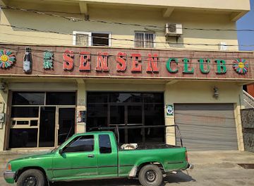
Sen Sen Club
Discover the vibrant nightlife of Belize City at Sen Sen Club, where locals and tourists mingle over affordable drinks in a lively atmosphere.
-
Night club
Hi5 Pub & Nightclub
Dive into the vibrant nightlife at Hi5 Pub & Nightclub in Orange Walk, where dance music and tasty food create unforgettable nights.
-
Bar
Revolution Nightclub
Discover the pulse of San Ignacio nightlife at Revolution Nightclub, where music, dance, and culture unite for an unforgettable experience.
-
Night club
Tequila Night Club
Unleash your night at Tequila Night Club in Red Creek, where electrifying music, vibrant cocktails, and unforgettable memories await.

Best shops in Mountain Pine Ridge
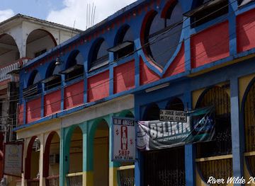
Shopping opportunities inside Mountain Pine Ridge are limited and generally attached to accommodation or small-scale visitor services. The practical purchases are usually refreshments, locally made food, simple crafts, books or small souvenirs rather than clothing, electronics or a broad retail selection. Visitors seeking Belizean artwork, handmade goods, woven items, woodwork or packaged regional produce will find more choice in San Ignacio and other Cayo communities outside the reserve. Market and independent-shop offerings can vary by day and season, so it is wise to buy essentials, cash and picnic supplies before entering the forest. Archaeological objects and natural materials should never be removed from sites or collected as souvenirs. A responsible purchase is one that is clearly a legitimate craft or food product and supports local makers without encouraging the removal of plants, rocks or cultural remains.
-
Tourist attraction
Rio On Pools
Experience the tranquility of Rio On Pools, a natural wonder in Belize with crystal-clear waters and breathtaking scenery.
-
National reserve
Mountain Pine Ridge Forest Reserve
Explore the stunning natural beauty and rich wildlife of Mountain Pine Ridge Forest Reserve, a premier national reserve in Belize.
-
Lodge
Ian Anderson's Caves Branch Jungle Lodge
Explore the lush jungles of Belize at Ian Anderson's Caves Branch Jungle Lodge, where adventure meets luxury in a stunning natural setting.
-
Art gallery
GariMaya Gift Shop
Explore the heart of Belizean craftsmanship at GariMaya Gift Shop, where every item tells a unique story of culture and artistry.


Get your free copy of our complete guide to Mountain Pine Ridge, delivered straight to you.
Everything on this page, from attractions and restaurants to essentials and local phrases, in one PDF you can read offline, print or share.
Already have an account? Sign in
Your Mountain Pine Ridge guide is ready.
We'll send it to · Not you? Sign out

Getting your guide ready…
We are putting together a fresh copy of the Mountain Pine Ridge guide. This can take up to a minute.
This can take a few moments. If your browser asks, choose Allow so the download can start. You'll find the guide in your Downloads folder.
Nothing happened? Download it again
Sorry, the guide is taking longer than usual. Please try again in a minute, or get it by email instead.
Mountain Pine Ridge essentials
Currency and Payment
Safety
Emergency Situations
Do's and Don'ts
Local Tips
From Eve
Local phrases worth knowing
You don't need to get them perfect. A few words go a long way, and locals appreciate the effort.
Basics
| English | Local | Say it |
|---|---|---|
| Hello | B'alam | [B'ah-lahm] |
| Goodbye | K'a'ayil | [K'ah-aye-eel] |
| Yes | Ja | [Hah] |
| No | Ma | [Mah] |
| Please/You're welcome | B'ix a k'a'am | [Beech ah kah-am] |
| Thank you | Yum'bo | [Yoom-bo] |
| Excuse me/Sorry | T'uxik | [Too-sheek] |
| How are you? | B'ix a wáay? | [Beech ah wah-ee?] |
| Fine. And you? | B'ix a k'áate'. E b'ix a wáay? | [Beech ah kah-teh. Eh beech ah wah-ee?] |
| Do you speak English? | B'ix a k'uj a b'ail? | [Beech ah koo-zh ah bye-l?] |
| I don't understand | T'ux a b'íil | [Too-sheek ah bee-eel] |
Eating & Drinking
| English | Local | Say it |
|---|---|---|
| I'd like to see the menu, please | B'ix a k'áate' k'áaba' menu, b'ix a k'a'am | [Beech ah kah-teh kah-bah men-oo, beech ah kah-am] |
| I don't eat meat | T'ux a k'ax a k'óok' | [Too-sheek ah kahx ah kohk'] |
| Cheers! | K'a'ayil! | [K'ah-aye-eel!] |
| I would like to pay, please | B'ix a k'áate' k'áaba' pagar, b'ix a k'a'am | [Beech ah kah-teh kah-bah pah-gar, beech ah kah-am] |
Emergencies
| English | Local | Say it |
|---|---|---|
| Help! | K'a'ayil! | [K'ah-aye-eel!] |
| Go away! | K'a'ayil k'áab' | [K'ah-aye-eel kahb'] |
| Call the Police! | K'ux a k'áab' k'óok' | [K'oo-sh ah kahb' kohk'] |
| Call a doctor! | K'ux a k'áab' k'óok' k'ux k'íik' | [K'oo-sh ah kahb' kohk' koo-sh kee-eek'] |
| I'm lost | T'ux a k'óok' k'áak' | [Too-sheek ah kohk' kahk'] |
| I'm ill | T'ux a k'áak' | [Too-sheek ah kahk'] |
Shopping
| English | Local | Say it |
|---|---|---|
| I'd like to buy... | B'ix a k'áate' k'áaba' bix... | [Beech ah kah-teh kah-bah beesh...] |
| I'm just looking | T'ux a k'uch' | [Too-sheek ah koo-ch'] |
| How much is it? | B'ix a k'áate' k'áaba' k'áa? | [Beech ah kah-teh kah-bah kah?] |
| That's too expensive | K'áa b'ix a k'áate' k'áab'ik' | [K'ah b'eech ah kah-teh kah-beek'] |
| Can you lower the price? | B'ix a k'uj k'áaba' b'ik' | [Beech ah koo-zh kah-bah beek'] |
Time & Numbers
| English | Local | Say it |
|---|---|---|
| What time is it? | B'ix a k'áate' k'áaba' k'áa? | [Beech ah kah-teh kah-bah kah?] |
| It's one o'clock | B'ix a k'áate' k'áaba' jun k'áak' | [Beech ah kah-teh kah-bah hoon kahk'] |
| Half past (10) | B'ix a k'áate' k'áaba' k'áa k'íik' k'áak' | [Beech ah kah-teh kah-bah kah kee-eek kahk'] |
| Morning | K'iik' | [Kee-eek'] |
| Afternoon | K'íik' | [Kee-eek'] |
| Evening | K'íik' | [Kee-eek'] |
| Yesterday | K'iik' k'áaba' k'ux | [Kee-eek' kah-bah koo-sh] |
| Today | K'iik' k'áaba' k'ux | [Kee-eek' kah-bah koo-sh] |
| Tomorrow | K'iik' k'áaba' k'ux | [Kee-eek' kah-bah koo-sh] |
| 1 | Jun | [Hoon] |
| 2 | K'a' | [K'ah] |
| 3 | T'uk' | [Too-k'] |
| 4 | K'ij' | [Keej'] |
| 5 | Wak' | [Wahk'] |
| 6 | Wuk' | [Woo-k'] |
| 7 | Wuk' k'iik' | [Woo-k' kee-eek'] |
| 8 | Wuk' k'ij' | [Woo-k' kee-j'] |
| 9 | Wuk' t'uk' | [Woo-k' too-k'] |
| 10 | Wuk' k'áa | [Woo-k' kah] |
Transport & Directions
| English | Local | Say it |
|---|---|---|
| Where's a/the...? | B'ix a k'áate' k'áaba' ...? | [Beech ah kah-teh kah-bah ...?] |
| What's the address? | B'ix a k'áate' k'áaba' k'áa? | [Beech ah kah-teh kah-bah kah?] |
| Can you show me (on the map)? | B'ix a k'uj a wáay (k'áaba' k'iik')? | [Beech ah koo-zh ah wah-ee (kah-bah kee-eek')?] |
| When's the next (bus)? | B'ix a k'áate' k'áaba' k'áa k'íik'? | [Beech ah kah-teh kah-bah kah kee-eek'?] |
| A ticket (to ....) | K'áa k'íik' (k'áaba' ...) | [K'ah kee-eek' (kah-bah ...)] |
History of Mountain Pine Ridge
Ancient Maya settlement and Caracol
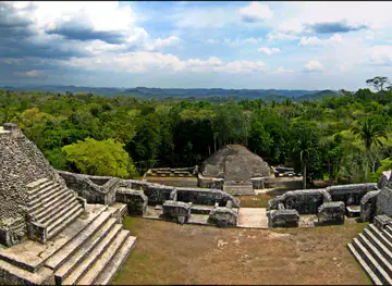
The Mountain Pine Ridge area forms part of the western Belizean uplands and the wider Maya lowlands, where communities developed complex societies centuries before European contact. Caracol, located in the southern part of the reserve area, became one of the great Maya cities of the region during the Classic period. Its rulers controlled an extensive settlement and agricultural landscape and were involved in major political conflicts with neighbouring Maya powers. The surviving plazas, temples, causeways and carved monuments show that the forest now experienced as remote once supported a large and highly organised population.
Maya trade, farming and landscape management
The ancient Maya used the broader Cayo uplands for farming, settlement, quarrying and movement between communities. Rivers, caves and ridges shaped travel and carried religious as well as practical significance. Maya presence did not end with the decline of the major Classic-period cities; later communities continued to occupy and use parts of western Belize. Archaeological remains in and around the reserve therefore represent a long regional history rather than a single abandoned city, and the surrounding forest still contains places where systematic research is continuing.
Colonial and post-contact transformation
After Spanish incursions into the wider Maya region, western Belize developed through a mixture of frontier settlement, forest exploitation and changing political control. The territory later administered as British Honduras remained sparsely settled in its interior compared with the coast, and dense forests became important sources of timber. European mapping and commercial activity altered patterns of access, but the upland interior retained a remote character. The modern reserve’s roads and visitor routes follow a much later phase of development than the ancient paths and settlements associated with the Maya landscape.
Logging and the creation of the forest reserve
Mountain Pine Ridge became important for forestry because its elevated plateaux support Caribbean pine, a species suited to the region’s seasonal conditions. Commercial extraction and concerns about managing the upland woodland contributed to the establishment of Mountain Pine Ridge Forest Reserve in the twentieth century, generally dated to 1944. Forestry shaped roads, work patterns and the reserve’s early official purpose. Today, conservation and recreation sit alongside that history, while evidence of forest management and old access routes remains part of the landscape.
Fire, pine beetles and forest change
The reserve’s ecology has been repeatedly reshaped by wildfire, drought, storms and outbreaks of pine bark beetles. In the early twenty-first century, beetle damage affected large areas of Belizean pine forest, while fires caused further loss and regeneration. These disturbances are natural parts of pine ecosystems but can become especially damaging when climatic stress and human activity combine. Visitors may see contrasts between mature woodland, open stands and regenerating areas, making the reserve a visible example of how tropical upland forests change over time.
Modern conservation and nature-based tourism
In recent decades, Mountain Pine Ridge has become a significant destination for Belize’s inland tourism, with interest focused on waterfalls, swimming pools, caves, wildlife and nearby archaeology. Conservation is managed within a wider national framework that includes protected areas and archaeological protection, while access is supported by local guides, lodges and communities in Cayo District. Tourism remains relatively low-density compared with Belize’s coast. Its future depends on keeping roads and sites usable without compromising watercourses, forests, wildlife habitat and the cultural importance of nearby Maya remains.
Mountain Pine Ridge in Photos
Browse through our photo collection highlighting the charm and character of the destination.
Neighbouring regions of Mountain Pine Ridge
The closest regions to Mountain Pine Ridge, if you have time for more than one.
-

-

-

-
-


Swipe for more regions
Explore more
Explore more of Belize
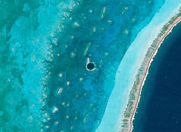
Discover Belize: A Caribbean paradise known for its stunning barrier reef, rich cultural heritage, and eco-friendly adventures in lush rainforests and pristine waters.
Explore Belize