

Free Sangre de Cristo Mountains Travel Guide & Mobile App
Explore Sangre de Cristo Mountains with free travel guides. Discover regional history, expert tips, proposed trips, and audio guides on web or mobile app.


Explore Colorado’s Sangre de Cristo Mountains for alpine wilderness, Great Sand Dunes, dark skies, high-desert towns and demanding mountain trails.
Read more about Sangre de Cristo Mountains
When is the best time to visit Sangre de Cristo Mountains?
Best: June–August · 18–21°C| Month | High (°C) | Rainfall (mm) |
|---|---|---|
| January | -1 | 30 |
| February | 1 | 28 |
| March | 6 | 35 |
| April | 9 | 40 |
| May | 13 | 55 |
| June (best) | 18 | 60 |
| July (best) | 21 | 70 |
| August (best) | 21 | 65 |
| September | 16 | 45 |
| October | 11 | 35 |
| November | 4 | 30 |
| December | 1 | 28 |
Getting to and around Sangre de Cristo Mountains
How to get there
Transportation
Top city travel guides in Sangre de Cristo Mountains
The cities of Sangre de Cristo Mountains, and the easiest places to base yourself.
-

-
-


Swipe for more cities
Destinations in Sangre de Cristo Mountains
Resorts, valleys and scenic spots worth a trip of their own.
-
-


Swipe for more destinations
Best attractions in Sangre de Cristo Mountains
The Colorado Sangre de Cristo Mountains offer a concentrated range of natural attractions rather than a large collection of built tourist sites. Great Sand Dunes National Park and Preserve is the defining experience: visitors can climb the open dunes, explore Medano Creek when flowing, walk through grassland and wetlands, and continue into mountain forests and alpine country. The park’s western and northern approaches also provide access to viewpoints and trails beneath the range. Near the same mountain front, Zapata Falls is reached by a short but uneven route that ends at a narrow seasonal waterfall. The Crestone area provides access to demanding wilderness trails, while Westcliffe and Silver Cliff are gateways to the eastern foothills, scenic roads and forest recreation. Experienced climbers and mountaineers come for the Crestone group, Kit Carson Mountain, Humboldt Peak and other high summits, but these objectives require appropriate skills and conditions. Lower-elevation activities include hiking, wildlife watching, photography, camping and stargazing, with broad skies and relatively little artificial light. The attractions are dispersed, and the changing landscape—from irrigated valley and dune field to spruce forest and exposed granite—matters as much as any individual site.
-
Theme park
Royal Gorge Bridge & Park
Experience breathtaking views and thrilling adventures at America's highest suspension bridge in the heart of the Colorado Rockies.
-
National park
Great Sand Dunes National Park and Preserve
Discover towering dunes, alpine peaks, and dark skies in this unique Colorado landscape. Hike, sandboard, and explore diverse ecosystems.
-
Tourist attraction
Bishop Castle
Explore a towering, hand-built castle in the Colorado mountains, a testament to one man's vision and relentless dedication.
-
Visitor center
Great Sand Dunes Visitor Center
Start your adventure at the Great Sand Dunes Visitor Center: Information, exhibits, and expert advice await!


Best landmarks in Sangre de Cristo Mountains
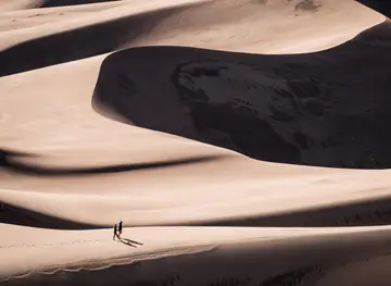
The most recognisable landmark is the Great Sand Dunes, whose sweeping apricot-coloured ridges rise unexpectedly from the San Luis Valley beneath the Sangre de Cristo crest. The dunes are a geological landmark created by wind, water and sediment moving between the mountains and valley, and their scale changes noticeably with light and weather. Above them, the Blanca Peak massif forms a powerful southern skyline, while the Crestone Needle and Crestone Peak create a jagged, highly distinctive outline north of the park. These peaks are important mountaineering landmarks but are not casual walking destinations. On the eastern side, the historic settlements of Westcliffe and Silver Cliff retain the character of former mining and ranching communities, with older civic and commercial buildings providing a human counterpoint to the wilderness. The Sangre de Cristo Wilderness itself is a landmark of conservation: its roadless ridges, high basins and granite summits express the range’s most remote character. Seen from the valley, the continuous wall of mountains is as significant as any single summit, linking Indigenous history, settlement, mining, agriculture and modern public-land protection.
-
Theme park
Royal Gorge Bridge & Park
Explore the iconic Royal Gorge Bridge & Park, where thrilling adventures meet stunning landscapes and rich history in the heart of Colorado.
-
Archaeological museum
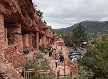
Manitou Cliff Dwellings
Explore the Manitou Cliff Dwellings: An Archaeological Marvel and Cultural Treasure in Colorado's Scenic Landscape.
-
Historical landmark
Cliff Palace
Explore Cliff Palace at Mesa Verde National Park, an archaeological treasure showcasing the ancient Puebloan cliff dwellings and breathtaking natural beauty.
-
Historical place
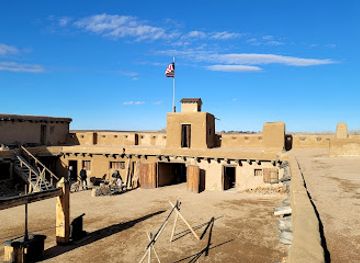
Bent's Old Fort National Historic Site
Explore Bent's Old Fort National Historic Site: A Living Museum of the 19th-Century American Frontier.

Explore Sangre de Cristo Mountains on the map
Plan your trip on one map. See where the top cities, national parks and sights are, and book hotels and experiences in a few clicks.
Best hotels in Sangre de Cristo Mountains
Best restaurants in Sangre de Cristo Mountains
Dining in the Colorado Sangre de Cristo region is shaped by small mountain and valley communities rather than by a concentrated restaurant district. Westcliffe, Silver Cliff, Crestone and the San Luis Valley provide cafés, casual restaurants, bakeries, taverns and locally oriented eateries, though opening patterns can be seasonal and options are limited outside population centres. Food traditions reflect both wider Colorado and the Hispano heritage of southern Colorado and northern New Mexico, with chile-based dishes, beans, tortillas, tamales and hearty breakfasts appearing alongside burgers, pizza and contemporary American cooking. The valley’s farms and ranches contribute produce, beef and other ingredients, while roadside stands and local markets may offer seasonal goods. Visitors staying near the dunes should plan meals and provisions before heading into the park or remote backcountry, where there are no conventional dining facilities. A packed lunch, plentiful water and food that travels well are often more useful than an elaborate dining itinerary.
-
Steak
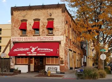
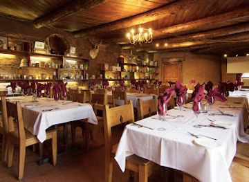
Buckhorn Exchange
Discover Denver's historic Buckhorn Exchange – where exquisite steaks meet rich Western heritage in an unforgettable dining experience.
-
Steak
The Fort
Discover The Fort: A premier steakhouse blending rich Western heritage with modern dining in beautiful Morrison, Colorado.
-
Italian
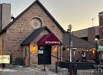
Scileppi's at The Old Stone Church
Experience authentic Italian cuisine at Scileppi's in Castle Rock - where every meal is a delightful journey through Italy.
-
American
Culinary Dropout
Discover Culinary Dropout in Denver: A lively American restaurant known for its delicious food and vibrant atmosphere featuring live music.
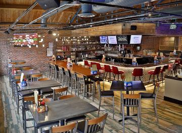
Best bars in Sangre de Cristo Mountains
Evening life in the Colorado Sangre de Cristo Mountains is modest and community-based. Westcliffe and Silver Cliff have the region’s most recognisable concentration of traditional bars, restaurants and occasional live-music evenings, while Crestone’s social life is influenced by cafés, retreats, arts activity and small community events rather than a club scene. In the San Luis Valley, Alamosa, outside the range, offers a broader choice of casual evening venues and serves as a practical service centre for visitors approaching Great Sand Dunes. Rural inns, taverns and brewery-style settings may provide a place to meet after a day outdoors, but opening arrangements can change and late-night transport is limited. The great evening attraction is often the sky: the dry, high-elevation environment and low population density make stargazing an important part of the region’s after-dark culture. Never drive mountain roads after drinking, and arrange accommodation before settling in for the night.
-
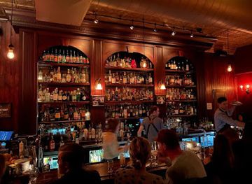
Bar
Williams & Graham
Experience the charm of a speakeasy at Williams & Graham, Denver's premier cocktail bar and grill with innovative drinks and delightful dishes.
-
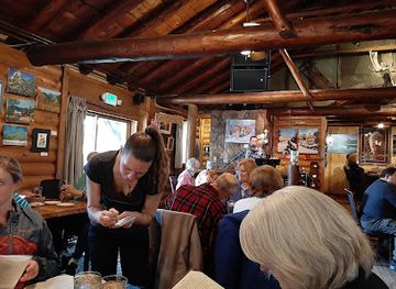
American
The Rock Inn Mountain Tavern
Experience the charm of American cuisine at The Rock Inn Mountain Tavern in Estes Park, where rustic ambiance meets delicious flavors.
-
Restaurant
Las Animas Grill
Discover the delightful flavors of Las Animas Grill in Trinidad, Colorado - where culinary creativity meets a warm, inviting atmosphere.
-
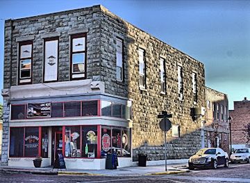
Bar
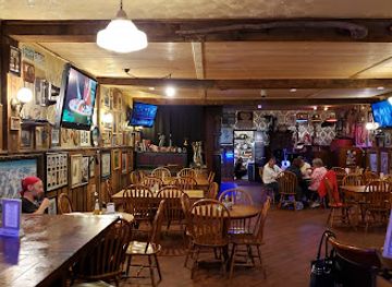
The Legendary Silver Dollar Saloon
Experience the spirit of the Wild West at The Legendary Silver Dollar Saloon in Leadville, offering strong drinks, delicious food, and a lively atmosphere.
Best nightclubs in Sangre de Cristo Mountains
Evening life in the Colorado Sangre de Cristo Mountains is modest and community-based. Westcliffe and Silver Cliff have the region’s most recognisable concentration of traditional bars, restaurants and occasional live-music evenings, while Crestone’s social life is influenced by cafés, retreats, arts activity and small community events rather than a club scene. In the San Luis Valley, Alamosa, outside the range, offers a broader choice of casual evening venues and serves as a practical service centre for visitors approaching Great Sand Dunes. Rural inns, taverns and brewery-style settings may provide a place to meet after a day outdoors, but opening arrangements can change and late-night transport is limited. The great evening attraction is often the sky: the dry, high-elevation environment and low population density make stargazing an important part of the region’s after-dark culture. Never drive mountain roads after drinking, and arrange accommodation before settling in for the night.
-
Night club
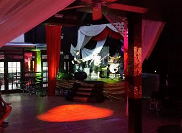
The Church Nightclub
Discover the enchanting atmosphere of The Church Nightclub, where Denver's nightlife comes alive with electrifying music and unforgettable experiences.
-
Night club
Copperhead Road Bar & Nightclub
Discover the vibrant nightlife at Copperhead Road Bar & Nightclub, where great drinks, lively music, and unforgettable experiences await in Colorado Springs.
-
Night club
Temple Nightclub Denver
Discover the dynamic nightlife of Denver at Temple Nightclub, where live music and vibrant dancing create unforgettable memories.
-
Dance club
El Potrero Night Club
Experience the vibrant nightlife at El Potrero Night Club, a premier dance and entertainment venue in Glendale, Colorado, welcoming all for unforgettable nights.



Best shops in Sangre de Cristo Mountains
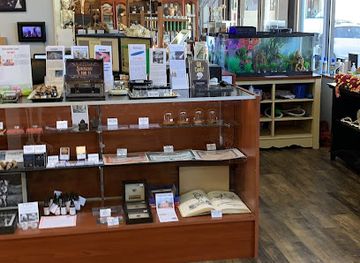
Shopping is limited and locally focused, with the strongest choice in Westcliffe, Silver Cliff, Crestone and the larger service communities of the San Luis Valley. Visitors can find independent galleries, artists’ studios, bookshops, small gift shops, outdoor equipment and locally made crafts rather than extensive department-store retail. Crestone has a particular association with spiritual, artistic and alternative communities, while Westcliffe’s shops and galleries reflect the town’s ranching, historic and mountain-recreation setting. Seasonal farmers’ markets and farm stands may offer produce, preserves, baked goods and other valley products, though dates and availability vary. Useful regional purchases include locally made pottery, jewellery, textiles, artwork, books about the mountains and practical hiking supplies. Buy food, fuel and essential equipment before travelling to remote trailheads or Great Sand Dunes, where shopping is not a major part of the visitor infrastructure. Respect private studios and community spaces, and check current opening arrangements in small towns before making a dedicated shopping trip.
-
Collectibles store
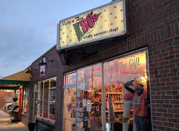
Fifty Two 80's A Totally Awesome Shop
Explore the colorful world of vintage collectibles at Fifty Two 80's, a nostalgic shop celebrating the iconic 1980s culture in Denver.
-
Home goods store
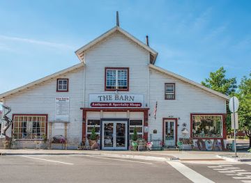
The Barn Antiques and Specialty Shops
Discover unique antiques and specialty items in the heart of Castle Rock at The Barn Antiques and Specialty Shops.
-
Gift shop
The Emporium
Explore unique and handmade treasures at The Emporium, Castle Rock's charming gift shop with something for everyone.
-
Gift shop
The Golden Curiosity Shop
Uncover unique treasures and whimsical finds at The Golden Curiosity Shop, a must-visit gift shop in the heart of Golden, Colorado.

Get your free copy of our complete guide to Sangre de Cristo Mountains, delivered straight to you.
Everything on this page, from attractions and restaurants to essentials and local phrases, in one PDF you can read offline, print or share.
Already have an account? Sign in
Your Sangre de Cristo Mountains guide is ready.
We'll send it to · Not you? Sign out

Getting your guide ready…
We are putting together a fresh copy of the Sangre de Cristo Mountains guide. This can take up to a minute.
This can take a few moments. If your browser asks, choose Allow so the download can start. You'll find the guide in your Downloads folder.
Nothing happened? Download it again
Sorry, the guide is taking longer than usual. Please try again in a minute, or get it by email instead.
Sangre de Cristo Mountains essentials
Currency and Payment
Safety
Emergency Situations
Do's and Don'ts
Local Tips
From Eve
Local phrases worth knowing
You don't need to get them perfect. A few words go a long way, and locals appreciate the effort.
Basics
| English | Local | Say it |
|---|---|---|
| Hello | Howdy | [haʊdi] |
| Goodbye | See ya | [si jə] |
| Yes | Yep | [jɛp] |
| No | Nope | [noʊp] |
| Please/You're welcome | Sure thing | [ʃʊr θɪŋ] |
| Thank you | Thanks a lot | [θæŋks ə lɑt] |
| Excuse me/Sorry | Pardon me | [ˈpɑrdən mi] |
| How are you? | How's it goin'? | [haʊz ɪt ˈgoʊɪn] |
| Fine. And you? | Good. You? | [ɡʊd ju] |
| Do you speak English? | Can you speak English? | [kæn ju spiːk ˈɪŋɡlɪʃ] |
| I don't understand | I ain't followin' | [aɪ eɪnt ˈfɑloʊɪn] |
Eating & Drinking
| English | Local | Say it |
|---|---|---|
| I'd like to see the menu, please | Can I see the menu? | [kæn aɪ si ðə ˈmɛnju] |
| I don't eat meat | I'm a vegetarian | [aɪm ə ˌvɛdʒəˈtɛriən] |
| Cheers! | Cheers! | [ʧɪrz] |
| I would like to pay, please | Can I get the check? | [kæn aɪ ɡɛt ðə ʧɛk] |
Emergencies
| English | Local | Say it |
|---|---|---|
| Help! | Help! | [hɛlp] |
| Go away! | Leave me be! | [liːv mi bi] |
| Call the Police! | Call the cops! | [kɔl ðə kɑps] |
| Call a doctor! | Get a doctor! | [ɡɛt ə ˈdɑktər] |
| I'm lost | I can't find my way | [aɪ kænt faɪnd maɪ weɪ] |
| I'm ill | I'm not feelin' well | [aɪm nɑt ˈfiːlɪn wɛl] |
Shopping
| English | Local | Say it |
|---|---|---|
| I'd like to buy... | I want to buy... | [aɪ wɑnt tə baɪ] |
| I'm just looking | Just browsing | [dʒʌst ˈbraʊzɪŋ] |
| How much is it? | What's the price? | [wʌts ðə praɪs] |
| That's too expensive | That's pricey | [ðæts ˈpraɪsi] |
| Can you lower the price? | Can you cut me a deal? | [kæn ju kʌt mi ə dil] |
Time & Numbers
| English | Local | Say it |
|---|---|---|
| What time is it? | What time ya got? | [wʌt taɪm jə ɡɑt] |
| It's one o'clock | It's one | [ɪts wʌn] |
| Half past (10) | Ten-thirty | [tɛn-ˈθɜrti] |
| Morning | Mornin' | [ˈmɔrnɪn] |
| Afternoon | Afternoon | [ˌæf.tɚˈnun] |
| Evening | Evenin' | [ˈivnɪn] |
| Yesterday | Yesterday | [ˈjɛstərdeɪ] |
| Today | Today | [təˈdeɪ] |
| Tomorrow | Tomorrow | [təˈmɔroʊ] |
| 1 | One | [wʌn] |
| 2 | Two | [tu] |
| 3 | Three | [θri] |
| 4 | Four | [fɔr] |
| 5 | Five | [faɪv] |
| 6 | Six | [sɪks] |
| 7 | Seven | [sɛvən] |
| 8 | Eight | [eɪt] |
| 9 | Nine | [naɪn] |
| 10 | Ten | [tɛn] |
Transport & Directions
| English | Local | Say it |
|---|---|---|
| Where's a/the...? | Where's the...? | [wɛrz ðə] |
| What's the address? | What's the address? | [wʌts ði ˈædres] |
| Can you show me (on the map)? | Can you point me on the map? | [kæn ju pɔɪnt mi ɒn ðə mæp] |
| When's the next (bus)? | When's the next bus? | [wɛnz ðə nɛkst bʌs] |
| A ticket (to ....) | A ticket to... | [ə ˈtɪkɪt tə] |
History of Sangre de Cristo Mountains
Ute Homelands and Indigenous Travel
The Sangre de Cristo Mountains and the San Luis Valley formed part of the homeland and travel landscape of Ute peoples, including bands associated with the Southern Ute and Ute Mountain Ute. Mountain passes, valleys, water sources and hunting grounds connected the range with wider routes across southern Colorado and northern New Mexico. European-American accounts often describe later exploration and settlement as if the landscape were empty, but Indigenous communities had long-standing knowledge of its ecology and geography. That earlier history remains essential to understanding the mountains as a lived cultural landscape rather than simply a recreational wilderness.
Spanish and Hispano Settlement in the San Luis Valley
Spanish colonial influence reached the upper Rio Grande region from the south, and Hispano settlement expanded into the San Luis Valley in the nineteenth century. San Luis, founded in 1851 east of the present-day Colorado range, is widely recognised as Colorado’s oldest continuously inhabited town. Settlers developed acequia irrigation systems, small farms and sheep- and cattle-based livelihoods in the valley beneath the mountains. Many place names, agricultural practices and community traditions around the Colorado Sangres reflect this Hispano history, which predates Colorado statehood and remains visible in the cultural landscape.
American Expansion and the Colorado Territory
During the nineteenth century, US territorial expansion brought new surveying, military, commercial and settlement activity to the San Luis Valley and the mountain passes. The Sangre de Cristos became part of a contested borderland shaped by federal policy, land grants, ranching and transportation routes. The creation of Colorado Territory in 1861 and statehood in 1876 placed the Colorado portion of the range within the political structure of the United States, while Spanish and Mexican land-use legacies continued to influence ownership and settlement patterns.
Silver Cliff and the Mining Era
Silver discoveries in the Wet Mountain Valley east of the range encouraged the growth of Silver Cliff and neighbouring Westcliffe during the late nineteenth century. Although the principal mining district was not located on the highest Sangre de Cristo summits themselves, its prosperity influenced roads, trade, construction and settlement on the eastern side of the mountains. The boom brought substantial buildings and businesses to the area, followed by decline as ore production and silver prices weakened. Today, the towns provide an important historical gateway to the range’s eastern landscapes.
Railways, Roads and Valley Agriculture
Transport improvements altered the relationship between the mountains and surrounding settlements. Railways reached parts of the San Luis Valley and connected agricultural communities with wider markets, while roads later made mountain passes and national-forest areas accessible to motorists. Irrigated farming, ranching and later tourism remained more important to the valley economy than large-scale industrial development in the high range. The result is a region where historic agricultural patterns coexist with wilderness, public land and outdoor recreation.
Great Sand Dunes and Conservation
The dunes at the foot of the Sangre de Cristos were first protected as Great Sand Dunes National Monument in 1932 after local and state efforts to preserve the unusual landscape from mineral exploitation. The protected area was expanded and redesignated Great Sand Dunes National Park and Preserve in 2004. The park safeguards the dune field, wetlands, grasslands, forests and alpine environments linked to the mountains. Its designation reflects the close ecological connection between the range and the San Luis Valley rather than treating the dunes as an isolated feature.
Wilderness Protection and Modern Recreation
The Sangre de Cristo Wilderness was established through the Colorado Wilderness Act of 1993, protecting a large area of steep, roadless mountain country. Other sections of the range are managed by the National Park Service, the US Forest Service and other public-land agencies. Conservation has shaped the modern visitor experience: trails, climbing routes and backcountry camps exist, but motor access is deliberately limited in wilderness areas. Today, mountaineering, hiking, stargazing, photography and wildlife observation sit alongside ranching and small-town life.
Sangre de Cristo Mountains in Photos
Browse through our photo collection highlighting the charm and character of the destination.
Neighbouring regions of Sangre de Cristo Mountains
The closest regions to Sangre de Cristo Mountains, if you have time for more than one.
-

-

-

-

-


Swipe for more regions
Explore more

Explore more of Colorado
Discover Colorado: A stunning blend of rugged mountains, vibrant cities, and rich history, offering endless adventures and unforgettable experiences.
Explore Colorado