

Free San Luis Valley Travel Guide & Mobile App
Explore San Luis Valley with free travel guides. Discover regional history, expert tips, proposed trips, and audio guides on web or mobile app.


Explore Colorado’s San Luis Valley for Great Sand Dunes, high-country wildlife, Hispano heritage, mountain towns and exceptionally clear skies.
Read more about San Luis Valley
When is the best time to visit San Luis Valley?
Best: May–June, September · 22–28°C| Month | High (°C) | Rainfall (mm) |
|---|---|---|
| January | 3 | 8 |
| February | 6 | 6 |
| March | 10 | 8 |
| April | 16 | 10 |
| May (best) | 22 | 15 |
| June (best) | 28 | 13 |
| July | 31 | 31 |
| August | 29 | 25 |
| September (best) | 25 | 15 |
| October | 17 | 10 |
| November | 9 | 8 |
| December | 3 | 8 |
Getting to and around San Luis Valley
How to get there
Transportation
Top city travel guides in San Luis Valley
The cities of San Luis Valley, and the easiest places to base yourself.
-

-

-

-
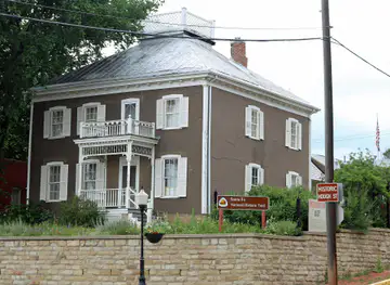
-
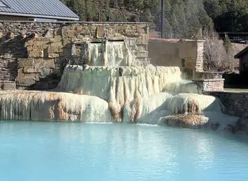
-


Swipe for more cities
Destinations in San Luis Valley
Resorts, valleys and scenic spots worth a trip of their own.
-
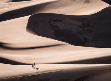
-

-
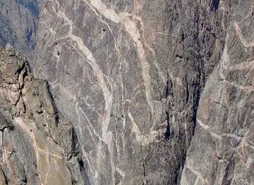
-
-


Swipe for more destinations
Best attractions in San Luis Valley
The San Luis Valley’s attractions are shaped by the meeting of high desert, wetlands, farmland and mountain wilderness. Great Sand Dunes National Park and Preserve is the defining experience, offering dune walking, seasonal Medano Creek, mountain trails and dark-sky scenery. The surrounding Sangre de Cristo country includes Zapata Falls and trailheads leading towards alpine landscapes, while the western side of the valley opens towards Rio Grande National Forest and the historic mining town of Creede. Alamosa and Monte Vista provide access to wildlife-rich wetlands, including the Alamosa, Monte Vista and Baca national wildlife refuges, where migratory birds gather along the Rio Grande system. Colorado Gators Reptile Park near Mosca presents an unusual local attraction built around warm-water aquaculture. Fort Garland Museum and Cultural Center interprets frontier military history, Hispanic settlement and regional communities. The Cumbres & Toltec Scenic Railroad departs from Antonito and travels through neighbouring New Mexico, making it a practical heritage excursion from the valley. Smaller museums, galleries, agricultural communities and scenic drives add context between the headline sites.
-
National park
Great Sand Dunes National Park and Preserve
Discover the tallest sand dunes in North America, surrounded by diverse ecosystems and stunning mountain views, at this unique national park.
-
Tourist attraction
Zapata Falls
Discover a hidden waterfall oasis near Great Sand Dunes National Park. Hike through a cool canyon to a unique cave with a 25-foot waterfall!
-
Tourist attraction
Trinidad Lake State Park
Explore Trinidad Lake State Park: Water sports, hiking trails, historical sites, and stunning mountain views in Southern Colorado.
-
Observation deck
UFO Watchtower
Explore the mysteries of the San Luis Valley at the UFO Watchtower: a unique roadside attraction with otherworldly views and cosmic energy.


Best landmarks in San Luis Valley
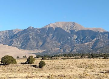
Great Sand Dunes is the valley’s most recognisable natural landmark, where immense dunes rise at the foot of the Sangre de Cristo Mountains and create an unusual visual boundary between desert-like plain and alpine terrain. Blanca Peak, visible from many parts of the eastern valley, is another defining presence, although high-altitude climbing requires serious preparation. In the south, the Stations of the Cross outside San Luis form a large devotional landscape overlooking the valley and express the area’s enduring Hispano Catholic heritage. The adobe buildings of Fort Garland preserve a tangible reminder of nineteenth-century military expansion and frontier administration. Creede’s historic downtown and surrounding mine landscapes mark the silver boom that reshaped the western mountains in the 1890s. The Rio Grande and its cottonwood corridors are less monumental but equally important, forming the geographic spine of the basin and sustaining farms, wetlands and migratory bird habitat. In Antonito, the historic railway infrastructure associated with the Cumbres & Toltec Scenic Railroad represents the transport networks that once connected the valley’s agricultural and mining settlements with markets beyond the mountains.
-
National park
Great Sand Dunes National Park and Preserve
Explore the enchanting Great Sand Dunes National Park, where towering dunes meet stunning mountain vistas in Colorado's natural beauty.
-
Tourist attraction
Bishop Castle
Explore the breathtaking Bishop Castle in Colorado, a spectacular masterpiece of stone crafted by one man's vision, surrounded by stunning mountain views.
-
State park
Trinidad Lake State Park
Explore the natural beauty of Trinidad Lake State Park, a stunning destination for outdoor activities and wildlife viewing in Colorado.
-
Museum
Fort Garland Museum & Cultural Center
Discover the captivating history of Colorado at Fort Garland Museum & Cultural Center, where engaging exhibits and cultural experiences await every visitor.


Explore San Luis Valley on the map
Plan your trip on one map. See where the top cities, national parks and sights are, and book hotels and experiences in a few clicks.
Best hotels in San Luis Valley
Best restaurants in San Luis Valley
Dining in the San Luis Valley reflects both Colorado’s broader regional food culture and the distinctive Hispano traditions of southern Colorado and northern New Mexico. Alamosa has the widest choice of cafés, casual restaurants, bakeries and international cuisines, while smaller communities tend to centre on diners, independent eateries, traditional Mexican and Hispano cooking, and locally oriented cafés. Look for dishes featuring potatoes, beans, beef, green chile and masa, alongside burgers, trout and contemporary American cooking. The valley is one of Colorado’s important potato-growing areas, and seasonal produce appears in farm shops, markets and restaurant menus. Creede, South Fork and mountain communities add rustic dining rooms, breweries and places suited to post-hike meals. Local establishments vary considerably in opening days outside the main summer season, so rural dining requires more planning than eating in a major city. Tipping follows standard United States practice, and advance reservations are sensible for small dining rooms during busy holiday periods.
-
American
The Rabbit Hole
Discover the enchanting flavors of America at The Rabbit Hole in downtown Colorado Springs—where culinary artistry meets fine dining.
-
Restaurant
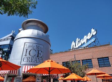
Linger
Experience exquisite global cuisine and breathtaking views at Linger in Denver's Highland neighborhood.
-
Steak
The Fort
Experience authentic Western cuisine at The Fort in Morrison, Colorado—where every meal tells a story of America's culinary heritage.
-
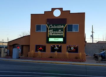
Mexican
Calvillo's Mexican Restaurant
Experience authentic Mexican flavors at Calvillo's Mexican Restaurant - where every dish tells a story.


Best bars in San Luis Valley
Nightlife in the San Luis Valley is generally low-key and community-oriented rather than club-driven. Alamosa has the broadest evening choice, including pubs, breweries, casual bars, restaurants and occasional live music, with activity often linked to the local college and seasonal visitors. Creede and South Fork offer historic-style watering holes, restaurants and mountain-town bars, while other communities may have only a small number of places open late. Breweries and taprooms provide a useful focus for sampling regional beer, but opening patterns can change with the season. Rural evenings are often better suited to dining, conversation, local performances or stargazing than to large nightclubs. Visitors should arrange a safe return journey in advance, especially when staying outside Alamosa, since taxi and rideshare availability is limited and distances between towns are considerable.
-
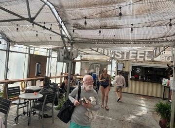
Restaurant
Sand Dunes Recreation
Sand Dunes Recreation: A Family-Friendly Destination Offering Poolside Relaxation, Delicious Dining, and Unique Gifts in the Heart of Colorado.
-
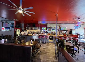
Bar
Chili's Grill & Bar
Discover the vibrant flavors of American and Tex-Mex cuisine at Chili's Grill & Bar in Alamosa, your perfect dining destination.
-
American
The Rubi Slipper LLC
Experience a delightful fusion of American, Mexican, seafood, and dessert cuisine at The Rubi Slipper LLC in Alamosa, Colorado.
-
American
Colorado Grille & Tap House
Savor the essence of Colorado at the Colorado Grille & Tap House, where American cuisine meets a welcoming atmosphere in Del Norte.


Best nightclubs in San Luis Valley
Nightlife in the San Luis Valley is generally low-key and community-oriented rather than club-driven. Alamosa has the broadest evening choice, including pubs, breweries, casual bars, restaurants and occasional live music, with activity often linked to the local college and seasonal visitors. Creede and South Fork offer historic-style watering holes, restaurants and mountain-town bars, while other communities may have only a small number of places open late. Breweries and taprooms provide a useful focus for sampling regional beer, but opening patterns can change with the season. Rural evenings are often better suited to dining, conversation, local performances or stargazing than to large nightclubs. Visitors should arrange a safe return journey in advance, especially when staying outside Alamosa, since taxi and rideshare availability is limited and distances between towns are considerable.
-
Night club
The Church Nightclub
Explore the unique nightlife of Denver at The Church Nightclub, where historic charm meets electrifying entertainment in a vibrant atmosphere.
-
Night club
Milk Bar
Discover the ultimate nightlife experience at Milk Bar in Denver, where music, drinks, and a vibrant atmosphere collide.
-
Night club
Temple Nightclub Denver
Discover the electrifying nightlife at Temple Nightclub Denver, where live music and vibrant dance floors create unforgettable experiences.
-
Night club
Club Vinyl
Discover the electrifying nightlife at Club Vinyl, Denver's top destination for diverse music and vibrant atmosphere, perfect for nightlife enthusiasts.




Best shops in San Luis Valley
Shopping in the San Luis Valley is centred on practical high streets, independent businesses, galleries, farm outlets and community markets rather than large retail districts. Alamosa has the broadest selection of outdoor equipment, books, clothing, groceries, cafés and locally made gifts, while Saguache, Del Norte, Creede, South Fork and San Luis offer smaller collections of galleries, studios, antiques and craft shops. Regional purchases may include pottery, paintings, textiles, jewellery, locally produced food, chile products, honey and valley-grown potatoes. Creede is particularly associated with arts, galleries and mining-themed keepsakes, while southern communities provide opportunities to learn about Hispano craft and land-based traditions. Farmers’ markets and seasonal roadside stands can be useful for fruit, vegetables and other produce, but their availability varies by time of year. Visitors should buy Indigenous-made or culturally significant items from reputable sources and avoid treating sacred designs or historical traditions as generic souvenirs.
-
Gift shop
Sand Dunes Recreation
Explore Sand Dunes Recreation, a vibrant hub in Hooper, Colorado, featuring a swimming pool, delicious dining, and unique shopping experiences.
-
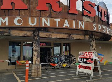
Outdoor sports store
Kristi Mountain Sports, LLC - Alamosa
Your ultimate destination for outdoor sports gear and rentals in Alamosa, Colorado, offering everything you need for your next adventure.
-
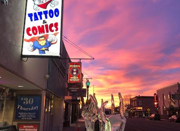
Tattoo and piercing shop
The Shop Tattoo & Comics
Explore the artistic fusion of tattoos and comics at The Shop Tattoo & Comics in Alamosa, Colorado - a must-visit for enthusiasts and collectors.
-
Hobby store
HobbyTown
Discover endless creativity and excitement at HobbyTown, your ultimate destination for all things hobby-related in Alamosa, Colorado.


Get your free copy of our complete guide to San Luis Valley, delivered straight to you.
Everything on this page, from attractions and restaurants to essentials and local phrases, in one PDF you can read offline, print or share.
Already have an account? Sign in
Your San Luis Valley guide is ready.
We'll send it to · Not you? Sign out

Getting your guide ready…
We are putting together a fresh copy of the San Luis Valley guide. This can take up to a minute.
This can take a few moments. If your browser asks, choose Allow so the download can start. You'll find the guide in your Downloads folder.
Nothing happened? Download it again
Sorry, the guide is taking longer than usual. Please try again in a minute, or get it by email instead.
San Luis Valley essentials
Currency and Payment
Safety
Emergency Situations
Do's and Don'ts
Local Tips
From Eve
Local phrases worth knowing
You don't need to get them perfect. A few words go a long way, and locals appreciate the effort.
Basics
| English | Local | Say it |
|---|---|---|
| Hello | Hola | [OH-lah] |
| Goodbye | Adiós | [ah-DYOS] |
| Yes | Sí | [SEE] |
| No | No | [NO] |
| Please/You're welcome | Por favor / De nada | [por fah-VOR / de NAH-dah] |
| Thank you | Gracias | [GRAH-syahs] |
| Excuse me/Sorry | Perdón | [pair-DON] |
| How are you? | ¿Cómo estás? | [KOH-moh ehs-TAHS] |
| Fine. And you? | Bien. ¿Y tú? | [BYEN. ee TOO] |
| Do you speak English? | ¿Hablas inglés? | [AH-blas een-GLES] |
| I don't understand | No entiendo | [NO en-TYEN-doh] |
Eating & Drinking
| English | Local | Say it |
|---|---|---|
| I'd like to see the menu, please | Me gustaría ver el menú, por favor | [may goos-tah-REE-ah vehr el meh-NOO, por fah-VOR] |
| I don't eat meat | No como carne | [NO KOH-mo KAR-neh] |
| Cheers! | ¡Salud! | [sah-LOOD] |
| I would like to pay, please | Me gustaría pagar, por favor | [may goos-tah-REE-ah pah-GAR, por fah-VOR] |
Emergencies
| English | Local | Say it |
|---|---|---|
| Help! | ¡Ayuda! | [ah-YOO-dah] |
| Go away! | ¡Vete! | [VEH-teh] |
| Call the Police! | ¡Llame a la policía! | [YAH-meh ah lah poh-lee-SEE-ah] |
| Call a doctor! | ¡Llame a un doctor! | [YAH-meh ah oon dok-TOR] |
| I'm lost | Estoy perdido | [es-TOY pair-DEE-doh] |
| I'm ill | Estoy enfermo/a | [es-TOY en-FER-mo/a] |
Shopping
| English | Local | Say it |
|---|---|---|
| I'd like to buy... | Me gustaría comprar... | [may goos-tah-REE-ah kom-PRAR] |
| I'm just looking | Solo estoy mirando | [SOH-lo es-TOY mee-RAN-doh] |
| How much is it? | ¿Cuánto cuesta? | [KWAN-toh KWEH-stah] |
| That's too expensive | Es muy caro | [es MOO-ee KAH-roh] |
| Can you lower the price? | ¿Puedes bajar el precio? | [PWEH-des bah-HAR el PREH-syo] |
Time & Numbers
| English | Local | Say it |
|---|---|---|
| What time is it? | ¿Qué hora es? | [KEH OR-ah es] |
| It's one o'clock | Es la una | [es lah OO-nah] |
| Half past (10) | Y diez y media | [ee DYAS ee MEH-dyah] |
| Morning | Mañana | [mah-NYAH-nah] |
| Afternoon | Tarde | [TAR-deh] |
| Evening | Noche | [NOH-cheh] |
| Yesterday | Ayer | [ah-YER] |
| Today | Hoy | [OY] |
| Tomorrow | Mañana | [mah-NYAH-nah] |
| 1 | Uno | [OO-noh] |
| 2 | Dos | [DOS] |
| 3 | Tres | [TRES] |
| 4 | Cuatro | [KWAH-troh] |
| 5 | Cinco | [SEEN-koh] |
| 6 | Seis | [SACE] |
| 7 | Siete | [SYEH-teh] |
| 8 | Ocho | [OH-choh] |
| 9 | Nueve | [NWEH-beh] |
| 10 | Diez | [DYAS] |
Transport & Directions
| English | Local | Say it |
|---|---|---|
| Where's a/the...? | ¿Dónde está un/una...? | [DON-day es-TAH oon/OO-nah] |
| What's the address? | ¿Cuál es la dirección? | [KWAL es lah dee-rek-SYON] |
| Can you show me (on the map)? | ¿Puedes mostrarme (en el mapa)? | [PWEH-des mos-TRAR-meh (en el MAH-pah)] |
| When's the next (bus)? | ¿Cuándo sale el próximo (autobús)? | [KWAN-doh SAH-leh el PROK-see-mo (ow-toh-BOOS)] |
| A ticket (to ....) | Un boleto (a ....) | [oon bo-LEH-toh (ah ....)] |
History of San Luis Valley
Indigenous Homelands and Routes
The San Luis Valley has long been used and inhabited by Indigenous peoples, including the Ute communities whose territories extended across the southern Rocky Mountains and surrounding basins. The valley’s rivers, wetlands and mountain passes supported seasonal movement, hunting and trade. Archaeological evidence and continuing Indigenous connections place the region within a much older history than the later settlement stories associated with forts, farms and mining. Visitors should understand the landscape as an Indigenous homeland as well as a scenic destination.
Spanish and Mexican Frontier, Eighteenth to Nineteenth Centuries
The valley lay on the northern edge of Spanish and later Mexican influence, connected to New Mexico by routes through the Sangre de Cristo Mountains. Trade, livestock raising and settlement expanded northwards from New Mexico, bringing Hispanic agricultural traditions and irrigation practices. After the United States acquired the area through the Treaty of Guadalupe Hidalgo in 1848, these existing communities and land claims became part of a new political order rather than appearing on an empty frontier.
San Luis and the Sangre de Cristo Land Grant
San Luis was founded in 1851 by Hispanic settlers associated with the Sangre de Cristo Land Grant and is recognised as Colorado’s oldest continuously inhabited town. Its history reflects communal land use, acequia irrigation and a population whose cultural links remain strongly connected to northern New Mexico. The town’s architecture, religious traditions and agricultural landscape provide an important counterpoint to the later mining and railroad narratives that dominate many accounts of the American West.
Fort Garland and U.S. Territorial Expansion
Fort Garland was established by the United States Army in 1858 to help supervise the southern Colorado frontier and protect transport routes. The post was associated with campaigns and negotiations involving Indigenous nations, including the Ute, as well as the wider process of American territorial expansion. The surviving adobe fort is now a state historic site, interpreting military life, Hispanic settlement and the complicated relationships among the army, Indigenous peoples and local communities.
Railways, Irrigation and Agricultural Settlement
During the late nineteenth and early twentieth centuries, railways and irrigation transformed the valley’s economy. Tracks connected agricultural communities and mining districts with markets beyond the mountains, while canals and acequias made cultivation more dependable in the dry basin. Alamosa developed as a regional commercial and transport centre. Potatoes, grains, livestock and other crops became central to the economy, and agriculture remains visually and economically important despite recurring pressures on water supplies.
Creede Silver and Mountain Mining
Silver discoveries near Creede in the 1890s produced a rapid mining boom in the valley’s western mountains. The settlement grew quickly, attracting prospectors, merchants and transport links, though the boom was vulnerable to fluctuating mineral prices and changes in federal monetary policy. Creede’s surviving historic buildings and mining landscapes reflect this volatile period. Today, the town combines heritage interpretation with access to the surrounding Rio Grande National Forest and high-country recreation.
Conservation and the Modern Valley
The twentieth century brought a growing emphasis on conserving the valley’s unusual landscapes and wetlands. Great Sand Dunes became a national monument in 1932 and a national park and preserve in 2004, while wildlife refuges protect migratory bird habitat along the Rio Grande system. Tourism now complements farming, ranching and outdoor recreation, but the region continues to face practical questions about water, drought, land use and how to sustain rural communities at high altitude.
San Luis Valley in Photos
Browse through our photo collection highlighting the charm and character of the destination.
Neighbouring regions of San Luis Valley
The closest regions to San Luis Valley, if you have time for more than one.
-

-

-

-

-


Swipe for more regions
Explore more

Explore more of Colorado
Discover Colorado: A stunning blend of rugged mountains, vibrant cities, and rich history, offering endless adventures and unforgettable experiences.
Explore Colorado