From Eve
Know before you go
Hi, I'm Eve. Here are a few practical things to know before exploring Hagerman Pass.
Local know-how to help you travel smarter and make the most of every moment.
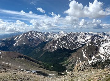
Drive through history on Hagerman Pass, a scenic 4WD route over the Continental Divide with stunning views and a glimpse into Colorado's mining past.
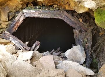
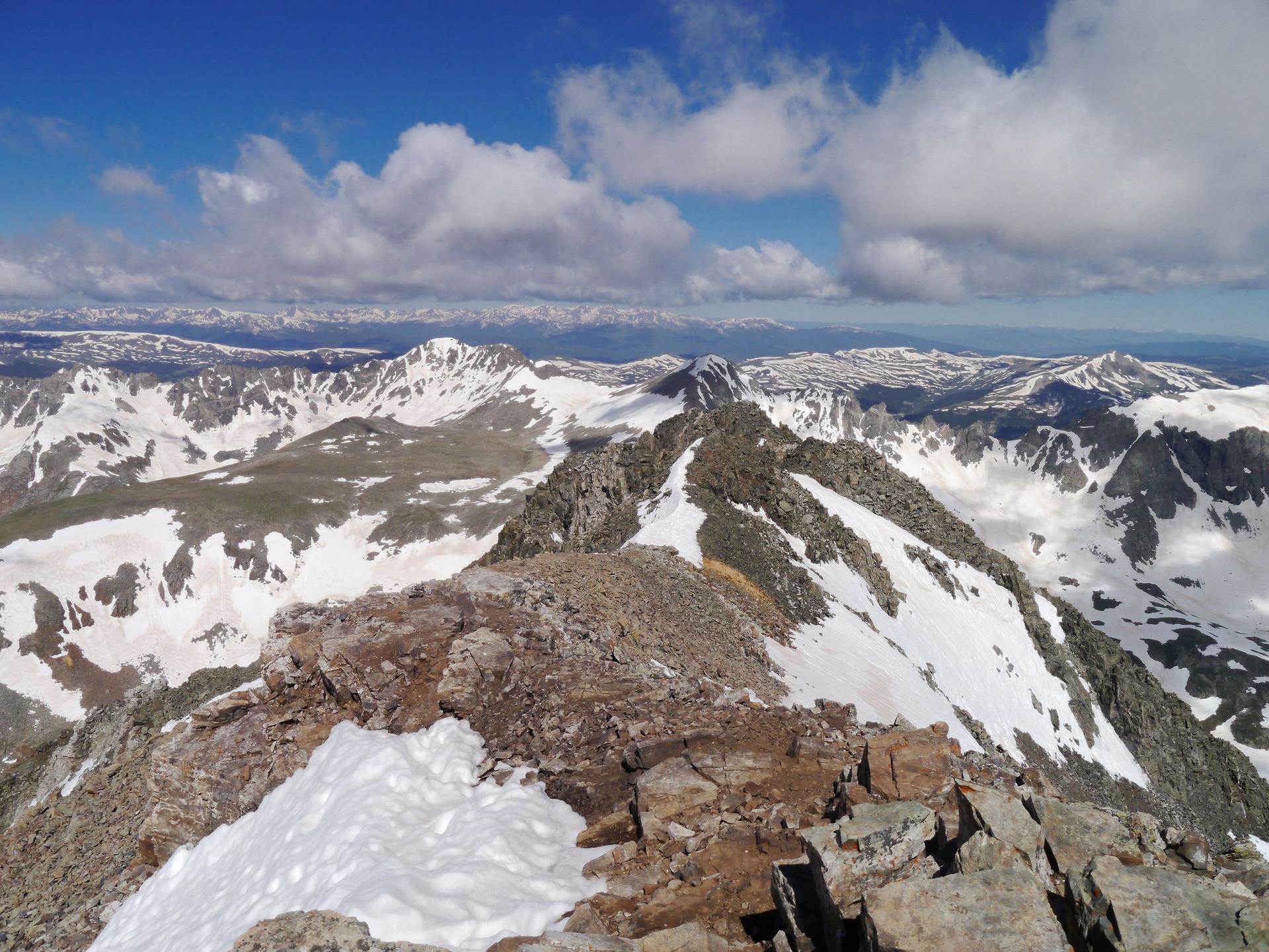
Hagerman Pass, sitting at 11,925 feet, is a high mountain pass on the Continental Divide in central Colorado. Once a railway route, it now offers a scenic, though rugged, 4WD road connecting Leadville and Basalt. Expect stunning views and a glimpse into Colorado's mining past.
Opening times, essentials, and a few local tips gathered into one calmer, easier-to-scan planning section.
Hi, I'm Eve. Here are a few practical things to know before exploring Hagerman Pass.
Local know-how to help you travel smarter and make the most of every moment.
Driving
From Leadville, head west on 6th Street, which becomes County Road 4/McWethy Drive. Follow County Road 4 for approximately 5 miles around Turquoise Lake. At a fork in the road, turn left onto Forest Service Road 105 (Hagerman Pass Road). This road is unpaved and requires a high-clearance 4WD vehicle. There are several parking areas along Hagerman Pass Road, including one for the Hagerman Tunnel trailhead. There are no fees or mandatory access costs.
Use Tower Bridge as your starting point for nearby food, family ideas, nightlife, and more local discoveries.

Explore expert travel guides, compare and book tours, experiences, hotels, and more—all from the palm of your hand. Download now for seamless trip planning wherever your wanderlust takes you.
Discover the Tenmile Range in Colorado: a stunning mountain escape offering year-round outdoor adventures, historical charm, and breathtaking natural beauty.
Tell me more about Tenmile Range