Background

Randers Fjord

A tranquil Danish fjord where the Gudenå River meets the Kattegat, blending reed-filled wetlands, historic ferries and gentle outdoor adventures in East Jutland.

4.7

Randers Fjord is a 30 km-long, lowland fjord in eastern Jutland where Denmark’s longest river, the Gudenå, meets the Kattegat. Winding through reed beds, salt marshes and open water between Randers and Udbyhøj, it forms the heart of Randers Fjord Nature Park, a 293 sq km protected landscape. Birdlife, rich fishing grounds, tiny harbours and historic ferries at Mellerup–Voer and Udbyhøj make this a rewarding destination for kayaking, cycling, gentle walks and slow coastal exploration in all seasons.

A brief summary to Randers Fjord

  • DK
  • Duration: 1.5 to 8 hours
  • Free
  • Environment icon Outdoor
  • Mobile reception: 4 out of 5

Local tips

  • Bring binoculars if you are interested in birdlife; the reed beds and salt marshes hold many species that are easiest to enjoy from a distance.
  • Layer your clothing and pack a windproof jacket, as breezes along the open water can feel cool even on bright days.
  • If you plan to fish, check current local regulations and seasons in advance, and consider hiring local guidance for the best spots along the fjord.
  • Allow extra time to ride one of the small ferries at Mellerup–Voer or Udbyhøj; the short crossings add a memorable local touch to your visit.
  • Carry water and snacks when exploring lesser‑visited stretches, as facilities are clustered around harbours, nature centres and a few villages.
widget icon

Getting There

  • Regional bus

    From Randers city centre, use regional bus services running towards fjordside villages such as Mellerup, Voer or Udbyhøj; typical journey times range from 30 to 60 minutes depending on the stop and connections. Single adult fares within the local fare zones are usually around 20–40 DKK. Services run more frequently on weekdays than weekends, and some routes may have limited evening departures, so it is wise to check current timetables before you set out.

  • Car from Randers

    Driving from Randers gives straightforward access to multiple points along Randers Fjord, such as small harbours, bird towers and ferry crossings. Most locations beside the fjord can be reached within 20–45 minutes on paved roads. There is no specific entrance fee for the nature park, and parking at smaller marinas or viewpoints is often free or low cost, though spaces can be limited at peak times and in narrow village streets.

  • Cycling from Randers area

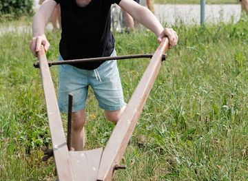
    Confident cyclists can follow minor country roads and signposted cycle routes from Randers towards villages like Uggelhuse, Mellerup or Voer, typically taking 45–90 minutes each way depending on distance and wind conditions. The terrain is mostly gentle but exposed near the fjord, so strong headwinds can make progress slower. There is no charge to use the routes, but bring lights and reflective gear if returning late, as some stretches have limited street lighting.

Randers Fjord location weather suitability

  • Weather icon Clear Skies
  • Weather icon Mild Temperatures
  • Weather icon Any Weather
  • Weather icon Cold Weather
  • Weather icon Hot Weather
  • Weather icon Windy Conditions
  • Weather icon Rain / Wet Weather

Unlock the Best of Randers Fjord

Buy tickets

    No tickets available

Book tours with entry

    No tours available

Book tours without entry

    No tours available

Discover more about Randers Fjord

Where River and Sea Flow Together

Randers Fjord is a classic Danish lowland fjord, stretching roughly 30 kilometres from the city of Randers to the open Kattegat. At Randersbro bridge the fresh waters of the Gudenå River widen and shift character, gradually turning brackish as they snake through meadows and marshlands towards the sea. It is a landscape of big skies, low horizons and constantly changing light, where the waterway itself has long acted as a natural highway between inland Jutland and the wider world. Despite its modest depth, the fjord remains navigable for smaller cargo vessels and leisure craft, and you will often see a mix of yachts, dinghies and fishing boats sharing the channel. The course is unusual: from Randers it first runs east–west, like other East Jutland fjords, before bending sharply at Uggelhuse and continuing north–south towards Udbyhøj and the Kattegat.

A Nature Park of Reeds, Marsh and Birdsong

Much of Randers Fjord lies within Randers Fjord Nature Park, one of Denmark’s largest designated nature parks. The protected area covers around 293 square kilometres of water, shore and hinterland, with habitats ranging from expansive reed forests and salt marshes to wet meadows and lowlying fields. The quiet, shallow coves and wide reed belts provide breeding and resting places for a wealth of birdlife, from waders probing the mudflats to raptors circling above the grazing cattle. Scattered along both banks you find simple infrastructure that makes it easy to linger outdoors: wooden tables and benches, primitive shelters, birdwatching towers and small marinas. Canal Island (Kanaløen), formed from dredged material, sits just south of Skalmstrup Vig and offers a good vantage point over the shipping channel and surrounding wetlands.

Historic Crossings and Working Waters

Human life along Randers Fjord has always been shaped by the water. For centuries ferries have carried people, livestock and later vehicles between the scattered settlements on either side. The Mellerup–Voer crossing, roughly midway along the fjord, is Denmark’s oldest royal privileged ferry route, dating back to the 18th century. Today a tiny motor ferry still shuttles across the 470‑metre stretch, often sharing the scene with kayakers and small fishing boats. Closer to the fjord’s mouth, the cable-drawn ferry at Udbyhøj connects the shores where the water widens towards the Kattegat. Small harbours such as Mellerup and Dronningborg function as gateways to the fjord, used by local sailors and visiting boats following the marked channel between Randers and the open sea. Speed limits vary along the waterway, helping to balance recreation, nature protection and the needs of maritime traffic.

Angling, Paddling and Quiet Exploration

Randers Fjord offers a broad palette of low-key outdoor activities rather than a single headline attraction. Anglers are drawn to Voer and nearby marinas like Uggelhuse, where seasonal runs of herring and other species take advantage of the mixing fresh and salt water. Elsewhere along the fjord, the calm surface and sheltered banks create inviting conditions for kayaking and canoeing, with longer trips leading into reed labyrinths and side channels. On land, levees, gravel tracks and small roads connect viewpoints, picnic spots and bird towers, making the area well suited to cycling and leisurely walks. The surrounding peninsula of Djursland, bounded in part by Randers Fjord, adds sandy beaches and gently rolling farmland to the experience, so a visit here can easily fill a relaxed day combining shoreline stops, short hikes and time by the water.

Seasonal Moods and Subtle Scenery

The fjord’s appeal lies in its quiet character rather than dramatic cliffs or mountains. In spring and early summer the meadows turn intense green and birdlife is at its busiest; late summer brings warm evenings and good conditions for being on the water. Autumn often bathes the reeds in golden tones, while clear winter days can reveal far‑reaching views when the air is crisp and the landscape stripped back. Whatever the season, Randers Fjord rewards unhurried exploration. It is a place to watch clouds drift over flat water, to follow the slow rhythm of ferries and fishing boats, and to sense how the meeting of river and sea has shaped this corner of Jutland for centuries.

Busiest months of the year

Busiest hours of the day

Popular Experiences near Randers Fjord

Popular Hotels near Randers Fjord

Select Currency